How to get to Rang's Cocina Moderne by bus?
Click on the bus route to see step by step directions with maps, line arrival times and updated time schedules.
From Downtown Grand Hotel & Casino An Ascend Hotel Collection Member, Las Vegas
50 minFrom Wyndham Grand Desert Resort (Wyndham Hotel Las Vegas), Paradise
50 minFrom Nordstrom Rack Downtown Summerlin, Summerlin South
44 minFrom Green Nation Landscaping, North Las Vegas
67 minFrom Spring Mountain Road & Mel Torme Way, Paradise
39 minFrom RTC Sunset Operations and Maintenance Facility, Enterprise
48 minFrom Lv12 Bofa Plaza DP, Las Vegas
40 minFrom Palo Verde High School, Las Vegas
53 minFrom The Strat, Las Vegas
48 minFrom Las Vegas Ballpark, Summerlin South
38 min
Bus stops near Rang's Cocina Moderne in Las Vegas
Bus lines to Rang's Cocina Moderne in Las Vegas
What are the closest stations to Rang's Cocina Moderne?
The closest stations to Rang's Cocina Moderne are:
- Wb Charleston After Upland is 651 yards away, 8 min walk.
- Sb Jones After Charleston is 710 yards away, 9 min walk.
- Eb Alta After Jones is 967 yards away, 12 min walk.
Which bus lines stop near Rang's Cocina Moderne?
These bus lines stop near Rang's Cocina Moderne: 102, 206.
What’s the nearest bus station to Rang's Cocina Moderne in Las Vegas?
The nearest bus station to Rang's Cocina Moderne in Las Vegas is Wb Charleston After Upland. It’s a 8 min walk away.
What time is the first bus to Rang's Cocina Moderne in Las Vegas?
The 206 is the first bus that goes to Rang's Cocina Moderne in Las Vegas. It stops nearby at 3:00 AM.
What time is the last bus to Rang's Cocina Moderne in Las Vegas?
The 206 is the last bus that goes to Rang's Cocina Moderne in Las Vegas. It stops nearby at 3:49 AM.
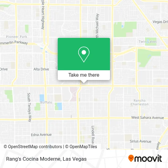
See Rang's Cocina Moderne, Las Vegas, on the map
Public Transit to Rang's Cocina Moderne in Las Vegas
Wondering how to get to Rang's Cocina Moderne in Las Vegas? Moovit helps you find the best way to get to Rang's Cocina Moderne with step-by-step directions from the nearest public transit station.
Moovit provides free maps and live directions to help you navigate through your city. View schedules, routes, timetables, and find out how long does it take to get to Rang's Cocina Moderne in real time.
Looking for the nearest stop or station to Rang's Cocina Moderne? Check out this list of stops closest to your destination: Wb Charleston After Upland; Sb Jones After Charleston; Eb Alta After Jones.
Bus: 102, 206, 207.
Want to see if there’s another route that gets you there at an earlier time? Moovit helps you find alternative routes or times. Get directions from and directions to Rang's Cocina Moderne easily from the Moovit App or Website.
We make riding to Rang's Cocina Moderne easy, which is why over 1.7 million users, including users in Las Vegas, trust Moovit as the best app for public transit. You don’t need to download an individual bus app or train app, Moovit is your all-in-one transit app that helps you find the best bus time or train time available.
For information on prices of bus, costs and ride fares to Rang's Cocina Moderne, please check the Moovit app.
Use the app to navigate to popular places including to the airport, hospital, stadium, grocery store, mall, coffee shop, school, college, and university.
Rang's Cocina Moderne Address: 5900 W Charleston Blvd street in Las Vegas
- Lush Life Spa Suites LLC,
- Amazon Locker-Bier,
- Aflac,
- Clark County Library,
- College Of Southern Nevada Charleston Campus,
- College of Southern Nevada,
- A-Abana Auto Insurance,
- W. Charleston CSN DRC,
- Earn Free Money $10-$100 Without Any Investment by Affiliate Marketing - Sprintzeal.Com,
- Zombie Bash,
- Magical Forest at Opportunity Village,
- Charleston Antique Mall,
- Blueberry Hill Family Restaurant,
- Decatur & Oakey,
- Iglesia Cristiana Jehova Jireh,
- Bingo,
- Arizona Charlie's Decatur (Arizona Charlie's Decatur Casino & Hotel),
- Torrey Pines Rehabilitation,
- SKECHERS Factory Outlet,
- Odyssey Charter School
Places Near Rang's Cocina Moderne (Las Vegas)
- The Neon Museum, Las Vegas,
- Las Vegas Premium Outlets-North, Enterprise,
- Las Vegas South Premium Outlets, Enterprise,
- Koolsville Tattoos, Las Vegas,
- Allegiant Stadium, Paradise,
- The Palms Casino Resort, Paradise,
- Las Vegas North Premium Outlets, Las Vegas,
- The Deuce Bus Stop at Fremont St, Las Vegas,
- Area15, Las Vegas,
- Trump International Hotel Las Vegas, Paradise,
- Walmart, Las Vegas,
- Meow Wolf - Las Vegas (Meow Wolf's Omega Mart), Las Vegas,
- Welcome To Fabulous Las Vegas Sign, Paradise,
- Omega Mart, Las Vegas,
- Lee Canyon, Las Vegas,
- Walmart Supercenter, Las Vegas,
- Zak Bagans Haunted Museum, Las Vegas,
- Town Square, Enterprise,
- Arte Museum Las Vegas, Paradise,
- Gold & Silver Pawn Shop, Las Vegas
How to get to popular places in Las Vegas with public transit
Get around Las Vegas by public transit!
Traveling around Las Vegas has never been so easy. See step by step directions as you travel to any attraction, street or major public transit station. View bus and train schedules, arrival times, service alerts and detailed routes on a map, so you know exactly how to get to anywhere in Las Vegas.
When traveling to any destination around Las Vegas use Moovit's Live Directions with Get Off Notifications to know exactly where and how far to walk, how long to wait for your line, and how many stops are left. Moovit will alert you when it's time to get off — no need to constantly re-check whether yours is the next stop.
Wondering how to use public transit in Las Vegas or how to pay for public transit in Las Vegas? Moovit public transit app can help you navigate your way with public transit easily, and at minimum cost. It includes public transit fees, ticket prices, and costs. Looking for a map of Las Vegas public transit lines? Moovit public transit app shows all public transit maps in Las Vegas with all Bus and Monorail routes and stops on an interactive map.
Las Vegas has 2 transit type(s), including: Bus and Monorail, operated by several transit agencies, including RTCSNV, City of Las Vegas, Alvand Transportation, Vegas Airporter, Las Vegas Monorail, FlixBus-us and Greyhound-us