How to get to Rangel by bus?
Click on the bus route to see step by step directions with maps, line arrival times and updated time schedules.
From Manzanares el Real, Manzanares El Real
119 minFrom Las Presillas, Rascafría
76 minFrom Hospital Público de Collado Villalba, Collado Villalba
46 minFrom Hospital HM Universitario Torrelodones, Torrelodones
80 minFrom Polígono P-29, Collado Villalba
104 minFrom Polígono Európolis, Las Rozas De Madrid
106 minFrom Centro Penitenciario Madrid V - Soto Del Real, Cuenca Alta Del Manzanares
146 minFrom The Style Outlets Las Rozas, Las Rozas De Madrid
82 minFrom Heron City Madrid, Área Metropolitana De Madrid Y Corredor Del Henares
81 minFrom Costco Wholesale, Las Rozas De Madrid
94 min
How to get to Rangel by train?
Click on the train route to see step by step directions with maps, line arrival times and updated time schedules.
Bus stop near Rangel in Cercedilla
- Carmen - Pza. María Mínguez, 1 min walk,VIEW
Train station near Rangel in Cercedilla
- Cercedilla, 17 min walk,VIEW
Bus lines to Rangel in Cercedilla
What are the closest stations to Rangel?
The closest stations to Rangel are:
- Carmen - Pza. María Mínguez is 66 meters away, 1 min walk.
- Cercedilla is 1284 meters away, 17 min walk.
Which bus lines stop near Rangel?
These bus lines stop near Rangel: 684, 692.
Which train line stops near Rangel?
C8B (Cercedilla)
What’s the nearest train station to Rangel in Cercedilla?
The nearest train station to Rangel in Cercedilla is Cercedilla. It’s a 17 min walk away.
What’s the nearest bus station to Rangel in Cercedilla?
The nearest bus station to Rangel in Cercedilla is Carmen - Pza. María Mínguez. It’s a 1 min walk away.
What time is the first train to Rangel in Cercedilla?
The C8B is the first train that goes to Rangel in Cercedilla. It stops nearby at 6:31 AM.
What time is the last train to Rangel in Cercedilla?
The C8B is the last train that goes to Rangel in Cercedilla. It stops nearby at 12:24 AM.
What time is the first bus to Rangel in Cercedilla?
The 684 is the first bus that goes to Rangel in Cercedilla. It stops nearby at 4:37 AM.
What time is the last bus to Rangel in Cercedilla?
The 684 is the last bus that goes to Rangel in Cercedilla. It stops nearby at 12:50 AM.
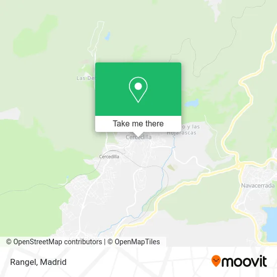
See Rangel, Cercedilla, on the map
Public Transit to Rangel in Cercedilla
Wondering how to get to Rangel in Cercedilla? Moovit helps you find the best way to get to Rangel with step-by-step directions from the nearest public transit station.
Moovit provides free maps and live directions to help you navigate through your city. View schedules, routes, timetables, and find out how long does it take to get to Rangel in real time.
Looking for the nearest stop or station to Rangel? Check out this list of stops closest to your destination: Carmen - Pza. María Mínguez; Cercedilla.
Bus: 684, 692, 1, 680.Train: C8B, C9, REG.
Want to see if there’s another route that gets you there at an earlier time? Moovit helps you find alternative routes or times. Get directions from and directions to Rangel easily from the Moovit App or Website.
We make riding to Rangel easy, which is why over 1.5 million users, including users in Cercedilla, trust Moovit as the best app for public transit. You don’t need to download an individual bus app or train app, Moovit is your all-in-one transit app that helps you find the best bus time or train time available.
For information on prices of bus and train, costs and ride fares to Rangel, please check the Moovit app.
Use the app to navigate to popular places including to the airport, hospital, stadium, grocery store, mall, coffee shop, school, college, and university.
Rangel Address: Calle Carmen, 15 28470 Cercedilla street in Cercedilla
- Carnicería Eugenio Sdm,
- Carnes Fiambres,
- Eugenio Sáenz de Miera Martín,
- Dragoneria Granel,
- Jiménez Serrano Rocio,
- La Despensa,
- Cercetel,
- Fernandez Gálvez Francisco Javier,
- Calle del Carmen 22,
- Travesía de la Fragua 1 3,
- El Vesubio - Reparto,
- Tienda Ropa Online Nieves y Sol Moda,
- Pescadería Alonso,
- Doner Kebab,
- La Posada,
- Yiralldy Nails,
- Sandra Montalvo Núñez,
- Panjua,
- Comestibles Montalvo Dulcería - Heladeria,
- Calle Cotos
Places Near Rangel (Cercedilla)
- Hospital Clínico Universitario San Carlos, Madrid,
- Estadio Wanda Metropolitano, Área Metropolitana De Madrid Y Corredor Del Henares,
- Plenilunio, Área Metropolitana De Madrid Y Corredor Del Henares,
- Rastro De Madrid, Área Metropolitana De Madrid Y Corredor Del Henares,
- Hospital Universitario Ramón y Cajal, Madrid,
- Calle de López de Hoyos 169, Madrid,
- Palacio De Vistalegre, Área Metropolitana De Madrid Y Corredor Del Henares,
- Tres Aguas, Alcorcón,
- Centro Comercial La Gavia, Área Metropolitana De Madrid Y Corredor Del Henares,
- Hospital Universitario La Paz, Madrid,
- Centro Comercial Islazul, Área Metropolitana De Madrid Y Corredor Del Henares,
- Estacion de Chamartin, Madrid,
- Plaza Mayor, Madrid,
- Sala La Riviera, Madrid,
- Nassica, Área Metropolitana De Madrid Y Corredor Del Henares,
- Centro Comercial La Vaguada, Área Metropolitana De Madrid Y Corredor Del Henares,
- Wizink Center, Madrid,
- Centro Comercial Oasiz Madrid, Área Metropolitana De Madrid Y Corredor Del Henares,
- Mercadillo de Majadahonda, Majadahonda,
- Mendez Alvaro, Madrid
How to get to popular places in Madrid with public transit
Get around Cercedilla by public transit!
Traveling around Cercedilla has never been so easy. See step by step directions as you travel to any attraction, street or major public transit station. View bus and train schedules, arrival times, service alerts and detailed routes on a map, so you know exactly how to get to anywhere in Cercedilla.
When traveling to any destination around Cercedilla use Moovit's Live Directions with Get Off Notifications to know exactly where and how far to walk, how long to wait for your line, and how many stops are left. Moovit will alert you when it's time to get off — no need to constantly re-check whether yours is the next stop.
Wondering how to use public transit in Cercedilla or how to pay for public transit in Cercedilla? Moovit public transit app can help you navigate your way with public transit easily, and at minimum cost. It includes public transit fees, ticket prices, and costs. Looking for a map of Cercedilla public transit lines? Moovit public transit app shows all public transit maps in Cercedilla with all Bus, Train, Metro and Light Rail routes and stops on an interactive map.
Madrid has 4 transit type(s), including: Bus, Train, Metro and Light Rail, operated by several transit agencies, including Metro de Madrid, Metro Ligero, Tranvía de Parla, Renfe Cercanías - Servicios de Autobús especiales, Renfe Cercanias, Renfe Cercanías, EMT, Interurbanos, Urbanos de Alcalá de Henares, Urbanos de Alcobendas, Urbanos de Alcorcón, Urbanos de Algete, Urbanos de Aranjuez, Urbanos de Arganda del Rey and Urbanos de Arroyomolinos