How to get to Rangra 1 by bus?
Click on the bus route to see step by step directions with maps, line arrival times and updated time schedules.
From Canabrava, Piraja
67 minFrom Itaú Porto Seco Pirajá, Piraja
48 minFrom Final De Linha Da Pituba, Salvador
61 minFrom Av Pinto de Aguiar, Itapoá
72 minFrom Unijorge (Campus Paralela), Piraja
68 minFrom Stand do ITC - International Trade Center Salvador, Amaralina
46 minFrom Praia De Armação, Região Geográfica Imediata De Salvador
60 minFrom Zoo, Piraja
61 minFrom Rua J-Qd 14- Castelo Branco | 3ª Etapa | Setor 02 41, Piraja
64 minFrom Parque Julio Cesar, Amaralina
51 min
How to get to Rangra 1 by metro?
Click on the metro route to see step by step directions with maps, line arrival times and updated time schedules.
Bus stops near Rangra 1 in Santo Antônio
Funicular stations near Rangra 1 in Santo Antônio
Ferry station near Rangra 1 in Santo Antônio
- Terminal Marítimo De São Joaquim, 34 min walk,VIEW
Bus lines to Rangra 1 in Santo Antônio
- 0152, Vasco Da Gama X Barbalho,VIEW
- 0221, Ribeira X Fazenda Garcia,VIEW
- 0310, Aeroporto X Liberdade/Barroquinha Via São Rafael,VIEW
- 0332, Fazenda Grande Do Retiro X Lapa Via Liberdade,VIEW
- 0333, Faz.Grande Retiro X Barroquinha/Brotas Liberdade,VIEW
- 1131, Liberdade/C.Polvora X Cabula Via T. Acesso Norte,VIEW
- 1154, Macaúbas Barbalho X Terminal Acesso Norte.,VIEW
- 1327, Estação Pirajá X Barroquinha Via S.Caetano,VIEW
- 1511, E. Velho Federação X Conjunto Piraja,VIEW
- 1606, Paripe X Barroquinha (Va),VIEW
- 015201, Barbalho X Vasco Da Gama,VIEW
- 160602, Periperi X Barroquinha,VIEW
- 160605, Vista Alegre/Paripe X Barroquinha,VIEW
- 031006, Barroquinha X Est.Pirajá,VIEW
- 160601, Barroquinha X Base Naval / Paripe,VIEW
- 160603, Paripe X Barroquinha,VIEW
- 160604, Nazare X Paripe (V),VIEW
What are the closest stations to Rangra 1?
The closest stations to Rangra 1 are:
- R. Eng. João Pimenta Bastos S/N - Barbalho Salvador - Ba Brazil is 119 meters away, 2 min walk.
- R. Ermídio Dos Santos S/N - Barbalho Salvador - Ba Brazil is 127 meters away, 2 min walk.
- Cidade Alta / Santo Antônio Além Do Carmo is 1625 meters away, 21 min walk.
- Cidade Alta / Pelourinho is 2189 meters away, 28 min walk.
- Terminal Marítimo De São Joaquim is 2606 meters away, 34 min walk.
Which bus lines stop near Rangra 1?
These bus lines stop near Rangra 1: 0310, 1327, 1511, 160605.
Which metro line stops near Rangra 1?
LINHA 1 (Sentido Lapa)
What’s the nearest bus station to Rangra 1 in Santo Antônio?
The nearest bus stations to Rangra 1 in Santo Antônio are R. Eng. João Pimenta Bastos S/N - Barbalho Salvador - Ba Brazil and R. Ermídio Dos Santos S/N - Barbalho Salvador - Ba Brazil. The closest one is a 2 min walk away.
What’s the nearest funicular station to Rangra 1 in Santo Antônio?
The nearest funicular station to Rangra 1 in Santo Antônio is Cidade Alta / Santo Antônio Além Do Carmo. It’s a 21 min walk away.
What time is the first bus to Rangra 1 in Santo Antônio?
The 0310 is the first bus that goes to Rangra 1 in Santo Antônio. It stops nearby at 4:16 AM.
What time is the last bus to Rangra 1 in Santo Antônio?
The 1154 is the last bus that goes to Rangra 1 in Santo Antônio. It stops nearby at 12:20 AM.
What time is the first ferry to Rangra 1 in Santo Antônio?
The TRAVESSIA is the first ferry that goes to Rangra 1 in Santo Antônio. It stops nearby at 5:00 AM.
What time is the last ferry to Rangra 1 in Santo Antônio?
The TRAVESSIA is the last ferry that goes to Rangra 1 in Santo Antônio. It stops nearby at 11:38 PM.
What time is the first funicular to Rangra 1 in Santo Antônio?
The PIP is the first funicular that goes to Rangra 1 in Santo Antônio. It stops nearby at 7:00 AM.
What time is the last funicular to Rangra 1 in Santo Antônio?
The PIG is the last funicular that goes to Rangra 1 in Santo Antônio. It stops nearby at 6:00 PM.
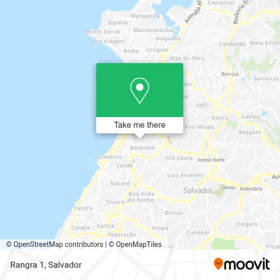
See Rangra 1, Santo Antônio, on the map
Public Transit to Rangra 1 in Santo Antônio
Wondering how to get to Rangra 1 in Santo Antônio? Moovit helps you find the best way to get to Rangra 1 with step-by-step directions from the nearest public transit station.
Moovit provides free maps and live directions to help you navigate through your city. View schedules, routes, timetables, and find out how long does it take to get to Rangra 1 in real time.
Looking for the nearest stop or station to Rangra 1? Check out this list of stops closest to your destination: R. Eng. João Pimenta Bastos S/N - Barbalho Salvador - Ba Brazil; R. Ermídio Dos Santos S/N - Barbalho Salvador - Ba Brazil; Cidade Alta / Santo Antônio Além Do Carmo; Cidade Alta / Pelourinho; Terminal Marítimo De São Joaquim.
Bus: 0310, 1327, 1511, 160605, 0152, 0221, 0332, 0333, 031006, 160601, 160603, 160604.Metro: LINHA 1.Funicular: PIP, PIG.Ferry: TRAVESSIA.
Want to see if there’s another route that gets you there at an earlier time? Moovit helps you find alternative routes or times. Get directions from and directions to Rangra 1 easily from the Moovit App or Website.
We make riding to Rangra 1 easy, which is why over 1.5 million users, including users in Santo Antônio, trust Moovit as the best app for public transit. You don’t need to download an individual bus app or train app, Moovit is your all-in-one transit app that helps you find the best bus time or train time available.
For information on prices of bus and metro, costs and ride fares to Rangra 1, please check the Moovit app.
Use the app to navigate to popular places including to the airport, hospital, stadium, grocery store, mall, coffee shop, school, college, and university.
Rangra 1 Address: Rua Emídio dos Santos, 388 Barbalho Salvador-BA 40301-015 street in Santo Antônio
- Ivan Martelinho de Ouro,
- Annes Clinica Odontologica,
- Story Suplementos,
- Maktub Studio,
- Aquario Copiadora,
- Fernandafahelde,
- Du Bar,
- Machado Transporte,
- Tecnojob Manutencao e Servicos,
- Laiane Ferreira da Paixao Silva,
- Eraildes Alves Silveir,
- Barbalho,
- Condominio Edificio Brasil-Espanha,
- Device,
- Ajatech,
- Juliane Araujo,
- Hello Pizza,
- Digital Pinto 7,
- Otica Marcedo,
- Santa Casa De Misericórdia Da Bahia
Places Near Rangra 1 (Santo Antônio)
- Praia Farol da Barra, Salvador,
- Turim Transportes (Linha: 803A) Dias D'ávila X Salvador, Dias D'Avila,
- shopping salvador, Salvador,
- Hospital Municipal de Salvador, Salvador,
- yyy, Piraja,
- Shopping Barra, Salvador,
- Centro De Convenções De Salvador, Amaralina,
- Salvador Norte Shopping, Região Geográfica Imediata De Salvador,
- Cemitério Bosque da Paz, Piraja,
- Hospital Teresa de Lisieux, Brotas,
- Lauro De Freitas, Região Geográfica Imediata De Salvador,
- HAPCLINICA PITUBA II, Salvador,
- Garibaldi, Salvador,
- Hospital Aristides Maltez, Região Geográfica Imediata De Salvador,
- Kkkkkkkkk, Simões Filho,
- Shopping Bela Vista, Salvador,
- Comércio, Região Geográfica Imediata De Salvador,
- Jardim Zoológico, Salvador,
- Parque Shopping Bahia, Lauro De Freitas,
- Hospital Metropolitano, Região Geográfica Imediata De Salvador
How to get to popular places in Salvador with public transit
Get around Santo Antônio by public transit!
Traveling around Santo Antônio has never been so easy. See step by step directions as you travel to any attraction, street or major public transit station. View bus and train schedules, arrival times, service alerts and detailed routes on a map, so you know exactly how to get to anywhere in Santo Antônio.
When traveling to any destination around Santo Antônio use Moovit's Live Directions with Get Off Notifications to know exactly where and how far to walk, how long to wait for your line, and how many stops are left. Moovit will alert you when it's time to get off — no need to constantly re-check whether yours is the next stop.
Wondering how to use public transit in Santo Antônio or how to pay for public transit in Santo Antônio? Moovit public transit app can help you navigate your way with public transit easily, and at minimum cost. It includes public transit fees, ticket prices, and costs. Looking for a map of Santo Antônio public transit lines? Moovit public transit app shows all public transit maps in Santo Antônio with all Bus, Metro, Ferry and Funicular routes and stops on an interactive map.
Salvador has 4 transit type(s), including: Bus, Metro, Ferry and Funicular, operated by several transit agencies, including CCR Metrô Bahia, Transalvador, Internacional Travessias Salvador, BRT Salvador, OTTrans, Plataforma, Conecta Camaçari, Governo da Bahia, STEC, Univale Transportes, Empresa de Transportes Costa Verde, Confortrans Transportes Eireli, Expresso Metropolitano, Viação Regional and Viação Novo Horizonte Ltda