How to get to Rann by bus?
Click on the bus route to see step by step directions with maps, line arrival times and updated time schedules.
How to get to Rann by train?
Click on the train route to see step by step directions with maps, line arrival times and updated time schedules.
Bus stops near Rann in Villingen-Schwenningen
Train stations near Rann in Villingen-Schwenningen
Bus lines to Rann in Villingen-Schwenningen
- 1, Schwenningen Schöneberger Weg - Schwenningen Busbahnhof,VIEW
- 27, Villingen Bahnhof - Villingen Bahnhof,VIEW
- 28, Villingen Bahnhof - Villingen Bahnhof,VIEW
- 5, Villingen Bahnhof - Villingen St. Georgener Str.,VIEW
- 500, Furtwangen Friedrichschule - Villingen Bahnhof,VIEW
- 6, Villingen Rietheimer Str. I - Villingen Tannenhöhe,VIEW
- 640, Villingen Bahnhof - Herzogenweiler Rathaus,VIEW
- 650, Villingen Bahnhof - Fischbach Ortsmitte,VIEW
- 655, Niedereschach Altes Rathaus - Schabenhausen Schlierbachhalle,VIEW
- 660, Villingen Bahnhof - St. Georgen Schwarzes Tor,VIEW
- 7, Villingen Bahnhof - Villingen Heidplatz,VIEW
- 8, Villingen Bahnhof - Villingen Hotelfachschule,VIEW
- 4, Villingen Sev.-Kern-Str.,VIEW
What are the closest stations to Rann?
The closest stations to Rann are:
- Villingen Riettor is 253 meters away, 4 min walk.
- Villingen Klosterring is 798 meters away, 11 min walk.
- Villingen Bahnhof/Zob is 935 meters away, 13 min walk.
- Marbach West (Zug) is 3167 meters away, 42 min walk.
Which train lines stop near Rann?
These train lines stop near Rann: RB42, RE2.
Which bus lines stop near Rann?
These bus lines stop near Rann: 1, 500, 6, 660.
What’s the nearest train station to Rann in Villingen-Schwenningen?
The nearest train station to Rann in Villingen-Schwenningen is Villingen Bahnhof/Zob. It’s a 13 min walk away.
What’s the nearest bus station to Rann in Villingen-Schwenningen?
The nearest bus station to Rann in Villingen-Schwenningen is Villingen Riettor. It’s a 4 min walk away.
What time is the first light rail to Rann in Villingen-Schwenningen?
The S1 is the first light rail that goes to Rann in Villingen-Schwenningen. It stops nearby at 7:14 AM.
What time is the last light rail to Rann in Villingen-Schwenningen?
The S1 is the last light rail that goes to Rann in Villingen-Schwenningen. It stops nearby at 7:14 AM.
What time is the first train to Rann in Villingen-Schwenningen?
The S10 is the first train that goes to Rann in Villingen-Schwenningen. It stops nearby at 4:27 AM.
What time is the last train to Rann in Villingen-Schwenningen?
The RE2 is the last train that goes to Rann in Villingen-Schwenningen. It stops nearby at 12:36 AM.
What time is the first bus to Rann in Villingen-Schwenningen?
The 660 is the first bus that goes to Rann in Villingen-Schwenningen. It stops nearby at 5:13 AM.
What time is the last bus to Rann in Villingen-Schwenningen?
The 500 is the last bus that goes to Rann in Villingen-Schwenningen. It stops nearby at 12:08 AM.
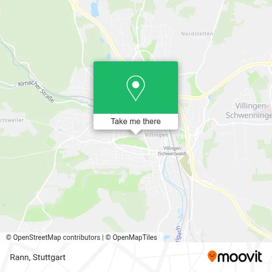
See Rann, Villingen-Schwenningen, on the map
Public Transit to Rann in Villingen-Schwenningen
Wondering how to get to Rann in Villingen-Schwenningen? Moovit helps you find the best way to get to Rann with step-by-step directions from the nearest public transit station.
Moovit provides free maps and live directions to help you navigate through your city. View schedules, routes, timetables, and find out how long does it take to get to Rann in real time.
Looking for the nearest stop or station to Rann? Check out this list of stops closest to your destination: Villingen Riettor; Villingen Klosterring; Villingen Bahnhof/Zob; Marbach West (Zug).
Train: RB42, RE2, S10, RE42, RB 42, RE 55, S1.Bus: 1, 500, 6, 660, 27, 28, 5, 4.
Want to see if there’s another route that gets you there at an earlier time? Moovit helps you find alternative routes or times. Get directions from and directions to Rann easily from the Moovit App or Website.
We make riding to Rann easy, which is why over 1.5 million users, including users in Villingen-Schwenningen, trust Moovit as the best app for public transit. You don’t need to download an individual bus app or train app, Moovit is your all-in-one transit app that helps you find the best bus time or train time available.
For information on prices of bus and train, costs and ride fares to Rann, please check the Moovit app.
Use the app to navigate to popular places including to the airport, hospital, stadium, grocery store, mall, coffee shop, school, college, and university.
Rann Address: Vöhrenbacher Straße street in Villingen-Schwenningen
- Der Brillenladen,
- Rann Fahrschule,
- J.7 Hairstyling,
- Ummenhofer Versicherungsbüro,
- Konrad Flöss Architekt,
- Debeka Versichern Bausparen Bezirksleitung,
- Milani Kanzlei,
- K3 Landschaftsarchitektur,
- Dr. Neugart,
- Dr. Wiessner,
- Dr. med. dent. Alex Wiessner Zahnarztpraxis,
- Hettich,
- Villingen Hubenloch,
- Richard Kienzler,
- AD VS Goethestraße,
- Volker Jehle Fahrschule,
- Hettich Grundstücksverwaltungs,
- Yasmins Tortenwelt,
- Parkhaus Theater am Ring,
- Aussichtsturm Hubenloch
Places Near Rann (Villingen-Schwenningen)
- Geilhaus Haus 33a, Reutlingen-Betzingen,
- Mettingen Eros-Center Puff Laufhaus, Esslingen Am Neckar,
- Im Wizemann (Halle), Bad Cannstatt,
- Hanns-Martin-Schleyer-Halle, Bad Cannstatt,
- Klinikum Stuttgart - Katharinenhospital, Stuttgart-Mitte,
- Schleyerhalle, Bad Cannstatt,
- Marmorsaal Im Weissenburgpark, Stuttgart-Süd,
- SI-Centrum, Möhringen,
- Porsche-Arena, Bad Cannstatt,
- Mercedes-Benz Museum (Mercedes Museum Stuttgart), Bad Cannstatt,
- FlixBus Haltestelle, Stuttgart,
- Porsche Museum, Zuffenhausen,
- Gasometer Pforzheim, Pforzheim,
- Hanns-Martin-Schleyer-Halle (Stuttgart Hans-Martin-Schleyerhalle), Bad Cannstatt,
- Gleis 101/102 (tief), Stuttgart-Mitte,
- Wilhelma (U-Bahn Wilhelma), Bad Cannstatt,
- Mercedes-Benz Museum, Bad Cannstatt,
- Hauptbahnhof Stuttgart, Stuttgart-Mitte,
- Pariser Platz Stuttgart, Stuttgart-Mitte,
- Waldfriedhof, Degerloch
How to get to popular places in Stuttgart with public transit
Get around Villingen-Schwenningen by public transit!
Traveling around Villingen-Schwenningen has never been so easy. See step by step directions as you travel to any attraction, street or major public transit station. View bus and train schedules, arrival times, service alerts and detailed routes on a map, so you know exactly how to get to anywhere in Villingen-Schwenningen.
When traveling to any destination around Villingen-Schwenningen use Moovit's Live Directions with Get Off Notifications to know exactly where and how far to walk, how long to wait for your line, and how many stops are left. Moovit will alert you when it's time to get off — no need to constantly re-check whether yours is the next stop.
Wondering how to use public transit in Villingen-Schwenningen or how to pay for public transit in Villingen-Schwenningen? Moovit public transit app can help you navigate your way with public transit easily, and at minimum cost. It includes public transit fees, ticket prices, and costs. Looking for a map of Villingen-Schwenningen public transit lines? Moovit public transit app shows all public transit maps in Villingen-Schwenningen with all Bus, Train, Subway, Light Rail, Ferry, S-Bahn and Funicular routes and stops on an interactive map.
Stuttgart has 7 transit type(s), including: Bus, Train, Subway, Light Rail, Ferry, S-Bahn and Funicular, operated by several transit agencies, including SSB - Stadtbahn, SSB, SSB - Seilbahn / Zacke, S-Bahn Stuttgart, Rhein-Neckar-Verkehr GmbH (rnv), Karlsruher Verkehrsverbund, DB AG, DB Regiobus BW, Arverio Baden-Württemberg GmbH, DB RegioNetz Verkehrs GmbH Westfrankenbahn, DB Regio AG Baden-Württemberg, Südwestdeutsche Verkehrs-AG, DB Regio AG Mitte Region Hessen, DB and Bodensee-Oberschwaben-Bahn