How to get to Ransley Square by bus?
Click on the bus route to see step by step directions with maps, line arrival times and updated time schedules.
Bus stops near Ransley Square in Fishkill
Bus lines to Ransley Square in Fishkill
What are the closest stations to Ransley Square?
The closest stations to Ransley Square are:
- Merritt Blvd. Rt. 9 North (Across From Walmart) is 58 yards away, 1 min walk.
- Walmart (Fishkill) is 640 yards away, 8 min walk.
- Main St & Route 9 is 1020 yards away, 13 min walk.
Which bus lines stop near Ransley Square?
These bus lines stop near Ransley Square: A MS, WPP.
What’s the nearest bus station to Ransley Square in Fishkill?
The nearest bus station to Ransley Square in Fishkill is Merritt Blvd. Rt. 9 North (Across From Walmart). It’s a 1 min walk away.
What time is the first bus to Ransley Square in Fishkill?
The A EXP is the first bus that goes to Ransley Square in Fishkill. It stops nearby at 5:55 AM.
What time is the last bus to Ransley Square in Fishkill?
The A MS is the last bus that goes to Ransley Square in Fishkill. It stops nearby at 11:04 PM.
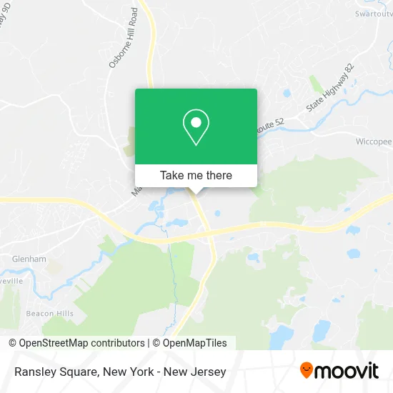
See Ransley Square, Fishkill, on the map
Public Transit to Ransley Square in Fishkill
Wondering how to get to Ransley Square in Fishkill? Moovit helps you find the best way to get to Ransley Square with step-by-step directions from the nearest public transit station.
Moovit provides free maps and live directions to help you navigate through your city. View schedules, routes, timetables, and find out how long does it take to get to Ransley Square in real time.
Looking for the nearest stop or station to Ransley Square? Check out this list of stops closest to your destination: Merritt Blvd. Rt. 9 North (Across From Walmart); Walmart (Fishkill); Main St & Route 9.
Bus: A MS, WPP, A SUN, F, A EXP, G MS, G MS1.
Want to see if there’s another route that gets you there at an earlier time? Moovit helps you find alternative routes or times. Get directions from and directions to Ransley Square easily from the Moovit App or Website.
We make riding to Ransley Square easy, which is why over 1.5 million users, including users in Fishkill, trust Moovit as the best app for public transit. You don’t need to download an individual bus app or train app, Moovit is your all-in-one transit app that helps you find the best bus time or train time available.
For information on prices of bus and train, costs and ride fares to Ransley Square, please check the Moovit app.
Use the app to navigate to popular places including to the airport, hospital, stadium, grocery store, mall, coffee shop, school, college, and university.
Ransley Square Address: 11 Merritt Blvd street in Fishkill
- Verizon,
- Milan Laser Hair Removal,
- Holiday Inn Express Fishkill-Mid Hudson Valley,
- Panera Bread,
- Chase Atm,
- Sean Igoe - Chase Home Lending Advisor - NMLS ID,
- Savona’S Pizzeria,
- Akari Sushi 2,
- Subway,
- Akari II,
- Homestead Studio Suites,
- Extended Stay America,
- Town Of Fishkill,
- Fishkill Winter Roofing Easy,
- Van Vlack's Cleaners,
- Concrete Solutions,
- Chestnut Market Fishkill,
- Chestnut Market,
- Foam and Wash Car Wash,
- Danielle Logiurato, MD
Places Near Ransley Square (Fishkill)
- 111 Centre New York City Supreme Court, Manhattan,
- Times Square, Manhattan,
- 3 Stone St, Manhattan,
- 1 Police Plaza, Manhattan,
- SoHo, Manhattan,
- Bellevue Hospital, Manhattan,
- 376 Hudson Street, Manhattan,
- Mountainside Hospital, Glen Ridge,
- San Gennaro Feast, Manhattan,
- Rockefeller Center, Manhattan,
- Queens Center Mall, Queens,
- 66 John Street, Manhattan,
- Pier 83, Manhattan,
- Katz's Deli, Manhattan,
- Wall Street, Manhattan,
- Hudson Yards, Manhattan,
- 911 Memorial, Manhattan,
- qqqq, Manhattan,
- Chinatown, Manhattan,
- 26 Federal Plaza, Manhattan
How to get to popular places in New York - New Jersey with public transit
Get around Fishkill by public transit!
Traveling around Fishkill has never been so easy. See step by step directions as you travel to any attraction, street or major public transit station. View bus and train schedules, arrival times, service alerts and detailed routes on a map, so you know exactly how to get to anywhere in Fishkill.
When traveling to any destination around Fishkill use Moovit's Live Directions with Get Off Notifications to know exactly where and how far to walk, how long to wait for your line, and how many stops are left. Moovit will alert you when it's time to get off — no need to constantly re-check whether yours is the next stop.
Wondering how to use public transit in Fishkill or how to pay for public transit in Fishkill? Moovit public transit app can help you navigate your way with public transit easily, and at minimum cost. It includes public transit fees, ticket prices, and costs. Looking for a map of Fishkill public transit lines? Moovit public transit app shows all public transit maps in Fishkill with all Bus, Train, Subway, Light Rail, Ferry and Cable Car routes and stops on an interactive map.
New York - New Jersey has 6 transit type(s), including: Bus, Train, Subway, Light Rail, Ferry and Cable Car, operated by several transit agencies, including MTA Subway, Metro-North Railroad, LIRR, PATH, MTA New York City Transit - Express routes, MTA Bus, NJ Transit, NYC Ferry, NICE bus, Bee-Line Bus, NJ Transit Rail, Norwalk Transit District, Hartford Line, River Valley Transit and HART