Directions to Raphael Amoona (Hewlett) with public transportation
The following transit lines have routes that pass near Raphael Amoona
 Bus: N1, N31, N32, N31X/M.
- Train: FAR ROCKAWAY BRANCH, BABYLON BRANCH, LONG BEACH BRANCH.
How to get to Raphael Amoona by bus?
Click on the bus route to see step by step directions with maps, line arrival times and updated time schedules.
From Plattduetsche Park, Franklin Square
64 minFrom Nostrand Ave, Brooklyn, Queens
64 minFrom DMV Jamaica Office, Queens
61 minFrom Elmont, NY, Elmont
62 minFrom Garden City, NY, Garden City
58 minFrom Uniondale, NY, Uniondale
61 minFrom Mercy Hospital, Rockville Centre
71 minFrom DMV Jamaica Nys, Queens
61 minFrom JFK Building 141, Queens
97 minFrom Jamaica, NY, Queens
59 min
How to get to Raphael Amoona by train?
Click on the train route to see step by step directions with maps, line arrival times and updated time schedules.
Bus stops near Raphael Amoona in Hewlett
Bus lines to Raphael Amoona in Hewlett
What are the closest stations to Raphael Amoona?
The closest stations to Raphael Amoona are:
- Munro Blvd + Horton Rd is 548 yards away, 7 min walk.
- Hewlett is 644 yards away, 8 min walk.
- Broadway + Stevenson Rd is 924 yards away, 11 min walk.
- Rockaway Av / Bway is 1263 yards away, 15 min walk.
- Lynbrook is 2732 yards away, 32 min walk.
Which bus lines stop near Raphael Amoona?
These bus lines stop near Raphael Amoona: N1, N31, N32.
Which train line stops near Raphael Amoona?
FAR ROCKAWAY BRANCH (Far Rockaway)
What’s the nearest train station to Raphael Amoona in Hewlett?
The nearest train station to Raphael Amoona in Hewlett is Hewlett. It’s a 8 min walk away.
What’s the nearest bus station to Raphael Amoona in Hewlett?
The nearest bus station to Raphael Amoona in Hewlett is Munro Blvd + Horton Rd. It’s a 7 min walk away.
What time is the first train to Raphael Amoona in Hewlett?
The FAR ROCKAWAY BRANCH is the first train that goes to Raphael Amoona in Hewlett. It stops nearby at 3:02 AM.
What time is the last train to Raphael Amoona in Hewlett?
The FAR ROCKAWAY BRANCH is the last train that goes to Raphael Amoona in Hewlett. It stops nearby at 3:07 AM.
What time is the first bus to Raphael Amoona in Hewlett?
The N32 is the first bus that goes to Raphael Amoona in Hewlett. It stops nearby at 4:55 AM.
What time is the last bus to Raphael Amoona in Hewlett?
The N32 is the last bus that goes to Raphael Amoona in Hewlett. It stops nearby at 12:22 AM.
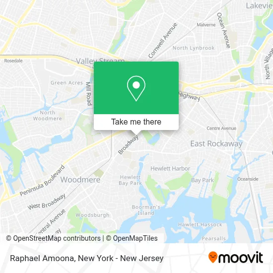
See Raphael Amoona, Hewlett, on the map
Public Transit to Raphael Amoona in Hewlett
Wondering how to get to Raphael Amoona in Hewlett? Moovit helps you find the best way to get to Raphael Amoona with step-by-step directions from the nearest public transit station.
Moovit provides free maps and live directions to help you navigate through your city. View schedules, routes, timetables, and find out how long does it take to get to Raphael Amoona in real time.
Looking for the nearest stop or station to Raphael Amoona? Check out this list of stops closest to your destination: Munro Blvd + Horton Rd; Hewlett; Broadway + Stevenson Rd; Rockaway Av / Bway; Lynbrook.
Bus: N1, N31, N32, N31X/M.Train: FAR ROCKAWAY BRANCH, BABYLON BRANCH, LONG BEACH BRANCH.
Want to see if there’s another route that gets you there at an earlier time? Moovit helps you find alternative routes or times. Get directions from and directions to Raphael Amoona easily from the Moovit App or Website.
We make riding to Raphael Amoona easy, which is why over 1.5 million users, including users in Hewlett, trust Moovit as the best app for public transit. You don’t need to download an individual bus app or train app, Moovit is your all-in-one transit app that helps you find the best bus time or train time available.
For information on prices of bus, train and light rail, costs and ride fares to Raphael Amoona, please check the Moovit app.
Use the app to navigate to popular places including to the airport, hospital, stadium, grocery store, mall, coffee shop, school, college, and university.
Raphael Amoona Address: 1573 Broadway street in Hewlett
- Cohen Children's Medical Center Northwell Pediatrics at Hewlett,
- Jeffrey Neal Olin, Md,
- Brian S Blinderman,
- Cash For My Miles,
- Cohen Children's Northwell Health Physician Partners General Pediatrics at Hewlett,
- Alan Markowitz,
- Fred L. Abrams Attorney at Law,
- Polish Me Please Li,
- Xenex Payment Systems,
- Wexler Glenda B Dvm,
- Ez-Roll,
- 247 Hvac Of Long Island,
- Steven Borenstein Public Adjusters,
- Distinctive Gem Inc.,
- Max's Appetizing & Kosher Delicatessen,
- Kalypsos,
- Max's Appetizing and Kosher Delicatessen / Majestic Catering,
- Xslot,
- David Kievman,
- Simchatone Orchestra
Places Near Raphael Amoona (Hewlett)
- qqqq, Manhattan,
- 3 Stone St, Manhattan,
- SoHo, Manhattan,
- Times Square, Manhattan,
- 66 John Street, Manhattan,
- 26 Federal Plaza, Manhattan,
- 111 Centre New York City Supreme Court, Manhattan,
- Rockefeller Center, Manhattan,
- Queens Center Mall, Queens,
- 1 Police Plaza, Manhattan,
- Wall Street, Manhattan,
- Mountainside Hospital, Glen Ridge,
- Hudson Yards, Manhattan,
- 376 Hudson Street, Manhattan,
- San Gennaro Feast, Manhattan,
- Bellevue Hospital, Manhattan,
- Chinatown, Manhattan,
- 911 Memorial, Manhattan,
- Katz's Deli, Manhattan,
- Pier 83, Manhattan
How to get to popular places in New York - New Jersey with public transit
Get around Hewlett by public transit!
Traveling around Hewlett has never been so easy. See step by step directions as you travel to any attraction, street or major public transit station. View bus and train schedules, arrival times, service alerts and detailed routes on a map, so you know exactly how to get to anywhere in Hewlett.
When traveling to any destination around Hewlett use Moovit's Live Directions with Get Off Notifications to know exactly where and how far to walk, how long to wait for your line, and how many stops are left. Moovit will alert you when it's time to get off — no need to constantly re-check whether yours is the next stop.
Wondering how to use public transit in Hewlett or how to pay for public transit in Hewlett? Moovit public transit app can help you navigate your way with public transit easily, and at minimum cost. It includes public transit fees, ticket prices, and costs. Looking for a map of Hewlett public transit lines? Moovit public transit app shows all public transit maps in Hewlett with all Bus, Train, Subway, Light Rail, Ferry and Cable Car routes and stops on an interactive map.
New York - New Jersey has 6 transit type(s), including: Bus, Train, Subway, Light Rail, Ferry and Cable Car, operated by several transit agencies, including MTA Subway, Metro-North Railroad, LIRR, PATH, MTA New York City Transit - Express routes, MTA Bus, NJ Transit, NYC Ferry, NICE bus, Bee-Line Bus, NJ Transit Rail, Norwalk Transit District, Hartford Line, River Valley Transit and HART