How to get to Raphia by bus?
Click on the bus route to see step by step directions with maps, line arrival times and updated time schedules.
From Jardin des Plantes, Paris
60 minFrom Hôpital Cochin, Paris
54 minFrom Hôpital Broca, Paris
58 minFrom Mairie du 14e arrondissement, Paris
46 minFrom Disneyland, Paris
59 minFrom Musée du Quai Branly — Jacques Chirac, Paris
53 minFrom Ikea Bus, Paris
55 minFrom Clamart, Clamart
68 minFrom OiiO, Paris
54 minFrom Atelier Des Lumieres, Paris
62 min
How to get to Raphia by train?
Click on the train route to see step by step directions with maps, line arrival times and updated time schedules.
Bus stops near Raphia in Courbevoie
Train station near Raphia in Courbevoie
- Courbevoie, 11 min walk,VIEW
Bus lines to Raphia in Courbevoie
- 163, Nanterre - Préfecture Rer - Porte De Clichy,VIEW
- 164, Porte De Champerret - Collège Claude Monet,VIEW
- 175, Les Bruyères - Porte De Saint-Cloud,VIEW
- 278, Les Bruyères - La Défense (voie Perronet Sud),VIEW
- 178, La Défense (Voie Perronet Nord),VIEW
- N152, Gare de Cergy-Le-Haut,VIEW
- 275, La Défense (Voie Perronet Nord),VIEW
- 167, Pont de Levallois - Bécon,VIEW
- 363, Les Bruyères,VIEW
What are the closest stations to Raphia?
The closest stations to Raphia are:
- Verdun - Rue Latérale is 143 meters away, 3 min walk.
- République - Colombes is 233 meters away, 4 min walk.
- Europe is 291 meters away, 4 min walk.
- Paix - Verdun is 448 meters away, 7 min walk.
- Moulin Des Bruyères is 515 meters away, 7 min walk.
- Courbevoie is 835 meters away, 11 min walk.
Which train line stops near Raphia?
L (Paris-Saint-Lazare)
Which bus lines stop near Raphia?
These bus lines stop near Raphia: 163, 164, 175, 178.
What’s the nearest train station to Raphia in Courbevoie?
The nearest train station to Raphia in Courbevoie is Courbevoie. It’s a 11 min walk away.
What’s the nearest bus station to Raphia in Courbevoie?
The nearest bus station to Raphia in Courbevoie is Verdun - Rue Latérale. It’s a 3 min walk away.
What time is the first light rail to Raphia in Courbevoie?
The T2 is the first light rail that goes to Raphia in Courbevoie. It stops nearby at 6:26 AM.
What time is the last light rail to Raphia in Courbevoie?
The T2 is the last light rail that goes to Raphia in Courbevoie. It stops nearby at 1:04 AM.
What time is the first train to Raphia in Courbevoie?
The J is the first train that goes to Raphia in Courbevoie. It stops nearby at 4:59 AM.
What time is the last train to Raphia in Courbevoie?
The J is the last train that goes to Raphia in Courbevoie. It stops nearby at 1:10 AM.
What time is the first bus to Raphia in Courbevoie?
The N152 is the first bus that goes to Raphia in Courbevoie. It stops nearby at 3:07 AM.
What time is the last bus to Raphia in Courbevoie?
The N152 is the last bus that goes to Raphia in Courbevoie. It stops nearby at 4:14 AM.
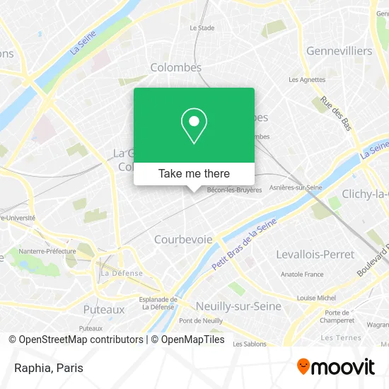
See Raphia, Courbevoie, on the map
Public Transit to Raphia in Courbevoie
Wondering how to get to Raphia in Courbevoie? Moovit helps you find the best way to get to Raphia with step-by-step directions from the nearest public transit station.
Moovit provides free maps and live directions to help you navigate through your city. View schedules, routes, timetables, and find out how long does it take to get to Raphia in real time.
Looking for the nearest stop or station to Raphia? Check out this list of stops closest to your destination: Verdun - Rue Latérale; République - Colombes; Europe; Paix - Verdun; Moulin Des Bruyères; Courbevoie.
Train: L.Bus: 163, 164, 175, 178, 278, N152, 275, 167, 363.
Want to see if there’s another route that gets you there at an earlier time? Moovit helps you find alternative routes or times. Get directions from and directions to Raphia easily from the Moovit App or Website.
We make riding to Raphia easy, which is why over 1.5 million users, including users in Courbevoie, trust Moovit as the best app for public transit. You don’t need to download an individual bus app or train app, Moovit is your all-in-one transit app that helps you find the best bus time or train time available.
For information on prices of bus, metro, train and RER, costs and ride fares to Raphia, please check the Moovit app.
Use the app to navigate to popular places including to the airport, hospital, stadium, grocery store, mall, coffee shop, school, college, and university.
Raphia Address: 5 Rue Paul Bert 92400 Courbevoie street in Courbevoie
- Boulevard De Verdun,
- Continental,
- 3 Villa des Fleurs,
- Prolog,
- Teliasonera,
- Honda Japauto,
- Naya Restaurant,
- CITROËN la Garenne Auto Service (Clas),
- Immeuble Le Cristallin,
- Centre Culturel Lumière,
- Overlap Groupe - Le Cristallin,
- Trinity Films,
- Harris Interactive,
- Martine Genain,
- 9 Rue du Moulin des Bruyères,
- Argedis,
- Rue Latérale,
- Nexen Services,
- Paricom,
- Picto Défense
Places Near Raphia (Courbevoie)
- Théâtre Mogador, Paris,
- Hôpital Beaujon, Clichy,
- Galeries Lafayette, Paris,
- Hopital Foch, Suresnes,
- Atelier Des Lumieres, Paris,
- Hôpital Necker, Paris,
- Hôpital Saint-Joseph, Paris,
- Créteil Soleil, Creteil,
- Hôpital Cochin, Paris,
- Beaugrenelle, Paris,
- Hôpital de la Pitié-Salpêtrière, Paris,
- Hopital Lariboisière, Paris,
- Galeries Lafayette Haussmann, Paris,
- Centre Hospitalier des 15/20, Paris,
- Fondation Louis Vuitton, Paris,
- Hôpital Pitié Salpêtrière, Paris,
- Gare Routière Flixbus, Paris,
- Marché Saint-Pierre, Paris,
- 29 Rue Manin, Paris,
- Hôpital Henri Mondor, Creteil
How to get to popular places in Paris with public transit
Get around Courbevoie by public transit!
Traveling around Courbevoie has never been so easy. See step by step directions as you travel to any attraction, street or major public transit station. View bus and train schedules, arrival times, service alerts and detailed routes on a map, so you know exactly how to get to anywhere in Courbevoie.
When traveling to any destination around Courbevoie use Moovit's Live Directions with Get Off Notifications to know exactly where and how far to walk, how long to wait for your line, and how many stops are left. Moovit will alert you when it's time to get off — no need to constantly re-check whether yours is the next stop.
Wondering how to use public transit in Courbevoie or how to pay for public transit in Courbevoie? Moovit public transit app can help you navigate your way with public transit easily, and at minimum cost. It includes public transit fees, ticket prices, and costs. Looking for a map of Courbevoie public transit lines? Moovit public transit app shows all public transit maps in Courbevoie with all Bus, Train, Metro, Light Rail, RER, Funicular and Gondola routes and stops on an interactive map.
Paris has 7 transit type(s), including: Bus, Train, Metro, Light Rail, RER, Funicular and Gondola, operated by several transit agencies, including RATP, RER, RER Bus de remplacement, Train, Train Bus de remplacement, Tramway Bus de remplacement, TER, ADP, Magical Shuttle, Argenteuil - Boucles de Seine, Autocars Dominique, Bièvre, Brie et 2 Morin, Le Bus - C.C. du Clermontois and Cœur d’Essonne