How to get to RapiPago by Colectivo?
Click on the Colectivo route to see step by step directions with maps, line arrival times and updated time schedules.
From Estación Moreno, Moreno
30 minFrom Villa Luzuriaga, La Matanza
41 minFrom Parada Línea 57 - Moreno-Once, Moreno
47 minFrom Hospital Posadas, Morón
29 minFrom Clinica Alcorta, Morón
50 minFrom Hospital Italiano Sede San Justo, La Matanza
82 minFrom General Belgrano / Constitución, Tres De Febrero
57 minFrom Hurlingham (Estación Hurlingham), Morón
46 minFrom Ramos Mejía, La Matanza
52 minFrom Centro De Atención Al Usuario Aysa Ramos Mejía, La Matanza
65 min
How to get to RapiPago by train?
Click on the train route to see step by step directions with maps, line arrival times and updated time schedules.
Colectivo stops near RapiPago in Morón
Train station near RapiPago in Morón
- Castelar, 21 min walk,VIEW
Colectivo lines to RapiPago in Morón
What are the closest stations to RapiPago?
The closest stations to RapiPago are:
- José María Paz Y Paso De Los Libres is 46 meters away, 1 min walk.
- La Piedad Y José María Paz is 161 meters away, 3 min walk.
- Castelar is 1587 meters away, 21 min walk.
Which Colectivo lines stop near RapiPago?
These Colectivo lines stop near RapiPago: 269, 395, 443.
Which train line stops near RapiPago?
SARMIENTO (Moreno→Once)
What’s the nearest train station to RapiPago in Morón?
The nearest train station to RapiPago in Morón is Castelar. It’s a 21 min walk away.
What’s the nearest Colectivo station to RapiPago in Morón?
The nearest Colectivo station to RapiPago in Morón is José María Paz Y Paso De Los Libres. It’s a 1 min walk away.
What time is the first train to RapiPago in Morón?
The SARMIENTO is the first train that goes to RapiPago in Morón. It stops nearby at 3:07 AM.
What time is the last train to RapiPago in Morón?
The SARMIENTO is the last train that goes to RapiPago in Morón. It stops nearby at 2:55 AM.
What time is the first Colectivo to RapiPago in Morón?
The 395 is the first Colectivo that goes to RapiPago in Morón. It stops nearby at 3:00 AM.
What time is the last Colectivo to RapiPago in Morón?
The 395 is the last Colectivo that goes to RapiPago in Morón. It stops nearby at 3:12 AM.
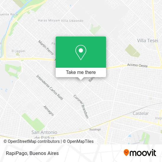
See RapiPago, Morón, on the map
Public Transit to RapiPago in Morón
Wondering how to get to RapiPago in Morón? Moovit helps you find the best way to get to RapiPago with step-by-step directions from the nearest public transit station.
Moovit provides free maps and live directions to help you navigate through your city. View schedules, routes, timetables, and find out how long does it take to get to RapiPago in real time.
Looking for the nearest stop or station to RapiPago? Check out this list of stops closest to your destination: José María Paz Y Paso De Los Libres; La Piedad Y José María Paz; Castelar.
Colectivo: 269, 395, 443, 504.Train: SARMIENTO.
Want to see if there’s another route that gets you there at an earlier time? Moovit helps you find alternative routes or times. Get directions from and directions to RapiPago easily from the Moovit App or Website.
We make riding to RapiPago easy, which is why over 1.5 million users, including users in Morón, trust Moovit as the best app for public transit. You don’t need to download an individual bus app or train app, Moovit is your all-in-one transit app that helps you find the best bus time or train time available.
For information on prices of Colectivo and train, costs and ride fares to RapiPago, please check the Moovit app.
Use the app to navigate to popular places including to the airport, hospital, stadium, grocery store, mall, coffee shop, school, college, and university.
RapiPago Address: José Ma. Paz street in Morón
- Parada del 269 Ituzaingo,
- Moron Parada del 269,
- Registro Seccional Motovehículos Morón B,
- Calle José María Paz 1714,
- Aquasol,
- Frio & Co-Refrigeración,
- Instituto Nuestra Señora del Pilar,
- Nahuel Huapi & Calle José María Paz,
- Ateneo Néstor Kirchner Ituzaingó,
- Escuela Secundaria N 12,
- Escuela Primaria N 16 Islas Malvinas,
- Muñoz Hogar,
- Zeta Motos Repuestos,
- Monroe 916,
- Grupo Scout Nuestra Señora Del Pilar,
- Electrodomesticos-Venta-Muñoz Hogar Grupo Gaona,
- Lojack Ituzaingo,
- Avenida José M. Paz / Coronel Barcala,
- Santos Dumont,
- Barcala y Gaona Km24
Places Near RapiPago (Morón)
- Tecnópolis, Vicente López,
- Flores, Distrito Federal,
- Hospital Santa Lucia, Distrito Federal,
- Unicenter Shopping, San Isidro,
- Estadio Monumental (River Plate), Distrito Federal,
- Dot Baires Shopping, Vicente López,
- Aeroparque Jorge Newbery,
- Abasto Shopping, Distrito Federal,
- Aeropuerto Ezeiza, Distrito Federal,
- Facultad de Odontología (UBA), Distrito Federal,
- Jardín Japonés, Distrito Federal,
- La Plata, La Plata,
- Movistar Arena, Distrito Federal,
- Buenos Aires, Distrito Federal,
- Avellaneda, Avellaneda,
- La Plata, La Plata,
- Barrio Chino, Distrito Federal,
- Parque de la Ciudad, Distrito Federal,
- CABA, Distrito Federal,
- Once, Distrito Federal
How to get to popular places in Buenos Aires with public transit
Get around Morón by public transit!
Traveling around Morón has never been so easy. See step by step directions as you travel to any attraction, street or major public transit station. View bus and train schedules, arrival times, service alerts and detailed routes on a map, so you know exactly how to get to anywhere in Morón.
When traveling to any destination around Morón use Moovit's Live Directions with Get Off Notifications to know exactly where and how far to walk, how long to wait for your line, and how many stops are left. Moovit will alert you when it's time to get off — no need to constantly re-check whether yours is the next stop.
Wondering how to use public transit in Morón or how to pay for public transit in Morón? Moovit public transit app can help you navigate your way with public transit easily, and at minimum cost. It includes public transit fees, ticket prices, and costs. Looking for a map of Morón public transit lines? Moovit public transit app shows all public transit maps in Morón with all Colectivo, Train, Subte, Light Rail and Ferry routes and stops on an interactive map.
Buenos Aires has 5 transit type(s), including: Colectivo, Train, Subte, Light Rail and Ferry, operated by several transit agencies, including Municipalidad Carmen de Areco, Trenes Argentinos, Ferrovías, Metrovías, Subte de Buenos Aires, Doscientos Ocho Transporte Automotor S.A., Empresa del Oeste, Empresa de Transportes Tratado del PIlar S.R.L., Transportes Veintidos de Septiembre, Sargento Cabral, Transportes Sesenta y Ocho, Transportes Quirno Costa, Transportes Santa Fe, Transportes Automotores Riachuelo and Transportes Atlantida