How to get to Rapid Mobile X-Ray by bus?
Click on the bus route to see step by step directions with maps, line arrival times and updated time schedules.
From I-95 Exit 33 - Laurel/Burtonsville (Sandy Spring Rd/MD 198), Prince George's County
100 minFrom Exit 19 - I-95/495 / US 50 (John Hanson Hwy) / Annapolis, Washington, Prince George's County
54 minFrom Woodmore Towne Centre at Glenarden, Prince George's County
74 minFrom Laurel, Maryland, Prince George's County
81 minFrom The Mall at Prince Georges, Prince George's County
90 minFrom Prince George's Sports and Learning Complex, Prince George's County
93 minFrom White Oak MVA, Montgomery County
83 minFrom Kaiser Permanente - Largo Medical Center, Prince George's County
98 minFrom Adventist HealthCare White Oak Medical Center-ER (Adventist White Oak Med Ctr-ER), Montgomery County
77 minFrom FedEx Field, Prince George's County
89 min
Bus stops near Rapid Mobile X-Ray in Prince George's County
Train station near Rapid Mobile X-Ray in Prince George's County
- Seabrook Marc Nb, 51 min walk,VIEW
Bus lines to Rapid Mobile X-Ray in Prince George's County
What are the closest stations to Rapid Mobile X-Ray?
The closest stations to Rapid Mobile X-Ray are:
- Ridge Road And Gardenway is 277 yards away, 4 min walk.
- Ridge Road & Gardenway is 335 yards away, 5 min walk.
- Seabrook Marc Nb is 4279 yards away, 51 min walk.
Which bus line stops near Rapid Mobile X-Ray?
P21 (South To New Carrollton)
What’s the nearest bus station to Rapid Mobile X-Ray in Prince George's County?
The nearest bus station to Rapid Mobile X-Ray in Prince George's County is Ridge Road And Gardenway. It’s a 4 min walk away.
What time is the first train to Rapid Mobile X-Ray in Prince George's County?
The MARC is the first train that goes to Rapid Mobile X-Ray in Prince George's County. It stops nearby at 5:32 AM.
What time is the last train to Rapid Mobile X-Ray in Prince George's County?
The MARC is the last train that goes to Rapid Mobile X-Ray in Prince George's County. It stops nearby at 10:21 PM.
What time is the first bus to Rapid Mobile X-Ray in Prince George's County?
The P21 is the first bus that goes to Rapid Mobile X-Ray in Prince George's County. It stops nearby at 5:34 AM.
What time is the last bus to Rapid Mobile X-Ray in Prince George's County?
The P20 is the last bus that goes to Rapid Mobile X-Ray in Prince George's County. It stops nearby at 12:21 AM.
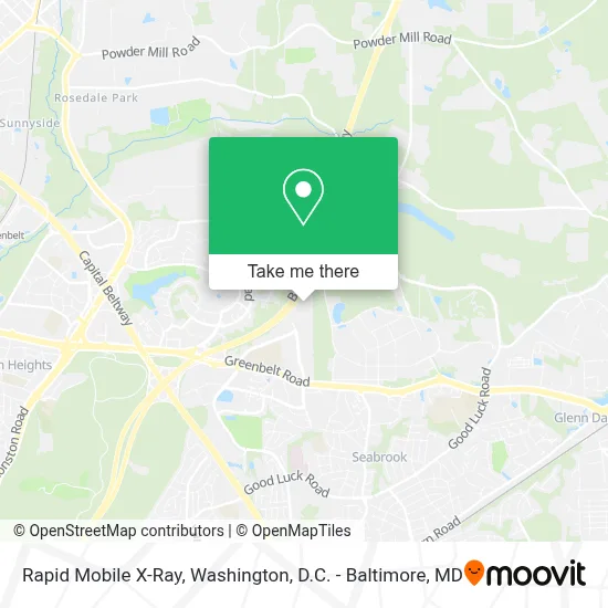
See Rapid Mobile X-Ray, Prince George's County, on the map
Public Transit to Rapid Mobile X-Ray in Prince George's County
Wondering how to get to Rapid Mobile X-Ray in Prince George's County? Moovit helps you find the best way to get to Rapid Mobile X-Ray with step-by-step directions from the nearest public transit station.
Moovit provides free maps and live directions to help you navigate through your city. View schedules, routes, timetables, and find out how long does it take to get to Rapid Mobile X-Ray in real time.
Looking for the nearest stop or station to Rapid Mobile X-Ray? Check out this list of stops closest to your destination: Ridge Road And Gardenway; Ridge Road & Gardenway; Seabrook Marc Nb.
Bus: P21, P20.Train: MARC.
Want to see if there’s another route that gets you there at an earlier time? Moovit helps you find alternative routes or times. Get directions from and directions to Rapid Mobile X-Ray easily from the Moovit App or Website.
We make riding to Rapid Mobile X-Ray easy, which is why over 1.7 million users, including users in Prince George's County, trust Moovit as the best app for public transit. You don’t need to download an individual bus app or train app, Moovit is your all-in-one transit app that helps you find the best bus time or train time available.
For information on prices of bus and metro, costs and ride fares to Rapid Mobile X-Ray, please check the Moovit app.
Use the app to navigate to popular places including to the airport, hospital, stadium, grocery store, mall, coffee shop, school, college, and university.
Rapid Mobile X-Ray Address: 8001 Mandan Rd street in Prince George's County
- Baltimore - Washington Parkway (MD 295),
- Eleanor Roosevelt High School,
- Greenbelt, MD,
- Greenbelt Rd,
- Hanover MD-193,
- NASA Goddard Farmer's Market,
- Greenbelt Branch Library,
- NASA Goddard Space Flight Center,
- Nasa Goddard Space Flight Center,
- St Hugh Parish,
- Greenway Center Dr Greenbelt Rd,
- Greenway Shopping Center,
- Goddard, Maryland,
- Greenbelt Lake,
- Ross Dress for Less,
- NASA Goddard Visitor Center,
- Woodspring Suites,
- Martin's Crosswinds,
- Holiday Inn Washington D.c.-Greenbelt Md,
- Sri Siva Vishnu Temple
Places Near Rapid Mobile X-Ray (Prince George's County)
- Westfield Montgomery Mall, Montgomery County,
- Washington DC VA Medical Center, Washington,
- National Theatre, Washington,
- The Anthem, Washington,
- Georgetown, Washington,
- PG Mall, Prince George's County,
- Marriott Marquis Washington, DC, Washington,
- Washington National Cathedral, Washington,
- Museum Of The Bible, Washington,
- Warner Theatre, Washington,
- Pennsylvania Ave NW (3rd st and pennsylvania), Washington,
- National Zoo, Washington,
- Capital One Arena, Washington,
- National Museum of African American History and Culture, Washington,
- M&T Bank Stadium, Baltimore,
- Rock Creek Tennis Center, Washington,
- Amazon Hq2, Arlington County,
- Basilica of the National Shrine, Washington,
- Sibley Memorial Hospital, Washington,
- Camden Yards, Baltimore
How to get to popular places in Washington, D.C. - Baltimore, MD with public transit
Get around Prince George's County by public transit!
Traveling around Prince George's County has never been so easy. See step by step directions as you travel to any attraction, street or major public transit station. View bus and train schedules, arrival times, service alerts and detailed routes on a map, so you know exactly how to get to anywhere in Prince George's County.
When traveling to any destination around Prince George's County use Moovit's Live Directions with Get Off Notifications to know exactly where and how far to walk, how long to wait for your line, and how many stops are left. Moovit will alert you when it's time to get off — no need to constantly re-check whether yours is the next stop.
Wondering how to use public transit in Prince George's County or how to pay for public transit in Prince George's County? Moovit public transit app can help you navigate your way with public transit easily, and at minimum cost. It includes public transit fees, ticket prices, and costs. Looking for a map of Prince George's County public transit lines? Moovit public transit app shows all public transit maps in Prince George's County with all Bus, Train, Metro, Light Rail and Ferry routes and stops on an interactive map.
Washington, D.C. - Baltimore, MD has 5 transit type(s), including: Bus, Train, Metro, Light Rail and Ferry, operated by several transit agencies, including WMATA, Montgomery County Ride On, Fairfax Connector, TheBus, PRTC, DASH - Alexandria, Arlington Transit (ART), RTA of Central Maryland, MDOT MTA, MDOT MTA Light RailLink, MDOT MTA Commuter Bus, MDOT MTA Local Bus, FXBGO!, Virginia Railway Express (VRE) and MARC