How to get to Rapp Getränke by bus?
Click on the bus route to see step by step directions with maps, line arrival times and updated time schedules.
From Berghütte Lauterbad, Vereinbarte Verwaltungsgemeinschaft Freudenstadt
141 minFrom Helios Klinik Rottweil-Notaufnahme, Rottweil
86 minFrom Panorama-Bad Freudenstadt, Vereinbarte Verwaltungsgemeinschaft Freudenstadt
202 minFrom Klinik Hohenfreudenstadt, Vereinbarte Verwaltungsgemeinschaft Freudenstadt
200 minFrom Ferien im Baudenkmal, St. Georgen Im Schwarzwald
65 minFrom Hotel Palmenwald, Vereinbarte Verwaltungsgemeinschaft Freudenstadt
135 minFrom Waldeck Spa, Bad Dürrheim
76 minFrom Bauhaus Villingen-Schwenningen, Villingen-Schwenningen
45 minFrom Stadtwerke Villingen-Schwenningen GmbH, Villingen-Schwenningen
46 min
Bus stops near Rapp Getränke in Hardt
Bus lines to Rapp Getränke in Hardt
What are the closest stations to Rapp Getränke?
The closest stations to Rapp Getränke are:
- Hardt Hardtschmiede is 720 meters away, 10 min walk.
- Hardt Römerweg is 751 meters away, 10 min walk.
- Buchenberg Siehdichfür II is 1006 meters away, 13 min walk.
Which bus line stops near Rapp Getränke?
7486 (Königsfeld Busbahnhof)
What’s the nearest bus station to Rapp Getränke in Hardt?
The nearest bus stations to Rapp Getränke in Hardt are Hardt Hardtschmiede and Hardt Römerweg. The closest one is a 10 min walk away.
What time is the first bus to Rapp Getränke in Hardt?
The 7486 is the first bus that goes to Rapp Getränke in Hardt. It stops nearby at 5:38 AM.
What time is the last bus to Rapp Getränke in Hardt?
The 9055 is the last bus that goes to Rapp Getränke in Hardt. It stops nearby at 8:37 PM.
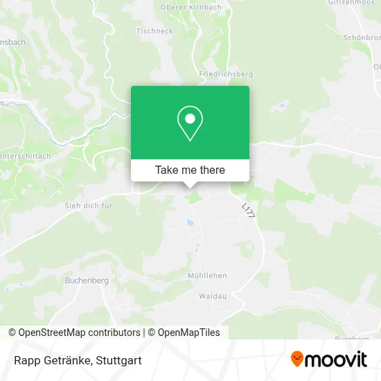
See Rapp Getränke, Hardt, on the map
Public Transit to Rapp Getränke in Hardt
Wondering how to get to Rapp Getränke in Hardt? Moovit helps you find the best way to get to Rapp Getränke with step-by-step directions from the nearest public transit station.
Moovit provides free maps and live directions to help you navigate through your city. View schedules, routes, timetables, and find out how long does it take to get to Rapp Getränke in real time.
Looking for the nearest stop or station to Rapp Getränke? Check out this list of stops closest to your destination: Hardt Hardtschmiede; Hardt Römerweg; Buchenberg Siehdichfür II.
Bus: 7486, 56, 9055, 9486, 675.
Want to see if there’s another route that gets you there at an earlier time? Moovit helps you find alternative routes or times. Get directions from and directions to Rapp Getränke easily from the Moovit App or Website.
We make riding to Rapp Getränke easy, which is why over 1.5 million users, including users in Hardt, trust Moovit as the best app for public transit. You don’t need to download an individual bus app or train app, Moovit is your all-in-one transit app that helps you find the best bus time or train time available.
For information on prices of bus, costs and ride fares to Rapp Getränke, please check the Moovit app.
Use the app to navigate to popular places including to the airport, hospital, stadium, grocery store, mall, coffee shop, school, college, and university.
Rapp Getränke Address: Römerweg street in Hardt
- Getränke Rapp,
- Bernd Storz,
- Römerweg,
- Gaus H.-J. Wohnen mit Holz,
- Erzknabberteufel Aichhalden,
- Gefühl Art,
- Astrid King,
- Renovier Klauss Inh. Michael Klaussner Malerbetrieb,
- Oberhardt,
- Förderverein Bildung und Erziehung,
- Easygadgets24,
- Getränkemarkt Storz,
- Maxxcompany,
- Entek Ingenieurbüro,
- Bausachverständige Maxxcompany,
- Tischtennisverein Hardt,
- Spielplatz Moos III,
- Fußballfeld,
- Flaig Magnetsysteme,
- Elektrotechnikhug
Places Near Rapp Getränke (Hardt)
- Geilhaus Haus 33a, Reutlingen-Betzingen,
- Hanns-Martin-Schleyer-Halle (Stuttgart Hans-Martin-Schleyerhalle), Bad Cannstatt,
- FlixBus Haltestelle, Stuttgart,
- Hanns-Martin-Schleyer-Halle, Bad Cannstatt,
- Gasometer Pforzheim, Pforzheim,
- Waldfriedhof, Degerloch,
- Klinikum Stuttgart - Katharinenhospital, Stuttgart-Mitte,
- Gleis 101/102 (tief), Stuttgart-Mitte,
- Porsche Museum, Zuffenhausen,
- Pariser Platz Stuttgart, Stuttgart-Mitte,
- Wilhelma (U-Bahn Wilhelma), Bad Cannstatt,
- Mercedes-Benz Museum, Bad Cannstatt,
- Porsche-Arena, Bad Cannstatt,
- Hauptbahnhof Stuttgart, Stuttgart-Mitte,
- Marmorsaal Im Weissenburgpark, Stuttgart-Süd,
- Mettingen Eros-Center Puff Laufhaus, Esslingen Am Neckar,
- Schleyerhalle, Bad Cannstatt,
- Mercedes-Benz Museum (Mercedes Museum Stuttgart), Bad Cannstatt,
- SI-Centrum, Möhringen,
- Im Wizemann (Halle), Bad Cannstatt
How to get to popular places in Stuttgart with public transit
Get around Hardt by public transit!
Traveling around Hardt has never been so easy. See step by step directions as you travel to any attraction, street or major public transit station. View bus and train schedules, arrival times, service alerts and detailed routes on a map, so you know exactly how to get to anywhere in Hardt.
When traveling to any destination around Hardt use Moovit's Live Directions with Get Off Notifications to know exactly where and how far to walk, how long to wait for your line, and how many stops are left. Moovit will alert you when it's time to get off — no need to constantly re-check whether yours is the next stop.
Wondering how to use public transit in Hardt or how to pay for public transit in Hardt? Moovit public transit app can help you navigate your way with public transit easily, and at minimum cost. It includes public transit fees, ticket prices, and costs. Looking for a map of Hardt public transit lines? Moovit public transit app shows all public transit maps in Hardt with all Bus, Train, Subway, Light Rail, Ferry, S-Bahn and Funicular routes and stops on an interactive map.
Stuttgart has 7 transit type(s), including: Bus, Train, Subway, Light Rail, Ferry, S-Bahn and Funicular, operated by several transit agencies, including SSB - Stadtbahn, SSB, SSB - Seilbahn / Zacke, S-Bahn Stuttgart, Rhein-Neckar-Verkehr GmbH (rnv), Karlsruher Verkehrsverbund, DB AG, DB Regiobus BW, Arverio Baden-Württemberg GmbH, DB RegioNetz Verkehrs GmbH Westfrankenbahn, DB Regio AG Baden-Württemberg, Südwestdeutsche Verkehrs-AG, DB Regio AG Mitte Region Hessen, DB and Bodensee-Oberschwaben-Bahn