How to get to Rappahannock River Patriot by bus?
Click on the bus route to see step by step directions with maps, line arrival times and updated time schedules.
From Leesburg VA-684, Fairfax County
59 minFrom Centreville, VA, Fairfax County
50 minFrom Burke, VA, Fairfax County
43 minFrom Tysons Corner Center, Fairfax County
52 minFrom Spa World, Fairfax County
54 minFrom Inova employee Shuttle, Fairfax County
42 minFrom Falls Church Marriott Fairview Park, Fairfax County
67 minFrom Springfield, VA, Fairfax County
56 minFrom Inova Fairfax Hospital North Tower Building, Fairfax County
43 minFrom Inova Fair Oaks Hospital, Fairfax County
51 min
Bus stops near Rappahannock River Patriot in Fairfax County
Bus lines to Rappahannock River Patriot in Fairfax County
What are the closest stations to Rappahannock River Patriot?
The closest stations to Rappahannock River Patriot are:
- Rappahannock Ln at Patriot Circle - Arrival is 102 yards away, 2 min walk.
- University Dr+George Mason Bl is 217 yards away, 3 min walk.
- University Dr @ George Mason Blvd is 238 yards away, 3 min walk.
Which bus lines stop near Rappahannock River Patriot?
These bus lines stop near Rappahannock River Patriot: 306, 610, F23, F50, GOLD 1.
What’s the nearest bus station to Rappahannock River Patriot in Fairfax County?
The nearest bus station to Rappahannock River Patriot in Fairfax County is Rappahannock Ln at Patriot Circle - Arrival. It’s a 2 min walk away.
What time is the first bus to Rappahannock River Patriot in Fairfax County?
The F50 is the first bus that goes to Rappahannock River Patriot in Fairfax County. It stops nearby at 5:18 AM.
What time is the last bus to Rappahannock River Patriot in Fairfax County?
The F23 is the last bus that goes to Rappahannock River Patriot in Fairfax County. It stops nearby at 10:38 PM.
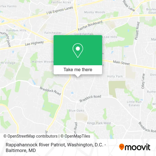
See Rappahannock River Patriot, Fairfax County, on the map
Public Transit to Rappahannock River Patriot in Fairfax County
Wondering how to get to Rappahannock River Patriot in Fairfax County? Moovit helps you find the best way to get to Rappahannock River Patriot with step-by-step directions from the nearest public transit station.
Moovit provides free maps and live directions to help you navigate through your city. View schedules, routes, timetables, and find out how long does it take to get to Rappahannock River Patriot in real time.
Looking for the nearest stop or station to Rappahannock River Patriot? Check out this list of stops closest to your destination: Rappahannock Ln at Patriot Circle - Arrival; University Dr+George Mason Bl; University Dr @ George Mason Blvd.
Bus: 306, 610, F23, F50, GOLD 1, GREEN 1, GOLD 2, GREEN 2, F29.
Want to see if there’s another route that gets you there at an earlier time? Moovit helps you find alternative routes or times. Get directions from and directions to Rappahannock River Patriot easily from the Moovit App or Website.
We make riding to Rappahannock River Patriot easy, which is why over 1.5 million users, including users in Fairfax County, trust Moovit as the best app for public transit. You don’t need to download an individual bus app or train app, Moovit is your all-in-one transit app that helps you find the best bus time or train time available.
For information on prices of bus and metro, costs and ride fares to Rappahannock River Patriot, please check the Moovit app.
Use the app to navigate to popular places including to the airport, hospital, stadium, grocery store, mall, coffee shop, school, college, and university.
Rappahannock River Patriot Address: Fairfax, VA 22030 street in Fairfax County
- Gmu Fairfax Campus - Rappahannock River Parking Deck,
- Alan and Sally Merten Hall - George Mason University,
- 4400 University Drive,
- The UPS Store,
- Cue Bus Shelter - George Mason University,
- George Mason University, Fairfax Campus - Rappahannock River Parking Deck,
- George Mason University Police Department,
- Gehl Group,
- Secure Command,
- WETA TV,
- Merten Hall Lot,
- Einstein Bros Bagels,
- Southside Dining Hall at Gmu,
- Globe Gmu,
- Jim McKay Natatorium,
- Wgmu,
- Mason Dreamers,
- Art and Design Building at Gmu,
- Virtual Library of Virginia,
- Sigma Chi - Iota XI (Beta Delta Chapter of Chi Upsilon Sigma National Latin Sorority)
Places Near Rappahannock River Patriot (Fairfax County)
- National Mall, Washington,
- Rock Creek Tennis Center, Washington,
- Capital One Arena, Washington,
- Georgetown, Washington,
- National Museum of African American History and Culture, Washington,
- Basilica of the National Shrine, Washington,
- Museum Of The Bible, Washington,
- Washington National Cathedral, Washington,
- The Anthem, Washington,
- M&T Bank Stadium, Baltimore,
- PG Mall, Prince George's County,
- Sibley Memorial Hospital, Washington,
- Amazon Hq2, Arlington County,
- Camden Yards, Baltimore,
- Washington DC VA Medical Center, Washington,
- National Zoo, Washington,
- Westfield Montgomery Mall, Montgomery County,
- Warner Theatre, Washington,
- Marriott Marquis Washington, DC, Washington,
- Pennsylvania Ave NW (3rd st and pennsylvania), Washington
How to get to popular places in Washington, D.C. - Baltimore, MD with public transit
Get around Fairfax County by public transit!
Traveling around Fairfax County has never been so easy. See step by step directions as you travel to any attraction, street or major public transit station. View bus and train schedules, arrival times, service alerts and detailed routes on a map, so you know exactly how to get to anywhere in Fairfax County.
When traveling to any destination around Fairfax County use Moovit's Live Directions with Get Off Notifications to know exactly where and how far to walk, how long to wait for your line, and how many stops are left. Moovit will alert you when it's time to get off — no need to constantly re-check whether yours is the next stop.
Wondering how to use public transit in Fairfax County or how to pay for public transit in Fairfax County? Moovit public transit app can help you navigate your way with public transit easily, and at minimum cost. It includes public transit fees, ticket prices, and costs. Looking for a map of Fairfax County public transit lines? Moovit public transit app shows all public transit maps in Fairfax County with all Bus, Train, Metro, Light Rail and Ferry routes and stops on an interactive map.
Washington, D.C. - Baltimore, MD has 5 transit type(s), including: Bus, Train, Metro, Light Rail and Ferry, operated by several transit agencies, including WMATA, Montgomery County Ride On, Fairfax Connector, TheBus, PRTC, DASH - Alexandria, Arlington Transit (ART), RTA of Central Maryland, MDOT MTA, MDOT MTA Light RailLink, MDOT MTA Commuter Bus, MDOT MTA Local Bus, FXBGO!, Virginia Railway Express (VRE) and MARC