How to get to Ras Norfolk by bus?
Click on the bus route to see step by step directions with maps, line arrival times and updated time schedules.
Light Rail stations near Ras Norfolk
- Monticello, 17 min walk,VIEW
What are the closest stations to Ras Norfolk?
The closest stations to Ras Norfolk are:
- Colley & 26th is 114 yards away, 2 min walk.
- Colonial & 26th is 539 yards away, 7 min walk.
- Monticello is 1368 yards away, 17 min walk.
Which bus lines stop near Ras Norfolk?
These bus lines stop near Ras Norfolk: 001, 023, 961.
Which light rail line stops near Ras Norfolk?
800 (Evmc Fort Norfolk Station)
What’s the nearest light rail station to Ras Norfolk?
The nearest light rail station to Ras Norfolk is Monticello. It’s a 17 min walk away.
What’s the nearest bus station to Ras Norfolk?
The nearest bus station to Ras Norfolk is Colley & 26th. It’s a 2 min walk away.
What time is the first light rail to Ras Norfolk?
The 800 is the first light rail that goes to Ras Norfolk. It stops nearby at 5:27 AM.
What time is the last light rail to Ras Norfolk?
The 800 is the last light rail that goes to Ras Norfolk. It stops nearby at 11:40 PM.
What time is the first bus to Ras Norfolk?
The 011 is the first bus that goes to Ras Norfolk. It stops nearby at 6:10 AM.
What time is the last bus to Ras Norfolk?
The 004 is the last bus that goes to Ras Norfolk. It stops nearby at 10:50 PM.
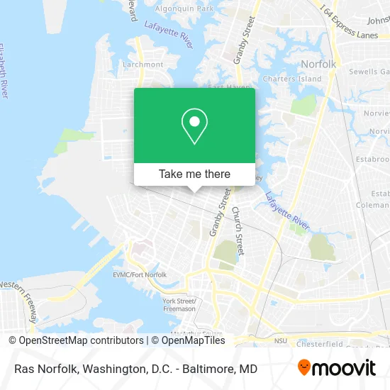
See Ras Norfolk on the map
Public Transportation to Ras Norfolk
Wondering how to get to Ras Norfolk? Moovit helps you find the best way to get to Ras Norfolk with step-by-step directions from the nearest public transit station.
Moovit provides free maps and live directions to help you navigate through your city. View schedules, routes, timetables, and find out how long does it take to get to Ras Norfolk in real time.
Looking for the nearest stop or station to Ras Norfolk? Check out this list of stops closest to your destination: Colley & 26th; Colonial & 26th; Monticello.
Bus: 001, 023, 961, 004, 011.Light Rail: 800.
Want to see if there’s another route that gets you there at an earlier time? Moovit helps you find alternative routes or times. Get directions from and directions to Ras Norfolk easily from the Moovit App or Website.
We make riding to Ras Norfolk easy, which is why over 1.5 million users, including users in Norfolk, trust Moovit as the best app for public transit. You don’t need to download an individual bus app or train app, Moovit is your all-in-one transit app that helps you find the best bus time or train time available.
For information on prices of bus, train and light rail, costs and ride fares to Ras Norfolk, please check the Moovit app.
Use the app to navigate to popular places including to the airport, hospital, stadium, grocery store, mall, coffee shop, school, college, and university.
Ras Norfolk Address: 2512 Colonial Ave Norfolk, VA 23517 street in Norfolk
- Torch Yoga Studio,
- It Can Be Coffee,
- Virginia Sash & Door,
- Champion Fences,
- Handsome Biscuit,
- Bryan Electric,
- Torrey Vacuum Packing Machines Service & Repair Vacuum Packing Machines,
- Tidewater Scale & Butcher Supplies,
- Jim's Auto Service,
- Healthy You Wellness Spa,
- B G Place Apartments,
- Equal Housing Opportunity,
- East End Academy,
- Mea Culpa,
- Goodwill Baptist Church,
- Superior Float Tanks,
- Tamco Paint,
- Modular Conex,
- Ecoformance,
- Bailey Roofing Company
Places Near Ras Norfolk
- Pennsylvania Ave NW (3rd st and pennsylvania), Washington,
- Amazon Hq2, Arlington County,
- M&T Bank Stadium, Baltimore,
- Westfield Montgomery Mall, Montgomery County,
- Georgetown, Washington,
- Washington National Cathedral, Washington,
- Capital One Arena, Washington,
- PG Mall, Prince George's County,
- Basilica of the National Shrine, Washington,
- Sibley Memorial Hospital, Washington,
- Marriott Marquis Washington, DC, Washington,
- Warner Theatre, Washington,
- Washington DC VA Medical Center, Washington,
- Rock Creek Tennis Center, Washington,
- National Museum of African American History and Culture, Washington,
- National Zoo, Washington,
- National Theatre, Washington,
- Camden Yards, Baltimore,
- Museum Of The Bible, Washington,
- The Anthem, Washington
How to get to popular places in Washington, D.C. - Baltimore, MD with public transit
Get around Norfolk by public transit!
Traveling around Norfolk has never been so easy. See step by step directions as you travel to any attraction, street or major public transit station. View bus and train schedules, arrival times, service alerts and detailed routes on a map, so you know exactly how to get to anywhere in Norfolk.
When traveling to any destination around Norfolk use Moovit's Live Directions with Get Off Notifications to know exactly where and how far to walk, how long to wait for your line, and how many stops are left. Moovit will alert you when it's time to get off — no need to constantly re-check whether yours is the next stop.
Wondering how to use public transit in Norfolk or how to pay for public transit in Norfolk? Moovit public transit app can help you navigate your way with public transit easily, and at minimum cost. It includes public transit fees, ticket prices, and costs. Looking for a map of Norfolk public transit lines? Moovit public transit app shows all public transit maps in Norfolk with all Bus, Train, Metro, Light Rail and Ferry routes and stops on an interactive map.
Washington, D.C. - Baltimore, MD has 5 transit type(s), including: Bus, Train, Metro, Light Rail and Ferry, operated by several transit agencies, including WMATA, Montgomery County Ride On, Fairfax Connector, TheBus, PRTC, DASH - Alexandria, Arlington Transit (ART), RTA of Central Maryland, MDOT MTA, MDOT MTA Light RailLink, MDOT MTA Commuter Bus, MDOT MTA Local Bus, FXBGO!, Virginia Railway Express (VRE) and MARC