How to get to Rasefa Inox by bus?
Click on the bus route to see step by step directions with maps, line arrival times and updated time schedules.
Bus stops near Rasefa Inox in San Martin
Bus lines to Rasefa Inox in San Martin
- 1214, Las Gardenias (Ate) - Canta Callao (San Martin De Porres),VIEW
- 1482, Chorrillos - S.M.P.,VIEW
- 1491, Puente Benavides (Surco) - Pacasmayo (Callao),VIEW
- CR24, Manylsa,VIEW
- CR44, Ate - Callao,VIEW
- IO30B, 28 De Julio (Lima) - Pacasmayo (S.M.P.),VIEW
- OM23, Callao - Rímac (B),VIEW
- OM33, Puente Santa Rosa (Rimac),VIEW
- 1030, Canta Callao (San Martin De Porres) - San Diego (San Martin De Porres),VIEW
- 1284, Canta Callao (San Martin De Porres),VIEW
- 1286, Mariategui (S.J. Lurigancho) - San Diego (S.M. Porres),VIEW
- 1429, Callao - S.M.P.,VIEW
- 1435, Minka (Callao) - Torre Blanca (Carabayllo),VIEW
- 1436, Collique (Comas) - Mi Peru (Ventanilla),VIEW
- 2208, Tantamayo - Japón,VIEW
- AN14, Bertello (San Martin De Porres) - Terminal Naranjal (Independencia),VIEW
- UCL01, Callao,VIEW
- 1161, Ate - Callao,VIEW
- 1279, Ceres,VIEW
- 1285, Callao - Ate ,VIEW
What are the closest stations to Rasefa Inox?
The closest stations to Rasefa Inox are:
- Avenida Pacasmayo is 61 meters away, 2 min walk.
- Pacasmayo is 123 meters away, 2 min walk.
- Tottus Canta Callao is 428 meters away, 6 min walk.
- Bertello is 442 meters away, 6 min walk.
Which bus lines stop near Rasefa Inox?
These bus lines stop near Rasefa Inox: 1030, 1214, 1284, 1286, 1491, CR24, OM33.
What’s the nearest bus station to Rasefa Inox in San Martin?
The nearest bus stations to Rasefa Inox in San Martin are Avenida Pacasmayo and Pacasmayo. The closest one is a 2 min walk away.
What time is the first bus to Rasefa Inox in San Martin?
The OM23 is the first bus that goes to Rasefa Inox in San Martin. It stops nearby at 3:02 AM.
What time is the last bus to Rasefa Inox in San Martin?
The OM23 is the last bus that goes to Rasefa Inox in San Martin. It stops nearby at 3:13 AM.
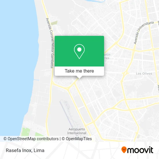
See Rasefa Inox, San Martin, on the map
Public Transit to Rasefa Inox in San Martin
Wondering how to get to Rasefa Inox in San Martin? Moovit helps you find the best way to get to Rasefa Inox with step-by-step directions from the nearest public transit station.
Moovit provides free maps and live directions to help you navigate through your city. View schedules, routes, timetables, and find out how long does it take to get to Rasefa Inox in real time.
Looking for the nearest stop or station to Rasefa Inox? Check out this list of stops closest to your destination: Avenida Pacasmayo; Pacasmayo; Tottus Canta Callao; Bertello.
Bus: 1030, 1214, 1284, 1286, 1491, CR24, OM33, 1482, CR44, 1429, 1435, 1435 SX, 1161, 1279, 1285, UCL02, UCL03.
Want to see if there’s another route that gets you there at an earlier time? Moovit helps you find alternative routes or times. Get directions from and directions to Rasefa Inox easily from the Moovit App or Website.
We make riding to Rasefa Inox easy, which is why over 1.5 million users, including users in San Martin, trust Moovit as the best app for public transit. You don’t need to download an individual bus app or train app, Moovit is your all-in-one transit app that helps you find the best bus time or train time available.
For information on prices of bus, costs and ride fares to Rasefa Inox, please check the Moovit app.
Use the app to navigate to popular places including to the airport, hospital, stadium, grocery store, mall, coffee shop, school, college, and university.
Rasefa Inox Address: Avenida Pacasmayo Las Praderas del Sol 4ta Etapa, 07031 Callao street in San Martin
- Paradero Pacasmayo - Metropolitano (AN - 14),
- Las Praderas Del Sol 4 Etapa,
- Canta Callao y Pacasmayo,
- Avenida Canta Callao & Avenida Pacasmayo,
- URB FIDADELFIA MZ F LOTE 27,
- Hotel Fhiladelfia,
- Clinica Veterinaria de Mascotas del Callao,
- avenida Canta Callao manzana b lote 5 san martin de porres,
- Avenida Canta Callao,
- Cisternas de Agua Corporacion Lopez Ayala,
- Western Union,
- manzana b lote 10 urb mi terruño,
- Manzana D Lote,
- Corporación Yesmian,
- Manzana C Lote lote 11,
- Lubricantes Claudia,
- Parque Los Olivos de Santa Rosa,
- Calle Los Robles Asoc Viv Los Robles de Santa Rosa,
- Mercado Los Robles De Santa Rosa,
- Colegio Matemático & Academia Preuniversitaria Alfagroup
Places Near Rasefa Inox (San Martin)
- Mall Del Sur,
- Miraflores, Miraflores,
- Paradero Av.Brasil,
- Larcomar, Miraflores,
- Av. Abancay, Lima,
- Real Plaza Puruchuco, Ate,
- Gamarra,
- Parque de las Leyendas, San Miguel,
- Plaza San Miguel, San Miguel,
- Av. La Marina, San Miguel,
- Jockey Plaza, Santiago D,
- Centro Comercial Plaza Norte, Independen,
- Pontificia Universidad Católica del Perú - PUCP, San Miguel,
- Av. Salaverry, Jesus Mari,
- Aeropuerto Internacional Jorge Chávez, Ventanilla,
- Circuito Mágico Del Agua, Lima,
- Hospital Edgardo Rebagliati Martins, Jesus Mari,
- Barranco, Barranco,
- av arequipa, Lima,
- Parque Kennedy, Miraflores
How to get to popular places in Lima with public transit
Get around San Martin by public transit!
Traveling around San Martin has never been so easy. See step by step directions as you travel to any attraction, street or major public transit station. View bus and train schedules, arrival times, service alerts and detailed routes on a map, so you know exactly how to get to anywhere in San Martin.
When traveling to any destination around San Martin use Moovit's Live Directions with Get Off Notifications to know exactly where and how far to walk, how long to wait for your line, and how many stops are left. Moovit will alert you when it's time to get off — no need to constantly re-check whether yours is the next stop.
Wondering how to use public transit in San Martin or how to pay for public transit in San Martin? Moovit public transit app can help you navigate your way with public transit easily, and at minimum cost. It includes public transit fees, ticket prices, and costs. Looking for a map of San Martin public transit lines? Moovit public transit app shows all public transit maps in San Martin with all Bus, Metro and Ferry routes and stops on an interactive map.
Lima has 3 transit type(s), including: Bus, Metro and Ferry, operated by several transit agencies, including Metro de Lima Línea 2 , Metro de Lima, Corredor Rojo, Metropolitano, Metropolitano - Alimentadores, Corredor Morado, Corredor Azul, Rutas Tradicionales, Transportes y Servicios La Esperanza S.A., Las Flores S.A., Virgen de la Asunción S.A., Consorcio HAM, Transportes y Service Canadá S.A., ETUL4SA and ETUCHISA