How to get to Rassa (Alles Rund Ums Handy) by bus?
Click on the bus route to see step by step directions with maps, line arrival times and updated time schedules.
From Marie-Baum-Schule Heidelberg, Wieblingen
158 minFrom Friedhof Käfertal, Käfertal
78 minFrom Globus Getränkecenter, Ludwigshafen-Oggersheim
49 minFrom Universitätsklinikum Heidelberg-Notaufnahme, Neuenheim
165 minFrom Möbel Höffner, Schwetzingen
68 minFrom Thoraxklinik Heidelberg, Neuenheim
160 minFrom Globus Getränkemarkt, Ludwigshafen-Oggersheim
50 minFrom GRN-Klinik Schwetzingen, Schwetzingen
111 minFrom MVV Energie Ladestation, Käfertal
67 min
How to get to Rassa (Alles Rund Ums Handy) by train?
Click on the train route to see step by step directions with maps, line arrival times and updated time schedules.
Bus stops near Rassa (Alles Rund Ums Handy) in Ludwigshafen-Südliche-Innenstadt
Light Rail stations near Rassa (Alles Rund Ums Handy) in Ludwigshafen-Südliche-Innenstadt
Bus lines to Rassa (Alles Rund Ums Handy) in Ludwigshafen-Südliche-Innenstadt
- 70, Lu Hauptbahnhof,VIEW
- 71, Notwende,VIEW
- 74, Berliner Platz,VIEW
- 74E, Leininger Straße,VIEW
- RNV 6, Ludwigsh., B. Pl. Bf Lu Mitte,VIEW
- 75, Berliner Platz Bf LU Mitte – LU Hauptbahnhof – LU Hochschule – Marienkrankenhaus – Rheingönheim Bf – Rheingönheim Neubruch,VIEW
- 75E, Berliner Platz Bf LU Mitte – LU Hauptbahnhof – LU Hochschule – Marienkrankenhaus – Rheingönheim Bf – Rheingönheim Neubruch,VIEW
- 76, Berliner Platz Bf LU Mitte – Rhein-Galerie – LU Hochschule – Marienkrankenhaus – Maudach Kleestraße,VIEW
- 90, Berliner Platz Bf LU Mitte - Friesenheim - Oggersheim Comeniusstraße - Notwende/Melm,VIEW
- 95, Berliner Platz Bf LU Mitte - Valentin-Bauer Siedlung - Marienkrankenhaus - Maudach,VIEW
- 96, Berliner Platz,VIEW
- 4, (Bad Dürkheim Bf –) Oggersheim Comeniusstraße – LU Hauptbahnhof – Berliner Platz Bf LU Mitte – Universität – MA Hauptbahnhof – Wasserturm – Paradeplatz – Abendakademie – Alte Feuerwache – Universitätsklinikum – Waldfriedhof,VIEW
- 4, Hans-Warsch-Platz - Berliner Platz, Bf LU Mitte,VIEW
- 7, Rheingönheim Neubruch – Am Schwanen – Südwest-Stadion – Berliner Platz Bf LU Mitte – Paradeplatz – Nationaltheater – Universitätsklinikum – Pfeifferswörth – Vogelstang West – Vogelstang,VIEW
- 77, Berliner Platz Bf LU Mitte - Parkinsel,VIEW
- 94, Berliner Platz Bf LU Mitte - Am Schwanen - Marienkrankenhaus - Niederfeld,VIEW
- 4A, (Bad Dürkheim Bf –) Oggersheim Comeniusstraße – LU Hauptbahnhof – Berliner Platz Bf LU Mitte – Universität – MA Hauptbahnhof – Wasserturm – Paradeplatz – Abendakademie – Alte Feuerwache – Universitätsklinikum – Waldfriedhof,VIEW
- E, Rheingönheim Neubruch – Am Schwanen – Südwest-Stadion – Berliner Platz Bf LU Mitte – Paradeplatz – Nationaltheater – Universitätsklinikum – Pfeifferswörth – Vogelstang West – Vogelstang,VIEW
- E, Berliner Platz, Bf LU Mitte - Maudach Kleestraße,VIEW
- E, (Bad Dürkheim Bf –) Oggersheim Comeniusstraße – LU Hauptbahnhof – Berliner Platz Bf LU Mitte – Universität – MA Hauptbahnhof – Wasserturm – Paradeplatz – Abendakademie – Alte Feuerwache – Universitätsklinikum – Waldfriedhof,VIEW
What are the closest stations to Rassa (Alles Rund Ums Handy)?
The closest stations to Rassa (Alles Rund Ums Handy) are:
- Lu Rathaus is 251 meters away, 4 min walk.
- Ludwigshafen, Rathaus Bstg A is 283 meters away, 4 min walk.
- Ludwigshafen, Rathaus Bstg G3 is 314 meters away, 5 min walk.
- Kaiser-Wilhelm-Straße is 616 meters away, 8 min walk.
- Pfalzbau/Wilhelm-Hack-Museum is 673 meters away, 10 min walk.
Which bus lines stop near Rassa (Alles Rund Ums Handy)?
These bus lines stop near Rassa (Alles Rund Ums Handy): 60, 62, 71, 710.
Which train lines stop near Rassa (Alles Rund Ums Handy)?
These train lines stop near Rassa (Alles Rund Ums Handy): S3, S6.
Which light rail lines stop near Rassa (Alles Rund Ums Handy)?
These light rail lines stop near Rassa (Alles Rund Ums Handy): 4A, 6, 6A, RNV 4, RNV 4A.
What’s the nearest light rail station to Rassa (Alles Rund Ums Handy) in Ludwigshafen-Südliche-Innenstadt?
The nearest light rail stations to Rassa (Alles Rund Ums Handy) in Ludwigshafen-Südliche-Innenstadt are Lu Rathaus and Ludwigshafen, Rathaus Bstg G3. The closest one is a 5 min walk away.
What’s the nearest bus station to Rassa (Alles Rund Ums Handy) in Ludwigshafen-Südliche-Innenstadt?
The nearest bus stations to Rassa (Alles Rund Ums Handy) in Ludwigshafen-Südliche-Innenstadt are Lu Rathaus and Ludwigshafen, Rathaus Bstg A. The closest one is a 4 min walk away.
What time is the first light rail to Rassa (Alles Rund Ums Handy) in Ludwigshafen-Südliche-Innenstadt?
The 4 is the first light rail that goes to Rassa (Alles Rund Ums Handy) in Ludwigshafen-Südliche-Innenstadt. It stops nearby at 4:03 AM.
What time is the last light rail to Rassa (Alles Rund Ums Handy) in Ludwigshafen-Südliche-Innenstadt?
The 4 is the last light rail that goes to Rassa (Alles Rund Ums Handy) in Ludwigshafen-Südliche-Innenstadt. It stops nearby at 1:24 AM.
What time is the first bus to Rassa (Alles Rund Ums Handy) in Ludwigshafen-Südliche-Innenstadt?
The 90E is the first bus that goes to Rassa (Alles Rund Ums Handy) in Ludwigshafen-Südliche-Innenstadt. It stops nearby at 4:25 AM.
What time is the last bus to Rassa (Alles Rund Ums Handy) in Ludwigshafen-Südliche-Innenstadt?
The 6 is the last bus that goes to Rassa (Alles Rund Ums Handy) in Ludwigshafen-Südliche-Innenstadt. It stops nearby at 12:35 AM.
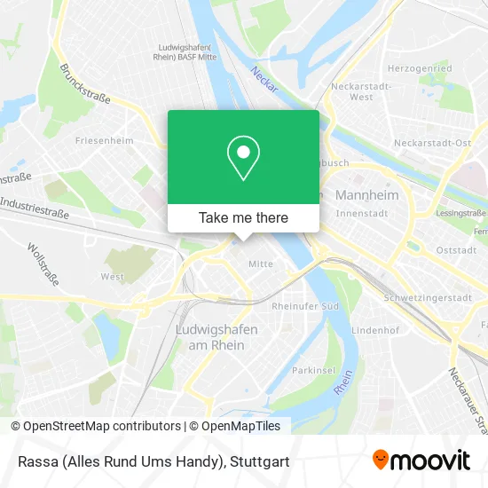
See Rassa (Alles Rund Ums Handy), Ludwigshafen-Südliche-Innenstadt, on the map
Public Transit to Rassa (Alles Rund Ums Handy) in Ludwigshafen-Südliche-Innenstadt
Wondering how to get to Rassa (Alles Rund Ums Handy) in Ludwigshafen-Südliche-Innenstadt? Moovit helps you find the best way to get to Rassa (Alles Rund Ums Handy) with step-by-step directions from the nearest public transit station.
Moovit provides free maps and live directions to help you navigate through your city. View schedules, routes, timetables, and find out how long does it take to get to Rassa (Alles Rund Ums Handy) in real time.
Looking for the nearest stop or station to Rassa (Alles Rund Ums Handy)? Check out this list of stops closest to your destination: Lu Rathaus; Ludwigshafen; Ludwigshafen; Kaiser-Wilhelm-Straße; Pfalzbau/Wilhelm-Hack-Museum.
Bus: 60, 62, 71, 710, 70, 74, 74E, RNV 6, 75, 75E, 76, 90, 95, 96, 4, 4, 7, 77, 94.Train: S3, S6.Light Rail: 4A, 6, 6A, RNV 4, RNV 4A.
Want to see if there’s another route that gets you there at an earlier time? Moovit helps you find alternative routes or times. Get directions from and directions to Rassa (Alles Rund Ums Handy) easily from the Moovit App or Website.
We make riding to Rassa (Alles Rund Ums Handy) easy, which is why over 1.5 million users, including users in Ludwigshafen-Südliche-Innenstadt, trust Moovit as the best app for public transit. You don’t need to download an individual bus app or train app, Moovit is your all-in-one transit app that helps you find the best bus time or train time available.
For information on prices of light rail, bus and train, costs and ride fares to Rassa (Alles Rund Ums Handy), please check the Moovit app.
Use the app to navigate to popular places including to the airport, hospital, stadium, grocery store, mall, coffee shop, school, college, and university.
Rassa (Alles Rund Ums Handy) Address: Mitte, 67059 Ludwigshafen am Rhein street in Ludwigshafen-Südliche-Innenstadt
- Dielmann 2,
- Ludwigshafen,
- Postfiliale,
- Büro Krumb,
- Tk Maxx,
- Vodafone,
- Dänisches Bettenlager,
- Rats-Apotheke,
- Deichmann,
- Bijou Brigitte,
- Reformhaus Joachim Escher,
- Bonita,
- Tedi Fil 6360,
- Apollo-Optik,
- McPaper,
- Haircut Friseure,
- Smyths Toys,
- New York Nails,
- DHL,
- Eduscho
Places Near Rassa (Alles Rund Ums Handy) (Ludwigshafen-Südliche-Innenstadt)
- Waldfriedhof, Degerloch,
- Hanns-Martin-Schleyer-Halle (Stuttgart Hans-Martin-Schleyerhalle), Bad Cannstatt,
- Im Wizemann (Halle), Bad Cannstatt,
- Geilhaus Haus 33a, Reutlingen-Betzingen,
- SI-Centrum, Möhringen,
- Gleis 101/102 (tief), Stuttgart-Mitte,
- Klinikum Stuttgart - Katharinenhospital, Stuttgart-Mitte,
- Schleyerhalle, Bad Cannstatt,
- Pariser Platz Stuttgart, Stuttgart-Mitte,
- Wilhelma (U-Bahn Wilhelma), Bad Cannstatt,
- FlixBus Haltestelle, Stuttgart,
- Marmorsaal Im Weissenburgpark, Stuttgart-Süd,
- Porsche Museum, Zuffenhausen,
- Hanns-Martin-Schleyer-Halle, Bad Cannstatt,
- Gasometer Pforzheim, Pforzheim,
- Porsche-Arena, Bad Cannstatt,
- Mettingen Eros-Center Puff Laufhaus, Esslingen Am Neckar,
- Mercedes-Benz Museum, Bad Cannstatt,
- Mercedes-Benz Museum (Mercedes Museum Stuttgart), Bad Cannstatt,
- Hauptbahnhof Stuttgart, Stuttgart-Mitte
How to get to popular places in Stuttgart with public transit
Get around Ludwigshafen-Südliche-Innenstadt by public transit!
Traveling around Ludwigshafen-Südliche-Innenstadt has never been so easy. See step by step directions as you travel to any attraction, street or major public transit station. View bus and train schedules, arrival times, service alerts and detailed routes on a map, so you know exactly how to get to anywhere in Ludwigshafen-Südliche-Innenstadt.
When traveling to any destination around Ludwigshafen-Südliche-Innenstadt use Moovit's Live Directions with Get Off Notifications to know exactly where and how far to walk, how long to wait for your line, and how many stops are left. Moovit will alert you when it's time to get off — no need to constantly re-check whether yours is the next stop.
Wondering how to use public transit in Ludwigshafen-Südliche-Innenstadt or how to pay for public transit in Ludwigshafen-Südliche-Innenstadt? Moovit public transit app can help you navigate your way with public transit easily, and at minimum cost. It includes public transit fees, ticket prices, and costs. Looking for a map of Ludwigshafen-Südliche-Innenstadt public transit lines? Moovit public transit app shows all public transit maps in Ludwigshafen-Südliche-Innenstadt with all Bus, Train, Subway, Light Rail, Ferry, S-Bahn and Funicular routes and stops on an interactive map.
Stuttgart has 7 transit type(s), including: Bus, Train, Subway, Light Rail, Ferry, S-Bahn and Funicular, operated by several transit agencies, including SSB - Stadtbahn, SSB, SSB - Seilbahn / Zacke, S-Bahn Stuttgart, Rhein-Neckar-Verkehr GmbH (rnv), Karlsruher Verkehrsverbund, DB AG, DB Regiobus BW, Arverio Baden-Württemberg GmbH, DB RegioNetz Verkehrs GmbH Westfrankenbahn, DB Regio AG Baden-Württemberg, Südwestdeutsche Verkehrs-AG, DB Regio AG Mitte Region Hessen, DB and Bodensee-Oberschwaben-Bahn
Public transit lines with stations closest to Rassa (Alles Rund Ums Handy) in Ludwigshafen-Südliche-Innenstadt
Bus lines with stations closest to Rassa (Alles Rund Ums Handy) in Ludwigshafen-Südliche-Innenstadt
Lu Rathaus
 70LU Hauptbahnhof - LU Rathaus - Marienkirche - BASF (Tor 1+2) - Friesenheim Mitte - Sternstraße - Hans-Warsch-Platz - Adolf-Kolping-Straße
- 71LU Rathaus – Marienkirche – Hans-Warsch-Platz – Karl-Kreuter-Straße – Großparthweiher
- 74Berliner Platz Bf LU Mitte – Am Schwanen – Marienkrankenhaus – Niederfeld – Valentin-Bauer-Siedlung – LU Hauptbahnhof – LU Rathaus
- 74EBerliner Platz Bf LU Mitte – Am Schwanen – Marienkrankenhaus – Niederfeld – Valentin-Bauer-Siedlung – LU Hauptbahnhof – LU Rathaus
Kaiser-Wilhelm-Straße
- 75Berliner Platz Bf LU Mitte – LU Hauptbahnhof – LU Hochschule – Marienkrankenhaus – Rheingönheim Bf – Rheingönheim Neubruch
- 75EBerliner Platz Bf LU Mitte – LU Hauptbahnhof – LU Hochschule – Marienkrankenhaus – Rheingönheim Bf – Rheingönheim Neubruch
- 76Berliner Platz Bf LU Mitte – Rhein-Galerie – LU Hochschule – Marienkrankenhaus – Maudach Kleestraße
- 90Berliner Platz Bf LU Mitte - Friesenheim - Oggersheim Comeniusstraße - Notwende/Melm
- 95Berliner Platz Bf LU Mitte - Valentin-Bauer Siedlung - Marienkrankenhaus - Maudach
Kaiser-Wilhelm-Straße
- 4(Bad Dürkheim Bf –) Oggersheim Comeniusstraße – LU Hauptbahnhof – Berliner Platz Bf LU Mitte – Universität – MA Hauptbahnhof – Wasserturm – Paradeplatz – Abendakademie – Alte Feuerwache – Universitätsklinikum – Waldfriedhof
- 4Hans-Warsch-Platz - Berliner Platz, Bf LU Mitte
- 7Rheingönheim Neubruch – Am Schwanen – Südwest-Stadion – Berliner Platz Bf LU Mitte – Paradeplatz – Nationaltheater – Universitätsklinikum – Pfeifferswörth – Vogelstang West – Vogelstang
- 77Berliner Platz Bf LU Mitte - Parkinsel
- 94Berliner Platz Bf LU Mitte - Am Schwanen - Marienkrankenhaus - Niederfeld