How to get to Rastelli Maurizio by bus?
Click on the bus route to see step by step directions with maps, line arrival times and updated time schedules.
From Chiesina Uzzanese, Chiesina Uzzanese
55 minFrom Pescia Hospital, Pescia
68 minFrom Pistoia Hospital, Pistoia
84 minFrom Tuscan Radiological Institute, Pistoia
78 minFrom San Jacopo Hospital, Pistoia
86 minFrom Gian Battista Vico Street 2A, Pistoia
79 minFrom Sandro Pertini Street, Pistoia
64 minFrom Adua Avenue, Pistoia
79 minFrom Ludovico Lazzaro Zamenhof Street, Pistoia
62 minFrom Don Carlos Disco, Chiesina Uzzanese
63 min
How to get to Rastelli Maurizio by train?
Click on the train route to see step by step directions with maps, line arrival times and updated time schedules.
Bus stops near Rastelli Maurizio in Montecatini-Terme
Train stations near Rastelli Maurizio in Montecatini-Terme
Bus lines to Rastelli Maurizio in Montecatini-Terme
- 808, Montecatini T. Italia Square [Railway Station],VIEW
- 808, Montecatini Alto,VIEW
- 1, Line 1 - North Circular,VIEW
- 60, Fucecchio - Lamporecchio - Larciano - Monsummano Terme - Montecatini Terme,VIEW
- 802, Montecatini Terme - Querceta - Montecatini Terme,VIEW
- 701, Montecatini Terme - Borgo A Buggiano - Chiesina Uzzanese - Pescia,VIEW
- 703, Montecatini Terme - Borgo A Buggiano - Santa Lucia - Pescia,VIEW
- 855, Panicagliora,VIEW
- 855, Marliana,VIEW
What are the closest stations to Rastelli Maurizio?
The closest stations to Rastelli Maurizio are:
- Montecatini Alto is 266 meters away, 4 min walk.
- Montecatini Center is 499 meters away, 7 min walk.
- Montecatini T. Querceta is 1417 meters away, 18 min walk.
- Minister is 1438 meters away, 19 min walk.
- Montecatini Terme-Monsummano is 4353 meters away, 56 min walk.
Which bus lines stop near Rastelli Maurizio?
These bus lines stop near Rastelli Maurizio: 63, 73, 808.
Which train line stops near Rastelli Maurizio?
R (Prato/Firenze)
What’s the nearest train station to Rastelli Maurizio in Montecatini-Terme?
The nearest train station to Rastelli Maurizio in Montecatini-Terme is Montecatini Center. It’s a 7 min walk away.
What’s the nearest bus station to Rastelli Maurizio in Montecatini-Terme?
The nearest bus station to Rastelli Maurizio in Montecatini-Terme is Montecatini Alto. It’s a 4 min walk away.
What time is the first train to Rastelli Maurizio in Montecatini-Terme?
The R is the first train that goes to Rastelli Maurizio in Montecatini-Terme. It stops nearby at 6:53 AM.
What time is the last train to Rastelli Maurizio in Montecatini-Terme?
The R is the last train that goes to Rastelli Maurizio in Montecatini-Terme. It stops nearby at 1:27 AM.
What time is the first bus to Rastelli Maurizio in Montecatini-Terme?
The 808 is the first bus that goes to Rastelli Maurizio in Montecatini-Terme. It stops nearby at 1:38 PM.
What time is the last bus to Rastelli Maurizio in Montecatini-Terme?
The 808 is the last bus that goes to Rastelli Maurizio in Montecatini-Terme. It stops nearby at 8:09 PM.
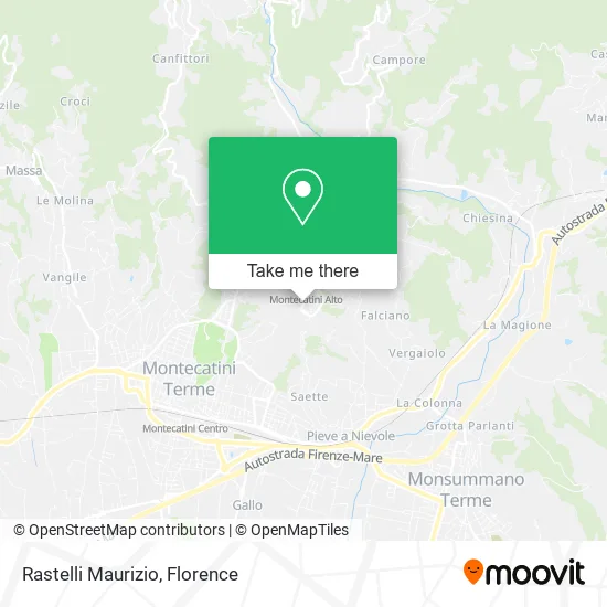
See Rastelli Maurizio, Montecatini-Terme, on the map
Public Transit to Rastelli Maurizio in Montecatini-Terme
Wondering how to get to Rastelli Maurizio in Montecatini-Terme? Moovit helps you find the best way to get to Rastelli Maurizio with step-by-step directions from the nearest public transit station.
Moovit provides free maps and live directions to help you navigate through your city. View schedules, routes, timetables, and find out how long does it take to get to Rastelli Maurizio in real time.
Looking for the nearest stop or station to Rastelli Maurizio? Check out this list of stops closest to your destination: Montecatini Alto; Montecatini Center; Montecatini T. Querceta; Minister; Montecatini Terme-Monsummano.
Bus: 63, 73, 808, 1, 60, 802, 701, 703, 855, 855.Train: R.
Want to see if there’s another route that gets you there at an earlier time? Moovit helps you find alternative routes or times. Get directions from and directions to Rastelli Maurizio easily from the Moovit App or Website.
We make riding to Rastelli Maurizio easy, which is why over 1.5 million users, including users in Montecatini-Terme, trust Moovit as the best app for public transit. You don’t need to download an individual bus app or train app, Moovit is your all-in-one transit app that helps you find the best bus time or train time available.
For information on prices of bus and train, costs and ride fares to Rastelli Maurizio, please check the Moovit app.
Use the app to navigate to popular places including to the airport, hospital, stadium, grocery store, mall, coffee shop, school, college, and university.
Rastelli Maurizio Address: Largo Vincenzo Martinelli, 51016 Montecatini Terme street in Montecatini-Terme
- Gira e Rigira Bio,
- Castel Lemmi Street,
- Montecatini Alto,
- Funicular,
- La Madonnina Institute Association,
- Barbano and Giovannetti Square,
- Belvedere Palace,
- Montecatini Alto Cemetery,
- Maria Enrica Mariotti,
- Ferdinando Martini Avenue, 4,
- Professional Association of Architects Pierluigi Guidi and Riccardo Loren,
- Fonteregia Shop,
- Onde Fashion Store,
- Uashmama,
- Casa Giulia,
- B Carmai Palace,
- Hermada-Montecatini Dog Shelter,
- Arci Montecatini Alto Club,
- Gala Boutique,
- From the Kitchen
Places Near Rastelli Maurizio (Montecatini-Terme)
- Michelangelo Square, Florence,
- Cascine Park, Florence,
- Asmana, Campi Bisenzio,
- Visarno Arena, Florence,
- Santa Maria Novella Station, Florence,
- Nelson Mandela Forum, Florence,
- I Gigli, Campi Bisenzio,
- Field of Mars, Florence,
- Michelangelo Square, Florence,
- Visarno Hippodrome, Florence,
- OOO, Florence,
- Tobacco Manufacture, Florence,
- Mandela Forum (Nelson Mandela Forum), Florence,
- IKEA Florence, Sesto Fiorentino,
- Artemio Franchi Municipal Stadium, Florence,
- Santa Maria Nuova Hospital, Florence,
- Campi Bisenzio, Campi Bisenzio,
- Verdi Theater, Florence,
- Torregalli Hospital Scandicci *, Scandicci,
- Piero Palagi Hospital Facility-Florence, Florence
How to get to popular places in Florence with public transit
Get around Montecatini-Terme by public transit!
Traveling around Montecatini-Terme has never been so easy. See step by step directions as you travel to any attraction, street or major public transit station. View bus and train schedules, arrival times, service alerts and detailed routes on a map, so you know exactly how to get to anywhere in Montecatini-Terme.
When traveling to any destination around Montecatini-Terme use Moovit's Live Directions with Get Off Notifications to know exactly where and how far to walk, how long to wait for your line, and how many stops are left. Moovit will alert you when it's time to get off — no need to constantly re-check whether yours is the next stop.
Wondering how to use public transit in Montecatini-Terme or how to pay for public transit in Montecatini-Terme? Moovit public transit app can help you navigate your way with public transit easily, and at minimum cost. It includes public transit fees, ticket prices, and costs. Looking for a map of Montecatini-Terme public transit lines? Moovit public transit app shows all public transit maps in Montecatini-Terme with all Bus, Train, Light Rail, Ferry and Funicular routes and stops on an interactive map.
Florence has 5 transit type(s), including: Bus, Train, Light Rail, Ferry and Funicular, operated by several transit agencies, including Florence Urban - Tuscan Bus Lines, GEST, Livorno and Province - Tuscan Bus Lines, Arezzo, Florence and Provinces - Tuscan Bus Lines, Prato and Province - Tuscan Bus Lines, Lucca and Province - Tuscan Bus Lines, Massa, Carrara and Province - Tuscan Bus Lines, Pisa and Province - Tuscan Bus Lines, Grosseto, Siena and Provinces - Tuscan Bus Lines, Arezzo, Siena and Provinces - Tuscan Bus Lines, Florence and Province - Tuscan Bus Lines, Pistoia and Province - Tuscan Bus Lines, Siena and Province - Tuscan Bus Lines, Arezzo and Province - Tuscan Bus Lines and Trenitalia