How to get to Rastplatz by bus?
Click on the bus route to see step by step directions with maps, line arrival times and updated time schedules.
From Berghütte Lauterbad, Vereinbarte Verwaltungsgemeinschaft Freudenstadt
153 minFrom Panorama-Bad Freudenstadt, Vereinbarte Verwaltungsgemeinschaft Freudenstadt
167 minFrom Lützenhardt, Verwaltungsverband Dornstetten
126 minFrom Helios Klinik Rottweil-Notaufnahme, Rottweil
144 minFrom Krankenhaus Herrenberg, Herrenberg (Stadt)
180 minFrom Klinik Hohenfreudenstadt, Vereinbarte Verwaltungsgemeinschaft Freudenstadt
160 minFrom Campingplatz Schüttehof Horb, Gemarkung Horb am Neckar
72 minFrom Hotel Palmenwald, Vereinbarte Verwaltungsgemeinschaft Freudenstadt
146 minFrom Fachklinik Sonnenhof Waldachtal, Verwaltungsverband Dornstetten
131 minFrom Krankenhaus Freudenstadt, Vereinbarte Verwaltungsgemeinschaft Freudenstadt
159 min
Bus stop near Rastplatz in Verwaltungsgemeinschaft Sulz am Neckar
- Mühlheim Rathaus, 3 min walk,VIEW
Bus lines to Rastplatz in Verwaltungsgemeinschaft Sulz am Neckar
What are the closest stations to Rastplatz?
The closest stations to Rastplatz are:
- Mühlheim Rathaus is 177 meters away, 3 min walk.
Which bus line stops near Rastplatz?
7402 (Horb Bahnhof/Zob)
What’s the nearest bus station to Rastplatz in Verwaltungsgemeinschaft Sulz am Neckar?
The nearest bus station to Rastplatz in Verwaltungsgemeinschaft Sulz am Neckar is Mühlheim Rathaus. It’s a 3 min walk away.
What time is the first bus to Rastplatz in Verwaltungsgemeinschaft Sulz am Neckar?
The 7402 is the first bus that goes to Rastplatz in Verwaltungsgemeinschaft Sulz am Neckar. It stops nearby at 5:27 AM.
What time is the last bus to Rastplatz in Verwaltungsgemeinschaft Sulz am Neckar?
The 9402 is the last bus that goes to Rastplatz in Verwaltungsgemeinschaft Sulz am Neckar. It stops nearby at 12:03 AM.
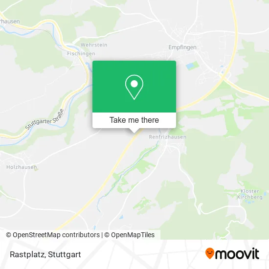
See Rastplatz, Verwaltungsgemeinschaft Sulz am Neckar, on the map
Public Transit to Rastplatz in Verwaltungsgemeinschaft Sulz am Neckar
Wondering how to get to Rastplatz in Verwaltungsgemeinschaft Sulz am Neckar? Moovit helps you find the best way to get to Rastplatz with step-by-step directions from the nearest public transit station.
Moovit provides free maps and live directions to help you navigate through your city. View schedules, routes, timetables, and find out how long does it take to get to Rastplatz in real time.
Looking for the nearest stop or station to Rastplatz? Check out this list of stops closest to your destination: Mühlheim Rathaus.
Bus: 7402, 7432, 9402.
Want to see if there’s another route that gets you there at an earlier time? Moovit helps you find alternative routes or times. Get directions from and directions to Rastplatz easily from the Moovit App or Website.
We make riding to Rastplatz easy, which is why over 1.5 million users, including users in Verwaltungsgemeinschaft Sulz am Neckar, trust Moovit as the best app for public transit. You don’t need to download an individual bus app or train app, Moovit is your all-in-one transit app that helps you find the best bus time or train time available.
For information on prices of bus and train, costs and ride fares to Rastplatz, please check the Moovit app.
Use the app to navigate to popular places including to the airport, hospital, stadium, grocery store, mall, coffee shop, school, college, and university.
Rastplatz Address: 72172 Sulz am Neckar street in Verwaltungsgemeinschaft Sulz am Neckar
- Autowerkstatt Kimmich,
- Sb-Auto Waschanlagen,
- B+G Metall GmbH & Co.,
- Intensivpflege Oster,
- Beatpack,
- Spielplatz. Schön Schattig Angelegt Direkt am Mühlbach,
- Immobilienverwaltung Mertmann,
- Markus Mertmann,
- Brunnen am Rathaus,
- Rathaus Von Renfrizhausen. Kindergarten Mühlheim-Renfrizhausen Befindet Sich Im Gleichen Gebäude,
- Druckenmüller Bernd, Baumgarthuber + Partner GmbH Versicherungsmakler,
- Mf Transport und Logistik,
- Kindergarten Renfrizhausen,
- Kreissparkasse, Kein Geldautomat,
- Mühlheim,
- Claudia und Klaus Haack,
- Jugendclub Mühlheim,
- Renfrizhausen Ort,
- Karl Wezel,
- 3k Impulse
Places Near Rastplatz (Verwaltungsgemeinschaft Sulz am Neckar)
- Gleis 101/102 (tief), Stuttgart-Mitte,
- FlixBus Haltestelle, Stuttgart,
- Mercedes-Benz Museum (Mercedes Museum Stuttgart), Bad Cannstatt,
- Mettingen Eros-Center Puff Laufhaus, Esslingen Am Neckar,
- Im Wizemann (Halle), Bad Cannstatt,
- Schleyerhalle, Bad Cannstatt,
- Klinikum Stuttgart - Katharinenhospital, Stuttgart-Mitte,
- Gasometer Pforzheim, Pforzheim,
- Waldfriedhof, Degerloch,
- Hanns-Martin-Schleyer-Halle, Bad Cannstatt,
- Porsche-Arena, Bad Cannstatt,
- Wilhelma (U-Bahn Wilhelma), Bad Cannstatt,
- Mercedes-Benz Museum, Bad Cannstatt,
- SI-Centrum, Möhringen,
- Geilhaus Haus 33a, Reutlingen-Betzingen,
- Hanns-Martin-Schleyer-Halle (Stuttgart Hans-Martin-Schleyerhalle), Bad Cannstatt,
- Pariser Platz Stuttgart, Stuttgart-Mitte,
- Hauptbahnhof Stuttgart, Stuttgart-Mitte,
- Porsche Museum, Zuffenhausen,
- Marmorsaal Im Weissenburgpark, Stuttgart-Süd
How to get to popular places in Stuttgart with public transit
Get around Verwaltungsgemeinschaft Sulz am Neckar by public transit!
Traveling around Verwaltungsgemeinschaft Sulz am Neckar has never been so easy. See step by step directions as you travel to any attraction, street or major public transit station. View bus and train schedules, arrival times, service alerts and detailed routes on a map, so you know exactly how to get to anywhere in Verwaltungsgemeinschaft Sulz am Neckar.
When traveling to any destination around Verwaltungsgemeinschaft Sulz am Neckar use Moovit's Live Directions with Get Off Notifications to know exactly where and how far to walk, how long to wait for your line, and how many stops are left. Moovit will alert you when it's time to get off — no need to constantly re-check whether yours is the next stop.
Wondering how to use public transit in Verwaltungsgemeinschaft Sulz am Neckar or how to pay for public transit in Verwaltungsgemeinschaft Sulz am Neckar? Moovit public transit app can help you navigate your way with public transit easily, and at minimum cost. It includes public transit fees, ticket prices, and costs. Looking for a map of Verwaltungsgemeinschaft Sulz am Neckar public transit lines? Moovit public transit app shows all public transit maps in Verwaltungsgemeinschaft Sulz am Neckar with all Bus, Train, Subway, Light Rail, Ferry, S-Bahn and Funicular routes and stops on an interactive map.
Stuttgart has 7 transit type(s), including: Bus, Train, Subway, Light Rail, Ferry, S-Bahn and Funicular, operated by several transit agencies, including SSB - Stadtbahn, SSB, SSB - Seilbahn / Zacke, S-Bahn Stuttgart, Rhein-Neckar-Verkehr GmbH (rnv), Karlsruher Verkehrsverbund, DB AG, DB Regiobus BW, Arverio Baden-Württemberg GmbH, DB RegioNetz Verkehrs GmbH Westfrankenbahn, DB Regio AG Baden-Württemberg, Südwestdeutsche Verkehrs-AG, DB Regio AG Mitte Region Hessen, DB and Bodensee-Oberschwaben-Bahn