How to get to Rastro Betel by bus?
Click on the bus route to see step by step directions with maps, line arrival times and updated time schedules.
From Centro Comercial Parque Corredor, Área Metropolitana De Madrid Y Corredor Del Henares
65 minFrom Barrio La zarzuela, Torrejón De Ardoz
26 minFrom Hospital De Torrejon De Ardoz, Torrejón De Ardoz
25 minFrom Torrejón de Ardoz, Torrejón De Ardoz
35 minFrom Oasiz Madrid, Torrejón De Ardoz
28 minFrom Recinto Ferial, Área Metropolitana De Madrid Y Corredor Del Henares
41 minFrom Torrejón, Área Metropolitana De Madrid Y Corredor Del Henares
31 minFrom Centro Comercial Oasiz Madrid, Área Metropolitana De Madrid Y Corredor Del Henares
29 minFrom Mágicas Navidades de Torrejón, Torrejón De Ardoz
36 minFrom Azuqueca de Henares, Azuqueca De Henares
29 min
How to get to Rastro Betel by train?
Click on the train route to see step by step directions with maps, line arrival times and updated time schedules.
From Barrio La zarzuela, Torrejón De Ardoz
48 minFrom Hospital De Torrejon De Ardoz, Torrejón De Ardoz
41 minFrom Torrejón de Ardoz, Torrejón De Ardoz
44 minFrom Oasiz Madrid, Torrejón De Ardoz
50 minFrom Azuqueca de Henares, Azuqueca De Henares
44 minFrom Recinto Ferial, Área Metropolitana De Madrid Y Corredor Del Henares
48 minFrom Torrejón, Área Metropolitana De Madrid Y Corredor Del Henares
40 minFrom Centro Comercial Oasiz Madrid, Área Metropolitana De Madrid Y Corredor Del Henares
51 minFrom Mágicas Navidades de Torrejón, Torrejón De Ardoz
45 min
Bus stops near Rastro Betel in Área Metropolitana De Madrid Y Corredor Del Henares
Train station near Rastro Betel in Área Metropolitana De Madrid Y Corredor Del Henares
- Alcalá De Henares, 13 min walk,VIEW
Bus lines to Rastro Betel in Área Metropolitana De Madrid Y Corredor Del Henares
- 11, La Garena - Est. Alcalá Universidad,VIEW
- 223, Madrid (Avda. América) - Alcalá de Henares,VIEW
- 231, Alcalá de Henares - Urb. Zulema - El Viso,VIEW
- 232, Alcalá de Henares - Torres de la Alameda,VIEW
- 251, Torrejón - Valdeavero - Alcalá,VIEW
- 252, Torrejón - Daganzo - Alcalá,VIEW
- 254, Valdeolmos/Fuente El Saz - Alcalá de Henares,VIEW
- 255, Valdeavero - Camarma de Esteruelas - Alcalá de Henares,VIEW
- 824, Madrid (Aeropuerto) - Torrejón de Ardoz - Alcalá de Henares,VIEW
- FS2, Torrelaguna - Alcalá de Henares,VIEW
- N200, Alcalá de Henares - Villalbilla - Alcalá de Henares,VIEW
- N202, Madrid (Avda. América) - Torrejón - Alcalá - Meco,VIEW
- 275, Av. Guadalajara - Brihuega,VIEW
- 2, Hospital / Universidad,VIEW
- 3, Estación Alcalá de Henares,VIEW
- 250, Vía Complutense - Atienza,VIEW
- 5, Nueva Rinconada,VIEW
- 1B, Circular Alcalá de Henares,VIEW
- 1A, Circular Alcalá de Henares,VIEW
- 229, Intercambiador De Avenida De América (Nivel -2),VIEW
What are the closest stations to Rastro Betel?
The closest stations to Rastro Betel are:
- Vía Complutense - Barrio Ledesma is 23 meters away, 1 min walk.
- Puerta Universo - Chinchón is 189 meters away, 3 min walk.
- Av. Meco - Aviación Española is 315 meters away, 5 min walk.
- Av. Meco - Pabellón Polideportivo is 482 meters away, 7 min walk.
- Ávila - C.º Esgaravita is 550 meters away, 8 min walk.
- Av. Lope De Figueroa - Fernando Flandes is 589 meters away, 8 min walk.
- Alcalá De Henares is 999 meters away, 13 min walk.
Which bus lines stop near Rastro Betel?
These bus lines stop near Rastro Betel: 11, 254, 824.
Which train lines stop near Rastro Betel?
These train lines stop near Rastro Betel: C2, C7.
What’s the nearest train station to Rastro Betel in Área Metropolitana De Madrid Y Corredor Del Henares?
The nearest train station to Rastro Betel in Área Metropolitana De Madrid Y Corredor Del Henares is Alcalá De Henares. It’s a 13 min walk away.
What’s the nearest bus station to Rastro Betel in Área Metropolitana De Madrid Y Corredor Del Henares?
The nearest bus station to Rastro Betel in Área Metropolitana De Madrid Y Corredor Del Henares is Vía Complutense - Barrio Ledesma. It’s a 1 min walk away.
What time is the first train to Rastro Betel in Área Metropolitana De Madrid Y Corredor Del Henares?
The C2 is the first train that goes to Rastro Betel in Área Metropolitana De Madrid Y Corredor Del Henares. It stops nearby at 5:06 AM.
What time is the last train to Rastro Betel in Área Metropolitana De Madrid Y Corredor Del Henares?
The C2 is the last train that goes to Rastro Betel in Área Metropolitana De Madrid Y Corredor Del Henares. It stops nearby at 12:33 AM.
What time is the first bus to Rastro Betel in Área Metropolitana De Madrid Y Corredor Del Henares?
The N202 is the first bus that goes to Rastro Betel in Área Metropolitana De Madrid Y Corredor Del Henares. It stops nearby at 3:00 AM.
What time is the last bus to Rastro Betel in Área Metropolitana De Madrid Y Corredor Del Henares?
The N200 is the last bus that goes to Rastro Betel in Área Metropolitana De Madrid Y Corredor Del Henares. It stops nearby at 3:29 AM.
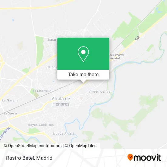
See Rastro Betel, Área Metropolitana De Madrid Y Corredor Del Henares, on the map
Public Transit to Rastro Betel in Área Metropolitana De Madrid Y Corredor Del Henares
Wondering how to get to Rastro Betel in Área Metropolitana De Madrid Y Corredor Del Henares? Moovit helps you find the best way to get to Rastro Betel with step-by-step directions from the nearest public transit station.
Moovit provides free maps and live directions to help you navigate through your city. View schedules, routes, timetables, and find out how long does it take to get to Rastro Betel in real time.
Looking for the nearest stop or station to Rastro Betel? Check out this list of stops closest to your destination: Vía Complutense - Barrio Ledesma; Puerta Universo - Chinchón; Av. Meco - Aviación Española; Av. Meco - Pabellón Polideportivo; Ávila - C.º Esgaravita; Av. Lope De Figueroa - Fernando Flandes; Alcalá De Henares.
Bus: 11, 254, 824, 223, 231, 232, 251, 275, 2, 3, 250, 5, 1B.Train: C2, C7.
Want to see if there’s another route that gets you there at an earlier time? Moovit helps you find alternative routes or times. Get directions from and directions to Rastro Betel easily from the Moovit App or Website.
We make riding to Rastro Betel easy, which is why over 1.5 million users, including users in Área Metropolitana De Madrid Y Corredor Del Henares, trust Moovit as the best app for public transit. You don’t need to download an individual bus app or train app, Moovit is your all-in-one transit app that helps you find the best bus time or train time available.
For information on prices of bus and train, costs and ride fares to Rastro Betel, please check the Moovit app.
Use the app to navigate to popular places including to the airport, hospital, stadium, grocery store, mall, coffee shop, school, college, and university.
Rastro Betel Address: Vía Complutense street in Área Metropolitana De Madrid Y Corredor Del Henares
- Mercadona,
- Urbanización Barrio Ledesma,
- Residencial Pórtico De Alcalá,
- Carglass B.V. Sucursal en Espa-a,
- Seur,
- Clinica Capio,
- Hospital De Día Quirón Salud,
- Hospital de Día Quirónsalud Alcalá de Henares,
- Camino de la Esgaravita 3,
- Calle Aranjuez,
- Calle Chinchón,
- Calle Francisco Huerta y Calopa,
- Pabellón de Baloncesto Miguel Hernández,
- Quimica Sintética, S.A.,
- Mrw,
- Calle Chinchón 409,
- Tlmovil,
- Trahena,
- Calle el Escorial 117,
- Chapa Henar
Places Near Rastro Betel (Área Metropolitana De Madrid Y Corredor Del Henares)
- Mendez Alvaro, Madrid,
- Hospital Universitario La Paz, Madrid,
- Hospital Clínico Universitario San Carlos, Madrid,
- Rastro De Madrid, Área Metropolitana De Madrid Y Corredor Del Henares,
- Hospital Universitario Ramón y Cajal, Madrid,
- Centro Comercial La Gavia, Área Metropolitana De Madrid Y Corredor Del Henares,
- Centro Comercial Oasiz Madrid, Área Metropolitana De Madrid Y Corredor Del Henares,
- Mercadillo de Majadahonda, Majadahonda,
- Nassica, Área Metropolitana De Madrid Y Corredor Del Henares,
- Tres Aguas, Alcorcón,
- Centro Comercial La Vaguada, Área Metropolitana De Madrid Y Corredor Del Henares,
- Estadio Wanda Metropolitano, Área Metropolitana De Madrid Y Corredor Del Henares,
- Calle de López de Hoyos 169, Madrid,
- Wizink Center, Madrid,
- Centro Comercial Islazul, Área Metropolitana De Madrid Y Corredor Del Henares,
- Plenilunio, Área Metropolitana De Madrid Y Corredor Del Henares,
- Estacion de Chamartin, Madrid,
- Sala La Riviera, Madrid,
- Palacio De Vistalegre, Área Metropolitana De Madrid Y Corredor Del Henares,
- Plaza Mayor, Madrid
How to get to popular places in Madrid with public transit
Get around Área Metropolitana De Madrid Y Corredor Del Henares by public transit!
Traveling around Área Metropolitana De Madrid Y Corredor Del Henares has never been so easy. See step by step directions as you travel to any attraction, street or major public transit station. View bus and train schedules, arrival times, service alerts and detailed routes on a map, so you know exactly how to get to anywhere in Área Metropolitana De Madrid Y Corredor Del Henares.
When traveling to any destination around Área Metropolitana De Madrid Y Corredor Del Henares use Moovit's Live Directions with Get Off Notifications to know exactly where and how far to walk, how long to wait for your line, and how many stops are left. Moovit will alert you when it's time to get off — no need to constantly re-check whether yours is the next stop.
Wondering how to use public transit in Área Metropolitana De Madrid Y Corredor Del Henares or how to pay for public transit in Área Metropolitana De Madrid Y Corredor Del Henares? Moovit public transit app can help you navigate your way with public transit easily, and at minimum cost. It includes public transit fees, ticket prices, and costs. Looking for a map of Área Metropolitana De Madrid Y Corredor Del Henares public transit lines? Moovit public transit app shows all public transit maps in Área Metropolitana De Madrid Y Corredor Del Henares with all Bus, Train, Metro and Light Rail routes and stops on an interactive map.
Madrid has 4 transit type(s), including: Bus, Train, Metro and Light Rail, operated by several transit agencies, including Metro de Madrid, Metro Ligero, Tranvía de Parla, Renfe Cercanías - Servicios de Autobús especiales, Renfe Cercanias, Renfe Cercanías, EMT, Interurbanos, Urbanos de Alcalá de Henares, Urbanos de Alcobendas, Urbanos de Alcorcón, Urbanos de Algete, Urbanos de Aranjuez, Urbanos de Arganda del Rey and Urbanos de Arroyomolinos