How to get to Rastro de Inma by bus?
Click on the bus route to see step by step directions with maps, line arrival times and updated time schedules.
From Parque De San Juan, Telde
44 minFrom Mercadillo de Jinámar, Las Palmas De Gran Canaria
34 minFrom Ciudad Del Campo, Las Palmas De Gran Canaria
45 minFrom Comisaría De Policía Las Palmas Norte, Las Palmas De Gran Canaria
24 minFrom El Hornillo, Telde
42 minFrom Estadio Municipal Pablo Hernandez, Telde
41 minFrom Tafira Alta, Las Palmas De Gran Canaria
47 minFrom La Majadilla, Telde
55 minFrom La Garita, Telde
34 minFrom Polideportivo Rita Hernandez, Telde
41 min
Bus stops near Rastro de Inma in Las Palmas De Gran Canaria
Bus lines to Rastro de Inma in Las Palmas De Gran Canaria
- 13, Tres Palmas,VIEW
- 13, 31 - Tres Palmas,VIEW
- 64, Cono Sur,VIEW
- 64, 56 - Medianoche - Cono Sur,VIEW
- L1, Hoya De La Plata,VIEW
- 9, Hoya De La Plata (Por Dr. Marañón),VIEW
- 12, Puerto,VIEW
- L1, 63 - Hoya de La Plata,VIEW
- 9, 27 - Hoya de La Plata (por Dr. Marañón),VIEW
- 12, 30 - Puerto,VIEW
- 6, Hoya De La Plata,VIEW
- 6, 24 - Hoya de La Plata (No accede al Barrio de San Cristobal),VIEW
What are the closest stations to Rastro de Inma?
The closest stations to Rastro de Inma are:
- Pº San José, Frente 154 is 37 meters away, 1 min walk.
- Pº San José, 170 is 93 meters away, 2 min walk.
- Córdoba (Bomberos Vegueta) is 238 meters away, 4 min walk.
- Alicante (C.S. San José) is 566 meters away, 8 min walk.
Which bus lines stop near Rastro de Inma?
These bus lines stop near Rastro de Inma: 12, 9, GL-L12, GL-L75.
What’s the nearest bus station to Rastro de Inma in Las Palmas De Gran Canaria?
The nearest bus station to Rastro de Inma in Las Palmas De Gran Canaria is Pº San José, Frente 154. It’s a 1 min walk away.
What time is the first bus to Rastro de Inma in Las Palmas De Gran Canaria?
The L1 is the first bus that goes to Rastro de Inma in Las Palmas De Gran Canaria. It stops nearby at 3:00 AM.
What time is the last bus to Rastro de Inma in Las Palmas De Gran Canaria?
The L1 is the last bus that goes to Rastro de Inma in Las Palmas De Gran Canaria. It stops nearby at 3:13 AM.
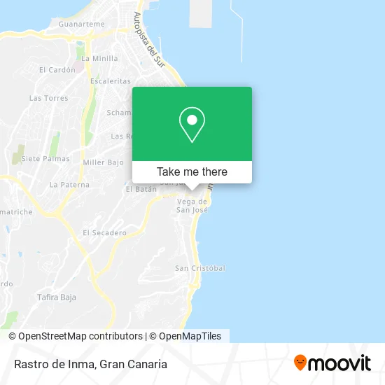
See Rastro de Inma, Las Palmas De Gran Canaria, on the map
Public Transit to Rastro de Inma in Las Palmas De Gran Canaria
Wondering how to get to Rastro de Inma in Las Palmas De Gran Canaria? Moovit helps you find the best way to get to Rastro de Inma with step-by-step directions from the nearest public transit station.
Moovit provides free maps and live directions to help you navigate through your city. View schedules, routes, timetables, and find out how long does it take to get to Rastro de Inma in real time.
Looking for the nearest stop or station to Rastro de Inma? Check out this list of stops closest to your destination: Pº San José; Pº San José; Córdoba (Bomberos Vegueta); Alicante (C.S. San José).
Bus: 12, 9, GL-L12, GL-L75, 13, 13, 64, 64, L1, L1, 6, 6.
Want to see if there’s another route that gets you there at an earlier time? Moovit helps you find alternative routes or times. Get directions from and directions to Rastro de Inma easily from the Moovit App or Website.
We make riding to Rastro de Inma easy, which is why over 1.5 million users, including users in Las Palmas De Gran Canaria, trust Moovit as the best app for public transit. You don’t need to download an individual bus app or train app, Moovit is your all-in-one transit app that helps you find the best bus time or train time available.
For information on prices of bus, costs and ride fares to Rastro de Inma, please check the Moovit app.
Use the app to navigate to popular places including to the airport, hospital, stadium, grocery store, mall, coffee shop, school, college, and university.
Rastro de Inma Address: Calle Córdoba, 35016 Vega de San José Las Palmas de Gran Canaria street in Las Palmas De Gran Canaria
- El Rinconcito de Ana,
- Europan Cordoba,
- Farmacia Ana Cantero,
- Bazar El Canario,
- Dulcería El Canario,
- Garfield El Glotón,
- Super Tito,
- Asadero Casa Mi Padre,
- Hamburguesería Garfield El Glotón,
- Pabellon San Jose. Club Baloncesto Gran Canaria,
- Restaurante Pinto's,
- Servicio de Mediacion Arbitraje Y Conciliacion SEMAC,
- Granja Tres Hermanas,
- Barbería Cabrera RUTA6,
- Yeraco Moda Pe,
- Era Arenas,
- Clínica Natural Esbelt,
- Haztesoldado.Com,
- Campo Futbol 7 Vega De San Jose,
- Las Francesitas
Places Near Rastro de Inma (Las Palmas De Gran Canaria)
- Hospital Dr. Negrín, Las Palmas De Gran Canaria,
- C.C. Alisios, Las Palmas De Gran Canaria,
- Hospital Militar, Las Palmas De Gran Canaria,
- La Minilla, Las Palmas De Gran Canaria,
- Mogán Mall, Mog�30,
- Los Alisios, Las Palmas De Gran Canaria,
- Centro Comercial Alcampo, Telde,
- Centro Comercial Las Terrazas, Telde,
- CC Las Terrazas, Las Palmas De Gran Canaria,
- Ferry Bus Armas, Las Palmas De Gran Canaria,
- Tanatorio De San Miguel, Las Palmas De Gran Canaria,
- IKEA Gran Canaria, Telde,
- C.C. El Mirador, Las Palmas De Gran Canaria,
- Cocodrilo Park, Agüimes,
- Estadio de Gran Canaria, Las Palmas De Gran Canaria,
- Centro Comercial Las Arenas, Las Palmas De Gran Canaria,
- Terminal Naviera Armas, Las Palmas De Gran Canaria,
- Vegueta, Las Palmas De Gran Canaria,
- Consulta de Traumatología y Cirugía Ortopédica Dr. Juan S Ojeda Castellano, Santa Luc�De Tirajana,
- Alcampo, Telde
How to get to popular places in Gran Canaria with public transit
Get around Las Palmas De Gran Canaria by public transit!
Traveling around Las Palmas De Gran Canaria has never been so easy. See step by step directions as you travel to any attraction, street or major public transit station. View bus and train schedules, arrival times, service alerts and detailed routes on a map, so you know exactly how to get to anywhere in Las Palmas De Gran Canaria.
When traveling to any destination around Las Palmas De Gran Canaria use Moovit's Live Directions with Get Off Notifications to know exactly where and how far to walk, how long to wait for your line, and how many stops are left. Moovit will alert you when it's time to get off — no need to constantly re-check whether yours is the next stop.
Wondering how to use public transit in Las Palmas De Gran Canaria or how to pay for public transit in Las Palmas De Gran Canaria? Moovit public transit app can help you navigate your way with public transit easily, and at minimum cost. It includes public transit fees, ticket prices, and costs. Looking for a map of Las Palmas De Gran Canaria public transit lines? Moovit public transit app shows all public transit maps in Las Palmas De Gran Canaria with all bus routes and stops on an interactive map.
Gran Canaria has 1 transit type(s), including: bus, operated by several transit agencies, including GLOBAL (AUTGC), GLOBAL Salcai-Utinsa S.A.L., GUAGUAS (AUTGC), Guaguas Municipales, PARDILLA BUS (AUTGC), TELBUS (AUTGC) and ALSA-GUMIDAFE (AUTGC)