How to get to Rate by bus?
Click on the bus route to see step by step directions with maps, line arrival times and updated time schedules.
From Union County College - Cranford Campus, Cranford
84 minFrom Community Coach 77 Bus Stop, Livingston
55 minFrom Plainfield, NJ, Plainfield
122 minFrom MMNJ, Parsippany-Troy Hills
55 minFrom Lakeland Bus Stop, Parsippany-Troy Hills
42 minFrom Parsippany, NJ, Parsippany-Troy Hills
57 minFrom Community Coach Bus 77, West Orange
67 minFrom West Orange, NJ, West Orange
80 minFrom Saint Barnabas Medical Center, Livingston
87 min
How to get to Rate by train?
Click on the train route to see step by step directions with maps, line arrival times and updated time schedules.
Bus stop near Rate in Madison
- Rt-124 at Central Ave, 3 min walk,VIEW
Train station near Rate in Madison
- Chatham, 10 min walk,VIEW
Bus lines to Rate in Madison
- 873, Greystone & Morristown,VIEW
What are the closest stations to Rate?
The closest stations to Rate are:
- Rt-124 at Central Ave is 207 yards away, 3 min walk.
- Chatham is 849 yards away, 10 min walk.
Which bus line stops near Rate?
873 (Greystone & Morristown)
Which train line stops near Rate?
MEL (Dover)
What’s the nearest train station to Rate in Madison?
The nearest train station to Rate in Madison is Chatham. It’s a 10 min walk away.
What’s the nearest bus station to Rate in Madison?
The nearest bus station to Rate in Madison is Rt-124 at Central Ave. It’s a 3 min walk away.
What time is the first train to Rate in Madison?
The MEL is the first train that goes to Rate in Madison. It stops nearby at 4:31 AM.
What time is the last train to Rate in Madison?
The MEL is the last train that goes to Rate in Madison. It stops nearby at 2:04 AM.
What time is the first bus to Rate in Madison?
The 873 is the first bus that goes to Rate in Madison. It stops nearby at 6:09 AM.
What time is the last bus to Rate in Madison?
The 873 is the last bus that goes to Rate in Madison. It stops nearby at 6:14 PM.
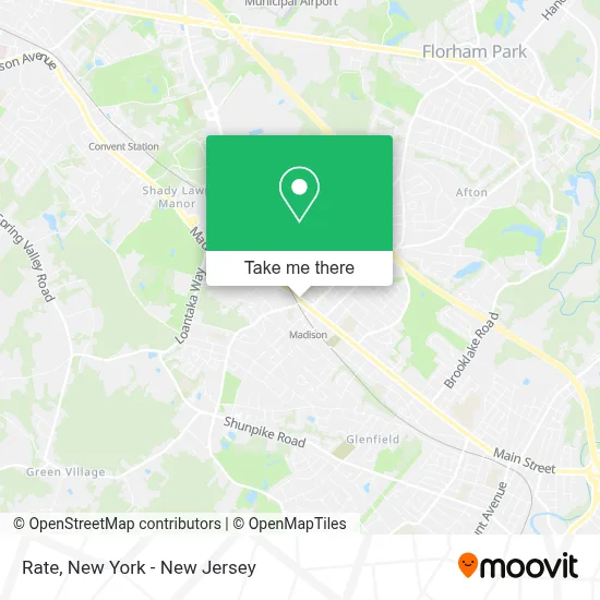
See Rate, Madison, on the map
Public Transit to Rate in Madison
Wondering how to get to Rate in Madison? Moovit helps you find the best way to get to Rate with step-by-step directions from the nearest public transit station.
Moovit provides free maps and live directions to help you navigate through your city. View schedules, routes, timetables, and find out how long does it take to get to Rate in real time.
Looking for the nearest stop or station to Rate? Check out this list of stops closest to your destination: Rt-124 at Central Ave; Chatham.
Bus: 873.Train: MEL.
Want to see if there’s another route that gets you there at an earlier time? Moovit helps you find alternative routes or times. Get directions from and directions to Rate easily from the Moovit App or Website.
We make riding to Rate easy, which is why over 1.5 million users, including users in Madison, trust Moovit as the best app for public transit. You don’t need to download an individual bus app or train app, Moovit is your all-in-one transit app that helps you find the best bus time or train time available.
For information on prices of bus and train, costs and ride fares to Rate, please check the Moovit app.
Use the app to navigate to popular places including to the airport, hospital, stadium, grocery store, mall, coffee shop, school, college, and university.
Rate Address: 14 Main St Ste 140 street in Madison
- Lori Neuhauser at Rate (Nmls #460200),
- Countryside Studios Madison Llc,
- Kevin Keane at Rate (Nmls #89852),
- Mountain Top Bookkeeping,
- Matthew Keane at Rate (Nmls #12966),
- Hat Shop Madison,
- Brian Fruehling Law,
- Fdu Fcu,
- Esmer Ps,
- Monika Fine Millinery,
- Makers: A Ceramics Shop,
- Thomas Detitta, Cpa,
- Strandz Salon J Of Madison,
- Matthew Keane,
- Lori Neuhauser,
- Kevin Keane at Guaranteed Rate,
- Atlantic Mutual,
- Streamlined Properties - Streamline,
- Mud Clay Studio,
- Coldwell Banker
Places Near Rate (Madison)
- Pier 83, Manhattan,
- qqqq, Manhattan,
- 66 John Street, Manhattan,
- Rockefeller Center, Manhattan,
- Bellevue Hospital, Manhattan,
- Mountainside Hospital, Glen Ridge,
- 911 Memorial, Manhattan,
- 1 Police Plaza, Manhattan,
- 376 Hudson Street, Manhattan,
- 111 Centre New York City Supreme Court, Manhattan,
- Queens Center Mall, Queens,
- Times Square, Manhattan,
- Katz's Deli, Manhattan,
- 3 Stone St, Manhattan,
- 26 Federal Plaza, Manhattan,
- SoHo, Manhattan,
- Hudson Yards, Manhattan,
- San Gennaro Feast, Manhattan,
- Wall Street, Manhattan,
- Chinatown, Manhattan
How to get to popular places in New York - New Jersey with public transit
Get around Madison by public transit!
Traveling around Madison has never been so easy. See step by step directions as you travel to any attraction, street or major public transit station. View bus and train schedules, arrival times, service alerts and detailed routes on a map, so you know exactly how to get to anywhere in Madison.
When traveling to any destination around Madison use Moovit's Live Directions with Get Off Notifications to know exactly where and how far to walk, how long to wait for your line, and how many stops are left. Moovit will alert you when it's time to get off — no need to constantly re-check whether yours is the next stop.
Wondering how to use public transit in Madison or how to pay for public transit in Madison? Moovit public transit app can help you navigate your way with public transit easily, and at minimum cost. It includes public transit fees, ticket prices, and costs. Looking for a map of Madison public transit lines? Moovit public transit app shows all public transit maps in Madison with all Bus, Train, Subway, Light Rail, Ferry and Cable Car routes and stops on an interactive map.
New York - New Jersey has 6 transit type(s), including: Bus, Train, Subway, Light Rail, Ferry and Cable Car, operated by several transit agencies, including MTA Subway, Metro-North Railroad, LIRR, PATH, MTA New York City Transit - Express routes, MTA Bus, NJ Transit, NYC Ferry, NICE bus, Bee-Line Bus, NJ Transit Rail, Norwalk Transit District, Hartford Line, River Valley Transit and HART