How to get to Rathaus by bus?
Click on the bus route to see step by step directions with maps, line arrival times and updated time schedules.
From D 78333 Stockach, Verwaltungsgemeinschaft Stockach
128 minFrom Aachbad Singen, Verwaltungsgemeinschaft Singen (Hohentwiel)
271 minFrom Stadtwerke Villingen-Schwenningen GmbH, Villingen-Schwenningen
79 minFrom Campingplatz Schüttehof Horb, Gemarkung Horb am Neckar
295 minFrom Waldeck Spa, Bad Dürrheim
68 minFrom Helios Klinik Rottweil-Notaufnahme, Rottweil
136 minFrom Antiquariat Trenkle, Aach
230 min
How to get to Rathaus by train?
Click on the train route to see step by step directions with maps, line arrival times and updated time schedules.
Bus stop near Rathaus in Verwaltungsgemeinschaft Spaichingen
- Aldingen Rathaus, 1 min walk,VIEW
Train stations near Rathaus in Verwaltungsgemeinschaft Spaichingen
Bus lines to Rathaus in Verwaltungsgemeinschaft Spaichingen
- 105, Aldingen Rathaus - Tuttlingen ZOB Stadtmitte Bstg A,VIEW
- 140, Aldingen Bahnhof - Trossingen Stadtbahnhof,VIEW
- 142, Trossingen Schulzentrum - Aldingen Bahnhof,VIEW
- 147, Spaichingen Bahnhof - Aldingen Gewerbegebiet Nagelsee,VIEW
- 150, Aldingen Bahnhof - Aixheim Rathaus,VIEW
- 210, Aldingen Bahnhof - Frittlingen Silcherstraße,VIEW
- 220, Aldingen Bahnhof - Deilingen An der Steig,VIEW
- 222, Deilingen An der Steig - Aldingen Abzw. L 433,VIEW
What are the closest stations to Rathaus?
The closest stations to Rathaus are:
- Aldingen Rathaus is 44 meters away, 1 min walk.
- Aldingen Bahnhof is 976 meters away, 13 min walk.
- Spaichingen Mitte is 3738 meters away, 48 min walk.
Which bus lines stop near Rathaus?
These bus lines stop near Rathaus: 105, 140, 210.
Which train lines stop near Rathaus?
These train lines stop near Rathaus: RB 43, RB43.
What’s the nearest train station to Rathaus in Verwaltungsgemeinschaft Spaichingen?
The nearest train station to Rathaus in Verwaltungsgemeinschaft Spaichingen is Aldingen Bahnhof. It’s a 13 min walk away.
What’s the nearest bus station to Rathaus in Verwaltungsgemeinschaft Spaichingen?
The nearest bus station to Rathaus in Verwaltungsgemeinschaft Spaichingen is Aldingen Rathaus. It’s a 1 min walk away.
What time is the first train to Rathaus in Verwaltungsgemeinschaft Spaichingen?
The RB43 is the first train that goes to Rathaus in Verwaltungsgemeinschaft Spaichingen. It stops nearby at 5:24 AM.
What time is the last train to Rathaus in Verwaltungsgemeinschaft Spaichingen?
The RB43 is the last train that goes to Rathaus in Verwaltungsgemeinschaft Spaichingen. It stops nearby at 9:32 PM.
What time is the first bus to Rathaus in Verwaltungsgemeinschaft Spaichingen?
The 150 is the first bus that goes to Rathaus in Verwaltungsgemeinschaft Spaichingen. It stops nearby at 4:58 AM.
What time is the last bus to Rathaus in Verwaltungsgemeinschaft Spaichingen?
The 150 is the last bus that goes to Rathaus in Verwaltungsgemeinschaft Spaichingen. It stops nearby at 8:51 PM.
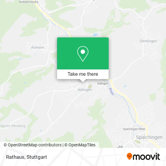
See Rathaus, Verwaltungsgemeinschaft Spaichingen, on the map
Public Transit to Rathaus in Verwaltungsgemeinschaft Spaichingen
Wondering how to get to Rathaus in Verwaltungsgemeinschaft Spaichingen? Moovit helps you find the best way to get to Rathaus with step-by-step directions from the nearest public transit station.
Moovit provides free maps and live directions to help you navigate through your city. View schedules, routes, timetables, and find out how long does it take to get to Rathaus in real time.
Looking for the nearest stop or station to Rathaus? Check out this list of stops closest to your destination: Aldingen Rathaus; Aldingen Bahnhof; Spaichingen Mitte.
Bus: 105, 140, 210, 142, 147, 150.Train: RB 43, RB43, RE4, RE4.
Want to see if there’s another route that gets you there at an earlier time? Moovit helps you find alternative routes or times. Get directions from and directions to Rathaus easily from the Moovit App or Website.
We make riding to Rathaus easy, which is why over 1.5 million users, including users in Verwaltungsgemeinschaft Spaichingen, trust Moovit as the best app for public transit. You don’t need to download an individual bus app or train app, Moovit is your all-in-one transit app that helps you find the best bus time or train time available.
For information on prices of train and bus, costs and ride fares to Rathaus, please check the Moovit app.
Use the app to navigate to popular places including to the airport, hospital, stadium, grocery store, mall, coffee shop, school, college, and university.
Rathaus Address: Hauptstraße 7 78554 Aldingen street in Verwaltungsgemeinschaft Spaichingen
- Kreissparkasse,
- Hotel Aurelia,
- Eugen Burkart,
- Restaurant Maja,
- MENNEKES Digital Services GmbH,
- Dietmar Link,
- Dr. med. Adelheid Radu,
- Maja,
- Jehle,
- Alex Tenten,
- Happy Sun,
- Sabi & Ben Fotografie,
- Dz Bank AG Deutsche Zentral Genossenschaftsbank,
- Gesund Fuß,
- Ladies World Fashion,
- Ergotherapie Praxis Andreas Braun,
- Friseurstüble,
- Schwab Verwaltungs,
- Salon Huelya Goekkaya,
- Hermes PaketShop
Places Near Rathaus (Verwaltungsgemeinschaft Spaichingen)
- Marmorsaal Im Weissenburgpark, Stuttgart-Süd,
- Im Wizemann (Halle), Bad Cannstatt,
- Waldfriedhof, Degerloch,
- Hauptbahnhof Stuttgart, Stuttgart-Mitte,
- Wilhelma (U-Bahn Wilhelma), Bad Cannstatt,
- FlixBus Haltestelle, Stuttgart,
- Klinikum Stuttgart - Katharinenhospital, Stuttgart-Mitte,
- Hanns-Martin-Schleyer-Halle (Stuttgart Hans-Martin-Schleyerhalle), Bad Cannstatt,
- Mercedes-Benz Museum, Bad Cannstatt,
- Mercedes-Benz Museum (Mercedes Museum Stuttgart), Bad Cannstatt,
- Hanns-Martin-Schleyer-Halle, Bad Cannstatt,
- Mettingen Eros-Center Puff Laufhaus, Esslingen Am Neckar,
- Pariser Platz Stuttgart, Stuttgart-Mitte,
- Gleis 101/102 (tief), Stuttgart-Mitte,
- Geilhaus Haus 33a, Reutlingen-Betzingen,
- Schleyerhalle, Bad Cannstatt,
- SI-Centrum, Möhringen,
- Porsche-Arena, Bad Cannstatt,
- Gasometer Pforzheim, Pforzheim,
- Porsche Museum, Zuffenhausen
How to get to popular places in Stuttgart with public transit
Get around Verwaltungsgemeinschaft Spaichingen by public transit!
Traveling around Verwaltungsgemeinschaft Spaichingen has never been so easy. See step by step directions as you travel to any attraction, street or major public transit station. View bus and train schedules, arrival times, service alerts and detailed routes on a map, so you know exactly how to get to anywhere in Verwaltungsgemeinschaft Spaichingen.
When traveling to any destination around Verwaltungsgemeinschaft Spaichingen use Moovit's Live Directions with Get Off Notifications to know exactly where and how far to walk, how long to wait for your line, and how many stops are left. Moovit will alert you when it's time to get off — no need to constantly re-check whether yours is the next stop.
Wondering how to use public transit in Verwaltungsgemeinschaft Spaichingen or how to pay for public transit in Verwaltungsgemeinschaft Spaichingen? Moovit public transit app can help you navigate your way with public transit easily, and at minimum cost. It includes public transit fees, ticket prices, and costs. Looking for a map of Verwaltungsgemeinschaft Spaichingen public transit lines? Moovit public transit app shows all public transit maps in Verwaltungsgemeinschaft Spaichingen with all Bus, Train, Subway, Light Rail, Ferry, S-Bahn and Funicular routes and stops on an interactive map.
Stuttgart has 7 transit type(s), including: Bus, Train, Subway, Light Rail, Ferry, S-Bahn and Funicular, operated by several transit agencies, including SSB - Stadtbahn, SSB, SSB - Seilbahn / Zacke, S-Bahn Stuttgart, Rhein-Neckar-Verkehr GmbH (rnv), Karlsruher Verkehrsverbund, DB AG, DB Regiobus BW, Arverio Baden-Württemberg GmbH, DB RegioNetz Verkehrs GmbH Westfrankenbahn, DB Regio AG Baden-Württemberg, Südwestdeutsche Verkehrs-AG, DB Regio AG Mitte Region Hessen, DB and Bodensee-Oberschwaben-Bahn