How to get to Rathaus by bus?
Click on the bus route to see step by step directions with maps, line arrival times and updated time schedules.
From M&I Fachkliniken Hohenurach, Gemeindeverwaltungsverband Bad Urach
193 minFrom Alb Thermen Bad Urach, Gemeindeverwaltungsverband Bad Urach
187 minFrom I&M Fachkliniken Hohenurach Haus 2, Gemeindeverwaltungsverband Bad Urach
189 minFrom Kloster Untermarchtal, Verwaltungsgemeinschaft Munderkingen
60 minFrom Parkplatz Ratiopharm Arena, Neu-Ulm
194 minFrom Kaufland Geislingen, Vereinbarte Verwaltungsgemeinschaft Der Stadt Geislingen An Der Steige
266 minFrom Reha-klinik Schwäbische Alb, Gemeindeverwaltungsverband Bad Urach
191 minFrom Uracher Wasserfall, Gemeindeverwaltungsverband Bad Urach
197 min
Bus stop near Rathaus in Allmendingen
- Schwörzkirch Rathaus, 1 min walk,VIEW
What are the closest stations to Rathaus?
The closest stations to Rathaus are:
- Schwörzkirch Rathaus is 8 meters away, 1 min walk.
Which bus lines stop near Rathaus?
These bus lines stop near Rathaus: 21, 231, 336, ADK2.
What’s the nearest bus station to Rathaus in Allmendingen?
The nearest bus station to Rathaus in Allmendingen is Schwörzkirch Rathaus. It’s a 1 min walk away.
What time is the first bus to Rathaus in Allmendingen?
The 231 is the first bus that goes to Rathaus in Allmendingen. It stops nearby at 6:01 AM.
What time is the last bus to Rathaus in Allmendingen?
The ADK2 is the last bus that goes to Rathaus in Allmendingen. It stops nearby at 11:39 PM.
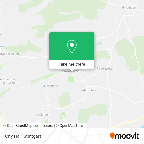
See Rathaus, Allmendingen, on the map
Public Transit to Rathaus in Allmendingen
Wondering how to get to Rathaus in Allmendingen? Moovit helps you find the best way to get to Rathaus with step-by-step directions from the nearest public transit station.
Moovit provides free maps and live directions to help you navigate through your city. View schedules, routes, timetables, and find out how long does it take to get to Rathaus in real time.
Looking for the nearest stop or station to Rathaus? Check out this list of stops closest to your destination: Schwörzkirch Rathaus.
Bus: 21, 231, 336, ADK2.
Want to see if there’s another route that gets you there at an earlier time? Moovit helps you find alternative routes or times. Get directions from and directions to Rathaus easily from the Moovit App or Website.
We make riding to Rathaus easy, which is why over 1.5 million users, including users in Allmendingen, trust Moovit as the best app for public transit. You don’t need to download an individual bus app or train app, Moovit is your all-in-one transit app that helps you find the best bus time or train time available.
For information on prices of bus and train, costs and ride fares to Rathaus, please check the Moovit app.
Use the app to navigate to popular places including to the airport, hospital, stadium, grocery store, mall, coffee shop, school, college, and university.
Rathaus Address: Hochsträß 18 Schwörzkirch, 89604 Allmendingen street in Allmendingen
- Rathaus Schwörzkirch,
- Schwörzkirch,
- Biohof Häussler,
- Sankt Stephanus,
- Jjvw,
- Baumbast-Neher Architekten,
- Florack Gabriele,
- K.I.S.E.,
- Kfz-Handel Oppelz,
- Erdbeerhof Mall,
- Natursteinwerk Wilhelm,
- Industriedampfsauger,
- Husqvarna Automower Nera,
- Roga Mähroboter Garagen das Original,
- Dampfsauger,
- Rasenmäher Roboter,
- Reinigungsgeräte und Motorgeräte Häussler,
- Reisinger Planungsbüro Reinhold,
- Bürodienstleistungen Swanner,
- Niederhofen
Places Near Rathaus (Allmendingen)
- Mercedes-Benz Museum (Mercedes Museum Stuttgart), Bad Cannstatt,
- Hanns-Martin-Schleyer-Halle, Bad Cannstatt,
- SI-Centrum, Möhringen,
- Waldfriedhof, Degerloch,
- Wilhelma (U-Bahn Wilhelma), Bad Cannstatt,
- Schleyerhalle, Bad Cannstatt,
- Porsche-Arena, Bad Cannstatt,
- Pariser Platz Stuttgart, Stuttgart-Mitte,
- Geilhaus Haus 33a, Reutlingen-Betzingen,
- Hauptbahnhof Stuttgart, Stuttgart-Mitte,
- Porsche Museum, Zuffenhausen,
- Gleis 101/102 (tief), Stuttgart-Mitte,
- Klinikum Stuttgart - Katharinenhospital, Stuttgart-Mitte,
- Gasometer Pforzheim, Pforzheim,
- Marmorsaal Im Weissenburgpark, Stuttgart-Süd,
- FlixBus Haltestelle, Stuttgart,
- Im Wizemann (Halle), Bad Cannstatt,
- Mercedes-Benz Museum, Bad Cannstatt,
- Mettingen Eros-Center Puff Laufhaus, Esslingen Am Neckar,
- Hanns-Martin-Schleyer-Halle (Stuttgart Hans-Martin-Schleyerhalle), Bad Cannstatt
How to get to popular places in Stuttgart with public transit
Get around Allmendingen by public transit!
Traveling around Allmendingen has never been so easy. See step by step directions as you travel to any attraction, street or major public transit station. View bus and train schedules, arrival times, service alerts and detailed routes on a map, so you know exactly how to get to anywhere in Allmendingen.
When traveling to any destination around Allmendingen use Moovit's Live Directions with Get Off Notifications to know exactly where and how far to walk, how long to wait for your line, and how many stops are left. Moovit will alert you when it's time to get off — no need to constantly re-check whether yours is the next stop.
Wondering how to use public transit in Allmendingen or how to pay for public transit in Allmendingen? Moovit public transit app can help you navigate your way with public transit easily, and at minimum cost. It includes public transit fees, ticket prices, and costs. Looking for a map of Allmendingen public transit lines? Moovit public transit app shows all public transit maps in Allmendingen with all Bus, Train, Subway, Light Rail, Ferry, S-Bahn and Funicular routes and stops on an interactive map.
Stuttgart has 7 transit type(s), including: Bus, Train, Subway, Light Rail, Ferry, S-Bahn and Funicular, operated by several transit agencies, including SSB - Stadtbahn, SSB, SSB - Seilbahn / Zacke, S-Bahn Stuttgart, Rhein-Neckar-Verkehr GmbH (rnv), Karlsruher Verkehrsverbund, DB AG, DB Regiobus BW, Arverio Baden-Württemberg GmbH, DB RegioNetz Verkehrs GmbH Westfrankenbahn, DB Regio AG Baden-Württemberg, Südwestdeutsche Verkehrs-AG, DB Regio AG Mitte Region Hessen, DB and Bodensee-Oberschwaben-Bahn