How to get to Rathaus by bus?
Click on the bus route to see step by step directions with maps, line arrival times and updated time schedules.
From SAP Walldorf P18, Walldorf
95 minFrom SAP Campus, Walldorf
91 minFrom Thermen & Badewelt Sinsheim, Sinsheim
123 minFrom Luxor Filmpalast, Bahnstadt
187 minFrom SAP Headquarters, Walldorf
95 minFrom GRN-Klinik Schwetzingen, Schwetzingen
116 minFrom Agaplesion Bethanien Krankenhaus Heidelberg, Südstadt
151 minFrom Globus Restaurant Waghäusel, Waghäusel
40 min
How to get to Rathaus by train?
Click on the train route to see step by step directions with maps, line arrival times and updated time schedules.
Bus stops near Rathaus in Kronau
- Kronau Ortsmitte, 11 min walk,VIEW
Train stations near Rathaus in Kronau
Light Rail stations near Rathaus in Kronau
- Stettfeld-Weiher, 22 min walk,VIEW
Bus lines to Rathaus in Kronau
What are the closest stations to Rathaus?
The closest stations to Rathaus are:
- Kronau Ortsmitte is 809 meters away, 11 min walk.
- Rot-Malsch, Bahnhof is 1108 meters away, 15 min walk.
- Stettfeld-Weiher is 1646 meters away, 22 min walk.
- Bad Schönborn-Kronau is 3631 meters away, 47 min walk.
Which bus lines stop near Rathaus?
These bus lines stop near Rathaus: 131, 132, 193, 702, 719.
Which train lines stop near Rathaus?
These train lines stop near Rathaus: RE71, S3.
Which light rail line stops near Rathaus?
S3 (Karlsruhe Hauptbahnhof)
What’s the nearest light rail station to Rathaus in Kronau?
The nearest light rail station to Rathaus in Kronau is Stettfeld-Weiher. It’s a 22 min walk away.
What’s the nearest train station to Rathaus in Kronau?
The nearest train station to Rathaus in Kronau is Rot-Malsch, Bahnhof. It’s a 15 min walk away.
What’s the nearest bus station to Rathaus in Kronau?
The nearest bus station to Rathaus in Kronau is Kronau Ortsmitte. It’s a 11 min walk away.
What time is the first light rail to Rathaus in Kronau?
The S1 is the first light rail that goes to Rathaus in Kronau. It stops nearby at 3:42 AM.
What time is the last light rail to Rathaus in Kronau?
The S3 is the last light rail that goes to Rathaus in Kronau. It stops nearby at 2:03 AM.
What time is the first train to Rathaus in Kronau?
The S3 is the first train that goes to Rathaus in Kronau. It stops nearby at 4:17 AM.
What time is the last train to Rathaus in Kronau?
The S3 is the last train that goes to Rathaus in Kronau. It stops nearby at 2:01 AM.
What time is the first bus to Rathaus in Kronau?
The 131 is the first bus that goes to Rathaus in Kronau. It stops nearby at 4:44 AM.
What time is the last bus to Rathaus in Kronau?
The 193 is the last bus that goes to Rathaus in Kronau. It stops nearby at 8:36 PM.
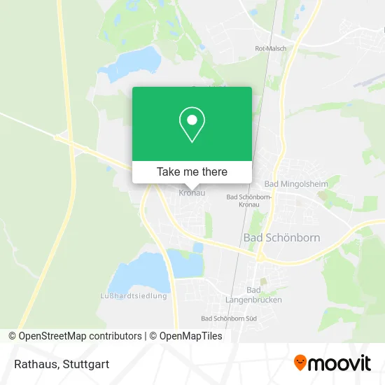
See Rathaus, Kronau, on the map
Public Transit to Rathaus in Kronau
Wondering how to get to Rathaus in Kronau? Moovit helps you find the best way to get to Rathaus with step-by-step directions from the nearest public transit station.
Moovit provides free maps and live directions to help you navigate through your city. View schedules, routes, timetables, and find out how long does it take to get to Rathaus in real time.
Looking for the nearest stop or station to Rathaus? Check out this list of stops closest to your destination: Kronau Ortsmitte; Rot-Malsch; Stettfeld-Weiher; Bad Schönborn-Kronau.
Bus: 131, 132, 193, 702, 719, 133, 133.Train: RE71, S3, RE73, RE40.Light Rail: S3.
Want to see if there’s another route that gets you there at an earlier time? Moovit helps you find alternative routes or times. Get directions from and directions to Rathaus easily from the Moovit App or Website.
We make riding to Rathaus easy, which is why over 1.5 million users, including users in Kronau, trust Moovit as the best app for public transit. You don’t need to download an individual bus app or train app, Moovit is your all-in-one transit app that helps you find the best bus time or train time available.
For information on prices of bus, train and light rail, costs and ride fares to Rathaus, please check the Moovit app.
Use the app to navigate to popular places including to the airport, hospital, stadium, grocery store, mall, coffee shop, school, college, and university.
Rathaus Address: Kirrlacher Straße 7 76709 Kronau street in Kronau
- Ladestation für Elektrofahrzeuge,
- Bäckerei Gerweck,
- Seelsorgeeinheit Bad Schönborn-Kronau,
- Edith-Stein-Haus,
- Stiftung Leben Pur,
- Toiletten für alle,
- Kindertagesstätte,
- Laurentius-Apotheke,
- Gemeindeverwaltung Kronau,
- Gaststätte Arena,
- Lieblingsplatz,
- Kindergarten Haus Der Kinder - Johannes Bosco,
- Gefallenendenkmal,
- Sparkasse,
- Casa Simeone,
- Chili's,
- St. Laurentius,
- Sahin Döner,
- Spielwaren Kronau Kiosk Dings,
- Hermes PaketShop
Places Near Rathaus (Kronau)
- Geilhaus Haus 33a, Reutlingen-Betzingen,
- Gleis 101/102 (tief), Stuttgart-Mitte,
- Mercedes-Benz Museum, Bad Cannstatt,
- Waldfriedhof, Degerloch,
- Klinikum Stuttgart - Katharinenhospital, Stuttgart-Mitte,
- Pariser Platz Stuttgart, Stuttgart-Mitte,
- Im Wizemann (Halle), Bad Cannstatt,
- Hanns-Martin-Schleyer-Halle, Bad Cannstatt,
- Porsche Museum, Zuffenhausen,
- FlixBus Haltestelle, Stuttgart,
- Mettingen Eros-Center Puff Laufhaus, Esslingen Am Neckar,
- Mercedes-Benz Museum (Mercedes Museum Stuttgart), Bad Cannstatt,
- Hauptbahnhof Stuttgart, Stuttgart-Mitte,
- Porsche-Arena, Bad Cannstatt,
- Hanns-Martin-Schleyer-Halle (Stuttgart Hans-Martin-Schleyerhalle), Bad Cannstatt,
- Gasometer Pforzheim, Pforzheim,
- SI-Centrum, Möhringen,
- Marmorsaal Im Weissenburgpark, Stuttgart-Süd,
- Wilhelma (U-Bahn Wilhelma), Bad Cannstatt,
- Schleyerhalle, Bad Cannstatt
How to get to popular places in Stuttgart with public transit
Get around Kronau by public transit!
Traveling around Kronau has never been so easy. See step by step directions as you travel to any attraction, street or major public transit station. View bus and train schedules, arrival times, service alerts and detailed routes on a map, so you know exactly how to get to anywhere in Kronau.
When traveling to any destination around Kronau use Moovit's Live Directions with Get Off Notifications to know exactly where and how far to walk, how long to wait for your line, and how many stops are left. Moovit will alert you when it's time to get off — no need to constantly re-check whether yours is the next stop.
Wondering how to use public transit in Kronau or how to pay for public transit in Kronau? Moovit public transit app can help you navigate your way with public transit easily, and at minimum cost. It includes public transit fees, ticket prices, and costs. Looking for a map of Kronau public transit lines? Moovit public transit app shows all public transit maps in Kronau with all Bus, Train, Subway, Light Rail, Ferry, S-Bahn and Funicular routes and stops on an interactive map.
Stuttgart has 7 transit type(s), including: Bus, Train, Subway, Light Rail, Ferry, S-Bahn and Funicular, operated by several transit agencies, including SSB - Stadtbahn, SSB, SSB - Seilbahn / Zacke, S-Bahn Stuttgart, Rhein-Neckar-Verkehr GmbH (rnv), Karlsruher Verkehrsverbund, DB AG, DB Regiobus BW, Arverio Baden-Württemberg GmbH, DB RegioNetz Verkehrs GmbH Westfrankenbahn, DB Regio AG Baden-Württemberg, Südwestdeutsche Verkehrs-AG, DB Regio AG Mitte Region Hessen, DB and Bodensee-Oberschwaben-Bahn