How to get to Rathaus Edingen by bus?
Click on the bus route to see step by step directions with maps, line arrival times and updated time schedules.
From MVV Energie Ladestation, Käfertal
75 minFrom Friedhof Käfertal, Käfertal
50 minFrom Agaplesion Bethanien Krankenhaus Heidelberg, Südstadt
71 minFrom FH 1863, Neckarstadt-Ost/Wohlgelegen
59 minFrom Luxor Filmpalast, Bahnstadt
49 minFrom Krankenhaus GRN, Weinheim
100 minFrom Hauptfeuerwache, Berufsfeuerwehr Mannheim, Neckarau
60 minFrom Neuenheimer Feld, Neuenheim
53 min
How to get to Rathaus Edingen by train?
Click on the train route to see step by step directions with maps, line arrival times and updated time schedules.
From MVV Energie Ladestation, Käfertal
84 minFrom Agaplesion Bethanien Krankenhaus Heidelberg, Südstadt
81 minFrom FH 1863, Neckarstadt-Ost/Wohlgelegen
71 minFrom Luxor Filmpalast, Bahnstadt
60 minFrom Krankenhaus GRN, Weinheim
71 minFrom Hauptfeuerwache, Berufsfeuerwehr Mannheim, Neckarau
78 minFrom Neuenheimer Feld, Neuenheim
69 min
Light Rail stations near Rathaus Edingen in Edingen-Neckarhausen
Bus stops near Rathaus Edingen in Edingen-Neckarhausen
Bus lines to Rathaus Edingen in Edingen-Neckarhausen
What are the closest stations to Rathaus Edingen?
The closest stations to Rathaus Edingen are:
- Edingen Bahnhof is 424 meters away, 6 min walk.
- Edingen, Bahnhof Bstg G2 is 430 meters away, 6 min walk.
- Edingen, Bahnhof is 462 meters away, 7 min walk.
- Pfälzer Hof is 466 meters away, 7 min walk.
Which train lines stop near Rathaus Edingen?
These train lines stop near Rathaus Edingen: RB68, RE60, S12, S3.
Which light rail line stops near Rathaus Edingen?
RNV 5 (Edingen, Bahnhof)
Which bus lines stop near Rathaus Edingen?
These bus lines stop near Rathaus Edingen: 42, 627, RNV 35, RNV 42.
What’s the nearest light rail station to Rathaus Edingen in Edingen-Neckarhausen?
The nearest light rail stations to Rathaus Edingen in Edingen-Neckarhausen are Edingen Bahnhof and Edingen, Bahnhof Bstg G2. The closest one is a 6 min walk away.
What’s the nearest bus station to Rathaus Edingen in Edingen-Neckarhausen?
The nearest bus stations to Rathaus Edingen in Edingen-Neckarhausen are Edingen, Bahnhof and Pfälzer Hof. The closest one is a 7 min walk away.
What time is the first light rail to Rathaus Edingen in Edingen-Neckarhausen?
The 5 is the first light rail that goes to Rathaus Edingen in Edingen-Neckarhausen. It stops nearby at 4:22 AM.
What time is the last light rail to Rathaus Edingen in Edingen-Neckarhausen?
The 5 is the last light rail that goes to Rathaus Edingen in Edingen-Neckarhausen. It stops nearby at 3:40 AM.
What time is the first bus to Rathaus Edingen in Edingen-Neckarhausen?
The 42 is the first bus that goes to Rathaus Edingen in Edingen-Neckarhausen. It stops nearby at 4:53 AM.
What time is the last bus to Rathaus Edingen in Edingen-Neckarhausen?
The 42 is the last bus that goes to Rathaus Edingen in Edingen-Neckarhausen. It stops nearby at 7:11 PM.
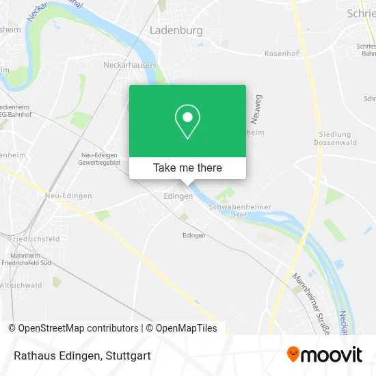
See Rathaus Edingen, Edingen-Neckarhausen, on the map
Public Transit to Rathaus Edingen in Edingen-Neckarhausen
Wondering how to get to Rathaus Edingen in Edingen-Neckarhausen? Moovit helps you find the best way to get to Rathaus Edingen with step-by-step directions from the nearest public transit station.
Moovit provides free maps and live directions to help you navigate through your city. View schedules, routes, timetables, and find out how long does it take to get to Rathaus Edingen in real time.
Looking for the nearest stop or station to Rathaus Edingen? Check out this list of stops closest to your destination: Edingen Bahnhof; Edingen; Edingen; Pfälzer Hof.
Train: RB68, RE60, S12, S3.Light Rail: RNV 5.Bus: 42, 627, RNV 35, RNV 42.
Want to see if there’s another route that gets you there at an earlier time? Moovit helps you find alternative routes or times. Get directions from and directions to Rathaus Edingen easily from the Moovit App or Website.
We make riding to Rathaus Edingen easy, which is why over 1.5 million users, including users in Edingen-Neckarhausen, trust Moovit as the best app for public transit. You don’t need to download an individual bus app or train app, Moovit is your all-in-one transit app that helps you find the best bus time or train time available.
For information on prices of bus, light rail and train, costs and ride fares to Rathaus Edingen, please check the Moovit app.
Use the app to navigate to popular places including to the airport, hospital, stadium, grocery store, mall, coffee shop, school, college, and university.
Rathaus Edingen Address: Hauptstraße street in Edingen-Neckarhausen
- Deutsche Giganetz - Glasfaser-Shop am Messplatz in Edingen Neckarhausen,
- Ambulante Pflegedienst Daheim,
- Bau- und Grundstücks-GmbH,
- Dr. Thomas Hünerbein,
- Eiscafé Cesare Di Leone,
- Lotto-Annahmestelle,
- DHL,
- Ratzefummel Bürgers Beate,
- Eiscafé Leone,
- Eis Leone Edingen,
- Dr. Alfred Kantner,
- Ratzefummel,
- Vr Rhein-Neckar Eg,
- Bäckerei und Konditorei Stahl,
- Bäckerei Stahl,
- Dr. med. dent. T. Huenerbein,
- Uwe's Frisuren-Studio,
- Königlichfairreisen,
- R+V Versicherung,
- Dz Bank AG Deutsche Zentral Genossenschaftsbank
Places Near Rathaus Edingen (Edingen-Neckarhausen)
- Geilhaus Haus 33a, Reutlingen-Betzingen,
- Marmorsaal Im Weissenburgpark, Stuttgart-Süd,
- Pariser Platz Stuttgart, Stuttgart-Mitte,
- Mercedes-Benz Museum (Mercedes Museum Stuttgart), Bad Cannstatt,
- Porsche-Arena, Bad Cannstatt,
- FlixBus Haltestelle, Stuttgart,
- Gleis 101/102 (tief), Stuttgart-Mitte,
- Klinikum Stuttgart - Katharinenhospital, Stuttgart-Mitte,
- SI-Centrum, Möhringen,
- Mettingen Eros-Center Puff Laufhaus, Esslingen Am Neckar,
- Hanns-Martin-Schleyer-Halle, Bad Cannstatt,
- Im Wizemann (Halle), Bad Cannstatt,
- Gasometer Pforzheim, Pforzheim,
- Porsche Museum, Zuffenhausen,
- Schleyerhalle, Bad Cannstatt,
- Wilhelma (U-Bahn Wilhelma), Bad Cannstatt,
- Waldfriedhof, Degerloch,
- Hanns-Martin-Schleyer-Halle (Stuttgart Hans-Martin-Schleyerhalle), Bad Cannstatt,
- Hauptbahnhof Stuttgart, Stuttgart-Mitte,
- Mercedes-Benz Museum, Bad Cannstatt
How to get to popular places in Stuttgart with public transit
Get around Edingen-Neckarhausen by public transit!
Traveling around Edingen-Neckarhausen has never been so easy. See step by step directions as you travel to any attraction, street or major public transit station. View bus and train schedules, arrival times, service alerts and detailed routes on a map, so you know exactly how to get to anywhere in Edingen-Neckarhausen.
When traveling to any destination around Edingen-Neckarhausen use Moovit's Live Directions with Get Off Notifications to know exactly where and how far to walk, how long to wait for your line, and how many stops are left. Moovit will alert you when it's time to get off — no need to constantly re-check whether yours is the next stop.
Wondering how to use public transit in Edingen-Neckarhausen or how to pay for public transit in Edingen-Neckarhausen? Moovit public transit app can help you navigate your way with public transit easily, and at minimum cost. It includes public transit fees, ticket prices, and costs. Looking for a map of Edingen-Neckarhausen public transit lines? Moovit public transit app shows all public transit maps in Edingen-Neckarhausen with all Bus, Train, Subway, Light Rail, Ferry, S-Bahn and Funicular routes and stops on an interactive map.
Stuttgart has 7 transit type(s), including: Bus, Train, Subway, Light Rail, Ferry, S-Bahn and Funicular, operated by several transit agencies, including SSB - Stadtbahn, SSB, SSB - Seilbahn / Zacke, S-Bahn Stuttgart, Rhein-Neckar-Verkehr GmbH (rnv), Karlsruher Verkehrsverbund, DB AG, DB Regiobus BW, Arverio Baden-Württemberg GmbH, DB RegioNetz Verkehrs GmbH Westfrankenbahn, DB Regio AG Baden-Württemberg, Südwestdeutsche Verkehrs-AG, DB Regio AG Mitte Region Hessen, DB and Bodensee-Oberschwaben-Bahn