How to get to Rathaus-Mayer's Tabakladen by bus?
Click on the bus route to see step by step directions with maps, line arrival times and updated time schedules.
From Alb Thermen Bad Urach, Gemeindeverwaltungsverband Bad Urach
159 minFrom I&M Fachkliniken Hohenurach Haus 2, Gemeindeverwaltungsverband Bad Urach
160 minFrom Freibad Pfullingen, Pfullingen
111 minFrom Kloster Untermarchtal, Verwaltungsgemeinschaft Munderkingen
38 minFrom M&I Fachkliniken Hohenurach, Gemeindeverwaltungsverband Bad Urach
163 minFrom Reha-klinik Schwäbische Alb, Gemeindeverwaltungsverband Bad Urach
162 minFrom Uracher Wasserfall, Gemeindeverwaltungsverband Bad Urach
156 minFrom 72793, Pfullingen
156 minFrom Kaufland, Pfullingen
119 minFrom Freibad, Reutlingen
105 min
How to get to Rathaus-Mayer's Tabakladen by train?
Click on the train route to see step by step directions with maps, line arrival times and updated time schedules.
From Alb Thermen Bad Urach, Gemeindeverwaltungsverband Bad Urach
217 minFrom I&M Fachkliniken Hohenurach Haus 2, Gemeindeverwaltungsverband Bad Urach
222 minFrom M&I Fachkliniken Hohenurach, Gemeindeverwaltungsverband Bad Urach
220 minFrom Reha-klinik Schwäbische Alb, Gemeindeverwaltungsverband Bad Urach
218 minFrom Uracher Wasserfall, Gemeindeverwaltungsverband Bad Urach
214 min
Bus stops near Rathaus-Mayer's Tabakladen in Gemarkung Riedlingen
Train station near Rathaus-Mayer's Tabakladen in Gemarkung Riedlingen
- Riedlingen Zob/Bahnhof, 13 min walk,VIEW
Bus lines to Rathaus-Mayer's Tabakladen in Gemarkung Riedlingen
- 260, Reutlingen Hauptbahnhof Bstg H4 - Großengstingen Marktpl.,VIEW
- 265, Riedlingen ZOB/Bahnhof Bstg 1 - Münsingen Bhf,VIEW
- 272, Riedlingen ZOB/Bahnhof Bstg 6 - Bad Schussenried Bahnhof,VIEW
- 320, Riedlingen ZOB/Bahnhof Bstg 6 - Ehingen Busbahnhof Bstg 6,VIEW
- 380, Riedlingen Kaplaneihaus - Riedlingen ZOB/Bahnhof Bstg 3,VIEW
- 381, Zwiefaltendorf - Unlingen Schule,VIEW
- 390, Egelfingen Fachwerkhaus - Langenenslingen Schule,VIEW
- 391, Ittenhausen Inneringer Str. - Ittenhausen Inneringer Str.,VIEW
- 393, Sigmaringen Bahnhof Bstg 2 - Mengen Bahnhof,VIEW
- 395, Riedlingen Klinge/Fischer Str. - Riedlingen Kaplaneihaus,VIEW
- 218, Riedlingen Kreisgymnasium,VIEW
- RE 55, Villingen Bahnhof,VIEW
- RS 3, Ulm Hauptbahnhof,VIEW
- X380, Riedlingen Zob/Bahnhof,VIEW
What are the closest stations to Rathaus-Mayer's Tabakladen?
The closest stations to Rathaus-Mayer's Tabakladen are:
- Riedlingen Stadthalle is 233 meters away, 4 min walk.
- Riedlingen Kreisgymnasium is 896 meters away, 12 min walk.
- Riedlingen Zob/Bahnhof is 975 meters away, 13 min walk.
Which train lines stop near Rathaus-Mayer's Tabakladen?
These train lines stop near Rathaus-Mayer's Tabakladen: RE 55, RE55.
Which bus lines stop near Rathaus-Mayer's Tabakladen?
These bus lines stop near Rathaus-Mayer's Tabakladen: 260, 265.
What’s the nearest train station to Rathaus-Mayer's Tabakladen in Gemarkung Riedlingen?
The nearest train station to Rathaus-Mayer's Tabakladen in Gemarkung Riedlingen is Riedlingen Zob/Bahnhof. It’s a 13 min walk away.
What’s the nearest bus station to Rathaus-Mayer's Tabakladen in Gemarkung Riedlingen?
The nearest bus station to Rathaus-Mayer's Tabakladen in Gemarkung Riedlingen is Riedlingen Stadthalle. It’s a 4 min walk away.
What time is the first train to Rathaus-Mayer's Tabakladen in Gemarkung Riedlingen?
The RE 55 is the first train that goes to Rathaus-Mayer's Tabakladen in Gemarkung Riedlingen. It stops nearby at 4:52 AM.
What time is the last train to Rathaus-Mayer's Tabakladen in Gemarkung Riedlingen?
The RE 55 is the last train that goes to Rathaus-Mayer's Tabakladen in Gemarkung Riedlingen. It stops nearby at 12:24 AM.
What time is the first bus to Rathaus-Mayer's Tabakladen in Gemarkung Riedlingen?
The 380 is the first bus that goes to Rathaus-Mayer's Tabakladen in Gemarkung Riedlingen. It stops nearby at 5:05 AM.
What time is the last bus to Rathaus-Mayer's Tabakladen in Gemarkung Riedlingen?
The X380 is the last bus that goes to Rathaus-Mayer's Tabakladen in Gemarkung Riedlingen. It stops nearby at 11:41 PM.
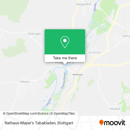
See Rathaus-Mayer's Tabakladen, Gemarkung Riedlingen, on the map
Public Transit to Rathaus-Mayer's Tabakladen in Gemarkung Riedlingen
Wondering how to get to Rathaus-Mayer's Tabakladen in Gemarkung Riedlingen? Moovit helps you find the best way to get to Rathaus-Mayer's Tabakladen with step-by-step directions from the nearest public transit station.
Moovit provides free maps and live directions to help you navigate through your city. View schedules, routes, timetables, and find out how long does it take to get to Rathaus-Mayer's Tabakladen in real time.
Looking for the nearest stop or station to Rathaus-Mayer's Tabakladen? Check out this list of stops closest to your destination: Riedlingen Stadthalle; Riedlingen Kreisgymnasium; Riedlingen Zob/Bahnhof.
Train: RE 55, RE55, RS3.Bus: 260, 265, 272, 320, 380, 218, RE 55, RS 3, X380.
Want to see if there’s another route that gets you there at an earlier time? Moovit helps you find alternative routes or times. Get directions from and directions to Rathaus-Mayer's Tabakladen easily from the Moovit App or Website.
We make riding to Rathaus-Mayer's Tabakladen easy, which is why over 1.5 million users, including users in Gemarkung Riedlingen, trust Moovit as the best app for public transit. You don’t need to download an individual bus app or train app, Moovit is your all-in-one transit app that helps you find the best bus time or train time available.
For information on prices of bus and train, costs and ride fares to Rathaus-Mayer's Tabakladen, please check the Moovit app.
Use the app to navigate to popular places including to the airport, hospital, stadium, grocery store, mall, coffee shop, school, college, and university.
Rathaus-Mayer's Tabakladen Address: Haldenstraße 9 88499 Riedlingen street in Gemarkung Riedlingen
- Dürninger,
- Lotto-Annahmestelle,
- Hermes PaketShop,
- Stoehr-Oster,
- Rhg Riedlingen,
- Damenbekleidung Sylvia Bendel,
- Sport und Mode,
- Ubv Verwaltungs,
- Revita Bau,
- A-Plus Energie & Bauplanung,
- Distelfink de,
- Chilioptik,
- Café Stadtgespräch,
- Schwedenbrunnen,
- Klaus Sauter,
- Optik Rumpel,
- Schuhhaus Breitfeld,
- Leben Bewegt - Gemeinsam Abnehmen,
- Rialto,
- Bäckerei Böck
Places Near Rathaus-Mayer's Tabakladen (Gemarkung Riedlingen)
- Geilhaus Haus 33a, Reutlingen-Betzingen,
- Hanns-Martin-Schleyer-Halle, Bad Cannstatt,
- Wilhelma (U-Bahn Wilhelma), Bad Cannstatt,
- Im Wizemann (Halle), Bad Cannstatt,
- Mercedes-Benz Museum (Mercedes Museum Stuttgart), Bad Cannstatt,
- Porsche Museum, Zuffenhausen,
- Hanns-Martin-Schleyer-Halle (Stuttgart Hans-Martin-Schleyerhalle), Bad Cannstatt,
- Gasometer Pforzheim, Pforzheim,
- Porsche-Arena, Bad Cannstatt,
- Mercedes-Benz Museum, Bad Cannstatt,
- Klinikum Stuttgart - Katharinenhospital, Stuttgart-Mitte,
- Schleyerhalle, Bad Cannstatt,
- Marmorsaal Im Weissenburgpark, Stuttgart-Süd,
- Mettingen Eros-Center Puff Laufhaus, Esslingen Am Neckar,
- SI-Centrum, Möhringen,
- Waldfriedhof, Degerloch,
- Hauptbahnhof Stuttgart, Stuttgart-Mitte,
- Gleis 101/102 (tief), Stuttgart-Mitte,
- Pariser Platz Stuttgart, Stuttgart-Mitte,
- FlixBus Haltestelle, Stuttgart
How to get to popular places in Stuttgart with public transit
Get around Gemarkung Riedlingen by public transit!
Traveling around Gemarkung Riedlingen has never been so easy. See step by step directions as you travel to any attraction, street or major public transit station. View bus and train schedules, arrival times, service alerts and detailed routes on a map, so you know exactly how to get to anywhere in Gemarkung Riedlingen.
When traveling to any destination around Gemarkung Riedlingen use Moovit's Live Directions with Get Off Notifications to know exactly where and how far to walk, how long to wait for your line, and how many stops are left. Moovit will alert you when it's time to get off — no need to constantly re-check whether yours is the next stop.
Wondering how to use public transit in Gemarkung Riedlingen or how to pay for public transit in Gemarkung Riedlingen? Moovit public transit app can help you navigate your way with public transit easily, and at minimum cost. It includes public transit fees, ticket prices, and costs. Looking for a map of Gemarkung Riedlingen public transit lines? Moovit public transit app shows all public transit maps in Gemarkung Riedlingen with all Bus, Train, Subway, Light Rail, Ferry, S-Bahn and Funicular routes and stops on an interactive map.
Stuttgart has 7 transit type(s), including: Bus, Train, Subway, Light Rail, Ferry, S-Bahn and Funicular, operated by several transit agencies, including SSB - Stadtbahn, SSB, SSB - Seilbahn / Zacke, S-Bahn Stuttgart, Rhein-Neckar-Verkehr GmbH (rnv), Karlsruher Verkehrsverbund, DB AG, DB Regiobus BW, Arverio Baden-Württemberg GmbH, DB RegioNetz Verkehrs GmbH Westfrankenbahn, DB Regio AG Baden-Württemberg, Südwestdeutsche Verkehrs-AG, DB Regio AG Mitte Region Hessen, DB and Bodensee-Oberschwaben-Bahn