How to get to Rathausparkplatz by bus?
Click on the bus route to see step by step directions with maps, line arrival times and updated time schedules.
From Berghütte Lauterbad, Vereinbarte Verwaltungsgemeinschaft Freudenstadt
171 minFrom Parkplatz Bauhaus, Verwaltungsgemeinschaft Offenburg
99 minFrom Krankenhaus Freudenstadt, Vereinbarte Verwaltungsgemeinschaft Freudenstadt
144 minFrom Hotel Palmenwald, Vereinbarte Verwaltungsgemeinschaft Freudenstadt
139 minFrom Lotto-Annahmestelle, Vereinbarte Verwaltungsgemeinschaft Sinzheim
194 minFrom Baden-Baden, Karlsruhe/Baden-Baden Airport, Rheinmünster
183 minFrom Panorama-Bad Freudenstadt, Vereinbarte Verwaltungsgemeinschaft Freudenstadt
143 minFrom Klinik Hohenfreudenstadt, Vereinbarte Verwaltungsgemeinschaft Freudenstadt
137 minFrom Grinde-Hütte, Seebach
79 min
How to get to Rathausparkplatz by train?
Click on the train route to see step by step directions with maps, line arrival times and updated time schedules.
From Höhenhotel Pfeifle, Baiersbronn
141 minFrom Parkplatz Bauhaus, Verwaltungsgemeinschaft Offenburg
55 minFrom Krankenhaus Freudenstadt, Vereinbarte Verwaltungsgemeinschaft Freudenstadt
172 minFrom Hotel Palmenwald, Vereinbarte Verwaltungsgemeinschaft Freudenstadt
154 minFrom Lotto-Annahmestelle, Vereinbarte Verwaltungsgemeinschaft Sinzheim
101 minFrom Panorama-Bad Freudenstadt, Vereinbarte Verwaltungsgemeinschaft Freudenstadt
167 minFrom Klinik Hohenfreudenstadt, Vereinbarte Verwaltungsgemeinschaft Freudenstadt
178 min
Bus stops near Rathausparkplatz in Kappelrodeck
Train stations near Rathausparkplatz in Kappelrodeck
Bus lines to Rathausparkplatz in Kappelrodeck
What are the closest stations to Rathausparkplatz?
The closest stations to Rathausparkplatz are:
- Kappelrodeck Waldulmer Straße is 269 meters away, 4 min walk.
- Kappelrodeck is 327 meters away, 5 min walk.
- Kappelrodeck Bahnhof is 2332 meters away, 30 min walk.
Which bus lines stop near Rathausparkplatz?
These bus lines stop near Rathausparkplatz: 400, 7124.
Which train line stops near Rathausparkplatz?
RS3 (Ottenhöfen)
What’s the nearest train station to Rathausparkplatz in Kappelrodeck?
The nearest train stations to Rathausparkplatz in Kappelrodeck are Kappelrodeck Bahnhof and Kappelrodeck. The closest one is a 30 min walk away.
What’s the nearest bus station to Rathausparkplatz in Kappelrodeck?
The nearest bus station to Rathausparkplatz in Kappelrodeck is Kappelrodeck Waldulmer Straße. It’s a 4 min walk away.
What time is the first train to Rathausparkplatz in Kappelrodeck?
The RS 3 is the first train that goes to Rathausparkplatz in Kappelrodeck. It stops nearby at 4:41 AM.
What time is the last train to Rathausparkplatz in Kappelrodeck?
The RS 3 is the last train that goes to Rathausparkplatz in Kappelrodeck. It stops nearby at 10:08 PM.
What time is the first bus to Rathausparkplatz in Kappelrodeck?
The 7124 is the first bus that goes to Rathausparkplatz in Kappelrodeck. It stops nearby at 6:54 AM.
What time is the last bus to Rathausparkplatz in Kappelrodeck?
The 425 is the last bus that goes to Rathausparkplatz in Kappelrodeck. It stops nearby at 6:46 PM.
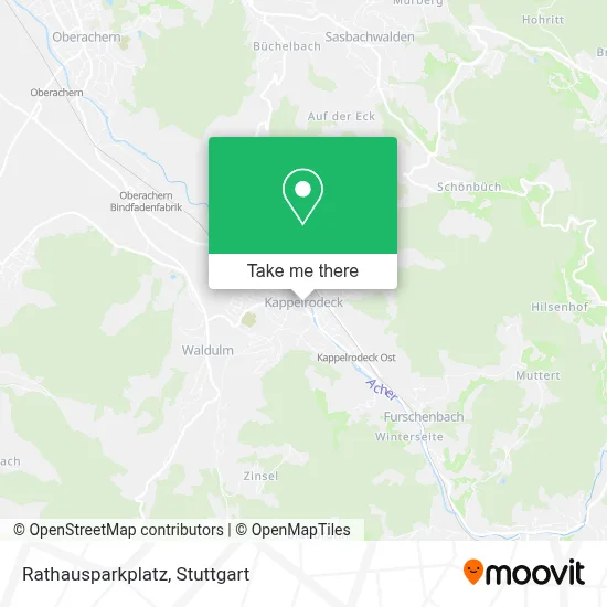
See Rathausparkplatz, Kappelrodeck, on the map
Public Transit to Rathausparkplatz in Kappelrodeck
Wondering how to get to Rathausparkplatz in Kappelrodeck? Moovit helps you find the best way to get to Rathausparkplatz with step-by-step directions from the nearest public transit station.
Moovit provides free maps and live directions to help you navigate through your city. View schedules, routes, timetables, and find out how long does it take to get to Rathausparkplatz in real time.
Looking for the nearest stop or station to Rathausparkplatz? Check out this list of stops closest to your destination: Kappelrodeck Waldulmer Straße; Kappelrodeck; Kappelrodeck Bahnhof.
Bus: 400, 7124, 425.Train: RS3, RS 3.
Want to see if there’s another route that gets you there at an earlier time? Moovit helps you find alternative routes or times. Get directions from and directions to Rathausparkplatz easily from the Moovit App or Website.
We make riding to Rathausparkplatz easy, which is why over 1.5 million users, including users in Kappelrodeck, trust Moovit as the best app for public transit. You don’t need to download an individual bus app or train app, Moovit is your all-in-one transit app that helps you find the best bus time or train time available.
For information on prices of train and bus, costs and ride fares to Rathausparkplatz, please check the Moovit app.
Use the app to navigate to popular places including to the airport, hospital, stadium, grocery store, mall, coffee shop, school, college, and university.
Rathausparkplatz Address: Hauptstraße street in Kappelrodeck
- Touristeninformation,
- Seebach Tourismus,
- Gemeinde Kappelrodeck,
- Das Achertal,
- Freiwillige Feuerwehr Kappelrodeck,
- Baden Aktiv,
- Friseursalon Endes,
- Rathaus Kappelrodeck,
- Öffentliches Wc Rathaus,
- Physiotherapiepraxis,
- Manuela Gerkis-Hasenburg,
- Sonja Schenker,
- Dufke,Kern & Partner,
- Thomas Fischer Rechtsanwaltskanzlei,
- Bäckerei Schneider,
- Bäckerei Conditorei Schneider,
- Wein Schatzteller Hex vom Dasenstein,
- Melanie,
- Zum Prinzen,
- Raiffeisen-Warengenossenschaft Kappelrodeck
Places Near Rathausparkplatz (Kappelrodeck)
- Hanns-Martin-Schleyer-Halle, Bad Cannstatt,
- Gleis 101/102 (tief), Stuttgart-Mitte,
- SI-Centrum, Möhringen,
- Gasometer Pforzheim, Pforzheim,
- Klinikum Stuttgart - Katharinenhospital, Stuttgart-Mitte,
- Marmorsaal Im Weissenburgpark, Stuttgart-Süd,
- Mercedes-Benz Museum (Mercedes Museum Stuttgart), Bad Cannstatt,
- Mercedes-Benz Museum, Bad Cannstatt,
- Geilhaus Haus 33a, Reutlingen-Betzingen,
- Porsche-Arena, Bad Cannstatt,
- Wilhelma (U-Bahn Wilhelma), Bad Cannstatt,
- Waldfriedhof, Degerloch,
- FlixBus Haltestelle, Stuttgart,
- Im Wizemann (Halle), Bad Cannstatt,
- Hanns-Martin-Schleyer-Halle (Stuttgart Hans-Martin-Schleyerhalle), Bad Cannstatt,
- Porsche Museum, Zuffenhausen,
- Pariser Platz Stuttgart, Stuttgart-Mitte,
- Schleyerhalle, Bad Cannstatt,
- Hauptbahnhof Stuttgart, Stuttgart-Mitte,
- Mettingen Eros-Center Puff Laufhaus, Esslingen Am Neckar
How to get to popular places in Stuttgart with public transit
Get around Kappelrodeck by public transit!
Traveling around Kappelrodeck has never been so easy. See step by step directions as you travel to any attraction, street or major public transit station. View bus and train schedules, arrival times, service alerts and detailed routes on a map, so you know exactly how to get to anywhere in Kappelrodeck.
When traveling to any destination around Kappelrodeck use Moovit's Live Directions with Get Off Notifications to know exactly where and how far to walk, how long to wait for your line, and how many stops are left. Moovit will alert you when it's time to get off — no need to constantly re-check whether yours is the next stop.
Wondering how to use public transit in Kappelrodeck or how to pay for public transit in Kappelrodeck? Moovit public transit app can help you navigate your way with public transit easily, and at minimum cost. It includes public transit fees, ticket prices, and costs. Looking for a map of Kappelrodeck public transit lines? Moovit public transit app shows all public transit maps in Kappelrodeck with all Bus, Train, Subway, Light Rail, Ferry, S-Bahn and Funicular routes and stops on an interactive map.
Stuttgart has 7 transit type(s), including: Bus, Train, Subway, Light Rail, Ferry, S-Bahn and Funicular, operated by several transit agencies, including SSB - Stadtbahn, SSB, SSB - Seilbahn / Zacke, S-Bahn Stuttgart, Rhein-Neckar-Verkehr GmbH (rnv), Karlsruher Verkehrsverbund, DB AG, DB Regiobus BW, Arverio Baden-Württemberg GmbH, DB RegioNetz Verkehrs GmbH Westfrankenbahn, DB Regio AG Baden-Württemberg, Südwestdeutsche Verkehrs-AG, DB Regio AG Mitte Region Hessen, DB and Bodensee-Oberschwaben-Bahn