How to get to Rathausplatz by bus?
Click on the bus route to see step by step directions with maps, line arrival times and updated time schedules.
How to get to Rathausplatz by train?
Click on the train route to see step by step directions with maps, line arrival times and updated time schedules.
Bus stops near Rathausplatz in Binzen
Train stations near Rathausplatz in Binzen
Bus lines to Rathausplatz in Binzen
- 1, Holzen Rathaus - Kandern Busbahnhof Bstg 4,VIEW
- 15, Welmlingen Rathaus - Lörrach Busbahnhof Bstg 9,VIEW
- 2, Binzen Dreispitz - Lörrach Busbahnhof Bstg 9,VIEW
- 55, Claraplatz - Kandern Busbahnhof Bstg 4,VIEW
- 220, Lörrach Busbahnhof Bstg 7,VIEW
- 306, Binzen Dreispitz,VIEW
- 310, Wittlingen Schule,VIEW
- 12, Haltingen West,VIEW
- 302, Märkt Altrheinhalle,VIEW
What are the closest stations to Rathausplatz?
The closest stations to Rathausplatz are:
- Binzen Rathausplatz is 40 meters away, 1 min walk.
- Binzen Bahnhof is 210 meters away, 4 min walk.
- Binzen Schule is 521 meters away, 7 min walk.
- Ötlingen Schule is 1427 meters away, 19 min walk.
- Eimeldingen Bahnhof is 2678 meters away, 35 min walk.
Which train lines stop near Rathausplatz?
These train lines stop near Rathausplatz: RB 27, RE 7, RE7.
Which bus lines stop near Rathausplatz?
These bus lines stop near Rathausplatz: 15, 220, 55.
What’s the nearest train station to Rathausplatz in Binzen?
The nearest train station to Rathausplatz in Binzen is Binzen Bahnhof. It’s a 4 min walk away.
What’s the nearest bus station to Rathausplatz in Binzen?
The nearest bus station to Rathausplatz in Binzen is Binzen Rathausplatz. It’s a 1 min walk away.
What time is the first train to Rathausplatz in Binzen?
The RB27 is the first train that goes to Rathausplatz in Binzen. It stops nearby at 4:16 AM.
What time is the last train to Rathausplatz in Binzen?
The RB27 is the last train that goes to Rathausplatz in Binzen. It stops nearby at 1:18 AM.
What time is the first bus to Rathausplatz in Binzen?
The 220 is the first bus that goes to Rathausplatz in Binzen. It stops nearby at 3:50 AM.
What time is the last bus to Rathausplatz in Binzen?
The 220 is the last bus that goes to Rathausplatz in Binzen. It stops nearby at 12:37 AM.
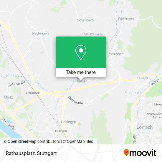
See Rathausplatz, Binzen, on the map
Public Transit to Rathausplatz in Binzen
Wondering how to get to Rathausplatz in Binzen? Moovit helps you find the best way to get to Rathausplatz with step-by-step directions from the nearest public transit station.
Moovit provides free maps and live directions to help you navigate through your city. View schedules, routes, timetables, and find out how long does it take to get to Rathausplatz in real time.
Looking for the nearest stop or station to Rathausplatz? Check out this list of stops closest to your destination: Binzen Rathausplatz; Binzen Bahnhof; Binzen Schule; Ötlingen Schule; Eimeldingen Bahnhof.
Train: RB 27, RE 7, RE7, KTB, RB27.Bus: 15, 220, 55, 1, 2, 306, 310, 12, 302.
Want to see if there’s another route that gets you there at an earlier time? Moovit helps you find alternative routes or times. Get directions from and directions to Rathausplatz easily from the Moovit App or Website.
We make riding to Rathausplatz easy, which is why over 1.5 million users, including users in Binzen, trust Moovit as the best app for public transit. You don’t need to download an individual bus app or train app, Moovit is your all-in-one transit app that helps you find the best bus time or train time available.
For information on prices of train, bus and light rail, costs and ride fares to Rathausplatz, please check the Moovit app.
Use the app to navigate to popular places including to the airport, hospital, stadium, grocery store, mall, coffee shop, school, college, and university.
Rathausplatz Address: Hauptstraße 79589 Binzen street in Binzen
- Bluemestübli Kühn,
- Post, Hauptstraße,
- Andrea Schlüter Goldschmiede,
- Blattwerk Binzen,
- Spieß & Retsch Elektrotechnik,
- Andreas Schneucker,
- Bürgermeisteramt Binzen,
- Ersatzhaltestelle Rümmingen Altes Rathaus,
- Rathaus Binzen,
- Gemeindeverwaltungsverband,
- Zum Ochsen,
- Ochsen,
- Ochsen Hotel-Restaurant Binzen,
- Platzbrunnen,
- Piccola Pausa,
- Mig Nails & Beauty Germany,
- Lotta Café&Bar,
- Piccola Pausa - das Kaffeehaus Fuer Italien-Liebhaber,
- Alnatura,
- Kandertal Apotheke
Places Near Rathausplatz (Binzen)
- Im Wizemann (Halle), Bad Cannstatt,
- Porsche-Arena, Bad Cannstatt,
- Hanns-Martin-Schleyer-Halle, Bad Cannstatt,
- Waldfriedhof, Degerloch,
- Gleis 101/102 (tief), Stuttgart-Mitte,
- Hauptbahnhof Stuttgart, Stuttgart-Mitte,
- Gasometer Pforzheim, Pforzheim,
- Geilhaus Haus 33a, Reutlingen-Betzingen,
- Klinikum Stuttgart - Katharinenhospital, Stuttgart-Mitte,
- Mercedes-Benz Museum (Mercedes Museum Stuttgart), Bad Cannstatt,
- SI-Centrum, Möhringen,
- FlixBus Haltestelle, Stuttgart,
- Porsche Museum, Zuffenhausen,
- Schleyerhalle, Bad Cannstatt,
- Pariser Platz Stuttgart, Stuttgart-Mitte,
- Marmorsaal Im Weissenburgpark, Stuttgart-Süd,
- Wilhelma (U-Bahn Wilhelma), Bad Cannstatt,
- Mercedes-Benz Museum, Bad Cannstatt,
- Mettingen Eros-Center Puff Laufhaus, Esslingen Am Neckar,
- Hanns-Martin-Schleyer-Halle (Stuttgart Hans-Martin-Schleyerhalle), Bad Cannstatt
How to get to popular places in Stuttgart with public transit
Get around Binzen by public transit!
Traveling around Binzen has never been so easy. See step by step directions as you travel to any attraction, street or major public transit station. View bus and train schedules, arrival times, service alerts and detailed routes on a map, so you know exactly how to get to anywhere in Binzen.
When traveling to any destination around Binzen use Moovit's Live Directions with Get Off Notifications to know exactly where and how far to walk, how long to wait for your line, and how many stops are left. Moovit will alert you when it's time to get off — no need to constantly re-check whether yours is the next stop.
Wondering how to use public transit in Binzen or how to pay for public transit in Binzen? Moovit public transit app can help you navigate your way with public transit easily, and at minimum cost. It includes public transit fees, ticket prices, and costs. Looking for a map of Binzen public transit lines? Moovit public transit app shows all public transit maps in Binzen with all Bus, Train, Subway, Light Rail, Ferry, S-Bahn and Funicular routes and stops on an interactive map.
Stuttgart has 7 transit type(s), including: Bus, Train, Subway, Light Rail, Ferry, S-Bahn and Funicular, operated by several transit agencies, including SSB - Stadtbahn, SSB, SSB - Seilbahn / Zacke, S-Bahn Stuttgart, Rhein-Neckar-Verkehr GmbH (rnv), Karlsruher Verkehrsverbund, DB AG, DB Regiobus BW, Arverio Baden-Württemberg GmbH, DB RegioNetz Verkehrs GmbH Westfrankenbahn, DB Regio AG Baden-Württemberg, Südwestdeutsche Verkehrs-AG, DB Regio AG Mitte Region Hessen, DB and Bodensee-Oberschwaben-Bahn