How to get to Rauch-Petz Gisela by bus?
Click on the bus route to see step by step directions with maps, line arrival times and updated time schedules.
From Beatparade, Verwaltungsgemeinschaft Horb am Neckar
127 minFrom Stadtwerke Villingen-Schwenningen GmbH, Villingen-Schwenningen
118 minFrom Fachklinik Sonnenhof Waldachtal, Verwaltungsverband Dornstetten
163 minFrom Hotel Palmenwald, Vereinbarte Verwaltungsgemeinschaft Freudenstadt
118 minFrom Bauhaus Villingen-Schwenningen, Villingen-Schwenningen
118 minFrom Waldeck Spa, Bad Dürrheim
138 minFrom Klinik Hohenfreudenstadt, Vereinbarte Verwaltungsgemeinschaft Freudenstadt
162 minFrom Lützenhardt, Verwaltungsverband Dornstetten
158 minFrom Berghütte Lauterbad, Vereinbarte Verwaltungsgemeinschaft Freudenstadt
125 minFrom Campingplatz Schüttehof Horb, Gemarkung Horb am Neckar
158 min
How to get to Rauch-Petz Gisela by train?
Click on the train route to see step by step directions with maps, line arrival times and updated time schedules.
From Stadtwerke Villingen-Schwenningen GmbH, Villingen-Schwenningen
54 minFrom Hotel Palmenwald, Vereinbarte Verwaltungsgemeinschaft Freudenstadt
202 minFrom Klinik Hohenfreudenstadt, Vereinbarte Verwaltungsgemeinschaft Freudenstadt
198 minFrom Campingplatz Schüttehof Horb, Gemarkung Horb am Neckar
63 min
Bus stops near Rauch-Petz Gisela in Rottweil
Train stations near Rauch-Petz Gisela in Rottweil
Bus lines to Rauch-Petz Gisela in Rottweil
- 1, Deißlingen Mitte - Zimmern ob Rottweil Zimmern Römerallee,VIEW
- 2, Rottweil Saline (Autohaus) - Rottweil RW Saline (Einkaufszentrum),VIEW
- 2021, Rottweil Bahnhof - Bösingen Dorfplatz,VIEW
- 3, Rottweil Hausen o.R. Horgenerstraße - Rottweil Göllsdorf Kreissparkasse,VIEW
- 34/35, Oberndorf am Neckar Oberndorf Bahnhof/ZOB Bstg G - Rottweil Saline (Autohaus),VIEW
- 4, Rottweil Friedrichsplatz - Rottweil Thyssenkrupp Testturm,VIEW
- 40, Rottweil Bahnhof - Schramberg Busbahnhof Bstg 6,VIEW
- 46, Rottweil Göllsdorf Kreissparkasse - Rottweil Vaihinger Hof-Linde,VIEW
- 49S, Dunningen Post - Rottweil Bahnhof,VIEW
- 7440, Rottweil Bahnhof - Balingen Bahnhof/Busbf Bstg 1,VIEW
- 7444, Rottweil Bahnhof - Oberndorf am Neckar Oberndorf Bahnhof/ZOB Bstg D,VIEW
- 7444, Oberndorf am Neckar Oberndorf Bahnhof/ZOB Bstg C - Rottweil Bahnhof,VIEW
- 7445, Deißlingen Mitte - Deißlingen Lauffen Kirchäcker,VIEW
- 9001, Deißlingen Mitte - Rottweil Zimmerner Straße,VIEW
- 9002, Rottweil Durschstraße - Rottweil Bahnhof,VIEW
- 9004, Rottweil Bahnhof - Rottweil Hausen o.R. Horgenerstraße,VIEW
- 9006, Rottweil Bahnhof - Rottweil Tannstraße,VIEW
- 9007, Rottweil Bahnhof - Rottweil Bahnhof,VIEW
- 9008, Rottweil Bahnhof - Rottweil Freibad,VIEW
- 9009, Zimmern ob Rottweil Zimmern o.R. Am Dorfplatz - Dunningen Post,VIEW
What are the closest stations to Rauch-Petz Gisela?
The closest stations to Rauch-Petz Gisela are:
- Rottweil Landratsamt is 30 meters away, 1 min walk.
- Rottweil Lra/Stadionstraße is 137 meters away, 3 min walk.
- Rottweil Hochb./Ruhe-Chr.Str. is 298 meters away, 5 min walk.
- Rottweil is 1135 meters away, 15 min walk.
- Rottweil Bahnhof is 1135 meters away, 15 min walk.
- Rottweil Göllsdorf Bahnhof is 2506 meters away, 33 min walk.
Which train lines stop near Rauch-Petz Gisela?
These train lines stop near Rauch-Petz Gisela: IC87, RB42.
Which bus lines stop near Rauch-Petz Gisela?
These bus lines stop near Rauch-Petz Gisela: 1, 2, 2021, 40, 49S, 7444.
What’s the nearest train station to Rauch-Petz Gisela in Rottweil?
The nearest train stations to Rauch-Petz Gisela in Rottweil are Rottweil and Rottweil Bahnhof. The closest one is a 15 min walk away.
What’s the nearest bus station to Rauch-Petz Gisela in Rottweil?
The nearest bus station to Rauch-Petz Gisela in Rottweil is Rottweil Landratsamt. It’s a 1 min walk away.
What time is the first train to Rauch-Petz Gisela in Rottweil?
The RE14 is the first train that goes to Rauch-Petz Gisela in Rottweil. It stops nearby at 5:11 AM.
What time is the last train to Rauch-Petz Gisela in Rottweil?
The RE14 is the last train that goes to Rauch-Petz Gisela in Rottweil. It stops nearby at 12:06 AM.
What time is the first bus to Rauch-Petz Gisela in Rottweil?
The 40 is the first bus that goes to Rauch-Petz Gisela in Rottweil. It stops nearby at 4:52 AM.
What time is the last bus to Rauch-Petz Gisela in Rottweil?
The 9478 is the last bus that goes to Rauch-Petz Gisela in Rottweil. It stops nearby at 12:50 AM.
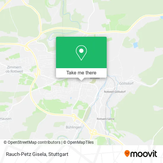
See Rauch-Petz Gisela, Rottweil, on the map
Public Transit to Rauch-Petz Gisela in Rottweil
Wondering how to get to Rauch-Petz Gisela in Rottweil? Moovit helps you find the best way to get to Rauch-Petz Gisela with step-by-step directions from the nearest public transit station.
Moovit provides free maps and live directions to help you navigate through your city. View schedules, routes, timetables, and find out how long does it take to get to Rauch-Petz Gisela in real time.
Looking for the nearest stop or station to Rauch-Petz Gisela? Check out this list of stops closest to your destination: Rottweil Landratsamt; Rottweil Lra/Stadionstraße; Rottweil Hochb./Ruhe-Chr.Str.; Rottweil; Rottweil Bahnhof; Rottweil Göllsdorf Bahnhof.
Train: IC87, RB42, SVG, RE4, RE14, RE4, RE4, RE4, RB14A, RE14A, RB 43.Bus: 1, 2, 2021, 40, 49S, 7444, 3, 34/35, 1S, 2120, 9440, 9444, 4S.
Want to see if there’s another route that gets you there at an earlier time? Moovit helps you find alternative routes or times. Get directions from and directions to Rauch-Petz Gisela easily from the Moovit App or Website.
We make riding to Rauch-Petz Gisela easy, which is why over 1.5 million users, including users in Rottweil, trust Moovit as the best app for public transit. You don’t need to download an individual bus app or train app, Moovit is your all-in-one transit app that helps you find the best bus time or train time available.
For information on prices of bus and train, costs and ride fares to Rauch-Petz Gisela, please check the Moovit app.
Use the app to navigate to popular places including to the airport, hospital, stadium, grocery store, mall, coffee shop, school, college, and university.
Rauch-Petz Gisela Address: Königstraße 35 78628 Rottweil street in Rottweil
- Mathieu P. Volkers,
- Tschirdewahn,
- Dr. med. Klausgünther Halm,
- Schumis Fahrschule,
- Sailers Apotheken,
- Dr. Sailer's Römer- Apotheke,
- Op Zentrum Schatz,
- Fielmann,
- Dr. med. Thomas Rößler,
- Herbert Dittmann,
- Kinder,
- Kardiologie Rottweil,
- Lungendoc Rottweil,
- La-Dy VI-Tal Rott-Weil - Inh. Steven David Buzzy,
- Aoz Schatz,
- Egbert Bold,
- Wallum Steuerberatungs,
- Startseite Coronatest Rottweil,
- Dr.Med. H.Ulrich Eckhardt Facharzt für Neurologie,
- Dr. med. Christian Holzhüter
Places Near Rauch-Petz Gisela (Rottweil)
- Gasometer Pforzheim, Pforzheim,
- Mercedes-Benz Museum, Bad Cannstatt,
- Wilhelma (U-Bahn Wilhelma), Bad Cannstatt,
- Geilhaus Haus 33a, Reutlingen-Betzingen,
- FlixBus Haltestelle, Stuttgart,
- Gleis 101/102 (tief), Stuttgart-Mitte,
- Pariser Platz Stuttgart, Stuttgart-Mitte,
- Mercedes-Benz Museum (Mercedes Museum Stuttgart), Bad Cannstatt,
- Hanns-Martin-Schleyer-Halle, Bad Cannstatt,
- SI-Centrum, Möhringen,
- Waldfriedhof, Degerloch,
- Mettingen Eros-Center Puff Laufhaus, Esslingen Am Neckar,
- Porsche-Arena, Bad Cannstatt,
- Schleyerhalle, Bad Cannstatt,
- Hanns-Martin-Schleyer-Halle (Stuttgart Hans-Martin-Schleyerhalle), Bad Cannstatt,
- Marmorsaal Im Weissenburgpark, Stuttgart-Süd,
- Klinikum Stuttgart - Katharinenhospital, Stuttgart-Mitte,
- Im Wizemann (Halle), Bad Cannstatt,
- Hauptbahnhof Stuttgart, Stuttgart-Mitte,
- Porsche Museum, Zuffenhausen
How to get to popular places in Stuttgart with public transit
Get around Rottweil by public transit!
Traveling around Rottweil has never been so easy. See step by step directions as you travel to any attraction, street or major public transit station. View bus and train schedules, arrival times, service alerts and detailed routes on a map, so you know exactly how to get to anywhere in Rottweil.
When traveling to any destination around Rottweil use Moovit's Live Directions with Get Off Notifications to know exactly where and how far to walk, how long to wait for your line, and how many stops are left. Moovit will alert you when it's time to get off — no need to constantly re-check whether yours is the next stop.
Wondering how to use public transit in Rottweil or how to pay for public transit in Rottweil? Moovit public transit app can help you navigate your way with public transit easily, and at minimum cost. It includes public transit fees, ticket prices, and costs. Looking for a map of Rottweil public transit lines? Moovit public transit app shows all public transit maps in Rottweil with all Bus, Train, Subway, Light Rail, Ferry, S-Bahn and Funicular routes and stops on an interactive map.
Stuttgart has 7 transit type(s), including: Bus, Train, Subway, Light Rail, Ferry, S-Bahn and Funicular, operated by several transit agencies, including SSB - Stadtbahn, SSB, SSB - Seilbahn / Zacke, S-Bahn Stuttgart, Rhein-Neckar-Verkehr GmbH (rnv), Karlsruher Verkehrsverbund, DB AG, DB Regiobus BW, Arverio Baden-Württemberg GmbH, DB RegioNetz Verkehrs GmbH Westfrankenbahn, DB Regio AG Baden-Württemberg, Südwestdeutsche Verkehrs-AG, DB Regio AG Mitte Region Hessen, DB and Bodensee-Oberschwaben-Bahn
Public transit lines with stations closest to Rauch-Petz Gisela in Rottweil
Train lines with stations closest to Rauch-Petz Gisela in Rottweil
Bus lines with stations closest to Rauch-Petz Gisela in Rottweil
Rottweil Landratsamt
 1Deißlingen Mitte - Zimmern ob Rottweil Zimmern Römerallee
- 2Rottweil Saline (Autohaus) - Rottweil RW Saline (Einkaufszentrum)
- 2021Rottweil Bahnhof - Bösingen Dorfplatz
- 3Rottweil Hausen o.R. Horgenerstraße - Rottweil Göllsdorf Kreissparkasse
- 34/35Oberndorf am Neckar Oberndorf Bahnhof/ZOB Bstg G - Rottweil Saline (Autohaus)