How to get to Raul Pelayo Garcia by bus?
Click on the bus route to see step by step directions with maps, line arrival times and updated time schedules.
From Metro República Argentina, Madrid
77 minFrom Coliseum, Madrid
40 minFrom Hospital Beata María Ana, Área Metropolitana De Madrid Y Corredor Del Henares
71 minFrom Caixaforum Madrid, Área Metropolitana De Madrid Y Corredor Del Henares
48 minFrom Calle Eraso, Madrid
67 minFrom Fuente del Berro, Madrid
77 minFrom Centro Médico Infanta Mercedes, Área Metropolitana De Madrid Y Corredor Del Henares
77 minFrom Alfonso XII, Madrid
46 minFrom Aravaca, Área Metropolitana De Madrid Y Corredor Del Henares
77 minFrom Av del General Peron, Madrid
80 min
How to get to Raul Pelayo Garcia by train?
Click on the train route to see step by step directions with maps, line arrival times and updated time schedules.
From Metro República Argentina, Madrid
42 minFrom Coliseum, Madrid
46 minFrom Caixaforum Madrid, Área Metropolitana De Madrid Y Corredor Del Henares
29 minFrom Centro Médico Infanta Mercedes, Área Metropolitana De Madrid Y Corredor Del Henares
57 minFrom Alfonso XII, Madrid
23 minFrom Aravaca, Área Metropolitana De Madrid Y Corredor Del Henares
60 minFrom Av del General Peron, Madrid
48 min
How to get to Raul Pelayo Garcia by metro?
Click on the metro route to see step by step directions with maps, line arrival times and updated time schedules.
From Metro República Argentina, Madrid
50 minFrom Coliseum, Madrid
33 minFrom Hospital Beata María Ana, Área Metropolitana De Madrid Y Corredor Del Henares
46 minFrom Caixaforum Madrid, Área Metropolitana De Madrid Y Corredor Del Henares
50 minFrom Calle Eraso, Madrid
50 minFrom Fuente del Berro, Madrid
51 minFrom Centro Médico Infanta Mercedes, Área Metropolitana De Madrid Y Corredor Del Henares
57 minFrom Alfonso XII, Madrid
48 minFrom Av del General Peron, Madrid
50 min
Bus stops near Raul Pelayo Garcia in Madrid
Metro station near Raul Pelayo Garcia in Madrid
- Empalme, 9 min walk,VIEW
Train station near Raul Pelayo Garcia in Madrid
- Aluche, 14 min walk,VIEW
Bus lines to Raul Pelayo Garcia in Madrid
What are the closest stations to Raul Pelayo Garcia?
The closest stations to Raul Pelayo Garcia are:
- Rafael Finat - Valle Inclán is 70 meters away, 2 min walk.
- Maestra Justa Freire - P. Aluche Cercanías is 373 meters away, 6 min walk.
- Millán Astray is 383 meters away, 6 min walk.
- Junta Municipal Latina is 488 meters away, 7 min walk.
- Empalme is 625 meters away, 9 min walk.
- Aluche is 1044 meters away, 14 min walk.
Which bus lines stop near Raul Pelayo Garcia?
These bus lines stop near Raul Pelayo Garcia: 138, 17, 34.
Which train line stops near Raul Pelayo Garcia?
C5 (Móstoles - El Soto)
Which metro line stops near Raul Pelayo Garcia?
M-5 (Casa de Campo)
What’s the nearest metro station to Raul Pelayo Garcia in Madrid?
The nearest metro station to Raul Pelayo Garcia in Madrid is Empalme. It’s a 9 min walk away.
What’s the nearest train station to Raul Pelayo Garcia in Madrid?
The nearest train station to Raul Pelayo Garcia in Madrid is Aluche. It’s a 14 min walk away.
What’s the nearest bus station to Raul Pelayo Garcia in Madrid?
The nearest bus station to Raul Pelayo Garcia in Madrid is Rafael Finat - Valle Inclán. It’s a 2 min walk away.
What time is the first metro to Raul Pelayo Garcia in Madrid?
The M-5 is the first metro that goes to Raul Pelayo Garcia in Madrid. It stops nearby at 6:05 AM.
What time is the last metro to Raul Pelayo Garcia in Madrid?
The M-5 is the last metro that goes to Raul Pelayo Garcia in Madrid. It stops nearby at 2:22 AM.
What time is the first train to Raul Pelayo Garcia in Madrid?
The C5 is the first train that goes to Raul Pelayo Garcia in Madrid. It stops nearby at 5:31 AM.
What time is the last train to Raul Pelayo Garcia in Madrid?
The C5 is the last train that goes to Raul Pelayo Garcia in Madrid. It stops nearby at 12:25 AM.
What time is the first bus to Raul Pelayo Garcia in Madrid?
The 155 is the first bus that goes to Raul Pelayo Garcia in Madrid. It stops nearby at 7:03 AM.
What time is the last bus to Raul Pelayo Garcia in Madrid?
The N18 is the last bus that goes to Raul Pelayo Garcia in Madrid. It stops nearby at 2:42 AM.
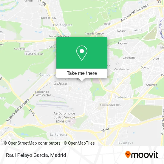
See Raul Pelayo Garcia, Madrid, on the map
Public Transit to Raul Pelayo Garcia in Madrid
Wondering how to get to Raul Pelayo Garcia in Madrid? Moovit helps you find the best way to get to Raul Pelayo Garcia with step-by-step directions from the nearest public transit station.
Moovit provides free maps and live directions to help you navigate through your city. View schedules, routes, timetables, and find out how long does it take to get to Raul Pelayo Garcia in real time.
Looking for the nearest stop or station to Raul Pelayo Garcia? Check out this list of stops closest to your destination: Rafael Finat - Valle Inclán; Maestra Justa Freire - P. Aluche Cercanías; Millán Astray; Junta Municipal Latina; Empalme; Aluche.
Bus: 138, 17, 34, 483, 487, 139, 155, N19.Train: C5.Metro: M-5.
Want to see if there’s another route that gets you there at an earlier time? Moovit helps you find alternative routes or times. Get directions from and directions to Raul Pelayo Garcia easily from the Moovit App or Website.
We make riding to Raul Pelayo Garcia easy, which is why over 1.5 million users, including users in Madrid, trust Moovit as the best app for public transit. You don’t need to download an individual bus app or train app, Moovit is your all-in-one transit app that helps you find the best bus time or train time available.
For information on prices of bus, metro and train, costs and ride fares to Raul Pelayo Garcia, please check the Moovit app.
Use the app to navigate to popular places including to the airport, hospital, stadium, grocery store, mall, coffee shop, school, college, and university.
Raul Pelayo Garcia Address: Calle Rafael Finat, 43 28044 Las Águilas Madrid street in Madrid
- Lushermay,
- Hernández Martin,
- Revestimientos Soria,
- Tomas Fernández Cruz,
- Entre Fogones,
- Bar Cafetería,
- Eos,
- Amarillas Mobiliario de Cocina,
- Marina Llorente Perez,
- Farmacia,
- Juan Antonio Chacon Prieto,
- Calle de Valle Inclán 2,
- Iglesia Evangelica Las Aguilas,
- Bt España Compañia de Servicios Globales de Telecomunicaciones,
- Ferrovial Construccion,
- Calle Fuerte de Navidad,
- Suma Supermercado,
- Calle Rafael Finat 41-43,
- Barrio Las Águilas,
- Calle Rafael Finat 17
Places Near Raul Pelayo Garcia (Madrid)
- Wizink Center, Madrid,
- Hospital Universitario Ramón y Cajal, Madrid,
- Calle de López de Hoyos 169, Madrid,
- Mercadillo de Majadahonda, Majadahonda,
- Centro Comercial La Vaguada, Área Metropolitana De Madrid Y Corredor Del Henares,
- Nassica, Área Metropolitana De Madrid Y Corredor Del Henares,
- Hospital Clínico Universitario San Carlos, Madrid,
- Hospital Universitario La Paz, Madrid,
- Mendez Alvaro, Madrid,
- Sala La Riviera, Madrid,
- Plenilunio, Área Metropolitana De Madrid Y Corredor Del Henares,
- Estadio Wanda Metropolitano, Área Metropolitana De Madrid Y Corredor Del Henares,
- Estacion de Chamartin, Madrid,
- Centro Comercial Oasiz Madrid, Área Metropolitana De Madrid Y Corredor Del Henares,
- Rastro De Madrid, Área Metropolitana De Madrid Y Corredor Del Henares,
- Centro Comercial Islazul, Área Metropolitana De Madrid Y Corredor Del Henares,
- Tres Aguas, Alcorcón,
- Palacio De Vistalegre, Área Metropolitana De Madrid Y Corredor Del Henares,
- Plaza Mayor, Madrid,
- Centro Comercial La Gavia, Área Metropolitana De Madrid Y Corredor Del Henares
How to get to popular places in Madrid with public transit
Get around Madrid by public transit!
Traveling around Madrid has never been so easy. See step by step directions as you travel to any attraction, street or major public transit station. View bus and train schedules, arrival times, service alerts and detailed routes on a map, so you know exactly how to get to anywhere in Madrid.
When traveling to any destination around Madrid use Moovit's Live Directions with Get Off Notifications to know exactly where and how far to walk, how long to wait for your line, and how many stops are left. Moovit will alert you when it's time to get off — no need to constantly re-check whether yours is the next stop.
Wondering how to use public transit in Madrid or how to pay for public transit in Madrid? Moovit public transit app can help you navigate your way with public transit easily, and at minimum cost. It includes public transit fees, ticket prices, and costs. Looking for a map of Madrid public transit lines? Moovit public transit app shows all public transit maps in Madrid with all Bus, Train, Metro and Light Rail routes and stops on an interactive map.
Madrid has 4 transit type(s), including: Bus, Train, Metro and Light Rail, operated by several transit agencies, including Metro de Madrid, Metro Ligero, Tranvía de Parla, Renfe Cercanías - Servicios de Autobús especiales, Renfe Cercanias, Renfe Cercanías, EMT, Interurbanos, Urbanos de Alcalá de Henares, Urbanos de Alcobendas, Urbanos de Alcorcón, Urbanos de Algete, Urbanos de Aranjuez, Urbanos de Arganda del Rey and Urbanos de Arroyomolinos