Directions to Rave.Fer (Capão Raso) with public transportation
The following transit lines have routes that pass near Rave.Fer
How to get to Rave.Fer by bus?
Click on the bus route to see step by step directions with maps, line arrival times and updated time schedules.
From Hipermercado Condor Cajuru, Cajuru
70 minFrom Rua Delegado Leopoldo Belczak, Capão Da Imbúia
52 minFrom Avenida Victor Ferreira do Amaral 2940, Tarumã
47 minFrom CEASA - Centrais de Abastecimento do Paraná, Tatuquara
26 minFrom Hospital De Olhos Do Paraná, Batel
28 minFrom Rua Augusto Stresser, Juvevê
53 minFrom Avenida Sete de Setembro 4228, Batel
34 minFrom Rua Sete de Setembro, São José Dos Pinhais
73 minFrom Rua Major Heitor Guimarães, Campina Do Siqueira
33 minFrom Dapi Mercês, Mercês
41 min
Bus stops near Rave.Fer in Capão Raso
Bus lines to Rave.Fer in Capão Raso
- 030 INTERBAIRROS III, Terminal Santa Cândida → Terminal Capão Raso,VIEW
- 609 MAD. CIC, Praça Rui Barbosa → Terminal CIC,VIEW
- X11 SÍTIO CERCADO / CAPÃO RASO, Terminal Sítio Cercado → Terminal Capão Raso,VIEW
- 502 CIRCULAR SUL (HORÁRIO), Sentido Horário,VIEW
- 603 PINHEIRINHO / RUI BARBOSA, Terminal Pinheirinho → Praça Rui Barbosa,VIEW
- 526 ITAMARATI / VILA SÃO PEDRO, Terminal Hauer → Terminal Capão Raso ,VIEW
- 625 GRAMADOS, Terminal Sítio Cercado → Terminal Capão Raso,VIEW
- F71 FAZENDA / GUADALUPE, Terminal Guadalupe → Terminal Fazenda,VIEW
- G72 AREIA BRANCA / GUADALUPE, Areia Branca → Terminal Guadalupe,VIEW
- G72 QUITANDINHA / GUADALUPE, Quitandinha → Terminal Guadalupe,VIEW
- 620 SANTA CRUZ, Terminal Capão Raso → Santa Cruz,VIEW
- 623 PARQUE INDUSTRIAL, Parque Industrial → Terminal Capão Raso,VIEW
- 627 BOSCH, Terminal Capão Raso → Bosch (Vila Verde),VIEW
- X08 REFORÇO PINHEIRINHO, Estação Coronel Dulcídio → Terminal Pinheirinho,VIEW
- X20 PORTÃO / SÍTIO CERCADO, Terminal Portão → Terminal Sítio Cercado,VIEW
- 602 CIRCULAR SUL (ANTI-HORÁRIO), Sentido Anti-Horário,VIEW
- G71 MANDIRITUBA / GUADALUPE, Terminal Rodoviário Mandirituba → Terminal Guadalupe,VIEW
What are the closest stations to Rave.Fer?
The closest stations to Rave.Fer are:
- R. Vereador Adeodato Volpi, 59 is 122 meters away, 2 min walk.
- Av. Winston Churchill, 2370 is 200 meters away, 3 min walk.
- José Bettega is 206 meters away, 3 min walk.
- R. Professor João Mazzarotto, 131 is 244 meters away, 4 min walk.
- R. Antônio Gasparin, 5600 is 273 meters away, 4 min walk.
- Pedro Gusso is 277 meters away, 4 min walk.
- R. Irmãs Paulinas, 5600 is 469 meters away, 7 min walk.
Which bus lines stop near Rave.Fer?
These bus lines stop near Rave.Fer: 020 INTERBAIRROS II (HORÁRIO), 021 INTERBAIRROS II (ANTI-HORÁRIO), 030 INTERBAIRROS III, 603 PINHEIRINHO / RUI BARBOSA, G71 MANDIRITUBA / GUADALUPE, G72 AREIA BRANCA / GUADALUPE.
What’s the nearest bus station to Rave.Fer in Capão Raso?
The nearest bus station to Rave.Fer in Capão Raso is R. Vereador Adeodato Volpi, 59. It’s a 2 min walk away.
What time is the first bus to Rave.Fer in Capão Raso?
The 609 MAD. CIC is the first bus that goes to Rave.Fer in Capão Raso. It stops nearby at 3:12 AM.
What time is the last bus to Rave.Fer in Capão Raso?
The 609 MAD. CIC is the last bus that goes to Rave.Fer in Capão Raso. It stops nearby at 3:13 AM.
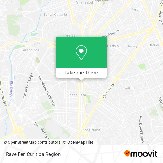
See Rave.Fer, Capão Raso, on the map
Public Transit to Rave.Fer in Capão Raso
Wondering how to get to Rave.Fer in Capão Raso? Moovit helps you find the best way to get to Rave.Fer with step-by-step directions from the nearest public transit station.
Moovit provides free maps and live directions to help you navigate through your city. View schedules, routes, timetables, and find out how long does it take to get to Rave.Fer in real time.
Looking for the nearest stop or station to Rave.Fer? Check out this list of stops closest to your destination: R. Vereador Adeodato Volpi; Av. Winston Churchill; José Bettega; R. Professor João Mazzarotto; R. Antônio Gasparin; Pedro Gusso; R. Irmãs Paulinas.
Bus: 020 INTERBAIRROS II (HORÁRIO), 021 INTERBAIRROS II (ANTI-HORÁRIO), 030 INTERBAIRROS III, 603 PINHEIRINHO / RUI BARBOSA, G71 MANDIRITUBA / GUADALUPE, G72 AREIA BRANCA / GUADALUPE, 609 MAD. CIC, X11 SÍTIO CERCADO / CAPÃO RASO, 502 CIRCULAR SUL (HORÁRIO), 526 ITAMARATI / VILA SÃO PEDRO, 625 GRAMADOS, F71 FAZENDA / GUADALUPE, G72 QUITANDINHA / GUADALUPE, 620 SANTA CRUZ, 623 PARQUE INDUSTRIAL, X08 REFORÇO PINHEIRINHO, X20 PORTÃO / SÍTIO CERCADO, 602 CIRCULAR SUL (ANTI-HORÁRIO).
Want to see if there’s another route that gets you there at an earlier time? Moovit helps you find alternative routes or times. Get directions from and directions to Rave.Fer easily from the Moovit App or Website.
We make riding to Rave.Fer easy, which is why over 1.5 million users, including users in Capão Raso, trust Moovit as the best app for public transit. You don’t need to download an individual bus app or train app, Moovit is your all-in-one transit app that helps you find the best bus time or train time available.
For information on prices of bus, costs and ride fares to Rave.Fer, please check the Moovit app.
Use the app to navigate to popular places including to the airport, hospital, stadium, grocery store, mall, coffee shop, school, college, and university.
Rave.Fer Address: Avenida Winston Churchill, 196 Capão Raso Curitiba-PR 81130-000 street in Capão Raso
- Farol dos Orixás Comércio de Artigos Religiosos Ltda,
- Roma and de Luca Sociedade de Advogados,
- Sinefeasc,
- Exapar Contabilidade,
- Geolive Pasta Emporium,
- Revefer - Assistência Técnica,
- Cooperadi - Cooperativa de Trabalho de Profissionais Em Radiologia do Paraná,
- Casa dos Faróis e Lanternas,
- Panificadora e Confeitaria Família,
- S.O.S. Mecatronica Automotiva,
- Eletro Capão Raso,
- Rua Henrique Schuta 63,
- Margutti Fomento Mercantil,
- Pão de Alho do Karioca,
- R Hinça Imóveis.,
- Consultório de Atendimento Psicopedagogia,
- Rally Som Store,
- Morada Santos/Silveira,
- Pizzaria Di Trevi,
- Premizou-Comercio De Maquinas E Acessorios
Places Near Rave.Fer (Capão Raso)
- Hospital Universitário Evangélico de Curitiba, Bigorrilho,
- Jockey Plaza Shopping Center, Tarumã,
- Shopping Estação, Rebouças,
- Hospital do Rocio, Campo,
- Hhhhh, Fazendinha,
- Hospital Angelina Caron, Campina Grande Do Sul,
- Rua General Mário Tourinho, Campina Do Siqueira,
- Hospital Da Cruz Vermelha, Batel,
- Arena Da Baixada - Curitiba,
- Jardim Botânico de Curitiba PR, Centro,
- Campo Largo, Campo,
- Rua Martim Afonso 558, Mercês,
- Hospital de Clínicas (HC - UFPR), Centro,
- Pontifícia Universidade Católica do Paraná (PUCPR), Prado Velho,
- Parque Barigui, Mercês,
- Hospital Erasto Gaertner, Jardim Das Américas,
- Hospital Nossa Senhora Das Graças, Mercês,
- Park Shopping Barigüi, Mossunguê,
- Hospital Madalena Sofia, Bairro Alto,
- Shopping Palladium, Portão
How to get to popular places in Curitiba Region with public transit
Get around Capão Raso by public transit!
Traveling around Capão Raso has never been so easy. See step by step directions as you travel to any attraction, street or major public transit station. View bus and train schedules, arrival times, service alerts and detailed routes on a map, so you know exactly how to get to anywhere in Capão Raso.
When traveling to any destination around Capão Raso use Moovit's Live Directions with Get Off Notifications to know exactly where and how far to walk, how long to wait for your line, and how many stops are left. Moovit will alert you when it's time to get off — no need to constantly re-check whether yours is the next stop.
Wondering how to use public transit in Capão Raso or how to pay for public transit in Capão Raso? Moovit public transit app can help you navigate your way with public transit easily, and at minimum cost. It includes public transit fees, ticket prices, and costs. Looking for a map of Capão Raso public transit lines? Moovit public transit app shows all public transit maps in Capão Raso with all Bus and Cable Car routes and stops on an interactive map.
Curitiba Region has 2 transit type(s), including: Bus and Cable Car, operated by several transit agencies, including Sistema Integrado de Mobilidade (URBS), Sistema Integrado de Mobilidade (AMEP), URBS (Cartões bancários e Dinheiro), URBS (Cartões bancários / Cartão URBS), AMEP (Cartões bancários / Cartão MetroCard), AMEP (Cartões bancários / Cartão MetroCard / Dinheiro), Viação Colombo (Dinheiro), TRIAR (Cartão TRIAR / Dinheiro), Empresa Curitiba Cerro Azul (Dinheiro), Expresso Nossa Senhora da Penha (Dinheiro), Empresa Campo Alto Tijucas (Dinheiro), Auto Viação São José (Cartão VEM / Dinheiro), BRT S/A (Cartão VEM / Dinheiro), TransPiedade (Cartão Cidadão / Dinheiro) and Oceânica Sul (Cartão Transporte / Dinheiro)