How to get to Monica Raveggi by bus?
Click on the bus route to see step by step directions with maps, line arrival times and updated time schedules.
From I Ragli Farm, San Casciano In Val Di Pesa
70 minFrom Emile Zatopek Athletics Stadium, Campi Bisenzio
72 minFrom Ponte Nuovo Hospital, Florence
57 minFrom hu Florence Camping in Town, Florence
53 minFrom Asmana, Campi Bisenzio
68 minFrom Sesto Fiorentino, Sesto Fiorentino
52 minFrom Signa, Signa
103 minFrom Municipality of Sesto Fiorentino, Sesto Fiorentino
71 minFrom Campi Bisenzio, Campi Bisenzio
68 minFrom Nencini Sport 1, Calenzano
77 min
How to get to Monica Raveggi by train?
Click on the train route to see step by step directions with maps, line arrival times and updated time schedules.
Bus stops near Monica Raveggi in Florence
Light Rail stations near Monica Raveggi in Florence
- Batoni, 10 min walk,VIEW
Bus lines to Monica Raveggi in Florence
- 4, Massa Bassi,VIEW
- 6, Novelli,VIEW
- 5, Filarete Soffiano - Fanfani Tre Pietre,VIEW
- 26, San Colombano/Badia A Settimo - Torregalli,VIEW
- 46, Via Pietriboni Galluzzo - San Lorenzo A Greve/Starnina,VIEW
- 72, T1 Nenni - Lastra A Signa Station/Signa/Montelupo,VIEW
- 371 A, Barberino Val D'Elsa Center,VIEW
- 373, Montespertoli Holocaust Memorial,VIEW
- 50, Pier Della Francesca Pisana,VIEW
What are the closest stations to Monica Raveggi?
The closest stations to Monica Raveggi are:
- Masolino Olivuzzo is 214 meters away, 3 min walk.
- Starnina Soffiano is 265 meters away, 4 min walk.
- Olivuzzo is 363 meters away, 5 min walk.
- Starnina of Scandicci is 453 meters away, 6 min walk.
- Matteo Di Giovanni is 697 meters away, 9 min walk.
- Batoni is 730 meters away, 10 min walk.
Which bus lines stop near Monica Raveggi?
These bus lines stop near Monica Raveggi: 55, 6.
Which train line stops near Monica Raveggi?
R (Arezzo/Chiusi)
Which light rail line stops near Monica Raveggi?
T1 (Villa Costanza)
What’s the nearest light rail station to Monica Raveggi in Florence?
The nearest light rail station to Monica Raveggi in Florence is Batoni. It’s a 10 min walk away.
What’s the nearest bus station to Monica Raveggi in Florence?
The nearest bus station to Monica Raveggi in Florence is Masolino Olivuzzo. It’s a 3 min walk away.
What time is the first light rail to Monica Raveggi in Florence?
The T2 is the first light rail that goes to Monica Raveggi in Florence. It stops nearby at 4:44 AM.
What time is the last light rail to Monica Raveggi in Florence?
The T2 is the last light rail that goes to Monica Raveggi in Florence. It stops nearby at 12:55 AM.
What time is the first bus to Monica Raveggi in Florence?
The 6 is the first bus that goes to Monica Raveggi in Florence. It stops nearby at 6:22 AM.
What time is the last bus to Monica Raveggi in Florence?
The 6 is the last bus that goes to Monica Raveggi in Florence. It stops nearby at 12:32 AM.
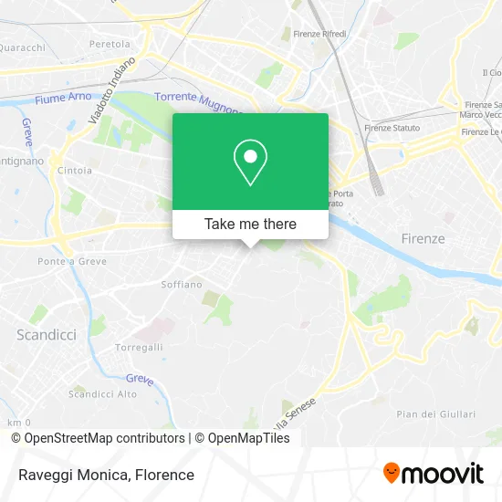
See Monica Raveggi, Florence, on the map
Public Transit to Monica Raveggi in Florence
Wondering how to get to Monica Raveggi in Florence? Moovit helps you find the best way to get to Monica Raveggi with step-by-step directions from the nearest public transit station.
Moovit provides free maps and live directions to help you navigate through your city. View schedules, routes, timetables, and find out how long does it take to get to Monica Raveggi in real time.
Looking for the nearest stop or station to Monica Raveggi? Check out this list of stops closest to your destination: Masolino Olivuzzo; Starnina Soffiano; Olivuzzo; Starnina of Scandicci; Matteo Di Giovanni; Batoni.
Bus: 55, 6, 4, 5, 26, 46, 72, 371 A, 373, 50.Train: R.Light Rail: T1.
Want to see if there’s another route that gets you there at an earlier time? Moovit helps you find alternative routes or times. Get directions from and directions to Monica Raveggi easily from the Moovit App or Website.
We make riding to Monica Raveggi easy, which is why over 1.5 million users, including users in Florence, trust Moovit as the best app for public transit. You don’t need to download an individual bus app or train app, Moovit is your all-in-one transit app that helps you find the best bus time or train time available.
For information on prices of bus, light rail and train, costs and ride fares to Monica Raveggi, please check the Moovit app.
Use the app to navigate to popular places including to the airport, hospital, stadium, grocery store, mall, coffee shop, school, college, and university.
Monica Raveggi Address: Via di Soffiano, 29 50143 Firenze street in Florence
- Soffiano Street / Domenico Veneziano Street,
- Skizzomania,
- Caffeccetera,
- Fiorentino Optical Laboratory by Vannini Luigi,
- Nozzoli Alessandro,
- Irene Iunco Studio,
- Psychologist Francesca Ceccherini,
- Stone Monkey Sports Association,
- Public Elementary Schools,
- Douglas Scotti of Vigoleno Alberto,
- Methodvisuals,
- Hair Center 17,
- Masterdent by Alfani Ugo & Seri Pier Luigi,
- Municipal Police - Participating Companies Control Department,
- Soffiano Street / Piero di Cosimo Street,
- Mazzanti Patrizia,
- Ardinghi Andrea,
- Brunetti Marco & C. Technical Expert Studio,
- The Three Flavors,
- Aerografia Online by Lopes Mendes Maria Isabel
Places Near Monica Raveggi (Florence)
- Artemio Franchi Municipal Stadium, Florence,
- Nelson Mandela Forum, Florence,
- OOO, Florence,
- Campi Bisenzio, Campi Bisenzio,
- Asmana, Campi Bisenzio,
- Cascine Park, Florence,
- I Gigli, Campi Bisenzio,
- Santa Maria Nuova Hospital, Florence,
- Field of Mars, Florence,
- IKEA Florence, Sesto Fiorentino,
- Verdi Theater, Florence,
- Michelangelo Square, Florence,
- Piero Palagi Hospital Facility-Florence, Florence,
- Visarno Arena, Florence,
- Santa Maria Novella Station, Florence,
- Mandela Forum (Nelson Mandela Forum), Florence,
- Tobacco Manufacture, Florence,
- Torregalli Hospital Scandicci *, Scandicci,
- Visarno Hippodrome, Florence,
- Michelangelo Square, Florence
How to get to popular places in Florence with public transit
Get around Florence by public transit!
Traveling around Florence has never been so easy. See step by step directions as you travel to any attraction, street or major public transit station. View bus and train schedules, arrival times, service alerts and detailed routes on a map, so you know exactly how to get to anywhere in Florence.
When traveling to any destination around Florence use Moovit's Live Directions with Get Off Notifications to know exactly where and how far to walk, how long to wait for your line, and how many stops are left. Moovit will alert you when it's time to get off — no need to constantly re-check whether yours is the next stop.
Wondering how to use public transit in Florence or how to pay for public transit in Florence? Moovit public transit app can help you navigate your way with public transit easily, and at minimum cost. It includes public transit fees, ticket prices, and costs. Looking for a map of Florence public transit lines? Moovit public transit app shows all public transit maps in Florence with all Bus, Train, Light Rail, Ferry and Funicular routes and stops on an interactive map.
Florence has 5 transit type(s), including: Bus, Train, Light Rail, Ferry and Funicular, operated by several transit agencies, including Florence Urban - Tuscan Bus Lines, GEST, Livorno and Province - Tuscan Bus Lines, Arezzo, Florence and Provinces - Tuscan Bus Lines, Prato and Province - Tuscan Bus Lines, Lucca and Province - Tuscan Bus Lines, Massa, Carrara and Province - Tuscan Bus Lines, Pisa and Province - Tuscan Bus Lines, Grosseto, Siena and Provinces - Tuscan Bus Lines, Arezzo, Siena and Provinces - Tuscan Bus Lines, Florence and Province - Tuscan Bus Lines, Pistoia and Province - Tuscan Bus Lines, Siena and Province - Tuscan Bus Lines, Arezzo and Province - Tuscan Bus Lines and Trenitalia