How to get to Rays Roofing by bus?
Click on the bus route to see step by step directions with maps, line arrival times and updated time schedules.
From St. Vincent Neuropsychology -7th floor, Indianapolis City (Balance)
62 minFrom E 86th St / N Meridian St, Indianapolis City (Balance)
61 minFrom Greyhound Bus, Indianapolis City (Balance)
39 minFrom Hunt Brothers Pizza, Indianapolis City (Balance)
34 minFrom Amanda Cassada, Realtor, Indianapolis City (Balance)
44 minFrom St. Vincent Heart Center of Indiana, Indianapolis City (Balance)
62 minFrom Aldi, Indianapolis City (Balance)
43 minFrom Pacers Bike Share, Indianapolis City (Balance)
27 minFrom Rockitcoin, Indianapolis City (Balance)
43 minFrom Riverwalk, Indianapolis City (Balance)
44 min
Bus stops near Rays Roofing in Indianapolis City (Balance)
Bus lines to Rays Roofing in Indianapolis City (Balance)
What are the closest stations to Rays Roofing?
The closest stations to Rays Roofing are:
- Meridian St & 34th St Station Sb is 270 yards away, 4 min walk.
- Illinois St & 40th St is 288 yards away, 4 min walk.
- 38th St & Boulevard Pl is 614 yards away, 8 min walk.
Which bus lines stop near Rays Roofing?
These bus lines stop near Rays Roofing: 38, 90, 92.
What’s the nearest bus station to Rays Roofing in Indianapolis City (Balance)?
The nearest bus stations to Rays Roofing in Indianapolis City (Balance) are Meridian St & 34th St Station Sb and Illinois St & 40th St. The closest one is a 4 min walk away.
What time is the first bus to Rays Roofing in Indianapolis City (Balance)?
The 92 is the first bus that goes to Rays Roofing in Indianapolis City (Balance). It stops nearby at 4:43 AM.
What time is the last bus to Rays Roofing in Indianapolis City (Balance)?
The 90 is the last bus that goes to Rays Roofing in Indianapolis City (Balance). It stops nearby at 12:58 AM.
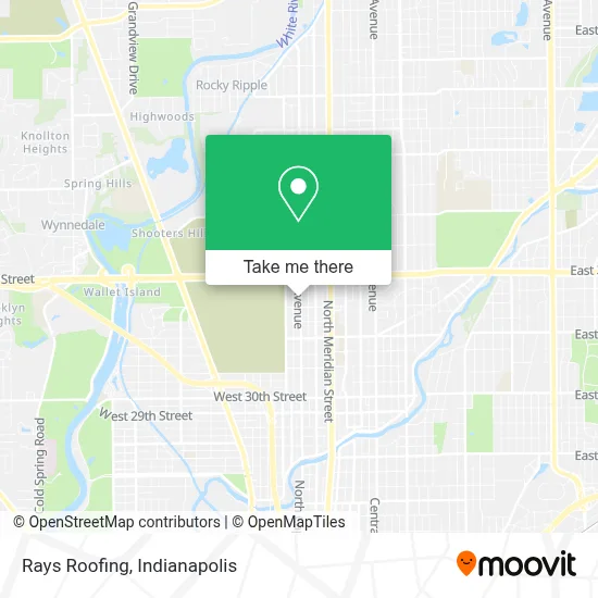
See Rays Roofing, Indianapolis City (Balance), on the map
Public Transit to Rays Roofing in Indianapolis City (Balance)
Wondering how to get to Rays Roofing in Indianapolis City (Balance)? Moovit helps you find the best way to get to Rays Roofing with step-by-step directions from the nearest public transit station.
Moovit provides free maps and live directions to help you navigate through your city. View schedules, routes, timetables, and find out how long does it take to get to Rays Roofing in real time.
Looking for the nearest stop or station to Rays Roofing? Check out this list of stops closest to your destination: Meridian St & 34th St Station Sb; Illinois St & 40th St; 38th St & Boulevard Pl.
Bus: 38, 90, 92, 28.
Want to see if there’s another route that gets you there at an earlier time? Moovit helps you find alternative routes or times. Get directions from and directions to Rays Roofing easily from the Moovit App or Website.
We make riding to Rays Roofing easy, which is why over 1.5 million users, including users in Indianapolis City (Balance), trust Moovit as the best app for public transit. You don’t need to download an individual bus app or train app, Moovit is your all-in-one transit app that helps you find the best bus time or train time available.
For information on prices of bus, costs and ride fares to Rays Roofing, please check the Moovit app.
Use the app to navigate to popular places including to the airport, hospital, stadium, grocery store, mall, coffee shop, school, college, and university.
Rays Roofing Address: 3634 N Capitol Ave street in Indianapolis City (Balance)
- New Christian Hope MBC,
- Smoking Soul Foods,
- Learn Mobile App Development,
- Lord of Heaven's Armies,
- Family Dollar,
- In Town Lock and Key Indianapolis,
- Aimee Nails,
- Marion County Adult Detention Center,
- W 38th St / N Capitol Ave,
- 38th and Boulevard,
- 3802 N KENWOOD Ave Parking,
- Affordable Tires,
- Bauer Apartments,
- Alkhemy,
- Kheprw Institute,
- 3802 N Illinois St Parking,
- Lucas Locksmith,
- Dave's Cleaning,
- Illinois St & 35th St,
- 78 West 38th Street Parking
Places Near Rays Roofing (Indianapolis City (Balance))
- Eskenazi Hospital, Indianapolis City (Balance),
- St. Vincent Hospital - Indianapolis, Indianapolis City (Balance),
- I-465 / I-65 Interchange, Indianapolis City (Balance),
- Gainbridge Fieldhouse, Indianapolis City (Balance),
- Indiana Convention Center, Indianapolis City (Balance),
- Indiana, Indianapolis City (Balance),
- Jersey Barn, Indianapolis City (Balance),
- Train Ride At Castleton Mall, Indianapolis City (Balance),
- Lilly Corporate Center (Eli Lilly & Co), Indianapolis City (Balance),
- Castleton Square Mall, Indianapolis,
- Cotter's Massage Parlor With Happy Endings, Indianapolis City (Balance),
- 119 W 19th St Parking, Indianapolis City (Balance),
- Methodist Hospital of Indianapolis, Indianapolis City (Balance),
- Indianapolis Motor Speedway, Speedway,
- St. Vincent entrance #1, Indianapolis City (Balance),
- Plainfield, IN, Plainfield,
- Indianapolis Airport Zone 2, Indianapolis City (Balance),
- THE BALT, Indianapolis City (Balance),
- Lucas Oil Stadium, Indianapolis City (Balance),
- I U Health Methodist Hospital, Indianapolis City (Balance)
How to get to popular places in Indianapolis with public transit
Get around Indianapolis City (Balance) by public transit!
Traveling around Indianapolis City (Balance) has never been so easy. See step by step directions as you travel to any attraction, street or major public transit station. View bus and train schedules, arrival times, service alerts and detailed routes on a map, so you know exactly how to get to anywhere in Indianapolis City (Balance).
When traveling to any destination around Indianapolis City (Balance) use Moovit's Live Directions with Get Off Notifications to know exactly where and how far to walk, how long to wait for your line, and how many stops are left. Moovit will alert you when it's time to get off — no need to constantly re-check whether yours is the next stop.
Wondering how to use public transit in Indianapolis City (Balance) or how to pay for public transit in Indianapolis City (Balance)? Moovit public transit app can help you navigate your way with public transit easily, and at minimum cost. It includes public transit fees, ticket prices, and costs. Looking for a map of Indianapolis City (Balance) public transit lines? Moovit public transit app shows all public transit maps in Indianapolis City (Balance) with all bus routes and stops on an interactive map.
Indianapolis has 1 transit type(s), including: bus, operated by several transit agencies, including IndyGo, FlixBus-us and Greyhound-us