Directions to Raytheon Co. (Harford County) with public transportation
The following transit lines have routes that pass near Raytheon Co.
 Bus: 3, 420, 7.
- Train: NORTHEAST REGIONAL, MARC.
How to get to Raytheon Co. by bus?
Click on the bus route to see step by step directions with maps, line arrival times and updated time schedules.
From Megabus Stop - White Marsh Park & Ride, Baltimore County
84 minFrom Walmart, Baltimore County
175 minFrom Franklin Square Dr (franklin hospital), Baltimore County
111 minFrom Edgewood, Maryland, Harford County
98 minFrom Middle River, Maryland, Baltimore County
152 minFrom Kohl's Distribution Center, Harford County
111 minFrom Medstar Franklin Square Medical Center, Baltimore County
112 minFrom I-695 Exit 29 (Loch Raven Blvd (MD 542)/Cromwell Bridge Rd), Baltimore County
197 minFrom I-95 Exit 80 - Belcamp (MD 543), Harford County
76 min
Train stations near Raytheon Co. in Harford County
What are the closest stations to Raytheon Co.?
The closest stations to Raytheon Co. are:
- Aberdeen Marc Nb is 2712 yards away, 33 min walk.
- Aberdeen, Md is 2712 yards away, 32 min walk.
Which bus lines stop near Raytheon Co.?
These bus lines stop near Raytheon Co.: 3, 420, 7.
What time is the first train to Raytheon Co. in Harford County?
The MARC is the first train that goes to Raytheon Co. in Harford County. It stops nearby at 4:33 AM.
What time is the last train to Raytheon Co. in Harford County?
The MARC is the last train that goes to Raytheon Co. in Harford County. It stops nearby at 10:46 PM.
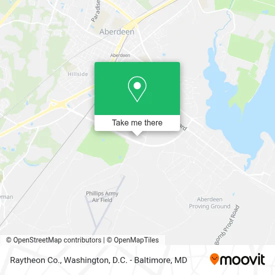
See Raytheon Co., Harford County, on the map
Public Transit to Raytheon Co. in Harford County
Wondering how to get to Raytheon Co. in Harford County? Moovit helps you find the best way to get to Raytheon Co. with step-by-step directions from the nearest public transit station.
Moovit provides free maps and live directions to help you navigate through your city. View schedules, routes, timetables, and find out how long does it take to get to Raytheon Co. in real time.
Looking for the nearest stop or station to Raytheon Co.? Check out this list of stops closest to your destination: Aberdeen Marc Nb; Aberdeen.
Bus: 3, 420, 7.Train: NORTHEAST REGIONAL, MARC.
Want to see if there’s another route that gets you there at an earlier time? Moovit helps you find alternative routes or times. Get directions from and directions to Raytheon Co. easily from the Moovit App or Website.
We make riding to Raytheon Co. easy, which is why over 1.7 million users, including users in Harford County, trust Moovit as the best app for public transit. You don’t need to download an individual bus app or train app, Moovit is your all-in-one transit app that helps you find the best bus time or train time available.
For information on prices of bus and train, costs and ride fares to Raytheon Co., please check the Moovit app.
Use the app to navigate to popular places including to the airport, hospital, stadium, grocery store, mall, coffee shop, school, college, and university.
Raytheon Co. Address: 6260 Guardian Gtwy street in Harford County
- APG - Bldg 4508,
- APG Shuttle,
- APG - Bldg 6002,
- APG Building 6001,
- Myer Auditorium,
- APG Bldg. 6007,
- APG Bldg 6010,
- Fanatics,
- MTF Building 6008,
- Amazon,
- Amazon Fulfillment Center-MTN2,
- Walmart Aberdeen Supercenter,
- Walmart Supercenter,
- Minute Key,
- Walmart (Pulaski Highway / Us 40),
- Building 5100,
- Aberdeen Proving Ground,
- APG building 3200,
- APG Bldg 3147,
- Aberdeen Marc/Amtrak Station
Places Near Raytheon Co. (Harford County)
- Washington DC VA Medical Center, Washington,
- Marriott Marquis Washington, DC, Washington,
- Washington National Cathedral, Washington,
- Pennsylvania Ave NW (3rd st and pennsylvania), Washington,
- PG Mall, Prince George's County,
- Amazon Hq2, Arlington County,
- Sibley Memorial Hospital, Washington,
- Westfield Montgomery Mall, Montgomery County,
- Capital One Arena, Washington,
- M&T Bank Stadium, Baltimore,
- National Museum of African American History and Culture, Washington,
- Camden Yards, Baltimore,
- Rock Creek Tennis Center, Washington,
- National Theatre, Washington,
- Basilica of the National Shrine, Washington,
- The Anthem, Washington,
- National Zoo, Washington,
- Warner Theatre, Washington,
- Georgetown, Washington,
- Museum Of The Bible, Washington
How to get to popular places in Washington, D.C. - Baltimore, MD with public transit
Get around Harford County by public transit!
Traveling around Harford County has never been so easy. See step by step directions as you travel to any attraction, street or major public transit station. View bus and train schedules, arrival times, service alerts and detailed routes on a map, so you know exactly how to get to anywhere in Harford County.
When traveling to any destination around Harford County use Moovit's Live Directions with Get Off Notifications to know exactly where and how far to walk, how long to wait for your line, and how many stops are left. Moovit will alert you when it's time to get off — no need to constantly re-check whether yours is the next stop.
Wondering how to use public transit in Harford County or how to pay for public transit in Harford County? Moovit public transit app can help you navigate your way with public transit easily, and at minimum cost. It includes public transit fees, ticket prices, and costs. Looking for a map of Harford County public transit lines? Moovit public transit app shows all public transit maps in Harford County with all Bus, Train, Metro, Light Rail and Ferry routes and stops on an interactive map.
Washington, D.C. - Baltimore, MD has 5 transit type(s), including: Bus, Train, Metro, Light Rail and Ferry, operated by several transit agencies, including WMATA, Montgomery County Ride On, Fairfax Connector, TheBus, PRTC, DASH - Alexandria, Arlington Transit (ART), RTA of Central Maryland, MDOT MTA, MDOT MTA Light RailLink, MDOT MTA Commuter Bus, MDOT MTA Local Bus, FXBGO!, Virginia Railway Express (VRE) and MARC