How to get to Raz-Lee Security by bus?
Click on the bus route to see step by step directions with maps, line arrival times and updated time schedules.
From Regeneron Pharmaceuticals Inc, Tarrytown
85 minFrom One Larkin Plaza, Yonkers
128 minFrom Palisades mall, West Nyack
37 minFrom Ridge Hill Mall, Yonkers
138 minFrom IKEA Paramus, Paramus
160 minFrom St. John's Riverside Hospital, Yonkers
121 minFrom Elmsford, NY, Elmsford
80 minFrom Bergen Community College, Paramus
163 minFrom Garden State Plaza, Paramus
148 minFrom Paramus, NJ, Paramus
137 min
How to get to Raz-Lee Security by train?
Click on the train route to see step by step directions with maps, line arrival times and updated time schedules.
Bus stop near Raz-Lee Security in Nanuet
- Main St. & Prospect Ave., 14 min walk,VIEW
Train station near Raz-Lee Security in Nanuet
- Spring Valley, 24 min walk,VIEW
Bus lines to Raz-Lee Security in Nanuet
- D, Nanuet Mall,VIEW
What are the closest stations to Raz-Lee Security?
The closest stations to Raz-Lee Security are:
- Main St. & Prospect Ave. is 1150 yards away, 14 min walk.
- Spring Valley is 2033 yards away, 24 min walk.
Which bus lines stop near Raz-Lee Security?
These bus lines stop near Raz-Lee Security: 59, A, D, H03, ROCKLAND COACHES.
Which train line stops near Raz-Lee Security?
PVL (Spring Valley)
What’s the nearest train station to Raz-Lee Security in Nanuet?
The nearest train station to Raz-Lee Security in Nanuet is Spring Valley. It’s a 24 min walk away.
What’s the nearest bus station to Raz-Lee Security in Nanuet?
The nearest bus station to Raz-Lee Security in Nanuet is Main St. & Prospect Ave.. It’s a 14 min walk away.
What time is the first train to Raz-Lee Security in Nanuet?
The PVL is the first train that goes to Raz-Lee Security in Nanuet. It stops nearby at 5:10 AM.
What time is the last train to Raz-Lee Security in Nanuet?
The PVL is the last train that goes to Raz-Lee Security in Nanuet. It stops nearby at 12:22 AM.
What time is the first bus to Raz-Lee Security in Nanuet?
The D is the first bus that goes to Raz-Lee Security in Nanuet. It stops nearby at 7:16 AM.
What time is the last bus to Raz-Lee Security in Nanuet?
The D is the last bus that goes to Raz-Lee Security in Nanuet. It stops nearby at 7:16 PM.
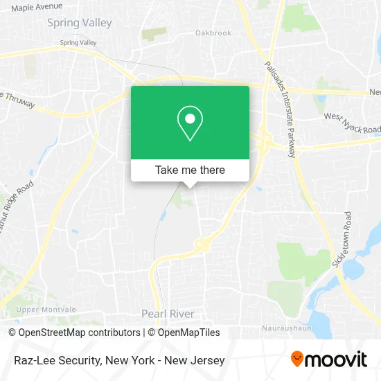
See Raz-Lee Security, Nanuet, on the map
Public Transit to Raz-Lee Security in Nanuet
Wondering how to get to Raz-Lee Security in Nanuet? Moovit helps you find the best way to get to Raz-Lee Security with step-by-step directions from the nearest public transit station.
Moovit provides free maps and live directions to help you navigate through your city. View schedules, routes, timetables, and find out how long does it take to get to Raz-Lee Security in real time.
Looking for the nearest stop or station to Raz-Lee Security? Check out this list of stops closest to your destination: Main St. & Prospect Ave.; Spring Valley.
Bus: 59, A, D, H03, ROCKLAND COACHES.Train: PVL, PASC.
Want to see if there’s another route that gets you there at an earlier time? Moovit helps you find alternative routes or times. Get directions from and directions to Raz-Lee Security easily from the Moovit App or Website.
We make riding to Raz-Lee Security easy, which is why over 1.5 million users, including users in Nanuet, trust Moovit as the best app for public transit. You don’t need to download an individual bus app or train app, Moovit is your all-in-one transit app that helps you find the best bus time or train time available.
For information on prices of bus and train, costs and ride fares to Raz-Lee Security, please check the Moovit app.
Use the app to navigate to popular places including to the airport, hospital, stadium, grocery store, mall, coffee shop, school, college, and university.
Raz-Lee Security Address: 12 Englewood Ave street in Nanuet
- Smile Center,
- Styledbybdey,
- Saint Anthonys Annex,
- Bath & Body Works,
- Sunglass Hut,
- Law Office Of Denise A. Sullivan,
- Keys Locksmith,
- Gmg Public Relations, Inc.,
- Irma Income Tax Inc,
- Myriam Nader Salomon,
- Protein Science Corporation,
- Cho Cho San Sushi and Hibachi,
- Gmg Public Relations Inc,
- Zimi's Bagels Cafe,
- Zimi Bagel Cafe and Deli,
- Angel's Launderette,
- Cho Cho San Noodle House,
- Sunoco Gas Station,
- Bruce A. Numeroff, Dc,
- Comprehensive Pain Management
Places Near Raz-Lee Security (Nanuet)
- Chinatown, Manhattan,
- Rockefeller Center, Manhattan,
- 911 Memorial, Manhattan,
- Wall Street, Manhattan,
- Katz's Deli, Manhattan,
- Pier 83, Manhattan,
- San Gennaro Feast, Manhattan,
- 3 Stone St, Manhattan,
- 111 Centre New York City Supreme Court, Manhattan,
- Hudson Yards, Manhattan,
- 376 Hudson Street, Manhattan,
- 66 John Street, Manhattan,
- 26 Federal Plaza, Manhattan,
- qqqq, Manhattan,
- Times Square, Manhattan,
- Queens Center Mall, Queens,
- Mountainside Hospital, Glen Ridge,
- SoHo, Manhattan,
- 1 Police Plaza, Manhattan,
- Bellevue Hospital, Manhattan
How to get to popular places in New York - New Jersey with public transit
Get around Nanuet by public transit!
Traveling around Nanuet has never been so easy. See step by step directions as you travel to any attraction, street or major public transit station. View bus and train schedules, arrival times, service alerts and detailed routes on a map, so you know exactly how to get to anywhere in Nanuet.
When traveling to any destination around Nanuet use Moovit's Live Directions with Get Off Notifications to know exactly where and how far to walk, how long to wait for your line, and how many stops are left. Moovit will alert you when it's time to get off — no need to constantly re-check whether yours is the next stop.
Wondering how to use public transit in Nanuet or how to pay for public transit in Nanuet? Moovit public transit app can help you navigate your way with public transit easily, and at minimum cost. It includes public transit fees, ticket prices, and costs. Looking for a map of Nanuet public transit lines? Moovit public transit app shows all public transit maps in Nanuet with all Bus, Train, Subway, Light Rail, Ferry and Cable Car routes and stops on an interactive map.
New York - New Jersey has 6 transit type(s), including: Bus, Train, Subway, Light Rail, Ferry and Cable Car, operated by several transit agencies, including MTA Subway, Metro-North Railroad, LIRR, PATH, MTA New York City Transit - Express routes, MTA Bus, NJ Transit, NYC Ferry, NICE bus, Bee-Line Bus, NJ Transit Rail, Norwalk Transit District, Hartford Line, River Valley Transit and HART