How to get to Rbi Officers Quarters by bus?
Click on the bus route to see step by step directions with maps, line arrival times and updated time schedules.
From Byculla Station-Rani Baug, Byculla
43 minFrom KEM Hospital, Shivadi
31 minFrom INFINITI Mall (Infinity Mall, andheri), Versova
54 minFrom Kemps Corner, Malabar Hill
47 minFrom Chor Bazaar, Mumbadevi
48 minFrom Bhabha Atomic Research Centre (BARC), Anushakti Nagar
53 minFrom NMIMS University, Andheri West
35 minFrom Powai, Andheri East
64 minFrom Charity Commissioner's Office, Worli
39 minFrom Khetwadi Ganpati, Malabar Hill
52 min
How to get to Rbi Officers Quarters by train?
Click on the train route to see step by step directions with maps, line arrival times and updated time schedules.
From Byculla Station-Rani Baug, Byculla
44 minFrom KEM Hospital, Shivadi
46 minFrom Kemps Corner, Malabar Hill
50 minFrom Chor Bazaar, Mumbadevi
62 minFrom Bhabha Atomic Research Centre (BARC), Anushakti Nagar
74 minFrom NMIMS University, Andheri West
41 minFrom Charity Commissioner's Office, Worli
58 minFrom Khetwadi Ganpati, Malabar Hill
48 min
How to get to Rbi Officers Quarters by metro?
Click on the metro route to see step by step directions with maps, line arrival times and updated time schedules.
Bus stops near Rbi Officers Quarters in Mumbai
Train station near Rbi Officers Quarters in Mumbai
- Bandra, 24 min walk,VIEW
Metro station near Rbi Officers Quarters in Mumbai
- Shitala Devi Mandir, 42 min walk,VIEW
Bus lines to Rbi Officers Quarters in Mumbai
- C-86, Bandra (W) Bus Station,VIEW
- 212, Prabodhankar Thackeray Udyan Bus Station (Sewree),VIEW
- A-211, Father Agnel Ashram,VIEW
- A-214, Mount Mary Steps (Municipal Garden),VIEW
- A-215, Tata Colony (Bandra-E),VIEW
- A-219, Bandra Reclamation Bus Station,VIEW
- A-422, Vikhroli Depot,VIEW
- A-1, Santacruz Depot - Chhatrapati Shivaji Maharaj Terminus,VIEW
- A-4, Goregaon Oshiwara Depot - JJ Hospital (Dr.M Iqbal Chowk),VIEW
- 28, JVPD Bus Station - Chhatrapati Shivaji Maharaj Terminus,VIEW
- A-33, Goregaon (W) Bus Station - Worli Depot,VIEW
- 51, Santacruz Depot - Colaba Bus Station,VIEW
- C-55, Santacruz Depot - CBD Belapur Bus Station,VIEW
- A-56, Worli Depot - Vesava Yari Road Bus Station,VIEW
- 83, Santacruz Depot - Pandit Paluskar Chowk (Opera House),VIEW
- 83, Santacruz Depot - Colaba Bus Station,VIEW
- A-84, Goregaon Oshiwara Depot - Dr.Shyamaprasad Mukherjee Chowk (Museum),VIEW
- A-200, Vesave Yari Road Bus Station - Jijamata Udyan (Byculla),VIEW
- 201, Santacruz Depot - Parel ST Depot (Sant Rohidas Chowk),VIEW
- A-202, Gorai Depot - Mahim Bus Station,VIEW
What are the closest stations to Rbi Officers Quarters?
The closest stations to Rbi Officers Quarters are:
- Akshay is 397 meters away, 6 min walk.
- Bandra Police Station is 1133 meters away, 16 min walk.
- P.Mohammed Rafi Chowk (Bandra-W) is 1222 meters away, 17 min walk.
- Mahim Koliwada is 1644 meters away, 22 min walk.
- Bandra is 1792 meters away, 24 min walk.
- Shitala Devi Mandir is 3278 meters away, 42 min walk.
Which bus lines stop near Rbi Officers Quarters?
These bus lines stop near Rbi Officers Quarters: 212, A-33, A-422, C-505, C-86.
Which train lines stop near Rbi Officers Quarters?
These train lines stop near Rbi Officers Quarters: HR, WR.
Which metro line stops near Rbi Officers Quarters?
LINE 3 (Aarey JVLR)
What’s the nearest train station to Rbi Officers Quarters in Mumbai?
The nearest train station to Rbi Officers Quarters in Mumbai is Bandra. It’s a 24 min walk away.
What’s the nearest bus station to Rbi Officers Quarters in Mumbai?
The nearest bus station to Rbi Officers Quarters in Mumbai is Akshay. It’s a 6 min walk away.
What time is the first metro to Rbi Officers Quarters in Mumbai?
The LINE 3 is the first metro that goes to Rbi Officers Quarters in Mumbai. It stops nearby at 6:16 AM.
What time is the last metro to Rbi Officers Quarters in Mumbai?
The LINE 3 is the last metro that goes to Rbi Officers Quarters in Mumbai. It stops nearby at 11:01 PM.
What time is the first train to Rbi Officers Quarters in Mumbai?
The WR is the first train that goes to Rbi Officers Quarters in Mumbai. It stops nearby at 4:05 AM.
What time is the last train to Rbi Officers Quarters in Mumbai?
The WR is the last train that goes to Rbi Officers Quarters in Mumbai. It stops nearby at 1:32 AM.
What time is the first bus to Rbi Officers Quarters in Mumbai?
The 51 is the first bus that goes to Rbi Officers Quarters in Mumbai. It stops nearby at 4:33 AM.
What time is the last bus to Rbi Officers Quarters in Mumbai?
The C-505 is the last bus that goes to Rbi Officers Quarters in Mumbai. It stops nearby at 2:36 AM.
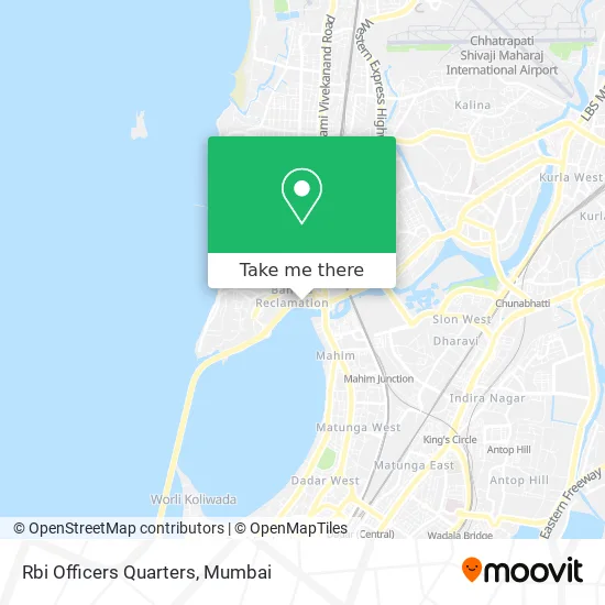
See Rbi Officers Quarters, Mumbai, on the map
Public Transit to Rbi Officers Quarters in Mumbai
Wondering how to get to Rbi Officers Quarters in Mumbai? Moovit helps you find the best way to get to Rbi Officers Quarters with step-by-step directions from the nearest public transit station.
Moovit provides free maps and live directions to help you navigate through your city. View schedules, routes, timetables, and find out how long does it take to get to Rbi Officers Quarters in real time.
Looking for the nearest stop or station to Rbi Officers Quarters? Check out this list of stops closest to your destination: Akshay; Bandra Police Station; P.Mohammed Rafi Chowk (Bandra-W); Mahim Koliwada; Bandra; Shitala Devi Mandir.
Bus: 212, A-33, A-422, C-505, C-86, A-211, A-214, A-215, A-219, A-1, A-4, 28, 51, 2 LTD, A-35, A-37, A-39, C-40.Train: HR, WR, BR, CGDR, WR-AC.Metro: LINE 3.
Want to see if there’s another route that gets you there at an earlier time? Moovit helps you find alternative routes or times. Get directions from and directions to Rbi Officers Quarters easily from the Moovit App or Website.
We make riding to Rbi Officers Quarters easy, which is why over 1.5 million users, including users in Mumbai, trust Moovit as the best app for public transit. You don’t need to download an individual bus app or train app, Moovit is your all-in-one transit app that helps you find the best bus time or train time available.
For information on prices of bus, train and metro, costs and ride fares to Rbi Officers Quarters, please check the Moovit app.
Use the app to navigate to popular places including to the airport, hospital, stadium, grocery store, mall, coffee shop, school, college, and university.
Rbi Officers Quarters Address: Aliyavar Jung Marg Mumbai 400050 MH street in Mumbai
- Mumbai Marathon Start Point,
- Nargiss Dutt Nagar,
- Sportinglions Foundation Sports Turf,
- Lal Mati (Lal Mitti),
- Kepchaki Momos,
- Ali Yavar Jung National Institute of Hearing Handicapped-Alternate Gate 1,
- R.T.O Office,
- Ali Yaver Jung Hospital-ER,
- Zai Dosa Corner,
- Bandra Reclamation,
- Neville Dsouza Football Turf,
- ALI YAVAR JUNG SANSTHA,
- MTNL Bandra Telephone Exchange,
- The Bombay Art Society,
- Embassy,
- Dirty Martini Kitchen & Cocktail Bar,
- marico,
- Rangsharda Auditorium,
- Mahalaxmi Saras,
- Hotel Rang Sharda
Places Near Rbi Officers Quarters (Mumbai)
- Dome @ Nsci - Svp Stadium Mumbai, Worli,
- Gateway Of India,
- TCS Olympus, Thane,
- Worli Sea Face,
- Hinduja Hospital, Mahim,
- Oberoi Sky City, Borivali East,
- Bhaucha Dhakka,
- R CITY MALL, Ghatkopar East,
- J. J. Hospital, Byculla,
- INFINITI Mall (Infinity Mall, andheri), Versova,
- Shanmukhananda Hall, Sion , Mumbai, Sion Koliwada,
- Rani Baug, Byculla,
- Malabar Hill, Malabar Hill,
- Ikea, Worli,
- Inorbit Mall, Malad West,
- Govardhan Ecovillage, Palghar (St),
- Bombay Exhibition Center, Goregaon,
- Mumbai University, Kalina,
- Oberoi Mall, Dindoshi,
- NESCO, Goregaon
How to get to popular places in Mumbai with public transit
Get around Mumbai by public transit!
Traveling around Mumbai has never been so easy. See step by step directions as you travel to any attraction, street or major public transit station. View bus and train schedules, arrival times, service alerts and detailed routes on a map, so you know exactly how to get to anywhere in Mumbai.
When traveling to any destination around Mumbai use Moovit's Live Directions with Get Off Notifications to know exactly where and how far to walk, how long to wait for your line, and how many stops are left. Moovit will alert you when it's time to get off — no need to constantly re-check whether yours is the next stop.
Wondering how to use public transit in Mumbai or how to pay for public transit in Mumbai? Moovit public transit app can help you navigate your way with public transit easily, and at minimum cost. It includes public transit fees, ticket prices, and costs. Looking for a map of Mumbai public transit lines? Moovit public transit app shows all public transit maps in Mumbai with all Bus, Train, Metro and Ferry routes and stops on an interactive map.
Mumbai has 4 transit type(s), including: Bus, Train, Metro and Ferry, operated by several transit agencies, including MMMOCL (Maha Mumbai Metro Operation Corporation Ltd.), NMM CIDCO (Navi Mumbai Metro Maha Metro), Reliance Mumbai Metro, MMRCL (Mumbai Metro Rail Corporation Ltd), BEST (Brihanmumbai Electricity Supply & Transport), BEST AC Services, A.C.Trains (Air-Conditioning Trains), W.R. (Western Railways), C.R. (Central Railways), C.R.MEMU (Central Railways Shuttle MEMU Trains), H.R. (Harbour Railways), T.R.(Trans Harbour Railways), U.R.(Uran-Ulwe Railways), I.R.(Indian Railways) and TMT (Thane Municipal Transport)