How to get to Rca Dome by bus?
Click on the bus route to see step by step directions with maps, line arrival times and updated time schedules.
From Five Star Hand Car Wash, Indianapolis City (Balance)
46 minFrom Newfields, Indianapolis City (Balance)
46 minFrom West 34th Street & Moller Road, Indianapolis
63 minFrom Dr Martin Luther King Jr St / W 30th St, Indianapolis City (Balance)
40 minFrom Gleaners Food Bank of Indiana, Indianapolis City (Balance)
53 minFrom D & I Carreto Construction, Indianapolis City (Balance)
52 minFrom 21st & Arlington Ave., Indianapolis City (Balance)
62 minFrom LR Advertising, Speedway
59 minFrom The Julia Carson Government Center, Indianapolis City (Balance)
36 minFrom Walmart 5443 Indianapolis, Beech Grove
52 min
Bus stops near Rca Dome in Indianapolis City (Balance)
Bus lines to Rca Dome in Indianapolis City (Balance)
- 16, Emerson,VIEW
- 31, U S 31,VIEW
- 8, Meijer E. Wash,VIEW
- 24, Ameriplex,VIEW
- GREYHOUND US0100, Atlanta - Chicago,VIEW
- GREYHOUND US0112, Montgomery - Nashville - Detroit,VIEW
- GREYHOUND US0120S, Chicago - Indianapolis,VIEW
- GREYHOUND US0157S, Indianapolis - Des Moines,VIEW
- GREYHOUND US0421, New York - Pittsburgh - St. Louis,VIEW
What are the closest stations to Rca Dome?
The closest stations to Rca Dome are:
- Delaware St & Merrill St is 279 yards away, 4 min walk.
- Washington St & Victory Field - 800 W is 355 yards away, 5 min walk.
- Washington St & Senate Ave is 366 yards away, 5 min walk.
- Indianapolis Bus Station is 806 yards away, 10 min walk.
Which bus lines stop near Rca Dome?
These bus lines stop near Rca Dome: 16, 24, 25, 56, 90.
What’s the nearest bus station to Rca Dome in Indianapolis City (Balance)?
The nearest bus station to Rca Dome in Indianapolis City (Balance) is Delaware St & Merrill St. It’s a 4 min walk away.
What time is the first bus to Rca Dome in Indianapolis City (Balance)?
The GREYHOUND US0100 is the first bus that goes to Rca Dome in Indianapolis City (Balance). It stops nearby at 4:40 AM.
What time is the last bus to Rca Dome in Indianapolis City (Balance)?
The GREYHOUND US0421 is the last bus that goes to Rca Dome in Indianapolis City (Balance). It stops nearby at 7:35 PM.
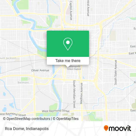
See Rca Dome, Indianapolis City (Balance), on the map
Public Transit to Rca Dome in Indianapolis City (Balance)
Wondering how to get to Rca Dome in Indianapolis City (Balance)? Moovit helps you find the best way to get to Rca Dome with step-by-step directions from the nearest public transit station.
Moovit provides free maps and live directions to help you navigate through your city. View schedules, routes, timetables, and find out how long does it take to get to Rca Dome in real time.
Looking for the nearest stop or station to Rca Dome? Check out this list of stops closest to your destination: Delaware St & Merrill St; Washington St & Victory Field - 800 W; Washington St & Senate Ave; Indianapolis Bus Station.
Bus: 16, 24, 25, 56, 90, 31, 8, GREYHOUND US0100, GREYHOUND US0112, GREYHOUND US0120S, GREYHOUND US0157S, GREYHOUND US0421.
Want to see if there’s another route that gets you there at an earlier time? Moovit helps you find alternative routes or times. Get directions from and directions to Rca Dome easily from the Moovit App or Website.
We make riding to Rca Dome easy, which is why over 1.5 million users, including users in Indianapolis City (Balance), trust Moovit as the best app for public transit. You don’t need to download an individual bus app or train app, Moovit is your all-in-one transit app that helps you find the best bus time or train time available.
For information on prices of bus, costs and ride fares to Rca Dome, please check the Moovit app.
Use the app to navigate to popular places including to the airport, hospital, stadium, grocery store, mall, coffee shop, school, college, and university.
Rca Dome Address: 100 S Capitol Ave street in Indianapolis City (Balance)
- Bud Light Party Zone,
- Lucas Oil Stadium,
- section 109 lucas oil stadium,
- MR. Rooter,
- Post Office,
- Indiana State Alliance of Ymcas,
- Hurst Bean Field,
- Greyhound Bus,
- Riley children's hospital,
- USA Vein Clinics,
- USPS,
- W Henry St & S Illinois St,
- Rolls Royce Garage,
- Isaiah,
- Indianapolis Amtrak Station,
- Atterbury Job Corp Center,
- HP Enterprise Services,
- Citizen's Thermal Perry Steam Plant,
- Crowne Plaza Indianapolis-Dwtn-Union Stn,
- Perfect Wedding Guide
Places Near Rca Dome (Indianapolis City (Balance))
- Lucas Oil Stadium, Indianapolis City (Balance),
- St. Vincent Hospital - Indianapolis, Indianapolis City (Balance),
- Indiana, Indianapolis City (Balance),
- Indiana Convention Center, Indianapolis City (Balance),
- THE BALT, Indianapolis City (Balance),
- Indianapolis Airport Zone 2, Indianapolis City (Balance),
- Train Ride At Castleton Mall, Indianapolis City (Balance),
- Eskenazi Hospital, Indianapolis City (Balance),
- Lilly Corporate Center (Eli Lilly & Co), Indianapolis City (Balance),
- I U Health Methodist Hospital, Indianapolis City (Balance),
- Methodist Hospital of Indianapolis, Indianapolis City (Balance),
- Gainbridge Fieldhouse, Indianapolis City (Balance),
- I-465 / I-65 Interchange, Indianapolis City (Balance),
- Indianapolis Motor Speedway, Speedway,
- Plainfield, IN, Plainfield,
- Jersey Barn, Indianapolis City (Balance),
- 119 W 19th St Parking, Indianapolis City (Balance),
- St. Vincent entrance #1, Indianapolis City (Balance),
- Cotter's Massage Parlor With Happy Endings, Indianapolis City (Balance),
- Castleton Square Mall, Indianapolis
How to get to popular places in Indianapolis with public transit
Get around Indianapolis City (Balance) by public transit!
Traveling around Indianapolis City (Balance) has never been so easy. See step by step directions as you travel to any attraction, street or major public transit station. View bus and train schedules, arrival times, service alerts and detailed routes on a map, so you know exactly how to get to anywhere in Indianapolis City (Balance).
When traveling to any destination around Indianapolis City (Balance) use Moovit's Live Directions with Get Off Notifications to know exactly where and how far to walk, how long to wait for your line, and how many stops are left. Moovit will alert you when it's time to get off — no need to constantly re-check whether yours is the next stop.
Wondering how to use public transit in Indianapolis City (Balance) or how to pay for public transit in Indianapolis City (Balance)? Moovit public transit app can help you navigate your way with public transit easily, and at minimum cost. It includes public transit fees, ticket prices, and costs. Looking for a map of Indianapolis City (Balance) public transit lines? Moovit public transit app shows all public transit maps in Indianapolis City (Balance) with all bus routes and stops on an interactive map.
Indianapolis has 1 transit type(s), including: bus, operated by several transit agencies, including IndyGo, FlixBus-us and Greyhound-us