How to get to Rccg Rehoboth Chapel Edmonton by bus?
Click on the bus route to see step by step directions with maps, line arrival times and updated time schedules.
From Jubilee Auditorium
74 minFrom Costco Warehouse
91 minFrom Canada Place Service Canada Centre
46 minFrom Comfort INN-Edmonton Downtown
45 minFrom Health Sciences/Jubilee LRT Station
74 minFrom Archbishop Macdonald
75 minFrom Court Of Queen's Bench Of Alberta
49 minFrom Northern Alberta Jubilee Auditorium
75 minFrom 8440 112 Street Northwest
75 minFrom T5G
30 min
Bus stops near Rccg Rehoboth Chapel Edmonton
Light Rail stations near Rccg Rehoboth Chapel Edmonton
- Belvedere Station, 9 min walk,VIEW
Bus lines to Rccg Rehoboth Chapel Edmonton
What are the closest stations to Rccg Rehoboth Chapel Edmonton?
The closest stations to Rccg Rehoboth Chapel Edmonton are:
- 55 Street & 129 Avenue is 233 meters away, 4 min walk.
- Belvedere Station is 674 meters away, 9 min walk.
- Belvedere Transit Centre is 730 meters away, 10 min walk.
Which bus lines stop near Rccg Rehoboth Chapel Edmonton?
These bus lines stop near Rccg Rehoboth Chapel Edmonton: 053, 106.
What’s the nearest light rail station to Rccg Rehoboth Chapel Edmonton?
The nearest light rail station to Rccg Rehoboth Chapel Edmonton is Belvedere Station. It’s a 9 min walk away.
What’s the nearest bus station to Rccg Rehoboth Chapel Edmonton?
The nearest bus station to Rccg Rehoboth Chapel Edmonton is 55 Street & 129 Avenue. It’s a 4 min walk away.
What time is the first bus to Rccg Rehoboth Chapel Edmonton?
The 002 is the first bus that goes to Rccg Rehoboth Chapel Edmonton. It stops nearby at 3:20 AM.
What time is the last bus to Rccg Rehoboth Chapel Edmonton?
The 002 is the last bus that goes to Rccg Rehoboth Chapel Edmonton. It stops nearby at 3:21 AM.
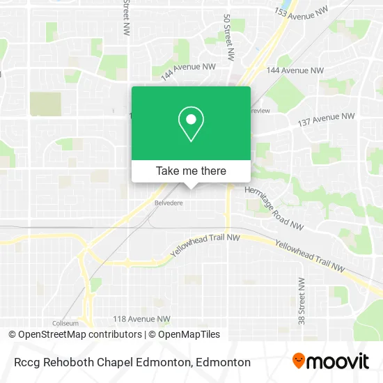
See Rccg Rehoboth Chapel Edmonton on the map
Public Transportation to Rccg Rehoboth Chapel Edmonton
Wondering how to get to Rccg Rehoboth Chapel Edmonton? Moovit helps you find the best way to get to Rccg Rehoboth Chapel Edmonton with step-by-step directions from the nearest public transit station.
Moovit provides free maps and live directions to help you navigate through your city. View schedules, routes, timetables, and find out how long does it take to get to Rccg Rehoboth Chapel Edmonton in real time.
Looking for the nearest stop or station to Rccg Rehoboth Chapel Edmonton? Check out this list of stops closest to your destination: 55 Street & 129 Avenue; Belvedere Station; Belvedere Transit Centre.
Bus: 053, 106, 108, CAPREP, 002, 107.
Want to see if there’s another route that gets you there at an earlier time? Moovit helps you find alternative routes or times. Get directions from and directions to Rccg Rehoboth Chapel Edmonton easily from the Moovit App or Website.
We make riding to Rccg Rehoboth Chapel Edmonton easy, which is why over 1.5 million users, including users in Edmonton, trust Moovit as the best app for public transit. You don’t need to download an individual bus app or train app, Moovit is your all-in-one transit app that helps you find the best bus time or train time available.
For information on prices of bus, costs and ride fares to Rccg Rehoboth Chapel Edmonton, please check the Moovit app.
Use the app to navigate to popular places including to the airport, hospital, stadium, grocery store, mall, coffee shop, school, college, and university.
Rccg Rehoboth Chapel Edmonton Address: 5521 130 Ave NW Edmonton, AB T5A 1B7 street in Edmonton
- Via San Pietro,
- Omega Aluminum Railing System,
- My Dog Raw Food,
- Super Clean Premium Cleaning Services,
- McJane Developments,
- Renovations by Montorio,
- Maple Truck Training,
- Kidsafe Program,
- Thut Accounting,
- H2b Contracting,
- Assemble It Help - Product - Furniture Assembly Service,
- Iceberg Overhead Doors,
- Lemar's Waterproofing,
- TDS Mulching & Skid Steer Services,
- Completely Neat,
- Hello Fresh,
- Plumbing Edmonton,
- Bula,
- Catastrophe Chocolates,
- Brickworks Landscaping
Places Near Rccg Rehoboth Chapel Edmonton
- Londonderry Mall, Edmonton,
- Rogers Place, Edmonton,
- West Edmonton Mall, Edmonton,
- Grey Nuns Community Hospital, Edmonton,
- University of Alberta, Edmonton,
- Alberta Legislature Building, Edmonton,
- Edmonton Valley Zoo, Edmonton,
- Canada Place Service Canada Centre, Edmonton,
- Edmonton VIA Rail Station, Edmonton,
- Cross Cancer Institute, Edmonton,
- Edmonton Commonwealth Stadium, Edmonton,
- Whyte Avenue, Edmonton,
- Fort Edmonton Park, Edmonton,
- Royal Alexandra Hospital, Edmonton,
- Kaye Edmonton Clinic, Edmonton,
- Borden Park, Edmonton,
- Northgate Centre, Edmonton,
- Kingsway Mall, Edmonton,
- Edmonton EXPO Centre, Edmonton,
- MacEwan University, Edmonton
How to get to popular places in Edmonton with public transit
Get around Edmonton by public transit!
Traveling around Edmonton has never been so easy. See step by step directions as you travel to any attraction, street or major public transit station. View bus and train schedules, arrival times, service alerts and detailed routes on a map, so you know exactly how to get to anywhere in Edmonton.
When traveling to any destination around Edmonton use Moovit's Live Directions with Get Off Notifications to know exactly where and how far to walk, how long to wait for your line, and how many stops are left. Moovit will alert you when it's time to get off — no need to constantly re-check whether yours is the next stop.
Wondering how to use public transit in Edmonton or how to pay for public transit in Edmonton? Moovit public transit app can help you navigate your way with public transit easily, and at minimum cost. It includes public transit fees, ticket prices, and costs. Looking for a map of Edmonton public transit lines? Moovit public transit app shows all public transit maps in Edmonton with all Bus and Light Rail routes and stops on an interactive map.
Edmonton has 2 transit type(s), including: Bus and Light Rail, operated by several transit agencies, including ETS LRT, ETS, Strathcona County Transit, St. Albert Transit, Spruce Grove Transit, Fort Saskatchewan Transit, Beaumont Transit and Leduc Transit