How to get to Rcity Homes by bus?
Click on the bus route to see step by step directions with maps, line arrival times and updated time schedules.
From Office of the Director of National Intelligence (DNI), Fairfax County
68 minFrom McLean, Virginia, Fairfax County
90 minFrom Cia Headquarters, Fairfax County
90 minFrom Kaiser Permanente Tysons Corner Medical Center, Fairfax County
36 minFrom Hollywood Casino at Charles Town Races, Fairfax County
62 minFrom Leesburg VA-684, Fairfax County
47 minFrom Inova Fair Oaks Hospital, Fairfax County
54 minFrom Springfield, VA, Fairfax County
73 minFrom [I-495] Exit 54 - Braddock Road, Fairfax County
62 min
How to get to Rcity Homes by metro?
Click on the metro route to see step by step directions with maps, line arrival times and updated time schedules.
Bus stops near Rcity Homes in Fairfax County
Metro station near Rcity Homes in Fairfax County
- Vienna Metro Station, 28 min walk,VIEW
Bus lines to Rcity Homes in Fairfax County
What are the closest stations to Rcity Homes?
The closest stations to Rcity Homes are:
- Arlington Blvd at Stonehurst Dr (Eb) is 176 yards away, 3 min walk.
- Arlington Bl+Stonehurst Dr is 176 yards away, 3 min walk.
- Nutley St + Barrick St is 445 yards away, 6 min walk.
- Pickett Rd+Arlington Bl is 675 yards away, 8 min walk.
- Fairfax Blvd And Pickett Road is 711 yards away, 9 min walk.
- Vienna Metro Station is 2368 yards away, 28 min walk.
Which bus lines stop near Rcity Homes?
These bus lines stop near Rcity Homes: F24, F60, GREEN 2.
Which metro line stops near Rcity Homes?
ORANGE (Vienna)
What’s the nearest metro station to Rcity Homes in Fairfax County?
The nearest metro station to Rcity Homes in Fairfax County is Vienna Metro Station. It’s a 28 min walk away.
What’s the nearest bus station to Rcity Homes in Fairfax County?
The nearest bus stations to Rcity Homes in Fairfax County are Arlington Blvd at Stonehurst Dr (Eb) and Arlington Bl+Stonehurst Dr. The closest one is a 3 min walk away.
What time is the first metro to Rcity Homes in Fairfax County?
The ORANGE is the first metro that goes to Rcity Homes in Fairfax County. It stops nearby at 5:00 AM.
What time is the last metro to Rcity Homes in Fairfax County?
The ORANGE is the last metro that goes to Rcity Homes in Fairfax County. It stops nearby at 12:32 AM.
What time is the first bus to Rcity Homes in Fairfax County?
The F61 is the first bus that goes to Rcity Homes in Fairfax County. It stops nearby at 4:59 AM.
What time is the last bus to Rcity Homes in Fairfax County?
The F61 is the last bus that goes to Rcity Homes in Fairfax County. It stops nearby at 2:39 AM.
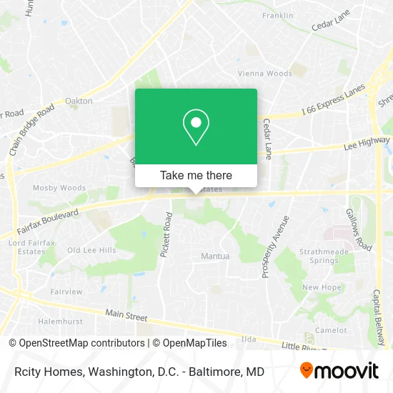
See Rcity Homes, Fairfax County, on the map
Public Transit to Rcity Homes in Fairfax County
Wondering how to get to Rcity Homes in Fairfax County? Moovit helps you find the best way to get to Rcity Homes with step-by-step directions from the nearest public transit station.
Moovit provides free maps and live directions to help you navigate through your city. View schedules, routes, timetables, and find out how long does it take to get to Rcity Homes in real time.
Looking for the nearest stop or station to Rcity Homes? Check out this list of stops closest to your destination: Arlington Blvd at Stonehurst Dr (Eb); Arlington Bl+Stonehurst Dr; Nutley St + Barrick St; Pickett Rd+Arlington Bl; Fairfax Blvd And Pickett Road; Vienna Metro Station.
Bus: F24, F60, GREEN 2, GREEN 1, F61, F50, GOLD 1.Metro: ORANGE.
Want to see if there’s another route that gets you there at an earlier time? Moovit helps you find alternative routes or times. Get directions from and directions to Rcity Homes easily from the Moovit App or Website.
We make riding to Rcity Homes easy, which is why over 1.5 million users, including users in Fairfax County, trust Moovit as the best app for public transit. You don’t need to download an individual bus app or train app, Moovit is your all-in-one transit app that helps you find the best bus time or train time available.
For information on prices of bus and metro, costs and ride fares to Rcity Homes, please check the Moovit app.
Use the app to navigate to popular places including to the airport, hospital, stadium, grocery store, mall, coffee shop, school, college, and university.
Rcity Homes Address: Arlington Blvd Fairfax, VA 22031 street in Fairfax County
- Clean House,
- Spiritelligence,
- Robert Doc' Barham,
- GPS Handyman Services,
- United Doctors,
- Sincerely Me Beauty,
- Homes Remodeling,
- Sandoval Cleaning Company,
- Time To Go Moving Services,
- Minutes Services,
- Arlington Blvd & Stonehurst Dr ,
- Stonehurst Stonehurst US-50,
- Nutley US-50,
- Nutley St (barrick st & nutley),
- Chevy Chase Bank, F.S.B.,
- Evolve Technologies LLC,
- Children's Parties To Go,
- American Foundation-St George,
- Rafi E, MD,
- Nova Caine Power Washing and Roof Cleaning
Places Near Rcity Homes (Fairfax County)
- National Museum of African American History and Culture, Washington,
- Basilica of the National Shrine, Washington,
- Capital One Arena, Washington,
- Pennsylvania Ave NW (3rd st and pennsylvania), Washington,
- Amazon Hq2, Arlington County,
- M&T Bank Stadium, Baltimore,
- Georgetown, Washington,
- PG Mall, Prince George's County,
- Sibley Memorial Hospital, Washington,
- Washington DC VA Medical Center, Washington,
- Rock Creek Tennis Center, Washington,
- The Anthem, Washington,
- Marriott Marquis Washington, DC, Washington,
- Camden Yards, Baltimore,
- National Mall, Washington,
- Washington National Cathedral, Washington,
- Warner Theatre, Washington,
- Westfield Montgomery Mall, Montgomery County,
- Museum Of The Bible, Washington,
- National Zoo, Washington
How to get to popular places in Washington, D.C. - Baltimore, MD with public transit
Get around Fairfax County by public transit!
Traveling around Fairfax County has never been so easy. See step by step directions as you travel to any attraction, street or major public transit station. View bus and train schedules, arrival times, service alerts and detailed routes on a map, so you know exactly how to get to anywhere in Fairfax County.
When traveling to any destination around Fairfax County use Moovit's Live Directions with Get Off Notifications to know exactly where and how far to walk, how long to wait for your line, and how many stops are left. Moovit will alert you when it's time to get off — no need to constantly re-check whether yours is the next stop.
Wondering how to use public transit in Fairfax County or how to pay for public transit in Fairfax County? Moovit public transit app can help you navigate your way with public transit easily, and at minimum cost. It includes public transit fees, ticket prices, and costs. Looking for a map of Fairfax County public transit lines? Moovit public transit app shows all public transit maps in Fairfax County with all Bus, Train, Metro, Light Rail and Ferry routes and stops on an interactive map.
Washington, D.C. - Baltimore, MD has 5 transit type(s), including: Bus, Train, Metro, Light Rail and Ferry, operated by several transit agencies, including WMATA, Montgomery County Ride On, Fairfax Connector, TheBus, PRTC, DASH - Alexandria, Arlington Transit (ART), RTA of Central Maryland, MDOT MTA, MDOT MTA Light RailLink, MDOT MTA Commuter Bus, MDOT MTA Local Bus, FXBGO!, Virginia Railway Express (VRE) and MARC