Bus stops near Rcn20t98 in Warsaw
Cable Car stations near Rcn20t98 in Warsaw
Bus lines to Rcn20t98 in Warsaw
- 141, Witomino Sosnowa - Pogórze Górne,VIEW
- 163, Chylonia Dworzec PKP - os. Meksyk - Pogórze Górne,VIEW
- 194, Plac Kaszubski - Pogórze Górne,VIEW
- 265, Obłuże Maciejewicza - Kosakowo - Urząd Gminy,VIEW
- 282, Dom Marynarza - Pogórze Górne,VIEW
- K, Obłuże Maciejewicza - Kacze Buki,VIEW
- N40, Witomino Leśniczówka - Pogórze Dolne,VIEW
- N94, Witomino Leśniczówka - Suchy Dwór - Borchardta,VIEW
- 128, Dom Marynarza 05,VIEW
- N10, Kacze Buki 01,VIEW
- 134, Obłuże Maciejewicza 03,VIEW
- 182, Węzeł Franciszki Cegielskiej 06,VIEW
- 197, Cisowa Sibeliusa 03,VIEW
- 770, Baza Na Pogórzu Dolnym 01,VIEW
- 105, Redłowo Szpital 01,VIEW
- 165, Chylonia Dworzec PKP - Os. Meksyk 03,VIEW
- SATURN Fitness,
- Pomorskie Centrum Optyczne Bartlomiej Benert,
- Slawomir Bone Matrix,
- PHU Tele-Car sp. 3305,
- Otcf 4f P,
- Sinsay,
- Good Luck Club Squash,
- Buena Lingerie,
- Is Folly,
- FPHU Abro,
- A.Blikle Cukiernie Trójmiasto,
- House,
- Reserved,
- Qualite Butik,
- Alma Delikatesy,
- Intermarché,
- Cukiernia Sowa,
- Neonet S.A.,
- Rr Corporation Robert,
- Wyspa Iqos - Galeria Szperk - Kosakowo
Places Near Rcn20t98 (Warsaw)
- Wołoska, Warsaw,
- Instytut Kardiologii w Aninie, Warsaw,
- Torwar, Warsaw,
- Szpital Spartanska, Warsaw,
- Sejm Rp, Warsaw,
- Galeria Północna, Warsaw,
- Szpital Bielański, Warsaw,
- Galeria Mokotów, Warsaw,
- Banacha - Szpital Kliniczny, Warsaw,
- Szpital Orłowskiego, Warsaw,
- Domaniewska, Warsaw,
- Wołoska-Szpital 01, Warsaw,
- Centralny Szpital Kliniczny MSWiA ul. Wołoska, Warsaw,
- Postępu, Warsaw,
- Cmentarz Bródnowski, Warsaw,
- Szaserów - Szpital, Warsaw,
- Szpital Czerniakowski, Warsaw,
- CH Arkadia, Warsaw,
- Stare Miasto, Warsaw,
- PGE Narodowy, Warsaw
How to get to popular places in Warsaw with public transit
What are the closest stations to Rcn20t98?
The closest stations to Rcn20t98 are:
- Galeria Szperk 02 is 162 meters away, 3 min walk.
- Sucharskiego 02 is 364 meters away, 5 min walk.
- Maciejewicza 01 is 365 meters away, 5 min walk.
- Obłuże Maciejewicza 03 is 442 meters away, 6 min walk.
- Obłuże Maciejewicza 01 is 487 meters away, 7 min walk.
- Pogórze - Przedszkole 02 is 1105 meters away, 15 min walk.
- Pogórze Dolne 04 is 1983 meters away, 26 min walk.
- Kadmowa 02 is 2366 meters away, 31 min walk.
- Kadmowa 01 is 2399 meters away, 31 min walk.
Which bus line stops near Rcn20t98?
194 (Pogórze Górne 01)
What’s the nearest bus station to Rcn20t98 in Warsaw?
The nearest bus station to Rcn20t98 in Warsaw is Galeria Szperk 02. It’s a 3 min walk away.
What’s the nearest cable car station to Rcn20t98 in Warsaw?
The nearest cable car station to Rcn20t98 in Warsaw is Pogórze Dolne 04. It’s a 26 min walk away.
What time is the first bus to Rcn20t98 in Warsaw?
The N10 is the first bus that goes to Rcn20t98 in Warsaw. It stops nearby at 3:05 AM.
What time is the last bus to Rcn20t98 in Warsaw?
The N10 is the last bus that goes to Rcn20t98 in Warsaw. It stops nearby at 4:03 AM.
What time is the first cable car to Rcn20t98 in Warsaw?
The 32 is the first cable car that goes to Rcn20t98 in Warsaw. It stops nearby at 5:14 AM.
What time is the last cable car to Rcn20t98 in Warsaw?
The 710 is the last cable car that goes to Rcn20t98 in Warsaw. It stops nearby at 10:59 PM.
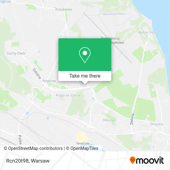
See Rcn20t98, Warsaw, on the map
Public Transit to Rcn20t98 in Warsaw
Wondering how to get to Rcn20t98 in Warsaw? Moovit helps you find the best way to get to Rcn20t98 with step-by-step directions from the nearest public transit station.
Moovit provides free maps and live directions to help you navigate through your city. View schedules, routes, timetables, and find out how long does it take to get to Rcn20t98 in real time.
Looking for the nearest stop or station to Rcn20t98? Check out this list of stops closest to your destination: Galeria Szperk 02; Sucharskiego 02; Maciejewicza 01; Obłuże Maciejewicza 03; Obłuże Maciejewicza 01; Pogórze - Przedszkole 02; Pogórze Dolne 04; Kadmowa 02; Kadmowa 01.
Bus: 194, 141, 163, 265, 282, 128, N10, 134, 182, 197, 770.Cable Car: 32, 125.
Want to see if there’s another route that gets you there at an earlier time? Moovit helps you find alternative routes or times. Get directions from and directions to Rcn20t98 easily from the Moovit App or Website.
We make riding to Rcn20t98 easy, which is why over 1.5 million users, including users in Warsaw, trust Moovit as the best app for public transit. You don’t need to download an individual bus app or train app, Moovit is your all-in-one transit app that helps you find the best bus time or train time available.
For information on prices of bus and train, costs and ride fares to Rcn20t98, please check the Moovit app.
Use the app to navigate to popular places including to the airport, hospital, stadium, grocery store, mall, coffee shop, school, college, and university.
Rcn20t98 Address: ulica płk. Stanisława Dąbka 338, 81-198 Kosakowo street in Warsaw
Get around Warsaw by public transit!
Traveling around Warsaw has never been so easy. See step by step directions as you travel to any attraction, street or major public transit station. View bus and train schedules, arrival times, service alerts and detailed routes on a map, so you know exactly how to get to anywhere in Warsaw.
When traveling to any destination around Warsaw use Moovit's Live Directions with Get Off Notifications to know exactly where and how far to walk, how long to wait for your line, and how many stops are left. Moovit will alert you when it's time to get off — no need to constantly re-check whether yours is the next stop.
Wondering how to use public transit in Warsaw or how to pay for public transit in Warsaw? Moovit public transit app can help you navigate your way with public transit easily, and at minimum cost. It includes public transit fees, ticket prices, and costs. Looking for a map of Warsaw public transit lines? Moovit public transit app shows all public transit maps in Warsaw with all Bus, Train, Metro, Light Rail, Ferry and Cable Car routes and stops on an interactive map.
Warsaw has 6 transit type(s), including: Bus, Train, Metro, Light Rail, Ferry and Cable Car, operated by several transit agencies, including Warszawski Transport Publiczny, Warszawska Kolej Dojazdowa, Koleje Mazowieckie, ZTP Kraków, Miasto Piastów, Miasto Ząbki, Koleje Małopolskie, Komunikacja Miejska Łomianki, Gmina Pruszków, MPK Wrocław, MZDiK Radom, UM w Grodzisku Mazowieckim, UM w Nowym Dworze Mazowieckim, UM Płońsk and Koleje Dolnośląskie