How to get to Rdg by bus?
Click on the bus route to see step by step directions with maps, line arrival times and updated time schedules.
From Inova Fairfax Hospital North Tower Building, Fairfax County
54 minFrom McLean, Virginia, Fairfax County
40 minFrom Inova employee Shuttle, Fairfax County
52 minFrom The Westin Arlington Gateway, Arlington County
60 minFrom Sibley Memorial Hospital, Washington
134 minFrom Intelligence Community Campus—Bethesda, Montgomery County
118 minFrom Walmart, Arlington County
58 minFrom Cia Headquarters, Fairfax County
40 minFrom Kaiser Permanente - Falls Church Medical Center, Falls Church
42 minFrom Fairfax County Courthouse, Fairfax County
64 min
How to get to Rdg by metro?
Click on the metro route to see step by step directions with maps, line arrival times and updated time schedules.
Bus stops near Rdg in Fairfax County
Metro stations near Rdg in Fairfax County
Bus lines to Rdg in Fairfax County
What are the closest stations to Rdg?
The closest stations to Rdg are:
- Old Courthouse Rd @ Old Courthouse is 189 yards away, 3 min walk.
- Chain Bridge Rd @ Old Courthouse Rd is 361 yards away, 5 min walk.
- Old Courthouse Rd@ Battery Park St is 397 yards away, 5 min walk.
- Greensboro is 876 yards away, 11 min walk.
- Dunn Loring Merrifield Metro Station is 4086 yards away, 49 min walk.
Which bus lines stop near Rdg?
These bus lines stop near Rdg: 462, 463, 798.
Which metro line stops near Rdg?
SILVER (Ashburn)
What’s the nearest metro station to Rdg in Fairfax County?
The nearest metro station to Rdg in Fairfax County is Greensboro. It’s a 11 min walk away.
What’s the nearest bus station to Rdg in Fairfax County?
The nearest bus station to Rdg in Fairfax County is Old Courthouse Rd @ Old Courthouse. It’s a 3 min walk away.
What time is the first metro to Rdg in Fairfax County?
The ORANGE is the first metro that goes to Rdg in Fairfax County. It stops nearby at 5:04 AM.
What time is the last metro to Rdg in Fairfax County?
The SILVER is the last metro that goes to Rdg in Fairfax County. It stops nearby at 12:43 AM.
What time is the first bus to Rdg in Fairfax County?
The 463 is the first bus that goes to Rdg in Fairfax County. It stops nearby at 5:17 AM.
What time is the last bus to Rdg in Fairfax County?
The 463 is the last bus that goes to Rdg in Fairfax County. It stops nearby at 11:37 PM.
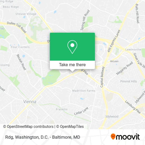
See Rdg, Fairfax County, on the map
Public Transit to Rdg in Fairfax County
Wondering how to get to Rdg in Fairfax County? Moovit helps you find the best way to get to Rdg with step-by-step directions from the nearest public transit station.
Moovit provides free maps and live directions to help you navigate through your city. View schedules, routes, timetables, and find out how long does it take to get to Rdg in real time.
Looking for the nearest stop or station to Rdg? Check out this list of stops closest to your destination: Old Courthouse Rd @ Old Courthouse; Chain Bridge Rd @ Old Courthouse Rd; Old Courthouse Rd@ Battery Park St; Greensboro; Dunn Loring Merrifield Metro Station.
Bus: 462, 463, 798, 467, 432.Metro: SILVER, ORANGE.
Want to see if there’s another route that gets you there at an earlier time? Moovit helps you find alternative routes or times. Get directions from and directions to Rdg easily from the Moovit App or Website.
We make riding to Rdg easy, which is why over 1.5 million users, including users in Fairfax County, trust Moovit as the best app for public transit. You don’t need to download an individual bus app or train app, Moovit is your all-in-one transit app that helps you find the best bus time or train time available.
For information on prices of bus and metro, costs and ride fares to Rdg, please check the Moovit app.
Use the app to navigate to popular places including to the airport, hospital, stadium, grocery store, mall, coffee shop, school, college, and university.
Rdg Address: 2070 Chain Bridge Rd Vienna, VA 22182 street in Fairfax County
- The Toilet Bowl Building,
- Curves,
- Terra's Ice Cream Coffee & Sweets,
- 2070 Chain Bridge Rd,
- Courthouse / Chain Bridge Rd,
- Chain Bridge VA-677,
- Koons Jeep,
- Vienna the Roofing Experts,
- Koons CHRYSLER Tysons,
- Koons CHRYSLER DODGE Tysons,
- Koons CHRYSLER DODGE Jeep Ram,
- Global Properties Mindset,
- TACO BELL,
- Virginia ABC,
- Grand Residences by Marriott-Tysons,
- Residence Inn by Marriott Tysons Corner Mall,
- Vienna Residence Inn,
- Chabad Tysons Jewish Center,
- Koons Tysons Chevrolet / Buick / GMC,
- Webformds.Com
Places Near Rdg (Fairfax County)
- M&T Bank Stadium, Baltimore,
- Sibley Memorial Hospital, Washington,
- Capital One Arena, Washington,
- Westfield Montgomery Mall, Montgomery County,
- Camden Yards, Baltimore,
- Warner Theatre, Washington,
- Georgetown, Washington,
- Washington DC VA Medical Center, Washington,
- National Zoo, Washington,
- Marriott Marquis Washington, DC, Washington,
- Rock Creek Tennis Center, Washington,
- PG Mall, Prince George's County,
- Pennsylvania Ave NW (3rd st and pennsylvania), Washington,
- Basilica of the National Shrine, Washington,
- Washington National Cathedral, Washington,
- National Mall, Washington,
- Amazon Hq2, Arlington County,
- The Anthem, Washington,
- National Museum of African American History and Culture, Washington,
- Museum Of The Bible, Washington
How to get to popular places in Washington, D.C. - Baltimore, MD with public transit
Get around Fairfax County by public transit!
Traveling around Fairfax County has never been so easy. See step by step directions as you travel to any attraction, street or major public transit station. View bus and train schedules, arrival times, service alerts and detailed routes on a map, so you know exactly how to get to anywhere in Fairfax County.
When traveling to any destination around Fairfax County use Moovit's Live Directions with Get Off Notifications to know exactly where and how far to walk, how long to wait for your line, and how many stops are left. Moovit will alert you when it's time to get off — no need to constantly re-check whether yours is the next stop.
Wondering how to use public transit in Fairfax County or how to pay for public transit in Fairfax County? Moovit public transit app can help you navigate your way with public transit easily, and at minimum cost. It includes public transit fees, ticket prices, and costs. Looking for a map of Fairfax County public transit lines? Moovit public transit app shows all public transit maps in Fairfax County with all Bus, Train, Metro, Light Rail and Ferry routes and stops on an interactive map.
Washington, D.C. - Baltimore, MD has 5 transit type(s), including: Bus, Train, Metro, Light Rail and Ferry, operated by several transit agencies, including WMATA, Montgomery County Ride On, Fairfax Connector, TheBus, PRTC, DASH - Alexandria, Arlington Transit (ART), RTA of Central Maryland, MDOT MTA, MDOT MTA Light RailLink, MDOT MTA Commuter Bus, MDOT MTA Local Bus, FXBGO!, Virginia Railway Express (VRE) and MARC