How to get to Rdv Carroceros by bus?
Click on the bus route to see step by step directions with maps, line arrival times and updated time schedules.
From Gran Via, Madrid
63 minFrom Mad Cool Festival, Madrid
77 minFrom Calle Arturo Soria, Madrid
47 minFrom Cercanías Ramón y Cajal, Madrid
50 minFrom Extracciones Hospital La Paz, Madrid
40 minFrom Las Tablas, Área Metropolitana De Madrid Y Corredor Del Henares
51 minFrom Hospital Universitario La Paz, Madrid
41 minFrom Hospital Sanitas La Moraleja - A, Madrid
42 minFrom Ronda de la COMUNICACION, S/N, Madrid
44 minFrom Residencia Mariscal, Madrid
67 min
How to get to Rdv Carroceros by train?
Click on the train route to see step by step directions with maps, line arrival times and updated time schedules.
How to get to Rdv Carroceros by metro?
Click on the metro route to see step by step directions with maps, line arrival times and updated time schedules.
From Calle Arturo Soria, Madrid
63 minFrom Cercanías Ramón y Cajal, Madrid
55 minFrom Extracciones Hospital La Paz, Madrid
46 minFrom Las Tablas, Área Metropolitana De Madrid Y Corredor Del Henares
35 minFrom Hospital Universitario La Paz, Madrid
45 minFrom Hospital Sanitas La Moraleja - A, Madrid
46 minFrom Ronda de la COMUNICACION, S/N, Madrid
28 min
Bus stops near Rdv Carroceros in San Sebastián De Los Reyes
Metro station near Rdv Carroceros in San Sebastián De Los Reyes
- Reyes Católicos, 9 min walk,VIEW
Train station near Rdv Carroceros in San Sebastián De Los Reyes
- Alcobendas - San Sebastián De Los Reyes, 41 min walk,VIEW
Bus lines to Rdv Carroceros in San Sebastián De Los Reyes
- 161, Senda Ardal - Caseta Control,VIEW
- 152C, Salvador Madariaga - C. C. Alegra,VIEW
- N102, Intercambiador De Plaza De Castilla (Nivel 0, Isla 4),VIEW
- 4, Moscatelares,VIEW
- 5, San Sebastián de los Reyes,VIEW
- 156, Intercambiador De Plaza De Castilla (Nivel 0, Isla 4),VIEW
- 166, Av. Principal - Urb. Valdelagua,VIEW
- 7, Circular (Estación FF.CC. - Polígonos - Estación FF.CC.),VIEW
- 154C, Av. Quiñones - Cerro Del Baile,VIEW
- 158, Av. San Luis - Av. Burgos,VIEW
What are the closest stations to Rdv Carroceros?
The closest stations to Rdv Carroceros are:
- Isla Graciosa - Isla Del Hierro is 290 meters away, 4 min walk.
- Real - Cementerio is 485 meters away, 7 min walk.
- Av. Aragón - Pza. Abogados De Atocha is 488 meters away, 7 min walk.
- Av. Aragón - Parque Velódromo is 567 meters away, 8 min walk.
- Reyes Católicos is 687 meters away, 9 min walk.
- Alcobendas - San Sebastián De Los Reyes is 3147 meters away, 41 min walk.
Which bus lines stop near Rdv Carroceros?
These bus lines stop near Rdv Carroceros: 154, 154C, 158.
Which train line stops near Rdv Carroceros?
C4A (Alcobendas - S. S. De Los Reyes)
Which metro line stops near Rdv Carroceros?
M-10 (Hospital Infanta Sofía)
What’s the nearest metro station to Rdv Carroceros in San Sebastián De Los Reyes?
The nearest metro station to Rdv Carroceros in San Sebastián De Los Reyes is Reyes Católicos. It’s a 9 min walk away.
What’s the nearest bus station to Rdv Carroceros in San Sebastián De Los Reyes?
The nearest bus station to Rdv Carroceros in San Sebastián De Los Reyes is Isla Graciosa - Isla Del Hierro. It’s a 4 min walk away.
What time is the first metro to Rdv Carroceros in San Sebastián De Los Reyes?
The M-10 is the first metro that goes to Rdv Carroceros in San Sebastián De Los Reyes. It stops nearby at 6:05 AM.
What time is the last metro to Rdv Carroceros in San Sebastián De Los Reyes?
The M-10 is the last metro that goes to Rdv Carroceros in San Sebastián De Los Reyes. It stops nearby at 1:54 AM.
What time is the first train to Rdv Carroceros in San Sebastián De Los Reyes?
The C4A is the first train that goes to Rdv Carroceros in San Sebastián De Los Reyes. It stops nearby at 5:30 AM.
What time is the last train to Rdv Carroceros in San Sebastián De Los Reyes?
The C4A is the last train that goes to Rdv Carroceros in San Sebastián De Los Reyes. It stops nearby at 12:02 AM.
What time is the first bus to Rdv Carroceros in San Sebastián De Los Reyes?
The N102 is the first bus that goes to Rdv Carroceros in San Sebastián De Los Reyes. It stops nearby at 3:18 AM.
What time is the last bus to Rdv Carroceros in San Sebastián De Los Reyes?
The N102 is the last bus that goes to Rdv Carroceros in San Sebastián De Los Reyes. It stops nearby at 2:32 AM.
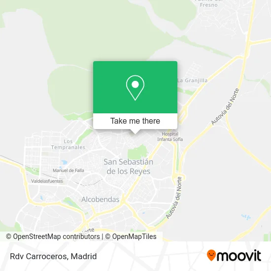
See Rdv Carroceros, San Sebastián De Los Reyes, on the map
Public Transit to Rdv Carroceros in San Sebastián De Los Reyes
Wondering how to get to Rdv Carroceros in San Sebastián De Los Reyes? Moovit helps you find the best way to get to Rdv Carroceros with step-by-step directions from the nearest public transit station.
Moovit provides free maps and live directions to help you navigate through your city. View schedules, routes, timetables, and find out how long does it take to get to Rdv Carroceros in real time.
Looking for the nearest stop or station to Rdv Carroceros? Check out this list of stops closest to your destination: Isla Graciosa - Isla Del Hierro; Real - Cementerio; Av. Aragón - Pza. Abogados De Atocha; Av. Aragón - Parque Velódromo; Reyes Católicos; Alcobendas - San Sebastián De Los Reyes.
Bus: 154, 154C, 158, 161, 152C, N102, 7, 4, 5, 156, 166.Train: C4A.Metro: M-10.
Want to see if there’s another route that gets you there at an earlier time? Moovit helps you find alternative routes or times. Get directions from and directions to Rdv Carroceros easily from the Moovit App or Website.
We make riding to Rdv Carroceros easy, which is why over 1.5 million users, including users in San Sebastián De Los Reyes, trust Moovit as the best app for public transit. You don’t need to download an individual bus app or train app, Moovit is your all-in-one transit app that helps you find the best bus time or train time available.
For information on prices of bus, metro and train, costs and ride fares to Rdv Carroceros, please check the Moovit app.
Use the app to navigate to popular places including to the airport, hospital, stadium, grocery store, mall, coffee shop, school, college, and university.
Rdv Carroceros Address: Calle Isla de Alegranza, 28703 San Sebastián de los Reyes street in San Sebastián De Los Reyes
- Johnson & Johnson,
- Joan Miró,
- Proselco,
- Super Garage Madrid - Alquiler de Coches Deportivos,
- Moflys Madrid,
- Ensaldas y Mas,
- Tsunami Sail Proyects,
- Vm Distribuciones Industriales,
- Electrodomésticos,
- Masario,
- Middleby España Delegación Centro,
- Proyectum Sport Team,
- Amcor Flexibles Pergut,
- Cedro Soluciones Totales,
- Dirt Racing Products,
- Freeboard Company,
- Calle Isla de Alegranza 6, Nave 36,
- Bynpaduno,
- Vibra Club,
- Tatu David
Places Near Rdv Carroceros (San Sebastián De Los Reyes)
- Centro Comercial Oasiz Madrid, Área Metropolitana De Madrid Y Corredor Del Henares,
- Mendez Alvaro, Madrid,
- Hospital Clínico Universitario San Carlos, Madrid,
- Centro Comercial La Gavia, Área Metropolitana De Madrid Y Corredor Del Henares,
- Plaza Mayor, Madrid,
- Mercadillo de Majadahonda, Majadahonda,
- Nassica, Área Metropolitana De Madrid Y Corredor Del Henares,
- Rastro De Madrid, Área Metropolitana De Madrid Y Corredor Del Henares,
- Sala La Riviera, Madrid,
- Estadio Wanda Metropolitano, Área Metropolitana De Madrid Y Corredor Del Henares,
- Tres Aguas, Alcorcón,
- Calle de López de Hoyos 169, Madrid,
- Centro Comercial La Vaguada, Área Metropolitana De Madrid Y Corredor Del Henares,
- Hospital Universitario La Paz, Madrid,
- Plenilunio, Área Metropolitana De Madrid Y Corredor Del Henares,
- Estacion de Chamartin, Madrid,
- Hospital Universitario Ramón y Cajal, Madrid,
- Centro Comercial Islazul, Área Metropolitana De Madrid Y Corredor Del Henares,
- Wizink Center, Madrid,
- Palacio De Vistalegre, Área Metropolitana De Madrid Y Corredor Del Henares
How to get to popular places in Madrid with public transit
Get around San Sebastián De Los Reyes by public transit!
Traveling around San Sebastián De Los Reyes has never been so easy. See step by step directions as you travel to any attraction, street or major public transit station. View bus and train schedules, arrival times, service alerts and detailed routes on a map, so you know exactly how to get to anywhere in San Sebastián De Los Reyes.
When traveling to any destination around San Sebastián De Los Reyes use Moovit's Live Directions with Get Off Notifications to know exactly where and how far to walk, how long to wait for your line, and how many stops are left. Moovit will alert you when it's time to get off — no need to constantly re-check whether yours is the next stop.
Wondering how to use public transit in San Sebastián De Los Reyes or how to pay for public transit in San Sebastián De Los Reyes? Moovit public transit app can help you navigate your way with public transit easily, and at minimum cost. It includes public transit fees, ticket prices, and costs. Looking for a map of San Sebastián De Los Reyes public transit lines? Moovit public transit app shows all public transit maps in San Sebastián De Los Reyes with all Bus, Train, Metro and Light Rail routes and stops on an interactive map.
Madrid has 4 transit type(s), including: Bus, Train, Metro and Light Rail, operated by several transit agencies, including Metro de Madrid, Metro Ligero, Tranvía de Parla, Renfe Cercanías - Servicios de Autobús especiales, Renfe Cercanias, Renfe Cercanías, EMT, Interurbanos, Urbanos de Alcalá de Henares, Urbanos de Alcobendas, Urbanos de Alcorcón, Urbanos de Algete, Urbanos de Aranjuez, Urbanos de Arganda del Rey and Urbanos de Arroyomolinos