How to get to Re/Max Edge by bus?
Click on the bus route to see step by step directions with maps, line arrival times and updated time schedules.
From Brooklyn Bridge Park - Pier 1, Manhattan
82 minFrom Wall Street, Manhattan
48 minFrom 8 Stone Street, Manhattan
45 minFrom 52 Broadway, Manhattan
44 minFrom Statue of Liberty, Manhattan
42 minFrom 3 Stone St, Manhattan
44 minFrom Complete Playground, Manhattan
44 minFrom 180 Maiden Lane, Manhattan
53 minFrom NY Lottery Center, Manhattan
45 min
How to get to Re/Max Edge by subway?
Click on the subway route to see step by step directions with maps, line arrival times and updated time schedules.
From Brooklyn Bridge Park - Pier 1, Manhattan
52 minFrom Wall Street, Manhattan
44 minFrom 8 Stone Street, Manhattan
41 minFrom 52 Broadway, Manhattan
45 minFrom Statue of Liberty, Manhattan
42 minFrom 3 Stone St, Manhattan
40 minFrom Complete Playground, Manhattan
45 minFrom 180 Maiden Lane, Manhattan
50 minFrom NY Lottery Center, Manhattan
43 min
Bus stops near Re/Max Edge in New York - New Jersey
Subway station near Re/Max Edge in New York - New Jersey
- 77 St, 3 min walk,VIEW
Ferry station near Re/Max Edge in New York - New Jersey
- Bay Ridge, 40 min walk,VIEW
Bus lines to Re/Max Edge in New York - New Jersey
What are the closest stations to Re/Max Edge?
The closest stations to Re/Max Edge are:
- 3 Av/95 St is 171 yards away, 3 min walk.
- 77 St is 226 yards away, 3 min walk.
- 3 Av/Marine Av is 235 yards away, 3 min walk.
- 3 Av/99 St is 248 yards away, 4 min walk.
- 4 Av/97 St is 429 yards away, 6 min walk.
- Bay Ridge is 3387 yards away, 40 min walk.
Which bus lines stop near Re/Max Edge?
These bus lines stop near Re/Max Edge: B37, B8.
Which subway line stops near Re/Max Edge?
R (Downtown & Brooklyn)
What’s the nearest subway station to Re/Max Edge in New York - New Jersey?
The nearest subway station to Re/Max Edge in New York - New Jersey is 77 St. It’s a 3 min walk away.
What’s the nearest bus station to Re/Max Edge in New York - New Jersey?
The nearest bus stations to Re/Max Edge in New York - New Jersey are 3 Av/95 St and 3 Av/Marine Av. The closest one is a 3 min walk away.
What time is the first subway to Re/Max Edge in New York - New Jersey?
The R is the first subway that goes to Re/Max Edge in New York - New Jersey. It stops nearby at 3:03 AM.
What time is the last subway to Re/Max Edge in New York - New Jersey?
The R is the last subway that goes to Re/Max Edge in New York - New Jersey. It stops nearby at 3:29 AM.
What time is the first bus to Re/Max Edge in New York - New Jersey?
The B8 is the first bus that goes to Re/Max Edge in New York - New Jersey. It stops nearby at 3:00 AM.
What time is the last bus to Re/Max Edge in New York - New Jersey?
The B8 is the last bus that goes to Re/Max Edge in New York - New Jersey. It stops nearby at 3:52 AM.
What time is the first ferry to Re/Max Edge in New York - New Jersey?
The SG is the first ferry that goes to Re/Max Edge in New York - New Jersey. It stops nearby at 6:32 AM.
What time is the last ferry to Re/Max Edge in New York - New Jersey?
The SG is the last ferry that goes to Re/Max Edge in New York - New Jersey. It stops nearby at 9:47 PM.
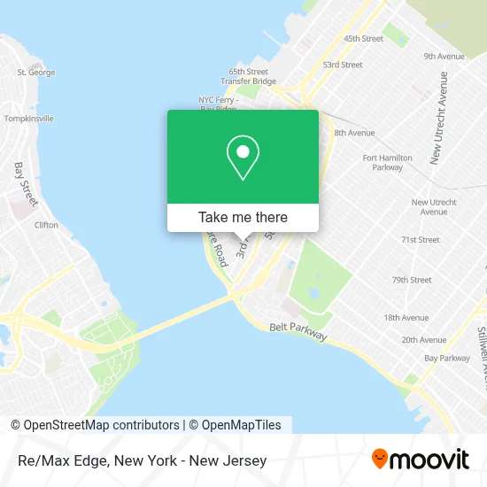
See Re/Max Edge, New York - New Jersey, on the map
Public Transit to Re/Max Edge in New York - New Jersey
Wondering how to get to Re/Max Edge in New York - New Jersey? Moovit helps you find the best way to get to Re/Max Edge with step-by-step directions from the nearest public transit station.
Moovit provides free maps and live directions to help you navigate through your city. View schedules, routes, timetables, and find out how long does it take to get to Re/Max Edge in real time.
Looking for the nearest stop or station to Re/Max Edge? Check out this list of stops closest to your destination: 3 Av/95 St; 77 St; 3 Av/Marine Av; 3 Av/99 St; 4 Av/97 St; Bay Ridge.
Bus: B37, B8, B16, X27, X37, B63.Subway: R.Ferry: SB, SG.
Want to see if there’s another route that gets you there at an earlier time? Moovit helps you find alternative routes or times. Get directions from and directions to Re/Max Edge easily from the Moovit App or Website.
We make riding to Re/Max Edge easy, which is why over 1.5 million users, including users in New York - New Jersey, trust Moovit as the best app for public transit. You don’t need to download an individual bus app or train app, Moovit is your all-in-one transit app that helps you find the best bus time or train time available.
For information on prices of subway and bus, costs and ride fares to Re/Max Edge, please check the Moovit app.
Use the app to navigate to popular places including to the airport, hospital, stadium, grocery store, mall, coffee shop, school, college, and university.
Re/Max Edge Address: 9425 3rd Ave street in New York - New Jersey
- Michelle Digaetano Licensed Nys Real Estate Salesperson,
- List & Sell With Nathalie,
- The Expansion Team at Remax Edge,
- Mr. Bagels Cafe,
- Joe Zhu | Re/Max Edge,
- Pep,
- Muffin's Pet Connection,
- Fade Factory Nyc,
- Walgreens #12732,
- Ups Access Point Location,
- Western Union,
- Libertyx Bitcoin Atm,
- 95th Street Pharmacy,
- Frank Pennacchi Associate / Broker,
- The Common,
- Brooklyn Kiwanis,
- Fedex,
- Mina Pecorella - Re/Max,
- Wicked Monk,
- 3rd Ave Auto Corporation
Places Near Re/Max Edge (New York - New Jersey)
- 66 John Street, Manhattan,
- Hudson Yards, Manhattan,
- Pier 83, Manhattan,
- Bellevue Hospital, Manhattan,
- Queens Center Mall, Queens,
- Times Square, Manhattan,
- 376 Hudson Street, Manhattan,
- Wall Street, Manhattan,
- San Gennaro Feast, Manhattan,
- 26 Federal Plaza, Manhattan,
- Chinatown, Manhattan,
- 111 Centre New York City Supreme Court, Manhattan,
- qqqq, Manhattan,
- Mountainside Hospital, Glen Ridge,
- 1 Police Plaza, Manhattan,
- Katz's Deli, Manhattan,
- 3 Stone St, Manhattan,
- 911 Memorial, Manhattan,
- Rockefeller Center, Manhattan,
- SoHo, Manhattan
How to get to popular places in New York - New Jersey with public transit
Get around New York - New Jersey by public transit!
Traveling around New York - New Jersey has never been so easy. See step by step directions as you travel to any attraction, street or major public transit station. View bus and train schedules, arrival times, service alerts and detailed routes on a map, so you know exactly how to get to anywhere in New York - New Jersey.
When traveling to any destination around New York - New Jersey use Moovit's Live Directions with Get Off Notifications to know exactly where and how far to walk, how long to wait for your line, and how many stops are left. Moovit will alert you when it's time to get off — no need to constantly re-check whether yours is the next stop.
Wondering how to use public transit in New York - New Jersey or how to pay for public transit in New York - New Jersey? Moovit public transit app can help you navigate your way with public transit easily, and at minimum cost. It includes public transit fees, ticket prices, and costs. Looking for a map of New York - New Jersey public transit lines? Moovit public transit app shows all public transit maps in New York - New Jersey with all Bus, Train, Subway, Light Rail, Ferry and Cable Car routes and stops on an interactive map.
New York - New Jersey has 6 transit type(s), including: Bus, Train, Subway, Light Rail, Ferry and Cable Car, operated by several transit agencies, including MTA Subway, Metro-North Railroad, LIRR, PATH, MTA New York City Transit - Express routes, MTA Bus, NJ Transit, NYC Ferry, NICE bus, Bee-Line Bus, NJ Transit Rail, Norwalk Transit District, Hartford Line, River Valley Transit and HART