Directions to Re/Max One Stop (Hempstead) with public transportation
The following transit lines have routes that pass near Re/Max One Stop
 Bus: N32, N6, N15, N31, N6X.
- Train: HEMPSTEAD BRANCH, WEST HEMPSTEAD BRANCH.
How to get to Re/Max One Stop by bus?
Click on the bus route to see step by step directions with maps, line arrival times and updated time schedules.
From Long Island Jewish Hospital, North New Hyde Park
59 minFrom Saint Albans, NY, Queens
65 minFrom Manhasset, NY, Manhasset
74 minFrom Walmart, Valley Stream
66 minFrom Queens Village, Queens
53 minFrom Roy Wilkins Park, Queens
75 minFrom Ohel Chabad Lubavitch, Queens
73 minFrom North Shore University Hospital, Manhasset
55 minFrom Springfield Gardens, NY, Queens
67 minFrom Elmont, NY, Elmont
45 min
How to get to Re/Max One Stop by train?
Click on the train route to see step by step directions with maps, line arrival times and updated time schedules.
Bus stops near Re/Max One Stop in Hempstead
Train stations near Re/Max One Stop in Hempstead
Bus lines to Re/Max One Stop in Hempstead
What are the closest stations to Re/Max One Stop?
The closest stations to Re/Max One Stop are:
- Front St / Fulton is 212 yards away, 3 min walk.
- Westminster Rd / Hempstead is 720 yards away, 9 min walk.
- West Hempstead is 2177 yards away, 26 min walk.
- Garden City is 2659 yards away, 32 min walk.
Which bus lines stop near Re/Max One Stop?
These bus lines stop near Re/Max One Stop: N32, N6.
Which train lines stop near Re/Max One Stop?
These train lines stop near Re/Max One Stop: HEMPSTEAD BRANCH, WEST HEMPSTEAD BRANCH.
What’s the nearest train station to Re/Max One Stop in Hempstead?
The nearest train station to Re/Max One Stop in Hempstead is West Hempstead. It’s a 26 min walk away.
What’s the nearest bus station to Re/Max One Stop in Hempstead?
The nearest bus station to Re/Max One Stop in Hempstead is Front St / Fulton. It’s a 3 min walk away.
What time is the first train to Re/Max One Stop in Hempstead?
The HEMPSTEAD BRANCH is the first train that goes to Re/Max One Stop in Hempstead. It stops nearby at 3:22 AM.
What time is the last train to Re/Max One Stop in Hempstead?
The HEMPSTEAD BRANCH is the last train that goes to Re/Max One Stop in Hempstead. It stops nearby at 3:29 AM.
What time is the first bus to Re/Max One Stop in Hempstead?
The N6 is the first bus that goes to Re/Max One Stop in Hempstead. It stops nearby at 3:09 AM.
What time is the last bus to Re/Max One Stop in Hempstead?
The N6 is the last bus that goes to Re/Max One Stop in Hempstead. It stops nearby at 2:52 AM.
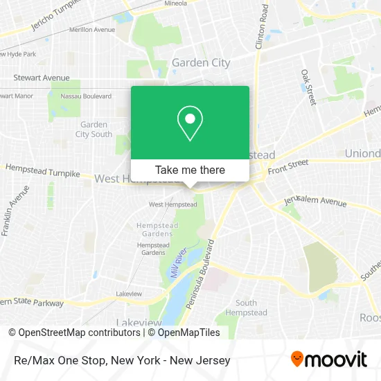
See Re/Max One Stop, Hempstead, on the map
Public Transit to Re/Max One Stop in Hempstead
Wondering how to get to Re/Max One Stop in Hempstead? Moovit helps you find the best way to get to Re/Max One Stop with step-by-step directions from the nearest public transit station.
Moovit provides free maps and live directions to help you navigate through your city. View schedules, routes, timetables, and find out how long does it take to get to Re/Max One Stop in real time.
Looking for the nearest stop or station to Re/Max One Stop? Check out this list of stops closest to your destination: Front St / Fulton; Westminster Rd / Hempstead; West Hempstead; Garden City.
Bus: N32, N6, N15, N31, N6X.Train: HEMPSTEAD BRANCH, WEST HEMPSTEAD BRANCH.
Want to see if there’s another route that gets you there at an earlier time? Moovit helps you find alternative routes or times. Get directions from and directions to Re/Max One Stop easily from the Moovit App or Website.
We make riding to Re/Max One Stop easy, which is why over 1.5 million users, including users in Hempstead, trust Moovit as the best app for public transit. You don’t need to download an individual bus app or train app, Moovit is your all-in-one transit app that helps you find the best bus time or train time available.
For information on prices of bus and train, costs and ride fares to Re/Max One Stop, please check the Moovit app.
Use the app to navigate to popular places including to the airport, hospital, stadium, grocery store, mall, coffee shop, school, college, and university.
Re/Max One Stop Address: 14 Front St street in Hempstead
- I-Solutions Group,
- Jacoby & Meyers, Llp,
- Office Move Solutions,
- A. Kuchkarov Insurance,
- Verizon,
- Wingstop,
- NY Juice & Grill,
- Newday Beauty and Wellness,
- Todd Rotwein,
- Zemsky and Salomon Pc,
- The Stanan Group,
- Jovia Financial Credit Union,
- Spine Care Club Of Hempstead,
- Marc L. Schwartz,
- Western Union,
- Jovia Financial Fcu,
- Bp,
- MTA - N15 (Long Beach),
- Diamond Food Mart Inc,
- Citgo
Places Near Re/Max One Stop (Hempstead)
- 26 Federal Plaza, Manhattan,
- 376 Hudson Street, Manhattan,
- Mountainside Hospital, Glen Ridge,
- 66 John Street, Manhattan,
- 111 Centre New York City Supreme Court, Manhattan,
- Rockefeller Center, Manhattan,
- 3 Stone St, Manhattan,
- Queens Center Mall, Queens,
- Wall Street, Manhattan,
- Bellevue Hospital, Manhattan,
- San Gennaro Feast, Manhattan,
- Katz's Deli, Manhattan,
- Chinatown, Manhattan,
- Hudson Yards, Manhattan,
- qqqq, Manhattan,
- 911 Memorial, Manhattan,
- 1 Police Plaza, Manhattan,
- Times Square, Manhattan,
- Pier 83, Manhattan,
- SoHo, Manhattan
How to get to popular places in New York - New Jersey with public transit
Get around Hempstead by public transit!
Traveling around Hempstead has never been so easy. See step by step directions as you travel to any attraction, street or major public transit station. View bus and train schedules, arrival times, service alerts and detailed routes on a map, so you know exactly how to get to anywhere in Hempstead.
When traveling to any destination around Hempstead use Moovit's Live Directions with Get Off Notifications to know exactly where and how far to walk, how long to wait for your line, and how many stops are left. Moovit will alert you when it's time to get off — no need to constantly re-check whether yours is the next stop.
Wondering how to use public transit in Hempstead or how to pay for public transit in Hempstead? Moovit public transit app can help you navigate your way with public transit easily, and at minimum cost. It includes public transit fees, ticket prices, and costs. Looking for a map of Hempstead public transit lines? Moovit public transit app shows all public transit maps in Hempstead with all Bus, Train, Subway, Light Rail, Ferry and Cable Car routes and stops on an interactive map.
New York - New Jersey has 6 transit type(s), including: Bus, Train, Subway, Light Rail, Ferry and Cable Car, operated by several transit agencies, including MTA Subway, Metro-North Railroad, LIRR, PATH, MTA New York City Transit - Express routes, MTA Bus, NJ Transit, NYC Ferry, NICE bus, Bee-Line Bus, NJ Transit Rail, Norwalk Transit District, Hartford Line, River Valley Transit and HART