How to get to Ready Scripts by bus?
Click on the bus route to see step by step directions with maps, line arrival times and updated time schedules.
From Martinez Distributors, Kendale Lakes-Tamiami
67 minFrom Florida International University-Modesto A. Maidique Campus, South Westside
48 minFrom Four Points by Sheraton Coral Gables Miami, Miami
69 minFrom Consulado-Geral do Brasil Em Miami, Miami
68 minFrom Madalon Law, Kendall-Palmetto Bay
72 minFrom Waterford Business District, Miami
69 minFrom General Consulate Brazil, Miami
68 minFrom La Colmena del Dr. Fausto Losana, Kendale Lakes-Tamiami
47 minFrom Doctors Hospital, Miami
40 minFrom Consulate General of Brazil, Miami
68 min
Bus stop near Ready Scripts in South Westside
- Sw 72 St & Sw 97 Av, 3 min walk,VIEW
Bus lines to Ready Scripts in South Westside
What are the closest stations to Ready Scripts?
The closest stations to Ready Scripts are:
- Sw 72 St & Sw 97 Av is 236 yards away, 3 min walk.
Which bus lines stop near Ready Scripts?
These bus lines stop near Ready Scripts: 272, 56, 72.
What’s the nearest bus station to Ready Scripts in South Westside?
The nearest bus station to Ready Scripts in South Westside is Sw 72 St & Sw 97 Av. It’s a 3 min walk away.
What time is the first bus to Ready Scripts in South Westside?
The 72 is the first bus that goes to Ready Scripts in South Westside. It stops nearby at 5:07 AM.
What time is the last bus to Ready Scripts in South Westside?
The 72 is the last bus that goes to Ready Scripts in South Westside. It stops nearby at 10:46 PM.
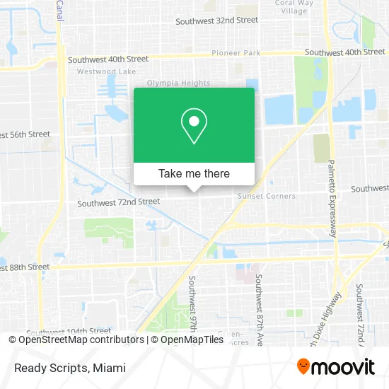
See Ready Scripts, South Westside, on the map
Public Transit to Ready Scripts in South Westside
Wondering how to get to Ready Scripts in South Westside? Moovit helps you find the best way to get to Ready Scripts with step-by-step directions from the nearest public transit station.
Moovit provides free maps and live directions to help you navigate through your city. View schedules, routes, timetables, and find out how long does it take to get to Ready Scripts in real time.
Looking for the nearest stop or station to Ready Scripts? Check out this list of stops closest to your destination: Sw 72 St & Sw 97 Av.
Bus: 272, 56, 72.
Want to see if there’s another route that gets you there at an earlier time? Moovit helps you find alternative routes or times. Get directions from and directions to Ready Scripts easily from the Moovit App or Website.
We make riding to Ready Scripts easy, which is why over 1.5 million users, including users in South Westside, trust Moovit as the best app for public transit. You don’t need to download an individual bus app or train app, Moovit is your all-in-one transit app that helps you find the best bus time or train time available.
For information on prices of bus and train, costs and ride fares to Ready Scripts, please check the Moovit app.
Use the app to navigate to popular places including to the airport, hospital, stadium, grocery store, mall, coffee shop, school, college, and university.
Ready Scripts Address: 9783 SW 72nd St Miami, FL 33173 street in South Westside
- Brightway Insurance, the Denge-Peek Agency,
- The Perfect Nails Salons,
- Bleach and Lash,
- Cao Bakery & Cafe,
- Eduardo Ubieta Arbesu,
- Sunset Family & Cosmetic Dentistry,
- Billoch and Associates PA,
- Sunset Professional Therapy,
- N.M. Global Marketing,
- New Life Healthcare Medical,
- Edimar Home Health,
- Figaro,
- Aznarez Realty- Attniet Aznarez, Broker,
- Rose Beauty Spa Miami,
- Amazon Locker-Zhane,
- Lanza Marketing 33,
- Eli Meyer Friedman, MD,
- BHMG Cadiology Loc VI,
- Dr. Roberto A Fernandez (Chiropractor) (Miami, Fl),
- BMO Harris Bank
Places Near Ready Scripts (South Westside)
- Dolphin Mall Bus, Miami,
- Port of Miami Cruise Terminal, Miami,
- Zoo Miami, Miami,
- Richard E. Gerstein Justice Building, Miami,
- Marlins Park, Miami,
- Little Havana, Miami,
- Miami Freedom Park, Miami,
- Brickell City Centre, Miami,
- Sawgrass mall ( FL ), Miami Beach,
- Dolphin Mall, Miami,
- Miami VA Hospital, Miami,
- Keiser University Flagship Campus, West Palm Beach,
- Bayside Marketplace, Miami,
- Aventura Mall, Miami Beach,
- Hard Rock Stadium, Miami Gardens,
- Wynwood, Miami,
- Sawgrass Mall, Miami,
- Aventura Mall, Miami,
- Miami Design District, Miami,
- Miami-Dade County Courthouse, Miami
How to get to popular places in Miami with public transit
Get around South Westside by public transit!
Traveling around South Westside has never been so easy. See step by step directions as you travel to any attraction, street or major public transit station. View bus and train schedules, arrival times, service alerts and detailed routes on a map, so you know exactly how to get to anywhere in South Westside.
When traveling to any destination around South Westside use Moovit's Live Directions with Get Off Notifications to know exactly where and how far to walk, how long to wait for your line, and how many stops are left. Moovit will alert you when it's time to get off — no need to constantly re-check whether yours is the next stop.
Wondering how to use public transit in South Westside or how to pay for public transit in South Westside? Moovit public transit app can help you navigate your way with public transit easily, and at minimum cost. It includes public transit fees, ticket prices, and costs. Looking for a map of South Westside public transit lines? Moovit public transit app shows all public transit maps in South Westside with all Bus, Train, Light Rail and Ferry routes and stops on an interactive map.
Miami has 4 transit type(s), including: Bus, Train, Light Rail and Ferry, operated by several transit agencies, including Broward County Transit, Miami-Dade Transit, Metrorail, Palm Tran, Tri-Rail, Brightline, MARTY, City of Homestead Trolley, Key West Transit, Treasure Coast Connector, GoLine IRT, Amtrak, Greyhound-us, FlixBus-us and Aventura Express Shuttle Bus