How to get to Real Design Associate by bus?
Click on the bus route to see step by step directions with maps, line arrival times and updated time schedules.
From 74th St, Queens
79 minFrom Staten Island Ferry, Staten Island
78 minFrom Middle Village, NY, Queens
68 minFrom Elmhurst Hospital, Queens
71 minFrom 110 E 59th St, Manhattan
28 minFrom Harlem, Manhattan
65 minFrom Brooklyn Museum, Manhattan
36 minFrom 300 E 66th street, Manhattan
38 minFrom Journal Square, Jersey City
74 minFrom West New York, NJ, West New York
53 min
How to get to Real Design Associate by train?
Click on the train route to see step by step directions with maps, line arrival times and updated time schedules.
How to get to Real Design Associate by subway?
Click on the subway route to see step by step directions with maps, line arrival times and updated time schedules.
Bus stops near Real Design Associate in Manhattan
Subway stations near Real Design Associate in Manhattan
Bus lines to Real Design Associate in Manhattan
- SIM1, Eltingville - Lower Manhattan Express,VIEW
- SIM1C, Eltingville - Manhattan Express,VIEW
- SIM3C, Pt. Richmond - Manhattan Express,VIEW
- SIM4C, Huguenot - Manhattan Express,VIEW
- SIM33C, Mariners Harbor - Greenwich Village Express,VIEW
- SIM34, Mariners Harbor - Lower Manhattan Express,VIEW
- X27, Bay Ridge - Manhattan Express,VIEW
- X28, Sea Gate / Bensonhurst - Manhattan Express,VIEW
- M55, South Ferry,VIEW
- SHORTLINE HUDSON, New York,VIEW
- SHORTLINE HUDSON, Circleville,VIEW
- SHORTLINE HUDSON, 500 - Monroe - Chester - Goshen,VIEW
- SHORTLINE HUDSON, 800 - Pennsylvania,VIEW
- SHORTLINE HUDSON, 700 - Newburgh - Poughkeepsie,VIEW
- BXM18, Riverdale 263 St Via Madison Av Via H. Hudson Pky,VIEW
What are the closest stations to Real Design Associate?
The closest stations to Real Design Associate are:
- Broadway/Broome St is 108 yards away, 2 min walk.
- Broadway/Grand St is 112 yards away, 2 min walk.
- Franklin St is 205 yards away, 3 min walk.
- Canal St is 220 yards away, 3 min walk.
- Church St & Leonard St is 297 yards away, 4 min walk.
- Broadway & Leonard St is 328 yards away, 4 min walk.
- Broadway/Lispenard St is 355 yards away, 5 min walk.
Which bus lines stop near Real Design Associate?
These bus lines stop near Real Design Associate: BXM18, SIM34.
Which train lines stop near Real Design Associate?
These train lines stop near Real Design Associate: RED, YEL.
Which subway lines stop near Real Design Associate?
These subway lines stop near Real Design Associate: 6, 6X, C, E, J, Q, R.
What’s the nearest subway station to Real Design Associate in Manhattan?
The nearest subway stations to Real Design Associate in Manhattan are Franklin St and Canal St. The closest one is a 3 min walk away.
What’s the nearest bus station to Real Design Associate in Manhattan?
The nearest bus stations to Real Design Associate in Manhattan are Broadway/Broome St and Broadway/Grand St. The closest one is a 2 min walk away.
What time is the first subway to Real Design Associate in Manhattan?
The J is the first subway that goes to Real Design Associate in Manhattan. It stops nearby at 3:00 AM.
What time is the last subway to Real Design Associate in Manhattan?
The 2 is the last subway that goes to Real Design Associate in Manhattan. It stops nearby at 4:06 AM.
What time is the first bus to Real Design Associate in Manhattan?
The SIM1C is the first bus that goes to Real Design Associate in Manhattan. It stops nearby at 3:49 AM.
What time is the last bus to Real Design Associate in Manhattan?
The SIM1C is the last bus that goes to Real Design Associate in Manhattan. It stops nearby at 2:51 AM.
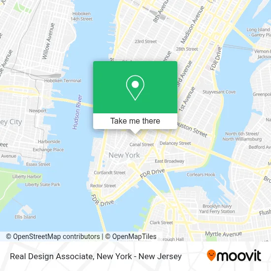
See Real Design Associate, Manhattan, on the map
Public Transit to Real Design Associate in Manhattan
Wondering how to get to Real Design Associate in Manhattan? Moovit helps you find the best way to get to Real Design Associate with step-by-step directions from the nearest public transit station.
Moovit provides free maps and live directions to help you navigate through your city. View schedules, routes, timetables, and find out how long does it take to get to Real Design Associate in real time.
Looking for the nearest stop or station to Real Design Associate? Check out this list of stops closest to your destination: Broadway/Broome St; Broadway/Grand St; Franklin St; Canal St; Church St & Leonard St; Broadway & Leonard St; Broadway/Lispenard St.
Bus: BXM18, SIM34, M55, SIM1, SIM1C, SIM3C, SIM4C, SIM33C, X27, X28.Train: RED, YEL.Subway: 6, 6X, C, E, J, Q, R, 1, 2, M, N, A.
Want to see if there’s another route that gets you there at an earlier time? Moovit helps you find alternative routes or times. Get directions from and directions to Real Design Associate easily from the Moovit App or Website.
We make riding to Real Design Associate easy, which is why over 1.5 million users, including users in Manhattan, trust Moovit as the best app for public transit. You don’t need to download an individual bus app or train app, Moovit is your all-in-one transit app that helps you find the best bus time or train time available.
For information on prices of subway, bus, train and ferry, costs and ride fares to Real Design Associate, please check the Moovit app.
Use the app to navigate to popular places including to the airport, hospital, stadium, grocery store, mall, coffee shop, school, college, and university.
Real Design Associate Address: 414 Broadway Fl 2 street in Manhattan
- Rare Pink,
- Sukhdeo Development,
- Snowplow Managed Services,
- Merit Roofing and Siding,
- The Superfair,
- Northeast Birth Doula,
- Mentally Fit Community,
- Twobirds New York,
- Squeaky Wheel,
- Skaggs Creative,
- Radiate,
- Neil Logan Architect,
- Perfect Moving Nyc,
- Loknath Gift Shop Inc,
- Radical Storage - Luggage Storage Nyc Chinatown,
- Exyte,
- Telfar,
- Therapy Lab - A Cbt Psychology Practice,
- Delta Emerald Ventures,
- Network Right
Places Near Real Design Associate (Manhattan)
- Mountainside Hospital, Glen Ridge,
- 3 Stone St, Manhattan,
- qqqq, Manhattan,
- 376 Hudson Street, Manhattan,
- Bellevue Hospital, Manhattan,
- 911 Memorial, Manhattan,
- 26 Federal Plaza, Manhattan,
- Rockefeller Center, Manhattan,
- Times Square, Manhattan,
- Chinatown, Manhattan,
- Pier 83, Manhattan,
- Katz's Deli, Manhattan,
- Hudson Yards, Manhattan,
- SoHo, Manhattan,
- 111 Centre New York City Supreme Court, Manhattan,
- 66 John Street, Manhattan,
- Wall Street, Manhattan,
- Queens Center Mall, Queens,
- San Gennaro Feast, Manhattan,
- 1 Police Plaza, Manhattan
How to get to popular places in New York - New Jersey with public transit
Get around Manhattan by public transit!
Traveling around Manhattan has never been so easy. See step by step directions as you travel to any attraction, street or major public transit station. View bus and train schedules, arrival times, service alerts and detailed routes on a map, so you know exactly how to get to anywhere in Manhattan.
When traveling to any destination around Manhattan use Moovit's Live Directions with Get Off Notifications to know exactly where and how far to walk, how long to wait for your line, and how many stops are left. Moovit will alert you when it's time to get off — no need to constantly re-check whether yours is the next stop.
Wondering how to use public transit in Manhattan or how to pay for public transit in Manhattan? Moovit public transit app can help you navigate your way with public transit easily, and at minimum cost. It includes public transit fees, ticket prices, and costs. Looking for a map of Manhattan public transit lines? Moovit public transit app shows all public transit maps in Manhattan with all Bus, Train, Subway, Light Rail, Ferry and Cable Car routes and stops on an interactive map.
New York - New Jersey has 6 transit type(s), including: Bus, Train, Subway, Light Rail, Ferry and Cable Car, operated by several transit agencies, including MTA Subway, Metro-North Railroad, LIRR, PATH, MTA New York City Transit - Express routes, MTA Bus, NJ Transit, NYC Ferry, NICE bus, Bee-Line Bus, NJ Transit Rail, Norwalk Transit District, Hartford Line, River Valley Transit and HART