Directions to Real K9 Solutions (Reno) with public transportation
The following transit lines have routes that pass near Real K9 Solutions
 Bus: 4.
How to get to Real K9 Solutions by bus?
Click on the bus route to see step by step directions with maps, line arrival times and updated time schedules.
From Arch of Reno Wedding Chapel Nevada, Reno
42 minFrom Michelle Nash Massage Therapy, Reno
53 minFrom Reno Aces (Greater Nevada Field), Reno
37 minFrom Walmart Supercenter, Reno
58 minFrom Metlife Auto & Home Insurance, Reno
63 minFrom Moana Diverging Diamond Interchange, Reno
71 minFrom Atlantis Hotel And Casino Conference Center, Reno
63 minFrom Reno Rock Transport, Reno
74 minFrom S Virginia Street at Century Park Lane Theaters, Reno
56 minFrom Ultimate Rush Speed & Thrill Park, Reno
57 min
Bus stop near Real K9 Solutions in Reno
- Sharlands Avenue And Avenida De Landa, 7 min walk,VIEW
Bus lines to Real K9 Solutions in Reno
- 4, Rtc 4th Street Station,VIEW
What are the closest stations to Real K9 Solutions?
The closest stations to Real K9 Solutions are:
- Sharlands Avenue And Avenida De Landa is 530 yards away, 7 min walk.
Which bus line stops near Real K9 Solutions?
4 (Sharlands Avenue And Robb Drive)
What’s the nearest bus station to Real K9 Solutions in Reno?
The nearest bus station to Real K9 Solutions in Reno is Sharlands Avenue And Avenida De Landa. It’s a 7 min walk away.
What time is the first bus to Real K9 Solutions in Reno?
The 4 is the first bus that goes to Real K9 Solutions in Reno. It stops nearby at 5:13 AM.
What time is the last bus to Real K9 Solutions in Reno?
The 4 is the last bus that goes to Real K9 Solutions in Reno. It stops nearby at 11:07 PM.
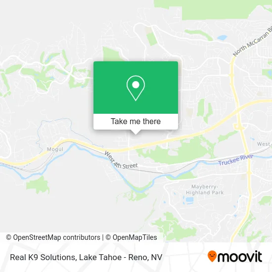
See Real K9 Solutions, Reno, on the map
Public Transit to Real K9 Solutions in Reno
Wondering how to get to Real K9 Solutions in Reno? Moovit helps you find the best way to get to Real K9 Solutions with step-by-step directions from the nearest public transit station.
Moovit provides free maps and live directions to help you navigate through your city. View schedules, routes, timetables, and find out how long does it take to get to Real K9 Solutions in real time.
Looking for the nearest stop or station to Real K9 Solutions? Check out this list of stops closest to your destination: Sharlands Avenue And Avenida De Landa.
Bus: 4.
Want to see if there’s another route that gets you there at an earlier time? Moovit helps you find alternative routes or times. Get directions from and directions to Real K9 Solutions easily from the Moovit App or Website.
We make riding to Real K9 Solutions easy, which is why over 1.7 million users, including users in Reno, trust Moovit as the best app for public transit. You don’t need to download an individual bus app or train app, Moovit is your all-in-one transit app that helps you find the best bus time or train time available.
For information on prices of bus, costs and ride fares to Real K9 Solutions, please check the Moovit app.
Use the app to navigate to popular places including to the airport, hospital, stadium, grocery store, mall, coffee shop, school, college, and university.
Real K9 Solutions Address: 6900 Sharlands Ave Reno, NV 89523 street in Reno
- Taste Catering,
- Rail City Holdings,
- Exit 9/Robb Drive/E,
- Masters Fasteners,
- Deep Water Guide Service,
- Vandermark & Son P,
- Tesla,
- Hampton Inn & Suites-Hampton Reno West,
- Delta Dirtwork,
- Hampton Inn & Suites Reno West,
- Lori Fuselier - Mortgage Advisor - United Federal Credit Union,
- Wilderness Forestry,
- Robb Drive at Scolari's,
- Infrared Systems,
- Hammer and Saw,
- Aesthetics Med Spa,
- Great Basin Institure,
- Labcorp,
- Club Ambassador Apartments,
- Hazardous Disposal Specialists
Places Near Real K9 Solutions (Reno)
- Peppermill, Reno,
- Walmart Supercenter, Reno,
- The Nugget Sparks - Tesla Destination, Sparks,
- University of Nevada, Reno, Reno,
- Social Security Administration, Reno,
- Hidden Beach, Incline Village,
- Emerald Bay, South Lake Tahoe,
- Reno, Nevada, Reno,
- Boreal Mountain Resort, Truckee,
- DMV, Reno,
- Tesla, Reno,
- Meadowood Mall, Reno,
- Tesla, Reno,
- Grand Sierra Resort, Reno,
- The Summit (Summit Shopping Center), Reno,
- 2777 usa Parkway, Sparks,
- Mount Rose Ski Resort Entrance, Reno,
- Department of Motor Vehicles (DMV), Reno,
- Tesla, Carson City,
- Boomtown Hotel, Reno
How to get to popular places in Lake Tahoe - Reno, NV with public transit
Get around Reno by public transit!
Traveling around Reno has never been so easy. See step by step directions as you travel to any attraction, street or major public transit station. View bus and train schedules, arrival times, service alerts and detailed routes on a map, so you know exactly how to get to anywhere in Reno.
When traveling to any destination around Reno use Moovit's Live Directions with Get Off Notifications to know exactly where and how far to walk, how long to wait for your line, and how many stops are left. Moovit will alert you when it's time to get off — no need to constantly re-check whether yours is the next stop.
Wondering how to use public transit in Reno or how to pay for public transit in Reno? Moovit public transit app can help you navigate your way with public transit easily, and at minimum cost. It includes public transit fees, ticket prices, and costs. Looking for a map of Reno public transit lines? Moovit public transit app shows all public transit maps in Reno with all Bus and Train routes and stops on an interactive map.
Lake Tahoe - Reno, NV has 2 transit type(s), including: Bus and Train, operated by several transit agencies, including RTC RIDE, Tahoe Truckee Area Regional Transit, North Lake Tahoe Express - 24 hour advance reservations required, Tahoe Transportation District, Amtrak and Greyhound-us