How to get to Real Net by bus?
Click on the bus route to see step by step directions with maps, line arrival times and updated time schedules.
From Heron City Madrid, Área Metropolitana De Madrid Y Corredor Del Henares
30 minFrom Polígono Európolis, Las Rozas De Madrid
50 minFrom Polígono P-29, Collado Villalba
52 minFrom Autovía A-6 Km 20, Las Rozas De Madrid
44 minFrom Mercado De Majadahonda, Área Metropolitana De Madrid Y Corredor Del Henares
45 minFrom Universidad Camilo José Cela (UCJC), Villanueva De La Cañada
73 minFrom The Style Outlets Las Rozas, Las Rozas De Madrid
31 minFrom Carril Bus-VAO A-6, Las Rozas De Madrid
85 minFrom Costco Wholesale, Las Rozas De Madrid
42 minFrom Autovía del Noroeste A-6 (Carretera de La Coruña), Las Rozas De Madrid
63 min
Bus stops near Real Net in Torrelodones
Train station near Real Net in Torrelodones
- Las Matas, 57 min walk,VIEW
Bus lines to Real Net in Torrelodones
- 1, Pueblo - Colonia - Estación FF.CC.,VIEW
- 613, Intercambiador De Moncloa (Islas 2 Y 3),VIEW
- 611, Madrid (Moncloa) - Hoyo de Manzanares,VIEW
- 612, Madrid (Moncloa) - Torrelodones,VIEW
- 633, Majadahonda (Hospital) - Torrelodones (Colonia) - Galapagar - Colmenarejo,VIEW
- 685, Majadahonda (Hospital) - Las Rozas - Guadarrama,VIEW
- 686, Madrid (Moncloa) - Torrelodones (por Los Peñascales),VIEW
- 611A, Madrid (Moncloa) - Hoyo de Manzanares (por Urb. Las Colinas),VIEW
- 686A, Madrid (Moncloa) - Torrelodones (por Montealegre),VIEW
- N602, Av. Juan Carlos I - Planetocio,VIEW
What are the closest stations to Real Net?
The closest stations to Real Net are:
- Av. Fontanilla - Parque is 133 meters away, 2 min walk.
- Pza. Abasto - C. C. Espacio Torrelodones is 482 meters away, 7 min walk.
- Ctra. A-6 - C. C. Espacio Torrelodones is 788 meters away, 11 min walk.
- Las Matas is 4461 meters away, 57 min walk.
Which bus lines stop near Real Net?
These bus lines stop near Real Net: 611, 612, 633, 685, 686.
What’s the nearest bus station to Real Net in Torrelodones?
The nearest bus station to Real Net in Torrelodones is Av. Fontanilla - Parque. It’s a 2 min walk away.
What time is the first train to Real Net in Torrelodones?
The C8A is the first train that goes to Real Net in Torrelodones. It stops nearby at 6:05 AM.
What time is the last train to Real Net in Torrelodones?
The C8A is the last train that goes to Real Net in Torrelodones. It stops nearby at 12:14 AM.
What time is the first bus to Real Net in Torrelodones?
The 611 is the first bus that goes to Real Net in Torrelodones. It stops nearby at 3:50 AM.
What time is the last bus to Real Net in Torrelodones?
The N602 is the last bus that goes to Real Net in Torrelodones. It stops nearby at 2:51 AM.
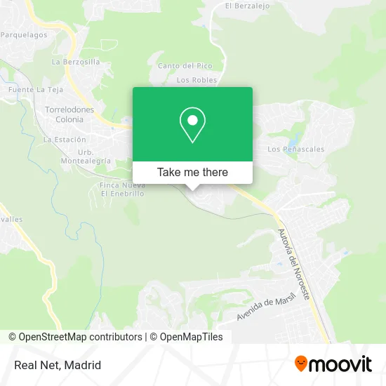
See Real Net, Torrelodones, on the map
Public Transit to Real Net in Torrelodones
Wondering how to get to Real Net in Torrelodones? Moovit helps you find the best way to get to Real Net with step-by-step directions from the nearest public transit station.
Moovit provides free maps and live directions to help you navigate through your city. View schedules, routes, timetables, and find out how long does it take to get to Real Net in real time.
Looking for the nearest stop or station to Real Net? Check out this list of stops closest to your destination: Av. Fontanilla - Parque; Pza. Abasto - C. C. Espacio Torrelodones; Ctra. A-6 - C. C. Espacio Torrelodones; Las Matas.
Bus: 611, 612, 633, 685, 686, 1, 613, N602.Train: C8A, C8B, C10, REG, REG.
Want to see if there’s another route that gets you there at an earlier time? Moovit helps you find alternative routes or times. Get directions from and directions to Real Net easily from the Moovit App or Website.
We make riding to Real Net easy, which is why over 1.5 million users, including users in Torrelodones, trust Moovit as the best app for public transit. You don’t need to download an individual bus app or train app, Moovit is your all-in-one transit app that helps you find the best bus time or train time available.
For information on prices of bus and train, costs and ride fares to Real Net, please check the Moovit app.
Use the app to navigate to popular places including to the airport, hospital, stadium, grocery store, mall, coffee shop, school, college, and university.
Real Net Address: Avenida de la Fontanilla, 26 28250 Torrelodones street in Torrelodones
- Psicovitalem,
- Lizarran,
- H&F Peluquería,
- Risk Management Solutions,
- Torrelodones Rugby Club,
- Punto Fa,
- Teatro Fernández-Baldor,
- Polideportivo María De Villota,
- Teatro José Ramón Fernández-Baldor,
- El Corte Inglés,
- Powerupsales,
- La Retoucherie de Manuela,
- Scanmy,
- D3 Arquitectura Arte y Multimedia,
- La Cuba de Baco,
- Itinera Tours,
- Calle Arroyo de los Viales 4,
- Movistar,
- Spagnolo Torrelodones,
- Campo De Rugby De Torrelodones
Places Near Real Net (Torrelodones)
- Wizink Center, Madrid,
- Mercadillo de Majadahonda, Majadahonda,
- Tres Aguas, Alcorcón,
- Rastro De Madrid, Área Metropolitana De Madrid Y Corredor Del Henares,
- Palacio De Vistalegre, Área Metropolitana De Madrid Y Corredor Del Henares,
- Plaza Mayor, Madrid,
- Centro Comercial La Gavia, Área Metropolitana De Madrid Y Corredor Del Henares,
- Hospital Clínico Universitario San Carlos, Madrid,
- Centro Comercial Oasiz Madrid, Área Metropolitana De Madrid Y Corredor Del Henares,
- Plenilunio, Área Metropolitana De Madrid Y Corredor Del Henares,
- Hospital Universitario La Paz, Madrid,
- Hospital Universitario Ramón y Cajal, Madrid,
- Estacion de Chamartin, Madrid,
- Estadio Wanda Metropolitano, Área Metropolitana De Madrid Y Corredor Del Henares,
- Mendez Alvaro, Madrid,
- Centro Comercial La Vaguada, Área Metropolitana De Madrid Y Corredor Del Henares,
- Sala La Riviera, Madrid,
- Calle de López de Hoyos 169, Madrid,
- Nassica, Área Metropolitana De Madrid Y Corredor Del Henares,
- Centro Comercial Islazul, Área Metropolitana De Madrid Y Corredor Del Henares
How to get to popular places in Madrid with public transit
Get around Torrelodones by public transit!
Traveling around Torrelodones has never been so easy. See step by step directions as you travel to any attraction, street or major public transit station. View bus and train schedules, arrival times, service alerts and detailed routes on a map, so you know exactly how to get to anywhere in Torrelodones.
When traveling to any destination around Torrelodones use Moovit's Live Directions with Get Off Notifications to know exactly where and how far to walk, how long to wait for your line, and how many stops are left. Moovit will alert you when it's time to get off — no need to constantly re-check whether yours is the next stop.
Wondering how to use public transit in Torrelodones or how to pay for public transit in Torrelodones? Moovit public transit app can help you navigate your way with public transit easily, and at minimum cost. It includes public transit fees, ticket prices, and costs. Looking for a map of Torrelodones public transit lines? Moovit public transit app shows all public transit maps in Torrelodones with all Bus, Train, Metro and Light Rail routes and stops on an interactive map.
Madrid has 4 transit type(s), including: Bus, Train, Metro and Light Rail, operated by several transit agencies, including Metro de Madrid, Metro Ligero, Tranvía de Parla, Renfe Cercanías - Servicios de Autobús especiales, Renfe Cercanias, Renfe Cercanías, EMT, Interurbanos, Urbanos de Alcalá de Henares, Urbanos de Alcobendas, Urbanos de Alcorcón, Urbanos de Algete, Urbanos de Aranjuez, Urbanos de Arganda del Rey and Urbanos de Arroyomolinos