How to get to Real Sweet by bus?
Click on the bus route to see step by step directions with maps, line arrival times and updated time schedules.
From Zudio, Pune & Velhe
44 minFrom Buntara Bhavana, Paud
47 minFrom Panchshil Business Park, Pune & Velhe
58 minFrom Indira College Of Commerce & Science (ICCS), Paud
52 minFrom Balaji Institute, Paud
42 minFrom Cummins India Office Campus, Pune & Velhe
59 minFrom Hotel Tip Top International-Wakad, Paud
34 minFrom Balewadi High Street, Pune & Velhe
58 minFrom 16 no. thergaon, Paud
44 minFrom Amar Business Park, Paud
45 min
Bus stops near Real Sweet in Paud
Bus lines to Real Sweet in Paud
- 74, Chinchwadgaon - Paud Shashkiya Vishramgruha,VIEW
- 77, Hinjawadi Maan Phase 3 - Ganpati Matha,VIEW
- 79, Hinjawadi Maan Phase 3 - Deccan Gymkhana,VIEW
- 100, Ma.Na.Pa Bhavan - Hinjawadi Maan Phase 3,VIEW
- 115, Hinjawadi Maan Phase 3 - Pune Station,VIEW
- 208, Bhekrainagar Depot - Hinjawadi Maan Phase 3,VIEW
- 225, Kharadi Gaon - Hinjawadi Maan Phase 3,VIEW
- 306, Dange Chowk - Hinjawadi Megapolis Phase 3,VIEW
- 316, Chinchwadgaon - Katarkhadak,VIEW
- 321, Hinjawadi Megapolis Phase 3 - Neilsoft Company Infosys (Phase 3),VIEW
- 324, Bhosari Terminal - Hinjawadi Maan Phase 3,VIEW
- 327, Alandi Darshan - Hinjawadi Maan Phase 3,VIEW
- 328, Kesnand Phata Wagholi - Hinjawadi Maan Phase 3,VIEW
- 333, Pune Station - Hinjawadi Maan Phase 3,VIEW
- 345, Hinjawadi Maan Phase 3 - Bhosari Terminal,VIEW
- 372, Nigdi Bhakti Shakti Terminal - Hinjawadi Megapolis Phase 3,VIEW
- 380, Bhosari Terminal - Hinjawadi Maan Phase 3,VIEW
- 381, Hinjawadi Megapolis Phase 3 - Chikhali Nageshwar Vidyalaya,VIEW
- 43A, Hinjawadi Maan Phase 3 - Katraj,VIEW
- 327A, Bhosari Gaon - Hinjawadi Maan Phase 3,VIEW
What are the closest stations to Real Sweet?
The closest stations to Real Sweet are:
- TCS Company is 468 meters away, 7 min walk.
- Neilsoft Company Infosys (Phase 3) is 780 meters away, 10 min walk.
- Hinjawadi Megapolis Phase 3 is 1186 meters away, 16 min walk.
Which bus lines stop near Real Sweet?
These bus lines stop near Real Sweet: 100C, 115, 208, 306, 328, 372, 43A.
What’s the nearest bus station to Real Sweet in Paud?
The nearest bus station to Real Sweet in Paud is TCS Company. It’s a 7 min walk away.
What time is the first bus to Real Sweet in Paud?
The 115 is the first bus that goes to Real Sweet in Paud. It stops nearby at 4:33 AM.
What time is the last bus to Real Sweet in Paud?
The 115 is the last bus that goes to Real Sweet in Paud. It stops nearby at 1:01 AM.
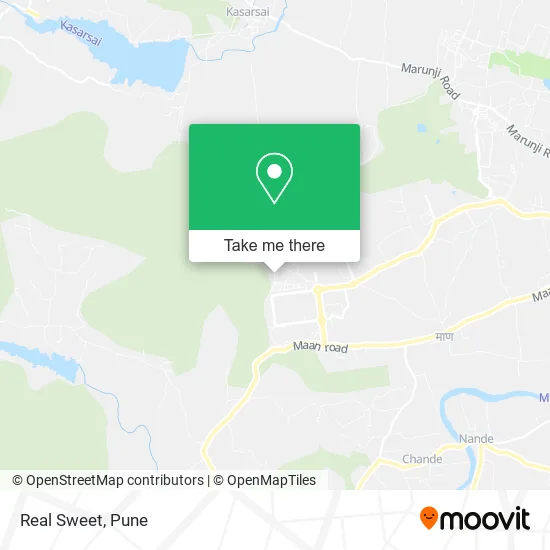
See Real Sweet, Paud, on the map
Public Transit to Real Sweet in Paud
Wondering how to get to Real Sweet in Paud? Moovit helps you find the best way to get to Real Sweet with step-by-step directions from the nearest public transit station.
Moovit provides free maps and live directions to help you navigate through your city. View schedules, routes, timetables, and find out how long does it take to get to Real Sweet in real time.
Looking for the nearest stop or station to Real Sweet? Check out this list of stops closest to your destination: TCS Company; Neilsoft Company Infosys (Phase 3); Hinjawadi Megapolis Phase 3.
Bus: 100C, 115, 208, 306, 328, 372, 43A, 74, 77, 79, 100, 124, 373, 375, 375C, 383C.
Want to see if there’s another route that gets you there at an earlier time? Moovit helps you find alternative routes or times. Get directions from and directions to Real Sweet easily from the Moovit App or Website.
We make riding to Real Sweet easy, which is why over 1.5 million users, including users in Paud, trust Moovit as the best app for public transit. You don’t need to download an individual bus app or train app, Moovit is your all-in-one transit app that helps you find the best bus time or train time available.
For information on prices of bus, costs and ride fares to Real Sweet, please check the Moovit app.
Use the app to navigate to popular places including to the airport, hospital, stadium, grocery store, mall, coffee shop, school, college, and university.
Real Sweet Address: मुलशी 411057 MH street in Paud
- Marquardt India Private Limited,
- Bank Of Maharashtra,
- Baskin-Robbins,
- Zilha Parishad Prathamik School Bhoirwadi,
- Venky Pg,
- Kanifnath Mandir,
- Melange Residences Wing A,
- Fusion Towers,
- Melange Garden D,
- Sp - S2 Torna, Tcs,
- Nivant Transit Quarters,
- TCS Sahyadri Park,
- Chai Point - Rajiv Gandhi Infotech Park, Hinjawadi,
- Monginis Cake Shop,
- S1 Poorna,
- Sparklet Skating Rink,
- Pawar Public School,
- Megapolis Sparklet,
- Dr Pansambal Clinic,
- International Tech Park
Places Near Real Sweet (Paud)
- Symbiosis Lavale Bus Stop, Pune & Velhe,
- BAPS Shri Swaminarayan Mandir, Pune & Velhe,
- Dagdusheth Halwai Ganpati Mandir, Pune & Velhe,
- Westend Mall, Pune & Velhe,
- Dagadusheth Halwai Ganapati Temple, Pune & Velhe,
- Laxmi Road, Pune & Velhe,
- Sarasbaug, Pune & Velhe,
- Chaturshringi Temple, Pune & Velhe,
- Ion Digital Zone, Pune & Velhe,
- ISKCON Nvcc Temple, Pune & Velhe,
- Vishwakarma Institute Of Technology (Vit), Pune & Velhe,
- Tulshibaug, Pune & Velhe,
- Pvr Icon - Pavilion Mall, Pune & Velhe,
- ISKCON Pune, Pune & Velhe,
- M G Road, Pune & Velhe,
- Senapati Bapat Road, Pune & Velhe,
- Pune Okayama Friendship Garden, Pune & Velhe,
- Fc Road, Pune & Velhe,
- Swaminarayan Mandir, Pune & Velhe,
- Cognizant Deccan Campus (CDC), Paud
How to get to popular places in Pune with public transit
Get around Paud by public transit!
Traveling around Paud has never been so easy. See step by step directions as you travel to any attraction, street or major public transit station. View bus and train schedules, arrival times, service alerts and detailed routes on a map, so you know exactly how to get to anywhere in Paud.
When traveling to any destination around Paud use Moovit's Live Directions with Get Off Notifications to know exactly where and how far to walk, how long to wait for your line, and how many stops are left. Moovit will alert you when it's time to get off — no need to constantly re-check whether yours is the next stop.
Wondering how to use public transit in Paud or how to pay for public transit in Paud? Moovit public transit app can help you navigate your way with public transit easily, and at minimum cost. It includes public transit fees, ticket prices, and costs. Looking for a map of Paud public transit lines? Moovit public transit app shows all public transit maps in Paud with all Bus, Train and Metro routes and stops on an interactive map.
Pune has 3 transit type(s), including: Bus, Train and Metro, operated by several transit agencies, including Pune Metro (Maha Metro), PMPML, PMPML Night Bus Service (Ratrani) and Central Railways (Indian Railways)