How to get to Reason Magazine by bus?
Click on the bus route to see step by step directions with maps, line arrival times and updated time schedules.
From Sheraton Pentagon City Hotel, Arlington County
58 minFrom Days Inn by Wyndham Arlington Pentagon, Arlington County
56 minFrom Prince George's Plaza Metro Station, Prince George's County
76 minFrom The Bullpen, Washington
41 minFrom Baileys Crossroads, Fairfax County
72 minFrom Wheaton Mall, Montgomery County
60 minFrom Navy Lodge, Washington
108 minFrom Nova- Alexandria Campus, Alexandria
67 minFrom Eden Center, Falls Church
80 minFrom Holy Cross Hospital, Montgomery County
54 min
How to get to Reason Magazine by metro?
Click on the metro route to see step by step directions with maps, line arrival times and updated time schedules.
Metro stations near Reason Magazine in Washington
Bus stops near Reason Magazine in Washington
Bus lines to Reason Magazine in Washington
What are the closest stations to Reason Magazine?
The closest stations to Reason Magazine are:
- Dupont Circle Metro Station is 105 yards away, 2 min walk.
- Connecticut Av Nw+Florida Av NW is 140 yards away, 2 min walk.
- Massachusetts Av Nw+20 St NW is 299 yards away, 4 min walk.
- Washington Dc (Dupont Circle) is 357 yards away, 5 min walk.
- Farragut West is 981 yards away, 12 min walk.
- U Street/African-Amer Civil War Memorial/ Cardozo is 1332 yards away, 16 min walk.
Which bus lines stop near Reason Magazine?
These bus lines stop near Reason Magazine: D70, D72, D74.
Which metro line stops near Reason Magazine?
RED (Shady Grove)
What’s the nearest metro station to Reason Magazine in Washington?
The nearest metro station to Reason Magazine in Washington is Dupont Circle Metro Station. It’s a 2 min walk away.
What’s the nearest bus station to Reason Magazine in Washington?
The nearest bus station to Reason Magazine in Washington is Connecticut Av Nw+Florida Av NW. It’s a 2 min walk away.
What time is the first metro to Reason Magazine in Washington?
The GREEN is the first metro that goes to Reason Magazine in Washington. It stops nearby at 5:18 AM.
What time is the last metro to Reason Magazine in Washington?
The GREEN is the last metro that goes to Reason Magazine in Washington. It stops nearby at 12:23 AM.
What time is the first bus to Reason Magazine in Washington?
The D72 is the first bus that goes to Reason Magazine in Washington. It stops nearby at 4:15 AM.
What time is the last bus to Reason Magazine in Washington?
The D70 is the last bus that goes to Reason Magazine in Washington. It stops nearby at 2:06 AM.
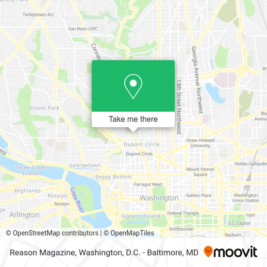
See Reason Magazine, Washington, on the map
Public Transit to Reason Magazine in Washington
Wondering how to get to Reason Magazine in Washington? Moovit helps you find the best way to get to Reason Magazine with step-by-step directions from the nearest public transit station.
Moovit provides free maps and live directions to help you navigate through your city. View schedules, routes, timetables, and find out how long does it take to get to Reason Magazine in real time.
Looking for the nearest stop or station to Reason Magazine? Check out this list of stops closest to your destination: Dupont Circle Metro Station; Connecticut Av Nw+Florida Av NW; Massachusetts Av Nw+20 St NW; Washington Dc (Dupont Circle); Farragut West; U Street/African-Amer Civil War Memorial/ Cardozo.
Bus: D70, D72, D74, D90, D96, FLIXBUS 2601.Metro: RED, BLUE, ORANGE, SILVER, GREEN, YELLOW.
Want to see if there’s another route that gets you there at an earlier time? Moovit helps you find alternative routes or times. Get directions from and directions to Reason Magazine easily from the Moovit App or Website.
We make riding to Reason Magazine easy, which is why over 1.5 million users, including users in Washington, trust Moovit as the best app for public transit. You don’t need to download an individual bus app or train app, Moovit is your all-in-one transit app that helps you find the best bus time or train time available.
For information on prices of bus and metro, costs and ride fares to Reason Magazine, please check the Moovit app.
Use the app to navigate to popular places including to the airport, hospital, stadium, grocery store, mall, coffee shop, school, college, and university.
Reason Magazine Address: 1747 Connecticut Ave NW (R Street) street in Washington
- The Board Room,
- Bistrot Du Coin,
- S St NW Connecticut Ave NW,
- Krave Restaurant & Lounge,
- Buca di Beppo,
- Guy Fieri's Flavortown Kitchen,
- Consulado Bolivia Washington,
- Bolivian Consulate,
- FHI 360,
- Annabelle,
- Joy of Motion Dance Center,
- Embassy Costa Rica (General Consulate Costa Rica),
- General Consulate Costa Rica,
- Arizona State University,
- Stay BNB DC,
- Embassy Of Sierra Leone,
- The Hepburn,
- Kalorama,
- Zorba's Cafe,
- Big Bus Tour
Places Near Reason Magazine (Washington)
- Pennsylvania Ave NW (3rd st and pennsylvania), Washington,
- Museum Of The Bible, Washington,
- Basilica of the National Shrine, Washington,
- National Zoo, Washington,
- Rock Creek Tennis Center, Washington,
- Amazon Hq2, Arlington County,
- Georgetown, Washington,
- PG Mall, Prince George's County,
- Warner Theatre, Washington,
- National Theatre, Washington,
- M&T Bank Stadium, Baltimore,
- Camden Yards, Baltimore,
- Washington National Cathedral, Washington,
- Sibley Memorial Hospital, Washington,
- Capital One Arena, Washington,
- National Museum of African American History and Culture, Washington,
- Marriott Marquis Washington, DC, Washington,
- Westfield Montgomery Mall, Montgomery County,
- The Anthem, Washington,
- Washington DC VA Medical Center, Washington
How to get to popular places in Washington, D.C. - Baltimore, MD with public transit
Get around Washington by public transit!
Traveling around Washington has never been so easy. See step by step directions as you travel to any attraction, street or major public transit station. View bus and train schedules, arrival times, service alerts and detailed routes on a map, so you know exactly how to get to anywhere in Washington.
When traveling to any destination around Washington use Moovit's Live Directions with Get Off Notifications to know exactly where and how far to walk, how long to wait for your line, and how many stops are left. Moovit will alert you when it's time to get off — no need to constantly re-check whether yours is the next stop.
Wondering how to use public transit in Washington or how to pay for public transit in Washington? Moovit public transit app can help you navigate your way with public transit easily, and at minimum cost. It includes public transit fees, ticket prices, and costs. Looking for a map of Washington public transit lines? Moovit public transit app shows all public transit maps in Washington with all Bus, Train, Metro, Light Rail and Ferry routes and stops on an interactive map.
Washington, D.C. - Baltimore, MD has 5 transit type(s), including: Bus, Train, Metro, Light Rail and Ferry, operated by several transit agencies, including WMATA, Montgomery County Ride On, Fairfax Connector, TheBus, PRTC, DASH - Alexandria, Arlington Transit (ART), RTA of Central Maryland, MDOT MTA, MDOT MTA Light RailLink, MDOT MTA Commuter Bus, MDOT MTA Local Bus, FXBGO!, Virginia Railway Express (VRE) and MARC