How to get to Reconstruccion de Clutch by bus?
Click on the bus route to see step by step directions with maps, line arrival times and updated time schedules.
From Los Arquitos, Aguascalientes
57 minFrom Universidad Tecnológica De Aguascalientes, Aguascalientes
61 minFrom Universidad Tecnologica De Aguascalientes, Aguascalientes
61 minFrom Subestacion Aguascalientes Sur CFE, Aguascalientes
32 minFrom Ronda Residencial, Aguascalientes
53 minFrom Plaza Vestir, Aguascalientes
32 minFrom Centro de Salud Margaritas, Aguascalientes
31 minFrom conalep jesus maria, Aguascalientes
49 minFrom Walmart, Aguascalientes
34 minFrom Fracc. La Misión, Aguascalientes
56 min
Bus stops near Reconstruccion de Clutch in Aguascalientes
Bus lines to Reconstruccion de Clutch in Aguascalientes
What are the closest stations to Reconstruccion de Clutch?
The closest stations to Reconstruccion de Clutch are:
- Héroe De Nacozari Norte, 2903 is 58 meters away, 1 min walk.
- Boulevard A Zacatecas, 1404(1402) is 139 meters away, 3 min walk.
- Héroe De Nacozari Norte, 2607 is 189 meters away, 3 min walk.
- Boulevard A Zacatecas, 402 is 302 meters away, 5 min walk.
- Avenida Paseo De La Solidaridad, 99 is 559 meters away, 8 min walk.
Which bus lines stop near Reconstruccion de Clutch?
These bus lines stop near Reconstruccion de Clutch: RUTA 01, RUTA 05, RUTA 18, RUTA 35.
What’s the nearest bus station to Reconstruccion de Clutch in Aguascalientes?
The nearest bus station to Reconstruccion de Clutch in Aguascalientes is Héroe De Nacozari Norte, 2903. It’s a 1 min walk away.
What time is the first bus to Reconstruccion de Clutch in Aguascalientes?
The RUTA 51 is the first bus that goes to Reconstruccion de Clutch in Aguascalientes. It stops nearby at 6:14 AM.
What time is the last bus to Reconstruccion de Clutch in Aguascalientes?
The RUTA 43 is the last bus that goes to Reconstruccion de Clutch in Aguascalientes. It stops nearby at 10:30 PM.
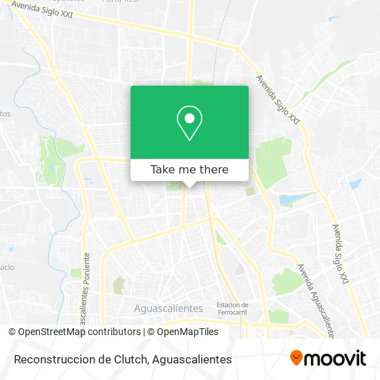
See Reconstruccion de Clutch, Aguascalientes, on the map
Public Transit to Reconstruccion de Clutch in Aguascalientes
Wondering how to get to Reconstruccion de Clutch in Aguascalientes? Moovit helps you find the best way to get to Reconstruccion de Clutch with step-by-step directions from the nearest public transit station.
Moovit provides free maps and live directions to help you navigate through your city. View schedules, routes, timetables, and find out how long does it take to get to Reconstruccion de Clutch in real time.
Looking for the nearest stop or station to Reconstruccion de Clutch? Check out this list of stops closest to your destination: Héroe De Nacozari Norte; Boulevard A Zacatecas; Héroe De Nacozari Norte; Boulevard A Zacatecas; Avenida Paseo De La Solidaridad.
Bus: RUTA 01, RUTA 05, RUTA 18, RUTA 35, RUTA 45, RUTA 03, RUTA 34, RUTA 43, RUTA 43, RUTA 51.
Want to see if there’s another route that gets you there at an earlier time? Moovit helps you find alternative routes or times. Get directions from and directions to Reconstruccion de Clutch easily from the Moovit App or Website.
We make riding to Reconstruccion de Clutch easy, which is why over 1.5 million users, including users in Aguascalientes, trust Moovit as the best app for public transit. You don’t need to download an individual bus app or train app, Moovit is your all-in-one transit app that helps you find the best bus time or train time available.
For information on prices of bus, costs and ride fares to Reconstruccion de Clutch, please check the Moovit app.
Use the app to navigate to popular places including to the airport, hospital, stadium, grocery store, mall, coffee shop, school, college, and university.
Reconstruccion de Clutch Address: Reconstruccion de Clutch, Avenida Héroe de Nacozari Norte, Fraccionamiento Las Hadas, 20140 Aguasca street in Aguascalientes
- Bodega de Distribuidora Central de Aguascalientes SA de CV,
- Solinda,
- Hs Iluminación,
- Falcon Pro Clutch Y Frenos,
- Nat Gas,
- Fraccionamiento Las Hadas,
- Refaccionaria Roca,
- Mangueras y Conexiones,
- Las Hadas,
- Jo-Par,
- Comercio al por Mayor de Material Eléctrico,
- Optimización Veterinaria de Aguascalientes,
- Fracc. Las Hadas,
- Fumisan Jardín,
- Frutas y Verduras,
- Negociación Comercial Anda Montero,
- Impulsora de Mercados Suc. Aguascalientes,
- Refaccionaria Los Comerciales,
- Insumos Contenedoores Plasticos,
- La Ciguenita
Places Near Reconstruccion de Clutch (Aguascalientes)
- clinica 3 uaa, Aguascalientes,
- La Isla San Marcos, Aguascalientes,
- Villas de Nuestra Señora de la Asunción, Aguascalientes,
- Blvd. Luis Donaldo Colosio, Aguascalientes,
- Universidad Autónoma de Aguascalientes, Aguascalientes,
- Centro Comercial Altaria, Aguascalientes,
- Centro, Aguascalientes,
- Jesús María, Aguascalientes,
- Nuevo Hospital Hidalgo, Aguascalientes,
- Parque Las Tres Centurias, Aguascalientes,
- Hospital Imss No. 3, Aguascalientes,
- ESPACIOS, Aguascalientes,
- Central De Autobuses, Aguascalientes,
- Agropecuario, Aguascalientes,
- Aeropuerto de Aguascalientes S.A. de C.V., Aguascalientes,
- Ciudad industrial, Aguascalientes,
- Isla San Marcos, Aguascalientes,
- Villasuncion, Aguascalientes,
- Imss Clinica 1, Aguascalientes,
- Terminal De Combis, Aguascalientes
How to get to popular places in Aguascalientes with public transit
Get around Aguascalientes by public transit!
Traveling around Aguascalientes has never been so easy. See step by step directions as you travel to any attraction, street or major public transit station. View bus and train schedules, arrival times, service alerts and detailed routes on a map, so you know exactly how to get to anywhere in Aguascalientes.
When traveling to any destination around Aguascalientes use Moovit's Live Directions with Get Off Notifications to know exactly where and how far to walk, how long to wait for your line, and how many stops are left. Moovit will alert you when it's time to get off — no need to constantly re-check whether yours is the next stop.
Wondering how to use public transit in Aguascalientes or how to pay for public transit in Aguascalientes? Moovit public transit app can help you navigate your way with public transit easily, and at minimum cost. It includes public transit fees, ticket prices, and costs. Looking for a map of Aguascalientes public transit lines? Moovit public transit app shows all public transit maps in Aguascalientes with all bus routes and stops on an interactive map.
Aguascalientes has 1 transit type(s), including: bus, operated by several transit agencies, including Coordinación General de Movilidad