Directions to Recovery Network (Baltimore) with public transportation
The following transit lines have routes that pass near Recovery Network
 Bus: 51, 94, 95, CITYLINK SILVER, PURPLE ROUTE.
- Train: ACELA, CARDINAL, CAROLINIAN, CRESCENT, NORTHEAST REGIONAL.
How to get to Recovery Network by bus?
Click on the bus route to see step by step directions with maps, line arrival times and updated time schedules.
From Port of Baltimore - Cruise Maryland Terminal, Baltimore
41 minFrom Baltimore Greyhound Station, Baltimore
34 minFrom Walmart, Baltimore County
44 minFrom University Of Maryland Baltimore (Umbc), Baltimore County
64 minFrom Good Samaritan Hospital, Baltimore
32 minFrom I-695 @ Exit 26 (York Rd/MD 45), Baltimore County
49 minFrom I-695 Exit 29 (Loch Raven Blvd (MD 542)/Cromwell Bridge Rd), Baltimore County
53 minFrom I-70 at Security Blvd Baltimore City Lot Park & Ride, Baltimore
60 minFrom I-695 @ Exit 27 (Dulaney Valley Road/MD 146), Baltimore County
56 minFrom Dundalk, Maryland, Baltimore County
57 min
Bus stops near Recovery Network in Baltimore
Light Rail stations near Recovery Network in Baltimore
- Mt. Royal / Mica, 20 min walk,VIEW
Train station near Recovery Network in Baltimore
- Baltimore Penn Station, 28 min walk,VIEW
Bus lines to Recovery Network in Baltimore
What are the closest stations to Recovery Network?
The closest stations to Recovery Network are:
- 25th St & Maryland Ave Wb FS is 55 yards away, 1 min walk.
- Maryland Ave & 25th St Sb is 73 yards away, 2 min walk.
- Charles St & 25th St Nb is 130 yards away, 2 min walk.
- 25th St. (Nb) is 136 yards away, 2 min walk.
- Howard St & 25th St is 149 yards away, 2 min walk.
- Mt. Royal / Mica is 1675 yards away, 20 min walk.
- Baltimore Penn Station is 2311 yards away, 28 min walk.
Which bus lines stop near Recovery Network?
These bus lines stop near Recovery Network: 51, 94, 95, CITYLINK SILVER, PURPLE ROUTE.
What’s the nearest light rail station to Recovery Network in Baltimore?
The nearest light rail station to Recovery Network in Baltimore is Mt. Royal / Mica. It’s a 20 min walk away.
What’s the nearest train station to Recovery Network in Baltimore?
The nearest train station to Recovery Network in Baltimore is Baltimore Penn Station. It’s a 28 min walk away.
What’s the nearest bus station to Recovery Network in Baltimore?
The nearest bus station to Recovery Network in Baltimore is 25th St & Maryland Ave Wb FS. It’s a 1 min walk away.
What time is the first light rail to Recovery Network in Baltimore?
The LIGHT RAILLINK is the first light rail that goes to Recovery Network in Baltimore. It stops nearby at 3:42 AM.
What time is the last light rail to Recovery Network in Baltimore?
The LIGHT RAILLINK is the last light rail that goes to Recovery Network in Baltimore. It stops nearby at 1:30 AM.
What time is the first train to Recovery Network in Baltimore?
The ACELA is the first train that goes to Recovery Network in Baltimore. It stops nearby at 5:34 AM.
What time is the last train to Recovery Network in Baltimore?
The SILVER METEOR is the last train that goes to Recovery Network in Baltimore. It stops nearby at 7:57 AM.
What time is the first bus to Recovery Network in Baltimore?
The CITYLINK SILVER is the first bus that goes to Recovery Network in Baltimore. It stops nearby at 3:52 AM.
What time is the last bus to Recovery Network in Baltimore?
The CITYLINK SILVER is the last bus that goes to Recovery Network in Baltimore. It stops nearby at 3:10 AM.
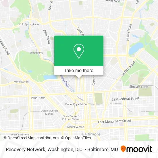
See Recovery Network, Baltimore, on the map
Public Transit to Recovery Network in Baltimore
Wondering how to get to Recovery Network in Baltimore? Moovit helps you find the best way to get to Recovery Network with step-by-step directions from the nearest public transit station.
Moovit provides free maps and live directions to help you navigate through your city. View schedules, routes, timetables, and find out how long does it take to get to Recovery Network in real time.
Looking for the nearest stop or station to Recovery Network? Check out this list of stops closest to your destination: 25th St & Maryland Ave Wb FS; Maryland Ave & 25th St Sb; Charles St & 25th St Nb; 25th St. (Nb); Howard St & 25th St; Mt. Royal / Mica; Baltimore Penn Station.
Bus: 51, 94, 95, CITYLINK SILVER, PURPLE ROUTE, 21.Train: ACELA, CARDINAL, CAROLINIAN, CRESCENT, NORTHEAST REGIONAL.
Want to see if there’s another route that gets you there at an earlier time? Moovit helps you find alternative routes or times. Get directions from and directions to Recovery Network easily from the Moovit App or Website.
We make riding to Recovery Network easy, which is why over 1.5 million users, including users in Baltimore, trust Moovit as the best app for public transit. You don’t need to download an individual bus app or train app, Moovit is your all-in-one transit app that helps you find the best bus time or train time available.
For information on prices of bus, costs and ride fares to Recovery Network, please check the Moovit app.
Use the app to navigate to popular places including to the airport, hospital, stadium, grocery store, mall, coffee shop, school, college, and university.
Recovery Network Address: 21 W 25th St Baltimore, MD 21218 street in Baltimore
- Luxe/Rich Beau,
- Notre Maison Connects,
- Legacy Trucking,
- Walkoutinstylebout,
- Blush Pro Beauty,
- Splash City Golf,
- Libertyx Bitcoin ATM,
- Village Parents,
- Forensic Employment Service,
- HB Power Wash,
- Finn Group,
- It Gets Greater Later,
- Try,
- Toasted Events and Bartending Academy,
- First Keystone Risk Retention Group,
- Eluka on Charles,
- 24 Hour Locksmith Baltimore Maryland,
- Circle Merchant Services & Mobile Notary,
- Lawson, Reuben Attorney at Law,
- Coinstar - Bitcoin ATM
Places Near Recovery Network (Baltimore)
- National Mall, Washington,
- National Zoo, Washington,
- Sibley Memorial Hospital, Washington,
- Westfield Montgomery Mall, Montgomery County,
- Georgetown, Washington,
- Camden Yards, Baltimore,
- M&T Bank Stadium, Baltimore,
- Washington National Cathedral, Washington,
- Marriott Marquis Washington, DC, Washington,
- The Anthem, Washington,
- PG Mall, Prince George's County,
- Basilica of the National Shrine, Washington,
- National Museum of African American History and Culture, Washington,
- Pennsylvania Ave NW (3rd st and pennsylvania), Washington,
- Rock Creek Tennis Center, Washington,
- Washington DC VA Medical Center, Washington,
- Warner Theatre, Washington,
- Amazon Hq2, Arlington County,
- Museum Of The Bible, Washington,
- Capital One Arena, Washington
How to get to popular places in Washington, D.C. - Baltimore, MD with public transit
Get around Baltimore by public transit!
Traveling around Baltimore has never been so easy. See step by step directions as you travel to any attraction, street or major public transit station. View bus and train schedules, arrival times, service alerts and detailed routes on a map, so you know exactly how to get to anywhere in Baltimore.
When traveling to any destination around Baltimore use Moovit's Live Directions with Get Off Notifications to know exactly where and how far to walk, how long to wait for your line, and how many stops are left. Moovit will alert you when it's time to get off — no need to constantly re-check whether yours is the next stop.
Wondering how to use public transit in Baltimore or how to pay for public transit in Baltimore? Moovit public transit app can help you navigate your way with public transit easily, and at minimum cost. It includes public transit fees, ticket prices, and costs. Looking for a map of Baltimore public transit lines? Moovit public transit app shows all public transit maps in Baltimore with all Bus, Train, Metro, Light Rail and Ferry routes and stops on an interactive map.
Washington, D.C. - Baltimore, MD has 5 transit type(s), including: Bus, Train, Metro, Light Rail and Ferry, operated by several transit agencies, including WMATA, Montgomery County Ride On, Fairfax Connector, TheBus, PRTC, DASH - Alexandria, Arlington Transit (ART), RTA of Central Maryland, MDOT MTA, MDOT MTA Light RailLink, MDOT MTA Commuter Bus, MDOT MTA Local Bus, FXBGO!, Virginia Railway Express (VRE) and MARC